1HappyHiker
Well-known member
Cannon Mountain is one of those oddities in the Whites where there’s a trailhead in the midst of the hubbub of modern society (I-93, tram station, etc.) However, you can quickly climb your way out of this environment to be in a wild and beautiful forest. But then upon reaching the summit, you’re right back in the “ambiance” that that you left behind at the trailhead (restaurant, lots of people, etc.)
Sort of like Mt. Washington, in a way!
Neither Zman nor I are obsessive about completing a round of the Winter 48, but he and I both chip away at them as opportunities present themselves. So anyway, on this fine 21st day of February, we opted to knock off another Winter 48 by conquering Cannon Mountain. We felt that the weather and trail conditions might be about as good as they’re going to get for ascending (and descending) via the Kinsman Ridge Trail. And as it turned out, this was indeed the case.
But OK, for the ascent, I’ll have to confess that we did not use the Kinsman Ridge Trail exclusively. We suspected that we had veered off onto one of Cannon’s glade ski-trails, despite trying our best not to do this. So, when we came to the intersection of the Vista Way ski trail, this confirmed our suspicions. A friendly Cannon ski-patrol person soon came along and told us that we could proceed to the summit on the ski trail. But she said we needed to stay well to the edge and be vigilant of approaching skiers. She assured us that we were not the first hikers to miss the turn-off for the Kinsman Ridge Trail.
We had to chuckle since this was the second consecutive weekend that we’ve had “trail-following” issues. Last weekend, we had a “directional-issue” on Tripoli Road after leaving the Livermore trailhead to do Mt. Osceola. Wasn’t there a movie from the 1970’s entitled something like “The Gang That Couldn’t Shoot Straight”?
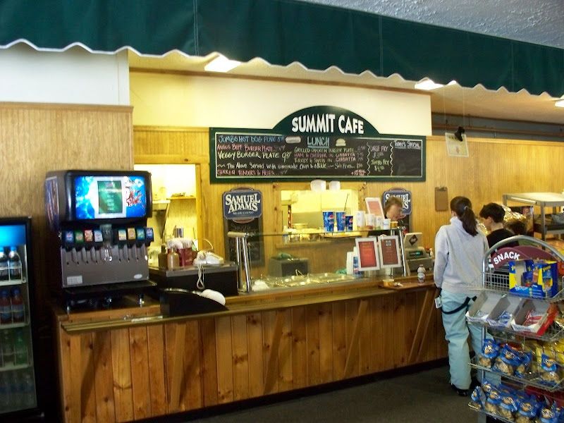
Once we arrived at the restaurant atop the mountain, it was packed and abuzz with activity. Somehow among all this bustle and commotion, a young woman we’d met at the trailhead was able to pick us out. Actually, it probably wasn’t all that difficult since we were the only two guys there who were not wearing ski attire!
But anyway, the woman said: “I have a question.” However, before she could ask it, I interrupted and said “If you’re going to ask about the hiking trail . . . don’t worry, we missed it too!” She laughed and confirmed that she also missed the turn, and then went on to say that she was on her way to try to descend via the “real” trail.
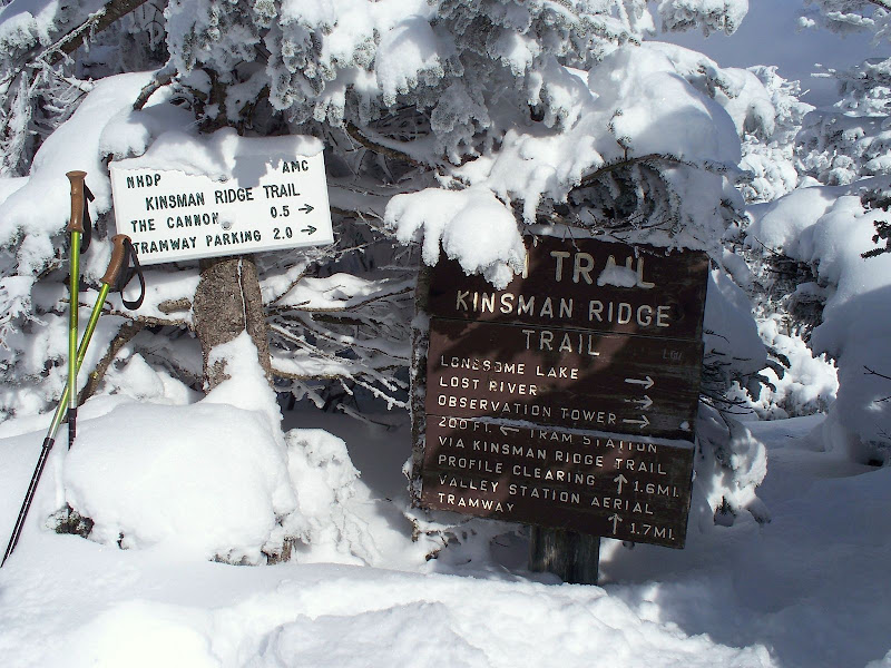
After Zman & I finished lunch at the summit restaurant (I still find this odd!), we then headed up to the actual summit of Cannon to make it an official Winter 48 hike. We then worked our way along the Rim Trail to intersect the “real” Kinsman Ridge Trail. We found it, and it looked like a single set of snowshoe prints was headed down the trail. This was most likely our lady-friend we had chatted with at the restaurant. We plunged through the scrub and headed down the “real” trail.
We eventually ran into another hiker on his way up who had met this lady on her way down. From the conversation he’d had with her, he verified that she was indeed the one who broke trail down to the point where the Kinsman Ridge Trail blends into a segment of the glade ski-trail. So, we (and probably she) felt vindicated as to how we’d all missed the turn for the Kinsman Ridge Trail on the way up. It had not been broken out, and so it was not easily seen!
I need to mention one other thing regarding the glade ski trail. This trail is very steep, and I personally marvel at how folks can ski this trail with such apparent ease. But, I was totally blown away by a group of eight or so very young kids that passed us while we were descending. These kids were so young that I seriously doubt if they have even been walking for more than 6 years! They were coming down the steep and winding glades with the greatest of ease. I’m sure their low center of gravity had to help. None of them could have been over 4 feet tall!
OK, way too much talk! Here are a few photos.
A Restaurant at the Top of a 4K Peak! (How convenient?!)
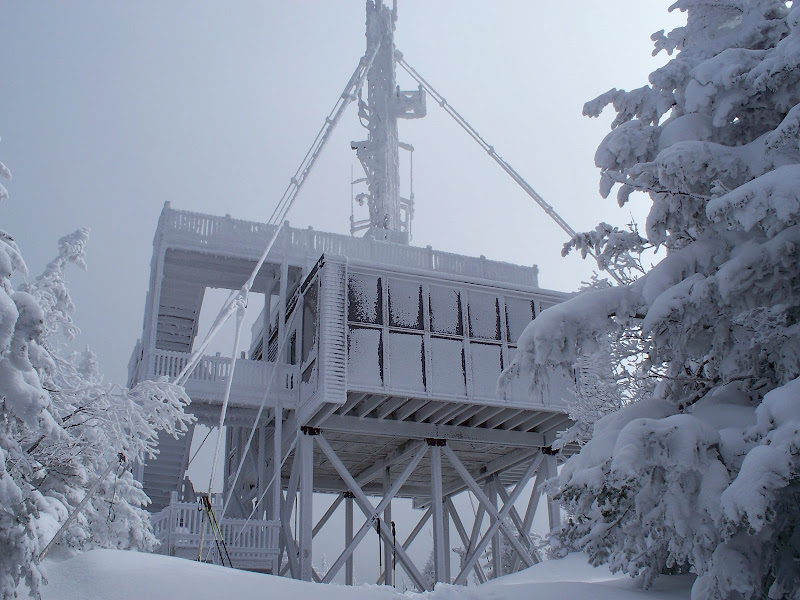
Approaching the Summit of Cannon
Hooray! Here’s the “real” Kinsman Ridge Trail
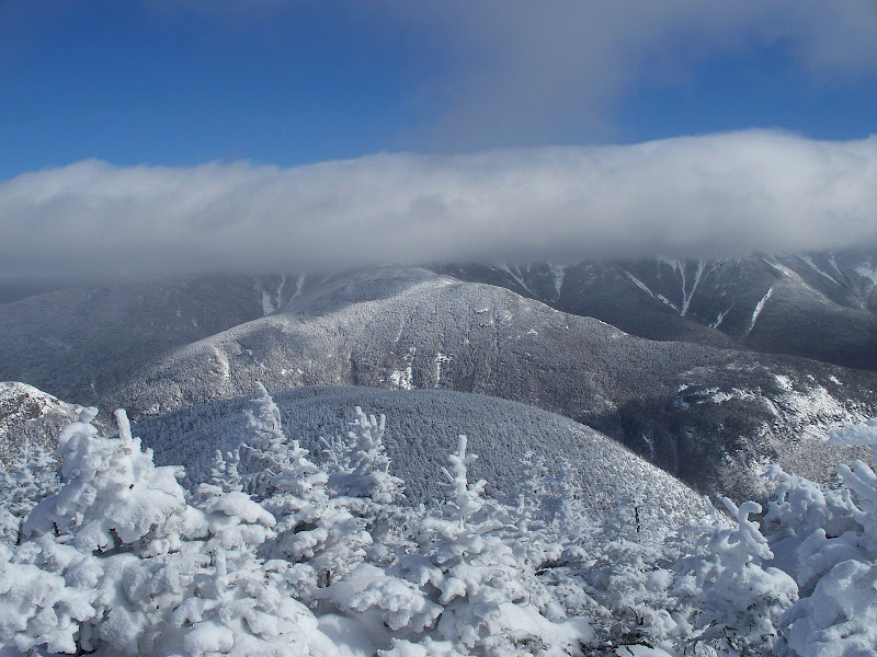
Persistent Cloud Hugging Franconia Range
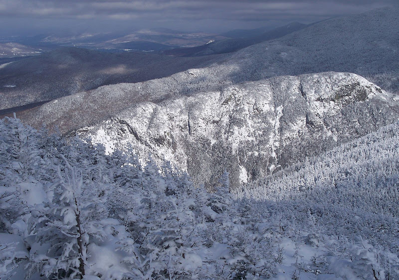
Love that “Hound Dog” Ridge! Foreground: Dog’s head on left (complete with eye and floppy ear) extending to rump on right
1HappyHiker
Sort of like Mt. Washington, in a way!
Neither Zman nor I are obsessive about completing a round of the Winter 48, but he and I both chip away at them as opportunities present themselves. So anyway, on this fine 21st day of February, we opted to knock off another Winter 48 by conquering Cannon Mountain. We felt that the weather and trail conditions might be about as good as they’re going to get for ascending (and descending) via the Kinsman Ridge Trail. And as it turned out, this was indeed the case.
But OK, for the ascent, I’ll have to confess that we did not use the Kinsman Ridge Trail exclusively. We suspected that we had veered off onto one of Cannon’s glade ski-trails, despite trying our best not to do this. So, when we came to the intersection of the Vista Way ski trail, this confirmed our suspicions. A friendly Cannon ski-patrol person soon came along and told us that we could proceed to the summit on the ski trail. But she said we needed to stay well to the edge and be vigilant of approaching skiers. She assured us that we were not the first hikers to miss the turn-off for the Kinsman Ridge Trail.
We had to chuckle since this was the second consecutive weekend that we’ve had “trail-following” issues. Last weekend, we had a “directional-issue” on Tripoli Road after leaving the Livermore trailhead to do Mt. Osceola. Wasn’t there a movie from the 1970’s entitled something like “The Gang That Couldn’t Shoot Straight”?
Once we arrived at the restaurant atop the mountain, it was packed and abuzz with activity. Somehow among all this bustle and commotion, a young woman we’d met at the trailhead was able to pick us out. Actually, it probably wasn’t all that difficult since we were the only two guys there who were not wearing ski attire!
But anyway, the woman said: “I have a question.” However, before she could ask it, I interrupted and said “If you’re going to ask about the hiking trail . . . don’t worry, we missed it too!” She laughed and confirmed that she also missed the turn, and then went on to say that she was on her way to try to descend via the “real” trail.
After Zman & I finished lunch at the summit restaurant (I still find this odd!), we then headed up to the actual summit of Cannon to make it an official Winter 48 hike. We then worked our way along the Rim Trail to intersect the “real” Kinsman Ridge Trail. We found it, and it looked like a single set of snowshoe prints was headed down the trail. This was most likely our lady-friend we had chatted with at the restaurant. We plunged through the scrub and headed down the “real” trail.
We eventually ran into another hiker on his way up who had met this lady on her way down. From the conversation he’d had with her, he verified that she was indeed the one who broke trail down to the point where the Kinsman Ridge Trail blends into a segment of the glade ski-trail. So, we (and probably she) felt vindicated as to how we’d all missed the turn for the Kinsman Ridge Trail on the way up. It had not been broken out, and so it was not easily seen!
I need to mention one other thing regarding the glade ski trail. This trail is very steep, and I personally marvel at how folks can ski this trail with such apparent ease. But, I was totally blown away by a group of eight or so very young kids that passed us while we were descending. These kids were so young that I seriously doubt if they have even been walking for more than 6 years!
OK, way too much talk! Here are a few photos.
A Restaurant at the Top of a 4K Peak! (How convenient?!)

Approaching the Summit of Cannon

Hooray! Here’s the “real” Kinsman Ridge Trail

Persistent Cloud Hugging Franconia Range

Love that “Hound Dog” Ridge! Foreground: Dog’s head on left (complete with eye and floppy ear) extending to rump on right

1HappyHiker
Last edited:

