1HappyHiker
Well-known member
There are no aspirations on my part to ever do all 72 of the 4K peaks on the Trailwright's list, be it winter or summer! However, it was one heck of a lot of fun to join my friend Steve on an 8.8 mile round-trip trek to Mt. Hight. It was just icing on the cake to have done this Trailwright's peak during the winter season.
Mt. Hight is one of my favorite peaks, and I don't go there nearly often enough. It is only 25 feet lower than Mt. Carrigain. And from the bare summit of Mt. Hight you get 360 degree views without the need to climb a tower!
This adventure was mild-mannered compared to many of the more aggressive adventures reported on this Forum, such as a Pemi traverse during the winter. However, this trek had just enough spice to make it more than just a plain-vanilla hike.
The hike began on the 19 Mile Brook Trail which was, of course, well broken out. It was interesting to see the brook was still quite frozen despite the recent stretch of warm temperatures.
19-Mile Brook
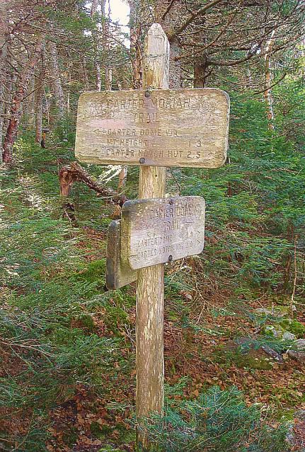
The Carter Dome Trail was only partially broken out, and then just up to the point of the second brook crossing. From that point we essentially broke trail all the way to the summit of Mt. Hight. But speaking of that second brook crossing, there are a number of confusing tracks on the other side of the brook. If you pay special attention to the directions provided in the WMG, you will end up on the trail. The WMG says that after the second brook crossing, the trail "swings left, then in 50 yd. turns sharp right". The sharp right turn is easy to miss, and seems counterintuitive to go in that direction.
Upon reaching Zeta Pass we did encounter relatively fresh snowshoe tracks along the ridge on the Carter-Moriah Trail. So, we had a brief reprieve from trailbreaking for 0.2 miles between Zeta Pass and the point where the Carter Dome Trail and the Carter-Moriah Trail part company.
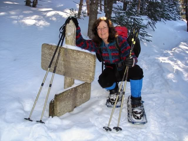
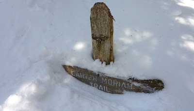
As expected, the snow pack up on the Carter ridge was deep. I partially dug out a trail sign, just to take a snapshot and provide some idea of the snow depth.
Trail Sign
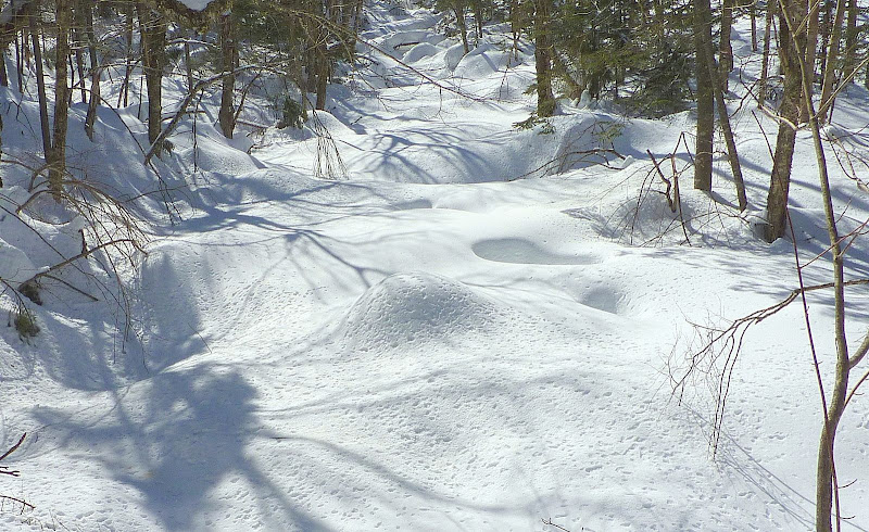
OK, let's go back to the point where the Carter Dome Trail and the Carter-Moriah Trail part company. If anyone should decide to go to Mt. Hight over the next few days, please be advised that we had some difficulty with locating the point where the Carter-Moriah Trail diverges from the Carter Dome Trail. If you go far enough along the Carter Dome Trail, you will see tracks leading off to the east in 3 different places. You can skip the first set of tracks. It's a dead end. The second and third set of tracks will get you to Mt. Hight. However, the third set of tracks follows the actual trail corridor for the entire distance.
It was quite a challenge breaking trail up the steep incline leading to Mt. Hight. However, the reward at the top was well worth the effort! And actually, even before arriving at the summit, it was quite a spectacular view looking up at the top of the mountain on the final approach.
Final Approach to Mt. Hight
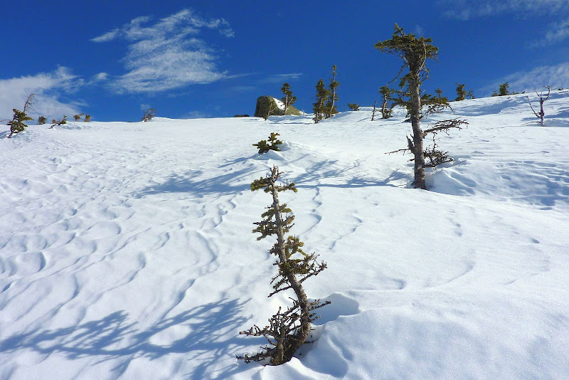
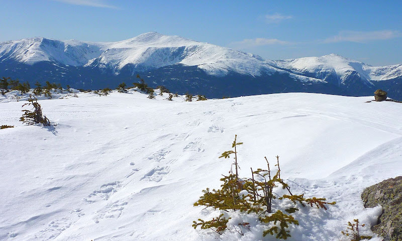
There are just so many awesome views from Mt. Hight, but I'll just show a few selected snapshots of a few of my favorites.
I love the way that the Presidential Range and the summit of Mt. Hight seem to blend together into continuous unbroken landscape.
Presidential Range from Mt. Hight
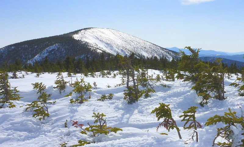
And, similar to the above photo, the mass of Carter Dome and the summit of Mt. Hight also sort of blend together into continuous unbroken landscape.
Carter Dome
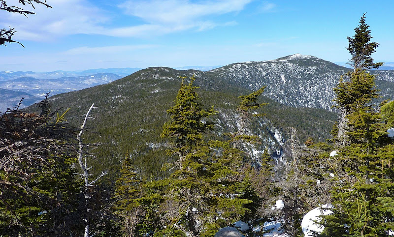
I also love the view of the Carter Range from Mt. Hight. From here, you can actually see definite peaks along the ridge; whereas, from many locations, this part of the range has the appearance of an uninteresting ridge that is a more or less flat.
Carter Range
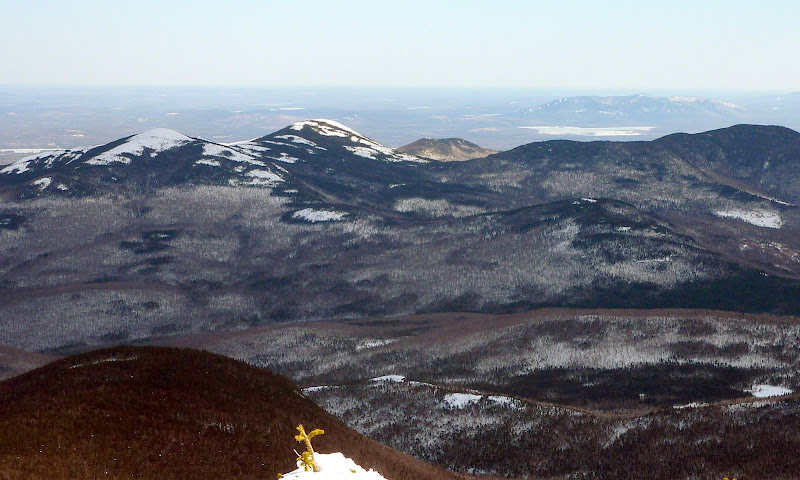
The eastward view toward the Baldfaces and Pleasant Mountain in Maine is also a nice vista. Looking through binoculars, you could even see the faint cityscape of Portland, ME way off in the distance.
Eastward View Toward Baldfaces
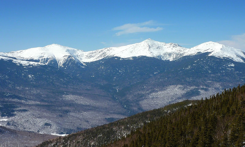
Just to add even a bit more "zing" to our adventure, we also did two very short bushwhacks. One of these whacks was a trek to a scrubby area just a bit south of Zeta Pass. From here, we got a pretty nice view of the Presidential Range.
Presidental Range from Outlook Near Zeta Pass
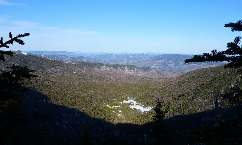
Our other whack was to an area just a bit east of Zeta Pass where we got a very unique view of the glacial cirque that is drained by Cypress Brook. Steve has bushwhacked to the snow-covered beaver pond that shows up in the bottom-center of the photo below.
Glacial Cirque on East Side of Zeta Pass Area
In summary . . . this was an excellent hike and a wonderful way to close out this winter season!
1HappyHiker
Mt. Hight is one of my favorite peaks, and I don't go there nearly often enough. It is only 25 feet lower than Mt. Carrigain. And from the bare summit of Mt. Hight you get 360 degree views without the need to climb a tower!
This adventure was mild-mannered compared to many of the more aggressive adventures reported on this Forum, such as a Pemi traverse during the winter. However, this trek had just enough spice to make it more than just a plain-vanilla hike.
The hike began on the 19 Mile Brook Trail which was, of course, well broken out. It was interesting to see the brook was still quite frozen despite the recent stretch of warm temperatures.
19-Mile Brook

The Carter Dome Trail was only partially broken out, and then just up to the point of the second brook crossing. From that point we essentially broke trail all the way to the summit of Mt. Hight. But speaking of that second brook crossing, there are a number of confusing tracks on the other side of the brook. If you pay special attention to the directions provided in the WMG, you will end up on the trail. The WMG says that after the second brook crossing, the trail "swings left, then in 50 yd. turns sharp right". The sharp right turn is easy to miss, and seems counterintuitive to go in that direction.
Upon reaching Zeta Pass we did encounter relatively fresh snowshoe tracks along the ridge on the Carter-Moriah Trail. So, we had a brief reprieve from trailbreaking for 0.2 miles between Zeta Pass and the point where the Carter Dome Trail and the Carter-Moriah Trail part company.
As expected, the snow pack up on the Carter ridge was deep. I partially dug out a trail sign, just to take a snapshot and provide some idea of the snow depth.
Trail Sign

OK, let's go back to the point where the Carter Dome Trail and the Carter-Moriah Trail part company. If anyone should decide to go to Mt. Hight over the next few days, please be advised that we had some difficulty with locating the point where the Carter-Moriah Trail diverges from the Carter Dome Trail. If you go far enough along the Carter Dome Trail, you will see tracks leading off to the east in 3 different places. You can skip the first set of tracks. It's a dead end. The second and third set of tracks will get you to Mt. Hight. However, the third set of tracks follows the actual trail corridor for the entire distance.
It was quite a challenge breaking trail up the steep incline leading to Mt. Hight. However, the reward at the top was well worth the effort! And actually, even before arriving at the summit, it was quite a spectacular view looking up at the top of the mountain on the final approach.
Final Approach to Mt. Hight

There are just so many awesome views from Mt. Hight, but I'll just show a few selected snapshots of a few of my favorites.
I love the way that the Presidential Range and the summit of Mt. Hight seem to blend together into continuous unbroken landscape.
Presidential Range from Mt. Hight

And, similar to the above photo, the mass of Carter Dome and the summit of Mt. Hight also sort of blend together into continuous unbroken landscape.
Carter Dome

I also love the view of the Carter Range from Mt. Hight. From here, you can actually see definite peaks along the ridge; whereas, from many locations, this part of the range has the appearance of an uninteresting ridge that is a more or less flat.
Carter Range

The eastward view toward the Baldfaces and Pleasant Mountain in Maine is also a nice vista. Looking through binoculars, you could even see the faint cityscape of Portland, ME way off in the distance.
Eastward View Toward Baldfaces

Just to add even a bit more "zing" to our adventure, we also did two very short bushwhacks. One of these whacks was a trek to a scrubby area just a bit south of Zeta Pass. From here, we got a pretty nice view of the Presidential Range.
Presidental Range from Outlook Near Zeta Pass

Our other whack was to an area just a bit east of Zeta Pass where we got a very unique view of the glacial cirque that is drained by Cypress Brook. Steve has bushwhacked to the snow-covered beaver pond that shows up in the bottom-center of the photo below.
Glacial Cirque on East Side of Zeta Pass Area

In summary . . . this was an excellent hike and a wonderful way to close out this winter season!
1HappyHiker
Last edited:

