Bay Circuit Trail - Nov. 15, 2009 (Completed)

vftt.org

Help Support vftt.org:

This site may earn a commission from merchant affiliate links, including eBay, Amazon, and others.

Amicus

Well-known member
Joined
Aug 28, 2005
Messages
1,145
Reaction score
112
Location
New England Avatar: Bay Circuit Trail
I hiked over 540 miles, in 39 day-hikes, to complete today a trail that will be just 200 miles long when it is finally finished - the Bay Circuit Trail, which with recent additions is now up to 180 officially open miles. I owe this dubious distinction to hiking most of it in both directions, and to pursuing many of the alternate routes, proposed sections and adjacent trails that give the BCT a large part of its charm.

"First proposed in 1929 as an outer 'emerald necklace,' linking parks, open spaces and waterways from Plum Island to Kingston Bay," the BCT got a boost when Al French and others organized the Bay Circuit Alliance in 1990. Al remains the BCA's energetic Chairman and leads the struggle to protect the linked jewels that run through some three dozen cities and towns in a giant semi-circle, between Routes 128 and 495. These jewels comprise a wealth of parks, forests, wetlands and reservations maintained by entities and organizations such as the Federal Government, the Mass DCR, the Trustees of Reservations (TTOR) and many of the Towns through which the Trail passes.

The BCT is nothing if not diverse. I've hiked through and by cemeteries - Colonial and modern, village greens, cranberry bogs, marshes, swamps, uncranberry bogs, mires, fens, two National Historical Parks - one preserving a rich slice the 19th Century textile industry and the other celebrating the Shot Heard 'Round the World, sloughs, glades deciduous, evergreen and mixed, three model aircraft flying fields, rivers, streams and brooks beyond measure, and the occasional morass. Eastern Massachusetts is even more verdant than I knew. Those retreating glaciers 10,000 years ago (which is about 5 minutes ago, speaking cosmically relatively) left a sandy, soppy web of green eskers, potholes and the occasional jutting highland - green and beautiful, I thought.

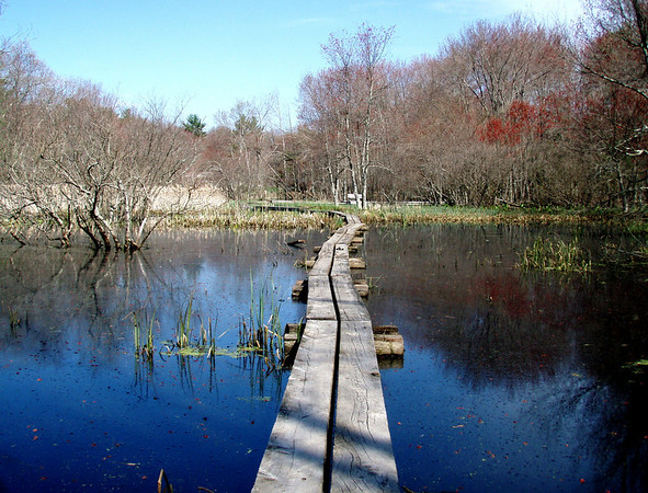
I brought my point-and-shoot for memory's sake, snapping some of those beautiful swamps:
285423968_VR9Z2-M-2.jpg


Wildlife:

426397634_ecNvB-M-3.jpg


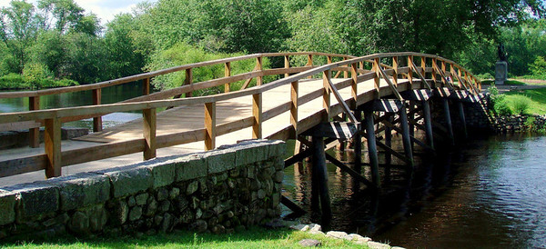
The Rude Bridge That Arched the Flood:
344249462_tmQin-M-3.jpg


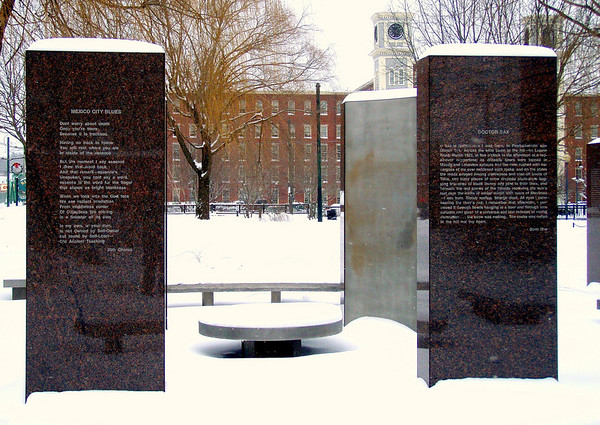
Kerouac Park and the Boott Cotton Mill:
440040673_KJsbz-M-3.jpg


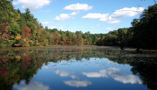
About 1,000 ponds, like this one:

386470479_gth6P-M-3.jpg


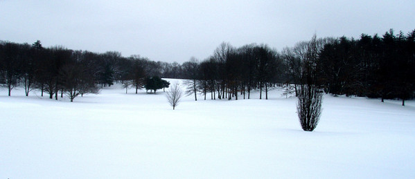
Great snowshoeing terrain:

440039444_w9KrE-M-3.jpg


And of course some of the mountain scenery for which Eastern Mass. is renowned, as in this view of Nobscot Hill in Framingham:

569322015_MsygB-M-3.jpg


Today's hike took me through Pembroke, in Map 13. (I'd leapfrogged ahead to the southern terminus at Kingston Bay last week, in order to hike that stretch with Maureen T., its Trail Maintainer.) Highlights were Pembroke Town Forest, Great Sandy Bottom Pond and the Tubbs Meadow Preserve - a representative hike.

The BCT has been great fun, and for the first time, I begin to think I'm learning my own backyard.
 
Last edited:
M--congrats; know you enjoyed the journey

The BCT is very different from what I usually do, but the type of trail/hike I wish i could do more of --a bit of everything, woven into the fabric of civilization/everyday life

jim
 
Last edited:
That's a wonderful undertaking, something that I'd like to pursue after retirement (soon!). Congratulations!

I too enjoy poking about the local neighborhood and often finding surprises I'd never have expected in a suburban setting.
 
jim:

"...a bit of everything, woven into the fabric of civilization/everyday life"
captures well the special charm of the BCT, compared with more familiar trails in northern New England. I should note, however, that civilization does not predominate. The majority of those 200-miles, while not exactly the Pemi Wilderness, are largely free of civilization.

Audrey:

Puttering around with BCT would be a wonderful retirement pastime. I'm certainly not through with it myself. Work is going on to fill the remaining gaps and to complete interesting alternate routes in places like Duxbury, Tewksbury, Billerica and Lowell, and I look forward to hiking them as they are dedicated.

If you haven't seen them, perhaps from a prior thread here on hikes in eastern Mass., I'm sure you would be interested by the 15 Maps and Trail Descriptions posted on-line by the Bay Circuit Association. The last few pages of each of the Descriptions describes the hiking ""Jewels" in the towns the BCT passes through or even near, many of them not even very close to the Trail.
 
Congratulations! That is awesome. :D

My home abutts the Georgetown-Rowley State Forest, so I am trail running and snowshoeing on the Bay Circuit Trail a lot. Even that stretch has gone through a lot of change over the past few years - beaver dam flooding, trail re-routes, bridges washed away, new bridges, built, etc. Very cool stuff.

Sapblatt and I did the Plum Island to Boxford, MA stretch one winter (except for the "Rowley Gap". We haven't done any more of the trail since. Maybe some day.....

Best regards,
Marty
 
Nice! Congratulations to you. :)

In the late 90s there was a point-to-point 50 miler on the northern part of the trail (GAC-Marty territory). I remember being impressed by the amount of "wildness" that close to the city.
 
In the late 90s there was a point-to-point 50 miler on the northern part of the trail (GAC-Marty territory). I remember being impressed by the amount of "wildness" that close to the city.

Well, I cheered you on, then.:D The original trail was to run on the road right past my house, but they re-routed it to come out to the street two doors down. We just walked down the street and cheered on the runners.

That section of trail has been changed two more times since then due to landowner issues and beaver dams.

Marty
 
Sapblatt and I did the Plum Island to Boxford, MA stretch one winter (except for the "Rowley Gap". We haven't done any more of the trail since. Maybe some day.....

That is a very nice stretch. Even the Rowley Gap isn't bad. The road-walk of under two miles on Rte. 3A has some views of salt-marshes and the traffic wasn't heavy one Sunday afternoon early in the summer - pleasant jogging.

As you note, the BCT evolves steadily, to deal with suburban phenomena like beavers and landowners who decide to revoke access (but I don't think I heard of any "new" postings during my 17 months hiking the BCT). Those have been more than offset by increasing engagement with the Trail on the part of conservation-minded individuals and organizations in the Towns through which it passes, which is why the "finished" total has climbed from 160 to 180 miles over the past two years.

If you plan to return to an area you've hiked before, you'd do well to check the current Map and Description on the BCT website rather than using an older one, as they do update them fairly frequently.

Stinkyfeet: That sounds like fun, but 50 miles is a little beyond my range. There is more wildness than most people know, between 495 and the Atlantic.
 
I hiked over 540 miles, in 39 day-hikes, to complete today a trail that will be just 200 miles long when it is finally finished
One of the trips in the canoe classic Quick Water and Smooth by Phillips and Cabot was a circuit of Boston by canoe, leaving the canoe at some agreeable spot every afternoon and returning home by trolley. (Co-author Cabot was one of the Cabots and perhaps lived on Beacon Hill.)

So with the aid of the famed MBTA, what would be the prospects for section-hiking this trail without a car?
 
So with the aid of the famed MBTA, what would be the prospects for section-hiking this trail without a car?

I drove my car to all 39 hikes, which was convenient but not optimally Green. I passed a few commuter rail stations and probably more weren't far. With diligence, you might be able to plan a traverse by public transportation, but you might end up sleeping on a few train-station benches.

That circuit of Boston by canoe and trolley sounds interesting. The Charles would have been a part, I expect, but I'm curious about the rest. I may look that volume up.
 
Love it! Reminds me of improvised routes in southern CT, but without the more "interesting" urban encounters. Somehow, the notion of driving east into a more populated area to go hiking makes me feel weird. Sort of like when I travel to CA and the ocean is where the sun sets...???

Weatherman
 
Somehow, the notion of driving east into a more populated area to go hiking makes me feel weird.

In my case, east is the one direction in which I did not drive, as my base was near the hub of the great semi-circle. The areas I drove to were less populated, with the exception of downtown Lowell. That is where I had my single "interesting urban adventure," traversing the east bank of the Concord River:

563811461_xYeBC-M-1.jpg


not far from its confluence with the Merrimack. This is one of the "gaps," and what started as a pleasant dirt track along a utility right-of-way deteriorated into my picking my way gingerly along the base of a steep bank, over and around muddy boulders, flotsam, jetsam, poison ivy and fences, with a couple of excursions into neighborhoods of a type I would not normally walk through. It was Sunday midday, however, so they seemed relatively quiet.

Had I been willing to wait, I would have been able, at least some day, to avoid all that by means of the Concord River Greenway Park, a work-in-progress of the Lowell Parks and Conservation Trust that will link the Lowell Auditorium district with the north end of the Bruce Freeman Rail Trail, eliminating that gap in the BCT.
 
Awesome Adventure!

I've hiked most of this in Andover, some very beautiful sections. If the rest is anything like that it must be well worth the effort. Nice going!

KDT
 
I've hiked most of this in Andover, some very beautiful sections. If the rest is anything like that it must be well worth the effort.

The Trail goes through several of the Andover Village Improvement Society (AVIS) Reservations and each is a gem. I liked Mary French Res. so much I made the picture I took there my avatar. Individual trail maps for these can be found on-line, as you probably know.

Many other parts of the BCT are as about an nice and many are not. A hiker would need to enjoy variety to undertake a complete traverse.
 
Top