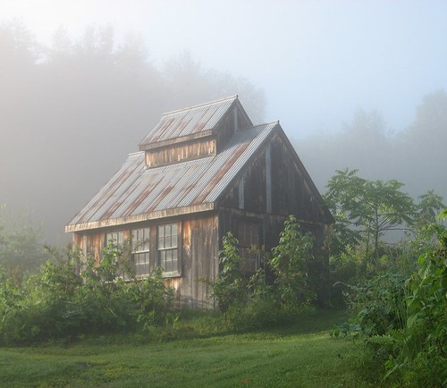
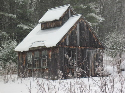
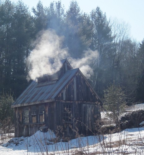
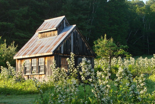
"Before and After"/Then and Now pics ?

vftt.org

Help Support vftt.org:

This site may earn a commission from merchant affiliate links, including eBay, Amazon, and others.
okay, here's mine, roughly the same position:

September, 2010:

IMG_2268.JPG


and this morning:

IMG_2446.JPG
 
On March 7th, 2010 I hiked with a group from a different Forum, where we traversed the Blackhead Range in the Catskills a couple of weeks after the record snowfalls that February. Three months later, I repeated most of that hike and took a few photo's of notable "landmarks" for comparison to the March hike. I put together the following set of photo's to illustrate the snow depths. While snow depths and photo's like these may be common to the Adirondacks & White's, they are unusual in the Catskills.

The Batavia Kill Lean-To:


Trail next to Batavia Kill Lean-To:


3500' Marker on East face of Blackhead (3940')


Snow depth's increased rapidly after the 3500' marker, I just don't have any photo's to illustrate that.
 
Those are great shots. My early age exposure to the Adirondacks was always in winter and it took me some time to figure out why the trail markers were always so close to "the ground". ;)
 
Pierce viewed from below Eisenhower summit
962918614_XvACG-M.jpg
474380077_m3Zyh-M.jpg


Crystal Cascades
469377560_tQx7Y-M.jpg
469391106_kGzbD-M.jpg


View from Artists Bluff, part 1
481421554_q3GQy-M.jpg
1034163049_iJRUc-M.jpg


View from Artists Bluff, part 2
481421635_XGNys-M.jpg
1034163624_nxW5E-M.jpg
 
This isn't so much a "same place / different season".........it's more of a "same place / different planet"

Looking west from the Bondcliff lookout

452041440_LDTNA-M.jpg
574050638_KLYFQ-M.jpg
 
Baker River Valley at different times of the day and year.


Above is this morning (2/4/11) about 8:00am. The smoke plume center right is the Plymouth State University physical plant, Smarts Mountain is behind it 20 miles in the distance.


Above is this morning about 11:00am.


Above was taken in 5/22 at 7 am. These shots were collected over the course of 5 1/2 years. The white rectangle center right is the PSU dorm under construction 5 years ago and covered with a white plastic wrap. This dorm is directly behind the physical plant mentioned above.


Above was taken in 9/10 3 pm.


Above was taken in 10/13 4:30 pm.


Above was taken in 11/22, 4:40 pm.
 
Last edited:
Thanks for starting this thread! I've had this idea myself for a while now, but now after seeing all these pictures (and knowing that people are actually interested in something like this) I've finally gotten the urge to go through my photos and pick out some of my comparison shots.

All of my images are from the Adirondacks, unless otherwise specified.

Ward Brook Lean-to, October 2005
dscn0064mo.jpg


Ward Brook Lean-to, November 2010

The lean-to has been repaired, and raised up off the ground. The sign on top is a new one.
dscn6523k.jpg


Ward Brook Lean-to, December 2010
dscn7041y.jpg


Summit marker on Seymour Mountain, October 2005
dscn0045n.jpg


Summit marker on Seymour Mountain, December 2010

The wooden sign is in the same spot, but the plastic disc has moved down a few inches on the tree. It looks like it's a new plastic disc, the lettering is different.
dscn7079o.jpg


Duck Hole Dam, October 2005
dscn0136za.jpg


Duck Hole Dam, January 2006
dscn0959j.jpg


Duck Hole Dam, November 2010

The dam still seems to be in more or less the same condition as it was 5 years before. One log is missing from the center pillar. I really like how you can see how the trees have grown since 2005.
dscn6562.jpg


Duck Hole Dam, October 2005
dscn0158k.jpg


Duck Hole Dam, January 2006
dscn0958gg.jpg


Duck Hole Dam, November 2010
Again, not too much seems to have changed since 2005. Some deterioration on the center pillar.
dscn6560.jpg

More coming! :)
 
If you look at the Seymour sign one you can see the nails from the previous yellow disc spot. The lettering style wise is the same, same person did it too, but the newer one starts at the edge of the disc. I like how the words are worn of the wooden sign.
 
Part 2:

Duck Hole, October 2005
dscn0155sn.jpg


Duck Hole, January 2006
dscn0957m.jpg


Duck Hole, November 2010
It looks like a couple of the larger trees on the shore on the left side of the picture have fallen over.
dscn6563y.jpg


Cold River, November 2010
dscn6473.jpg


Cold River, 3 days later
It had rained non-stop for about 24 hours, and all of the snow that was present melted, resulting in pretty high water levels.
dscn6588o.jpg


Lower Ausable Lake, viewed from Mt Colvin, July 2006
dscn1987.jpg


Lower Ausable Lake, viewed from Mt Colvin, January 2011
dscn7299t.jpg


Great Range, viewed from Mt Colvin, July 2006
dscn1976g.jpg


Great Range, viewed from Mt Colvin, January 2011
dscn7325.jpg


Summit of Gothics, August 2006
dscn2480g.jpg


Summit of Gothics, January 2011
dscn7456.jpg


Part 3:

Mt Adams Fire Tower Observer's Cabin, April 2006
dscn0206l.jpg


Mt Adams Fire Tower Observer's Cabin, January 2011
You can see that the cabin has been repaired.
dscn7684m.jpg


Summit marker on Street Mountain, August 2006
dscn2383be.jpg


Summit marker on Street Mountain, January 2011
Again, as with the Seymour marker, it looks like the plastic marker here has been replaced.
dscn7668.jpg


View of the Great Range from Noonmark, September 2006
dscn2873o.jpg


View of the Great Range from Noonmark, December 2010
greatrange04.jpg


Waterfall on Allen Brook, along the herd path to Allen Mountain, September 2006
dscn3060.jpg


Waterfall on Allen Brook, along the herd path to Allen Mountain, January 2011
dscn7726j.jpg


Summit of Allen Mountain, September 2006
My friend Teresa will kill me if she finds out I posted this photo. And yes, she's hiking with a cast on her arm (ax accident).
dscn3102n.jpg


Summit of Allen Mountain, January 2011
At first, I thought the sign had moved down on the tree, then I realized that it was just that the snow is a few feet deep.
dscn7739.jpg


View of Burnt Knob from Acra Point (Catskills), May 2008
dscn0214x.jpg


View of Burnt Knob from Acra Point (Catskills), November 2010
dscn6338.jpg


Part 4:

Blackhead Range from Acra Point (Catskills), May 2008
dscn0213j.jpg


Blackhead Range from Acra Point (Catskills), November 2010
dscn6339q.jpg


Giants Washbowl, August 2006
dscn2317q.jpg


Giants Washbowl, February 2008
dscn0052w.jpg


Clear Pond (Pharaoh Lake WA), June 2009
dscn1570t.jpg


Clear Pond (Pharaoh Lake WA), October 2009
dscn2670r.jpg


Glasby Pond (Five Ponds WA), October 2009
dscn2490o.jpg


Glasby Pond (Five Ponds WA), October 2010
cranberrylake02.jpg


High Falls, October 2009
dscn2541w.jpg


High Falls, October 2010
dscn5563e.jpg

Somewhere, I found online a picture from the early 90's that showed what High Falls looked like before the microburst. I looked for it again, but couldn't find it... the difference was like night and day, the falls looked like they were permanently in shadow from the pines towering overhead.
 
snow cave on January 29th...

1174907244_STdsd-M.jpg


snow cave on March 6th...

1217735016_SCRwm-M.jpg
 
Top