Best winter route for Moosilauke ?

vftt.org

Help Support vftt.org:

This site may earn a commission from merchant affiliate links, including eBay, Amazon, and others.

1SlowHiker

New member
Joined
Nov 29, 2012
Messages
300
Reaction score
0
Location
Rhode Island (Aquidneck Island)
I’m hoping to do Mooselauke Wednesday (1/14/14) or Thursday. I’ve done her via Gorge Brook when the road was open but don’t want to do the winter road walk. I’m split between going from the Glencliff or Beaver Brook. Both seem to be about the same distance and elevation gain. I think both have had recent traffic. Any recommendations for which to take based on recent track conditions, crossings and exposure to wind. I think Beaver may be more shielded from predicted W/SW wind.
Also, does anyone have a source for a GPS track for Beaver Brook approach? I have a Glencliff track. Both being on the AT (I believe), its no big deal though.
 
Last edited:
I don't have info on recent conditions, but I do recommend the Glencliff approach. It's mainly sheltered from the wind (until treeline of course), and it's just pretty and quiet and has a more isolated feel to it (at least in my opinion).
 
I like the Beaver Brook route. It is steep and can be icey. I carry crampons for the route, as micro's dont cut it for me on that steep section.
 
pretty and quiet and has a more isolated feel to it (at least in my opinion).

Both times I have hiked this route during the week I didn't see a single person. Did it this spring in the afternoon after working a half day. There are no real steep or hard sections this route and only one (really low) water "crossing" to worry about near the start. On a nice weather day, the view of the summit coming up the carriage road can be great.
 
Also, does anyone have a source for a GPS track for Beaver Brook approach?
I finally found a beaver brook approach track on wiciloc. As someone recently mentioned it's search engine isn't the greatest. Searching Mooselauke only gave me the the Glencliff approach but searching "beaver brook" gave me the beaver brook approach.
 
I finally found a beaver brook approach track on wiciloc. As someone recently mentioned it's search engine isn't the greatest. Searching Mooselauke only gave me the the Glencliff approach but searching "beaver brook" gave me the beaver brook approach.

I would have include the GPS track, but truth be told, I have never even held a GPS unit in my hand.
 
I love the Glencliff Trail, personally. The view from the talus field near the top is spectacular, and the ridge walk along Carriage Road is awesome. Glencliff tends to be broken out the whole way.
 
I think its 5 to 2 for Glencliff and those favoring Beaver Brook mentioned steepness and ice. Since I haven't hiked in almost a month and haven't hiked a 4k since March, and... ate way too much over the holidays; I'm heading for Glencliff. I passed on S. Peak when I last did Mooselauke (snow but not "winter"), so maybe I'll tag her if I have any steam left on the way back and the skies are clear. Thanks all for the advice.
 
I’m hoping to do Mooselauke Wednesday (1/14/14) or Thursday. I’ve done her via Gorge Brook when the road was open but don’t want to do the winter road walk. I’m split between going from the Glencliff or Beaver Brook. Both seem to be about the same distance and elevation gain. I think both have had recent traffic. Any recommendations for which to take based on recent track conditions, crossings and exposure to wind. I think Beaver may be more shielded from predicted W/SW wind.
Also, does anyone have a source for a GPS track for Beaver Brook approach? I have a Glencliff track. Both being on the AT (I believe), its no big deal though.

You are a year behind. :)

I have done Asquam Ridge, Carriage Road, and Gorge Brook in winter. All were nice, but all have a long walk in/walkout. Glencliff gets to the point a lot faster, and Beaver Brook is nothing but the point. I would think Glencliff would be a nicer approach right now.
 
You are a year behind. :)

I have done Asquam Ridge, Carriage Road, and Gorge Brook in winter. All were nice, but all have a long walk in/walkout. Glencliff gets to the point a lot faster, and Beaver Brook is nothing but the point. I would think Glencliff would be a nicer approach right now.


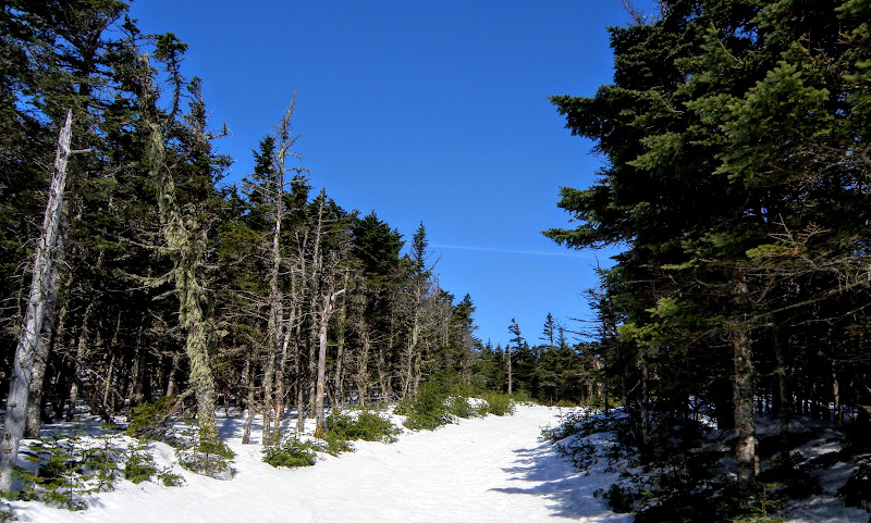
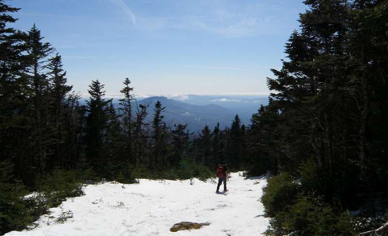
I've used the Carriage Road from it's begining at the end of Breezy Point Rd. in winter. I thought it great route. Easy grades with some great woods and views along the way. I liked it far more than Beaver Brook which is the only other approach I've used in winter. It would still allow you to bag S. Peak. It's 2.5-3 miles longer.

P3170044.JPG

P3170165.JPG


The only thing I'm not positive of is if we were able to get to the end where the parking is because it's plowed or because it was 3/17 and there was a lot of melt. But it is a residential Rd. for at least the first mile so I assume it's plowed to the end. There was signs of heavy usage of the trail from the get go.
 
The road is usually plowed to just before the old Moosilauke Inn site, just shy of the trailhead. It can be icy but it's usually driveable.
 
I've used the Carriage Road from it's begining at the end of Breezy Point Rd. in winter. I thought it great route. Easy grades with some great woods and views along the way. I liked it far more than Beaver Brook which is the only other approach I've used in winter. It would still allow you to bag S. Peak. It's 2.5-3 miles longer.
The only thing I'm not positive of is if we were able to get to the end where the parking is because it's plowed or because it was 3/17 and there was a lot of melt. But it is a residential Rd. for at least the first mile so I assume it's plowed to the end. There was signs of heavy usage of the trail from the get go.

The road is usually plowed to just before the old Moosilauke Inn site, just shy of the trailhead. It can be icy but it's usually driveable.

Too late. I did Mooselauke up Glencliff yesterday. In hindsight carriage road may have been the best choice for me. The steeper sections of Glencliff (which aren't really that steep) really slowed me down (5+hrs to the top). The section of carriage road that I did do was well packed out by at least 3 passes by snowboarder. Yes a snowboarder at 4500' !! Not sure if it was like that all the way down but it was an easy grade with snowshoes.
 
Too late. I did Mooselauke up Glencliff yesterday. In hindsight carriage road may have been the best choice for me. The steeper sections of Glencliff (which aren't really that steep) really slowed me down (5+hrs to the top). The section of carriage road that I did do was well packed out by at least 3 passes by snowboarder. Yes a snowboarder at 4500' !! Not sure if it was like that all the way down but it was an easy grade with snowshoes.

Sorry I meant to chime in the other day. We saw ski tracks on pretty much the entire Carriage Rd. I believe it's a pretty popular trail to ski down.
 
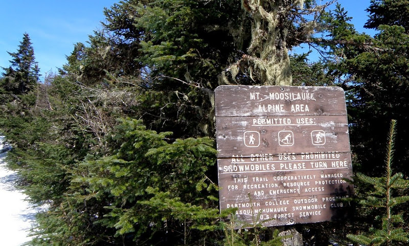
Yes, Carriage Road, Gorge Brook and Snapper all get plenty of ski and board use in the winter. Snowmobiles run on the Carriage Road up to the turnaround area about 1000' linear feet below the junction with Glencliff.
 
Yes, Carriage Road, Gorge Brook and Snapper all get plenty of ski and board use in the winter. Snowmobiles run on the Carriage Road up to the turnaround area about 1000' linear feet below the junction with Glencliff.


Probably one of the more interesting signs I've seen in the Whites.
P3170058.JPG
 
Top