Week 1 of my vacation is being spent in Stratton at the Spillover Motel. I convinced Bob Hayes to hike with me, and Ed Smith is up for one night/two days. The Spillover is one of the nicer looking establishments around here and thanks to all who recommended it. When I checked in I asked if I could get the "Hiker Ed discount" and the woman rolled her eyes  Yesterday was the best forecast of three and so we headed for the Bigelows.
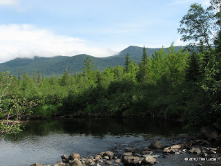
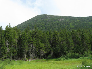
Bob drove the Suburban all the way to Stratton Brook where we began the clockwise loop on the Firewarden's Trail. The first stretch follows a road along Stratton Pond and Stratton Brook which feeds it before diverging on the Horns Pond Trail (left). This trail passes a boggy area with a nice view to South Horn, and occasional outlooks towards Sugarloaf. Once around the bog, it climbs more seriously up to the junction with the Bigelow Range Trail (AT).
Shortly beyond the junction is the Horns Pond Lean-To (there are two, plus numerous camp sites.) We had a brief chat with the caretaker (who referred to our loop as the "iron triangle" - I hadn't heard this referenced as such before.) We met a couple here with their dog and we would leapfrog them several more times that day. He was a local resident (not native) and put in his plug for skiing at Sugarloaf. They had plans to go sailing that night on Flagstaff Lake. Tough life
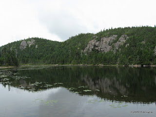
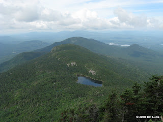
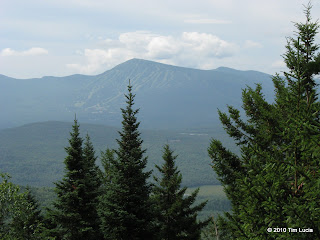
The BRT/AT from Horns Pond got much steeper and wetter as it ascends the spine of the ridge. You can definitely get some views in all directions from a handful of spots along this trail. After a good leg-and-lung-workout, we topped out on South Horn (NEHH #59 for me) where we enjoyed the views towards the remaining area 4Ks while having a sandwich.
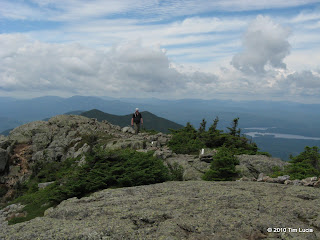

The initial descent from South Horn is steep and the footing is very rocky, but once off the cone, the trail softens in grade as well as the footbed being more dirt and mud. It looks like a long way to West Peak but it was only an hour before we were there. West Peak as 360 degree views to rival pretty much anywhere in the Whites. I might have to come back on a bluebird day. There are a bunch of windmills forming a windfarm across the lake and at the very edge of visibility we thought we could see Katahdin.
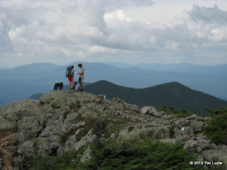
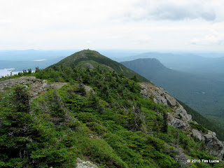
We hung out here for a while, eating, hydrating, chatting and just enjoying the light but cool breeze. OK, it was still very humid but it was better than being in the trees. Bob found a green croc and decided to leave it here. On the way up Avery Peak, its owner was backtracking in hopes of finding it. She was both happy and not to know where it was. After a brief stop on Avery Peak, we returned to the col with West Peak and headed down the Firewarden's Trail - very steep, with some nice stone steps. After 6:45 we were back at the truck for a round of cold ones. Back at the motel we grilled up (they have a grill and some picnic tables) some pork chops, chicken and an enormous collection of vegetables. After listening to Bob's scuba tales for a while we retired for the evening.
Off to do Crockers + Redington today
All Photos
Tim


Bob drove the Suburban all the way to Stratton Brook where we began the clockwise loop on the Firewarden's Trail. The first stretch follows a road along Stratton Pond and Stratton Brook which feeds it before diverging on the Horns Pond Trail (left). This trail passes a boggy area with a nice view to South Horn, and occasional outlooks towards Sugarloaf. Once around the bog, it climbs more seriously up to the junction with the Bigelow Range Trail (AT).


Shortly beyond the junction is the Horns Pond Lean-To (there are two, plus numerous camp sites.) We had a brief chat with the caretaker (who referred to our loop as the "iron triangle" - I hadn't heard this referenced as such before.) We met a couple here with their dog and we would leapfrog them several more times that day. He was a local resident (not native) and put in his plug for skiing at Sugarloaf. They had plans to go sailing that night on Flagstaff Lake. Tough life


The BRT/AT from Horns Pond got much steeper and wetter as it ascends the spine of the ridge. You can definitely get some views in all directions from a handful of spots along this trail. After a good leg-and-lung-workout, we topped out on South Horn (NEHH #59 for me) where we enjoyed the views towards the remaining area 4Ks while having a sandwich.


The initial descent from South Horn is steep and the footing is very rocky, but once off the cone, the trail softens in grade as well as the footbed being more dirt and mud. It looks like a long way to West Peak but it was only an hour before we were there. West Peak as 360 degree views to rival pretty much anywhere in the Whites. I might have to come back on a bluebird day. There are a bunch of windmills forming a windfarm across the lake and at the very edge of visibility we thought we could see Katahdin.


We hung out here for a while, eating, hydrating, chatting and just enjoying the light but cool breeze. OK, it was still very humid but it was better than being in the trees. Bob found a green croc and decided to leave it here. On the way up Avery Peak, its owner was backtracking in hopes of finding it. She was both happy and not to know where it was. After a brief stop on Avery Peak, we returned to the col with West Peak and headed down the Firewarden's Trail - very steep, with some nice stone steps. After 6:45 we were back at the truck for a round of cold ones. Back at the motel we grilled up (they have a grill and some picnic tables) some pork chops, chicken and an enormous collection of vegetables. After listening to Bob's scuba tales for a while we retired for the evening.
Off to do Crockers + Redington today
All Photos
Tim
Last edited:

