John in NH
Member
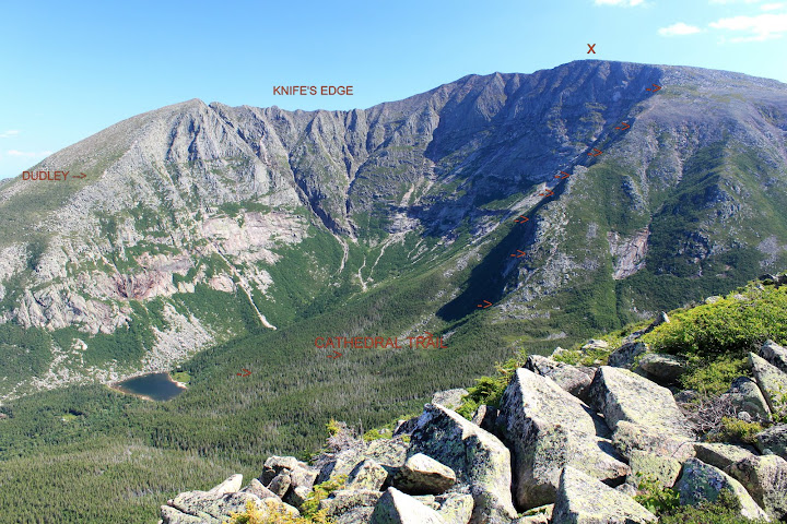
Cathedral Trail indicated in red, straight up the buttress dividing south basin of Katahdin, to the summit (x), as seen from Hamlin Ridge Trail later in day
My sixty seven in a single year quest (2012) has brought me to some great places. Finally getting up Katahdin has certainly been a standout highlight. For me, there is simply no other mountain that compares in the Northeast in terms of “real” mountain feel (in summer at least).
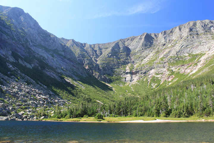
Looking up South Basin from Chimney Pond to the cliffs below the Knife Edge
Last year I was planning on going up the Cathedral Trail with a relatively inexperienced friend who said he was uneasy about heights. I saw that summit post rated it class 3 / 4 at the time so I sought advice here http://www.vftt.org/forums/showthre...rail-on-Katahdin-Question&highlight=cathedral . My friend never made the trip. I went anyway, only to be chased off the lower reaches of the Cathedral Trail by torrential rain. This year I had much better weather and couldn’t wait to see what I couldn’t last year.
My impressions of the Cathedral trail: Fun and one of the most spectacular trails in New England! Everyone seems to focus on doing the Knife Edge when they go to Katahdin, but that would mean skipping Cathedral if also going for Hamlin Peak. It’s a shame to miss this trail though.
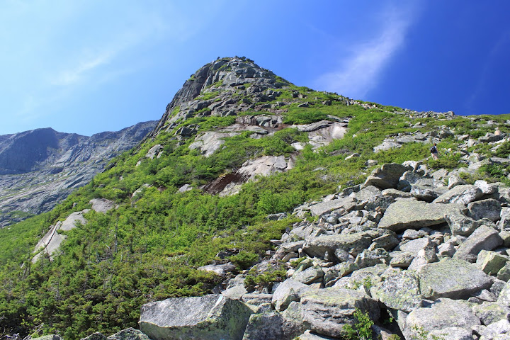
A hiker starting the climb up the first Cathedral
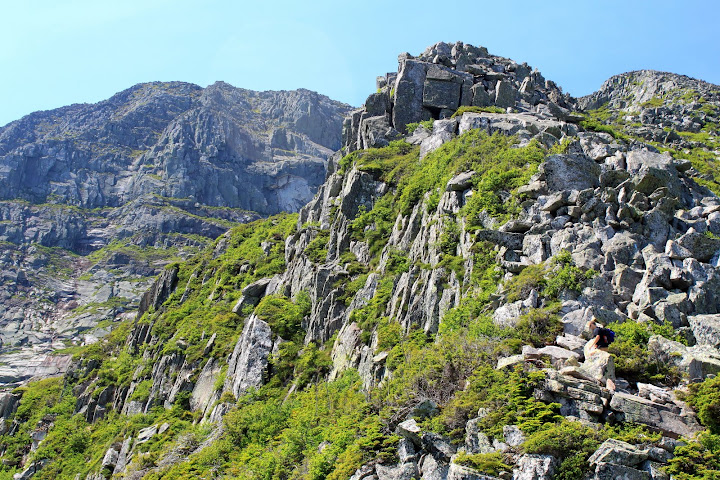
The trail goes right over the 3 cathedrals
There really is minimal sense of exposure on this trail, so unless you were extremely, extremely sensitive to heights that wouldn’t be a problem. The scrambles are well marked, and its mostly just going over boulders 5 to 10 feet high, and that’s about the worst you feel like you would fall. It would be a terrible place to need rescue though, I would think a liter carry would be at an absurd angle down and a helicopter unlikely. The rock is super grippy when dry albeit sharper than in the whites.
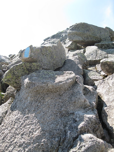
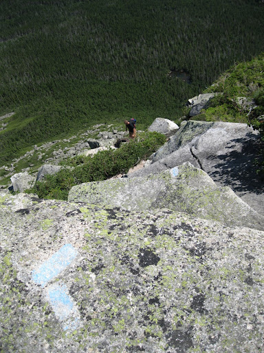
This is one of the few routes in NE I would say “I climbed” versus “I hiked,” not technical climbing, but in the sense that you are using all fours almost constantly during the whole steepest 1.2 miles. So the Colorado Roach definition of class 3 “easiest climbing category ....'Scrambling'...you are beginning to look for and use handholds for upward movement” seemed most accurate. (I think it would be class 2+ in Yosemite/California definitions) There were only 3 or 4 trickier section of larger slab that took a little pause and thought.
Plan for more time than normal, I usually hike at least 2 mph going uphill on 4k’s including stoppages, but this trail took me 2 hours per mile (.5 mph), although I took 100 pictures and more than a few moments to enjoy being in this special place, so I could have gone faster.
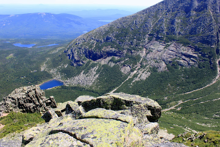
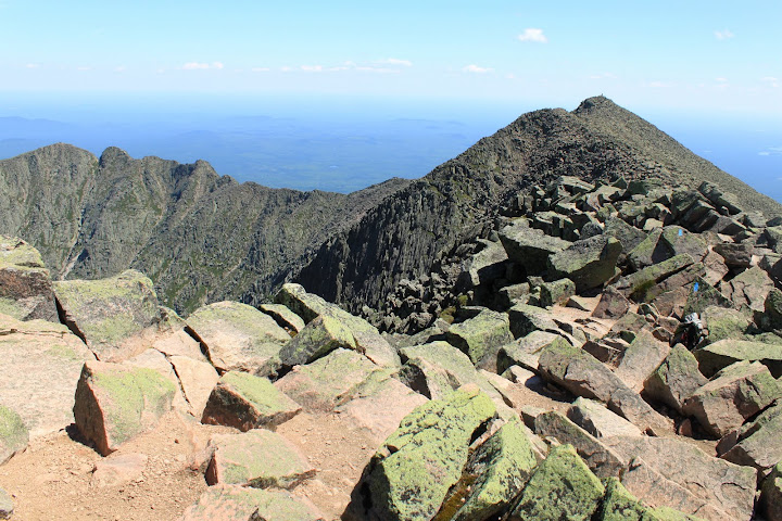
On Baxter summit, looking across Knife Edge, hikers are huddled on Pamola summit at farthest left. See them?
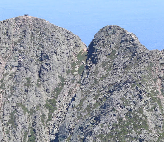
Is the hump to the right of them the dreaded chimney on the knife's edge, or is that further along?
I would not recommend Cathedral trail for descent, though I suppose you could if experienced, but it would be brutal plus those 3-4 spots would be interesting. Smaller children under teenage (note: children 6 and under are forbidden to be on Katahdin per the rules) or adults for that matter might struggle with this route, as some of the moves require some good stretching. Would definitely not recommend in the rain.
Hamlin Ridge Trail is a real gem by the way.
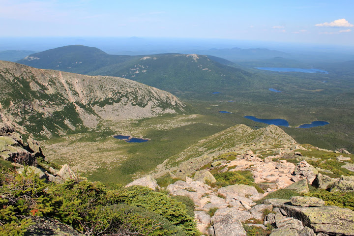
Looking down Hamlin Ridge, the humps further down the trail become only 8-10 foot wide in spots
I didn’t see a soul out there descending it, and you can look into both basins simultaneously.
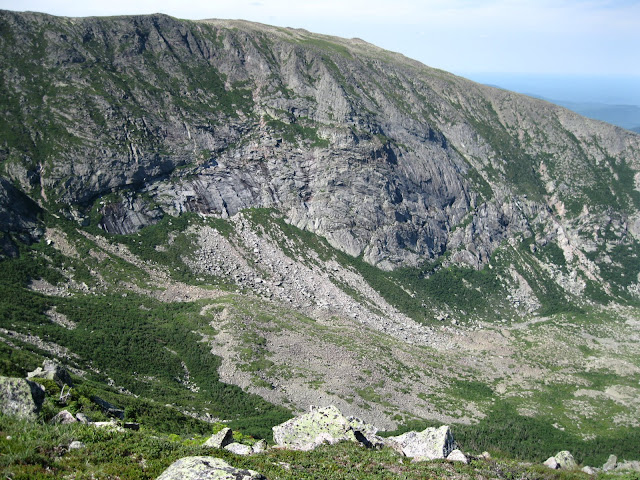
The undeveloped/untrailed Northwest Basin and headwalls
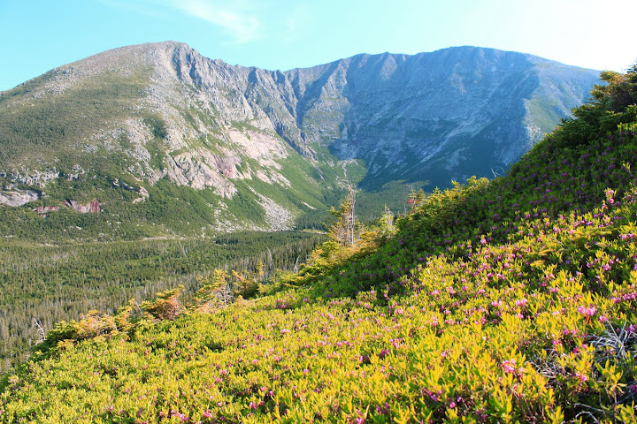
Back to south basin and Katahdin over a field of blooming blueberry bush
An interesting thing my conversations with other hikers revealed was that almost no one on the mountain knew what a “4000 footer” was—most were there just because of what Katahdin was, not because of a list or spreadsheet. People were from all over: Wisconsin, Texas, Canada, Germany, Illinois, etc.
Katahdin is the gem of the East Coast. It felt like a Western mountain and almost like I should have had to buy a plane ticket to get to such a place.
