PETCH
New member
HIKE#1
Date: Friday July15,2011
Peaks/Trails: Washington and Clay via Jewell, Gulfside, Clay Loop trails
Trail Conditions: Jewell trail was in good shape with just a little mud. Everything above treeline was as it always is.
Cast of Characters: Just me
Well, I was at near max on vaca time, so the decision was made to take Friday as a vacation day and do a solo hike. Threw the gear in the truck and started driving. Destination unknown. Trying to keep with the theme of hitting new trails and/or peaks. I decided on a new trail and peak: the Jewell Trail and Mount Clay.
Started up the Jewell trail about 9am in very comfortable clear conditions. I would have to say the Jewell trail is easier than the Ammo. Passed a few people on the way up and before breaking out of the taller trees, I came across the campsite that I had heard much about. It's apparent that this site/area gets lots of use. There were foot paths heading into the woods in all directions. Freshly burnt logs as well.
Then into the scrub area with great views in all directions, before hitting the Gulfside trail. I have hit the Northern Presi's several times, and been up Washington a dozen plus times, but have never been between Jefferson and Washington. So I figured I would take the Gulfside up to Mount Washington, then double back and take the Mt Clay loop trail up and over Clay and head towards Sphinx col. At that point, based on time and how I felt, I would decide what to do.
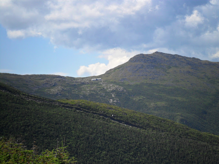
A view across towards Lakes of the Clouds Hut and Monroe
Beautiful day to be above treeline, and lots of hikers on the ridge. Many of which were doing multi-day Presi traverses.
The Gulfside trail heading up towards Washington passes on the edge of the Great Gulf, awarding incredible views of the headwall, Spaulding lake, the Northern Presi's, etc. Such a vast area.
One of my favorite pics
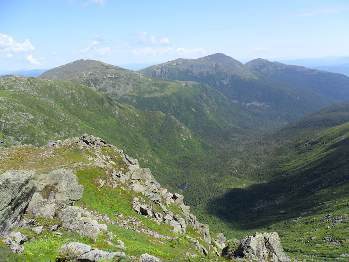
Great Gulf headwall
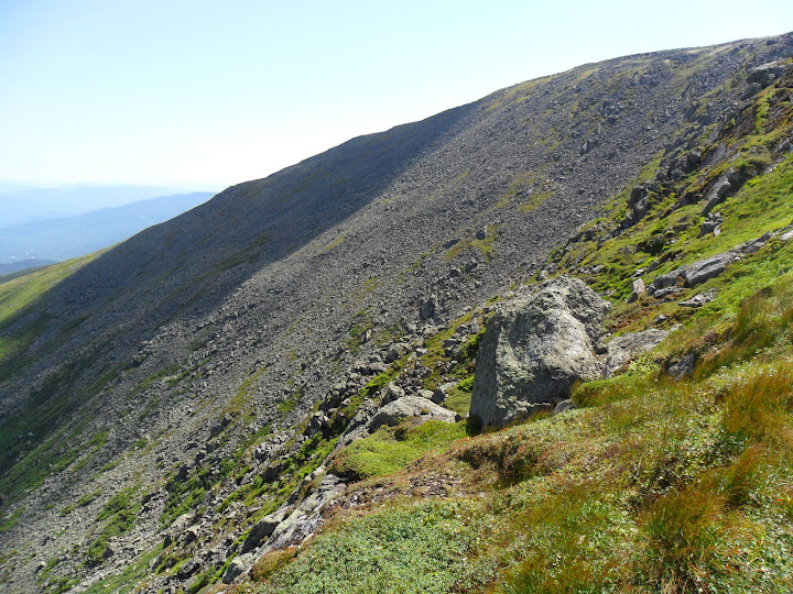
I crossed the cog tracks and went up made a quick stop on Washington to use the facilities, then got the heck out of "Touristville". I prefer Washington in February. Back down across the tracks and off towards Mount Clay.
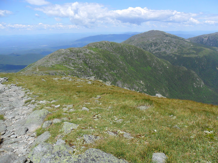
Mt Clay
I headed down the Clay loop trail to the Gulfside trail then went North until I hit the Sphinx col area. I followed the Sphinx trail a little until I came upon some rocks to have lunch on.
Sphinx Col
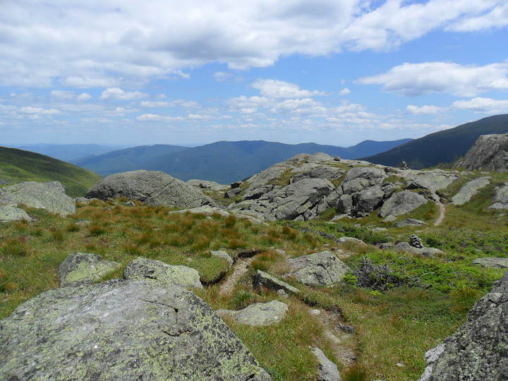
It was about 1pm, so I decided to head back so I could be home for supper. But, it wasn't all downhill from here. I had to climb several hundred feet of elevation on the Gulfside trail to get back to the junction with the Jewell trail. The upper part of the Jewell is very rugged and slow. Once into the trees, the trail is much faster. Back down at the truck at 3p. Time for the 2 1/2 hour drive back to Maine......
Gorgeous hiking day!
Washington, Clay via Jewell, Gulfside, Clay Loop
Stats: 11.6 miles, 4500ft of ele, 6 hrs
Slideshow from this trip
HIKE #2
Date: Sunday July17,2011
Peaks/Trails: Carter Dome and Mt Hight via 19Mile Brook, Carter Moriah, and Carter Dome trails
Trail Conditions: I believe there were 2 good size blowdowns, one on Carter Dome tr and one on 19MB tr.
Cast of Characters: CrazyBob, Jorge, and me, plus Henrietta
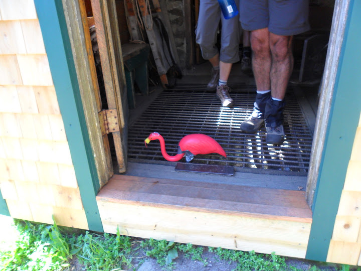
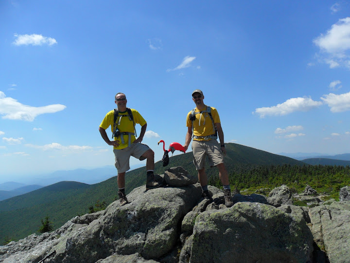
Sunday, I was scheduled to get together with Jorge and CrazyBob to do a death march of the Great Gulf. But, we decided to dial things back and save that hike for another time. We opted for a peak none of us had been to: Mt Hight. We figured we'd throw Carter Dome into the trip, assaulting the peak on the Carter-Moriah trail from the notch. Another trail section I've been meaning to hit. We also brought along a special guest- Henrietta the pink flamingo. She will be joining Jorge and CrazyBob on a trip to the Cascades next week, so I thought it best she get a little fresh air prior to the trip. She's been extremely quiet the last several weeks.
With Jorge and CrazyBob in the lead, I followed in tow. "For the love of God, what's the hurry?" We made short order of the 19MB trail and were quickly at the hut. After, re-inhaling one of my lungs which I had coughed up, I regained my composure and was ready for the climb.
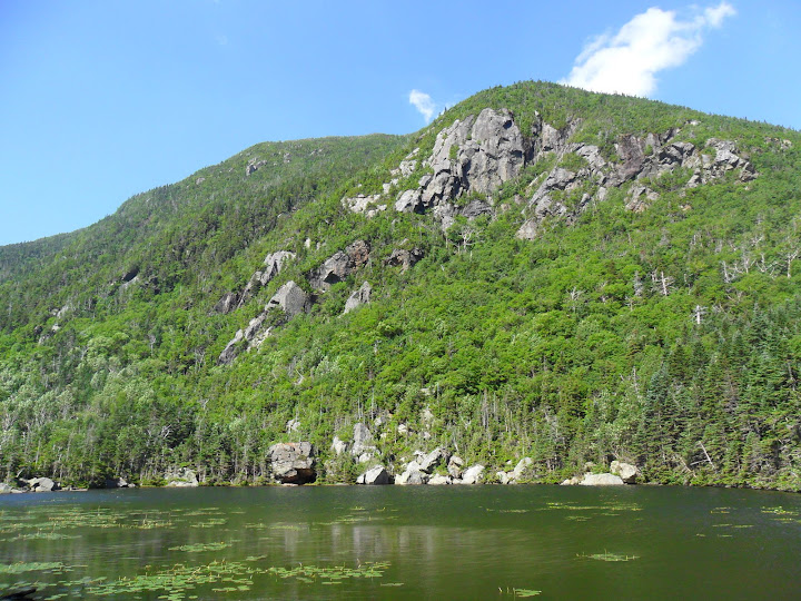
Carter lakes and Wildcat A
"Who put a grated floor here? Dang it!"......
The Carter Moriah trail is steep when leaving the notch. But it does moderate and overall wasn't as bad I thought it would be. It's really quite amazing how Jorge and CrazyBob can carry on a meaningful and lively conversation while climbing steep terrain at over 2.5 mph? I can't talk when climbing. It screws up my attempt at breathing......
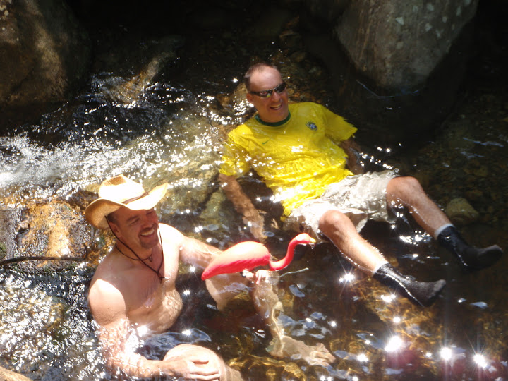
After taking a break on the Dome, we headed down and made the trip over to Mt Hight. Outstanding 360 degree views. We decided to call it an early day. Instead of adding some Carters, we just headed down from Zeta pass back down to 19MB trail. It was pretty dang hot outside, so Jorge and I decided to jump in the brook to cool off....It felt fantastic!
Jorge and CrazyBob on Hight
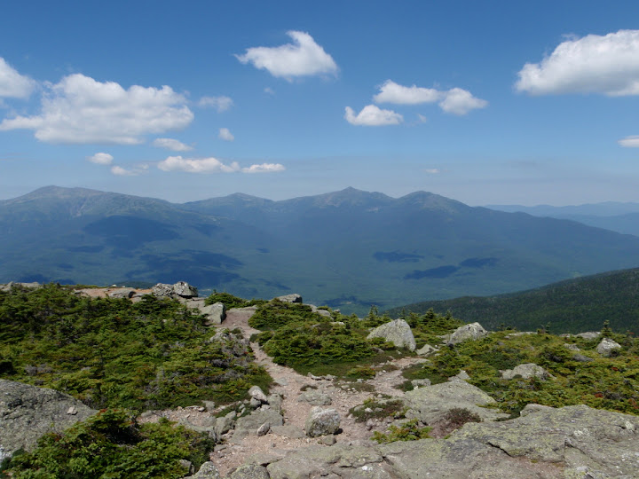
El Presadenta's
A perfect way to end a hike
Carter Dome, Mt Hight via 19MB, Carter Moriah, Carter Dome
Stats: 10.6 miles, 3660ft of ele, 5 1/2 hrs
Slideshow from this trip
Petch
Date: Friday July15,2011
Peaks/Trails: Washington and Clay via Jewell, Gulfside, Clay Loop trails
Trail Conditions: Jewell trail was in good shape with just a little mud. Everything above treeline was as it always is.
Cast of Characters: Just me
Well, I was at near max on vaca time, so the decision was made to take Friday as a vacation day and do a solo hike. Threw the gear in the truck and started driving. Destination unknown. Trying to keep with the theme of hitting new trails and/or peaks. I decided on a new trail and peak: the Jewell Trail and Mount Clay.
Started up the Jewell trail about 9am in very comfortable clear conditions. I would have to say the Jewell trail is easier than the Ammo. Passed a few people on the way up and before breaking out of the taller trees, I came across the campsite that I had heard much about. It's apparent that this site/area gets lots of use. There were foot paths heading into the woods in all directions. Freshly burnt logs as well.
Then into the scrub area with great views in all directions, before hitting the Gulfside trail. I have hit the Northern Presi's several times, and been up Washington a dozen plus times, but have never been between Jefferson and Washington. So I figured I would take the Gulfside up to Mount Washington, then double back and take the Mt Clay loop trail up and over Clay and head towards Sphinx col. At that point, based on time and how I felt, I would decide what to do.
A view across towards Lakes of the Clouds Hut and Monroe

Beautiful day to be above treeline, and lots of hikers on the ridge. Many of which were doing multi-day Presi traverses.
The Gulfside trail heading up towards Washington passes on the edge of the Great Gulf, awarding incredible views of the headwall, Spaulding lake, the Northern Presi's, etc. Such a vast area.
One of my favorite pics

Great Gulf headwall

I crossed the cog tracks and went up made a quick stop on Washington to use the facilities, then got the heck out of "Touristville". I prefer Washington in February. Back down across the tracks and off towards Mount Clay.
Mt Clay

I headed down the Clay loop trail to the Gulfside trail then went North until I hit the Sphinx col area. I followed the Sphinx trail a little until I came upon some rocks to have lunch on.
Sphinx Col

It was about 1pm, so I decided to head back so I could be home for supper. But, it wasn't all downhill from here. I had to climb several hundred feet of elevation on the Gulfside trail to get back to the junction with the Jewell trail. The upper part of the Jewell is very rugged and slow. Once into the trees, the trail is much faster. Back down at the truck at 3p. Time for the 2 1/2 hour drive back to Maine......
Gorgeous hiking day!
Washington, Clay via Jewell, Gulfside, Clay Loop
Stats: 11.6 miles, 4500ft of ele, 6 hrs

Slideshow from this trip
HIKE #2
Date: Sunday July17,2011
Peaks/Trails: Carter Dome and Mt Hight via 19Mile Brook, Carter Moriah, and Carter Dome trails
Trail Conditions: I believe there were 2 good size blowdowns, one on Carter Dome tr and one on 19MB tr.
Cast of Characters: CrazyBob, Jorge, and me, plus Henrietta
Sunday, I was scheduled to get together with Jorge and CrazyBob to do a death march of the Great Gulf. But, we decided to dial things back and save that hike for another time. We opted for a peak none of us had been to: Mt Hight. We figured we'd throw Carter Dome into the trip, assaulting the peak on the Carter-Moriah trail from the notch. Another trail section I've been meaning to hit. We also brought along a special guest- Henrietta the pink flamingo. She will be joining Jorge and CrazyBob on a trip to the Cascades next week, so I thought it best she get a little fresh air prior to the trip. She's been extremely quiet the last several weeks.
With Jorge and CrazyBob in the lead, I followed in tow. "For the love of God, what's the hurry?" We made short order of the 19MB trail and were quickly at the hut. After, re-inhaling one of my lungs which I had coughed up, I regained my composure and was ready for the climb.
Carter lakes and Wildcat A

"Who put a grated floor here? Dang it!"......

The Carter Moriah trail is steep when leaving the notch. But it does moderate and overall wasn't as bad I thought it would be. It's really quite amazing how Jorge and CrazyBob can carry on a meaningful and lively conversation while climbing steep terrain at over 2.5 mph? I can't talk when climbing. It screws up my attempt at breathing......
After taking a break on the Dome, we headed down and made the trip over to Mt Hight. Outstanding 360 degree views. We decided to call it an early day. Instead of adding some Carters, we just headed down from Zeta pass back down to 19MB trail. It was pretty dang hot outside, so Jorge and I decided to jump in the brook to cool off....It felt fantastic!
Jorge and CrazyBob on Hight

El Presadenta's

A perfect way to end a hike

Carter Dome, Mt Hight via 19MB, Carter Moriah, Carter Dome
Stats: 10.6 miles, 3660ft of ele, 5 1/2 hrs

Slideshow from this trip
Petch
