1HappyHiker
Well-known member
Circumstances caused me to get another one of my "crack of noon" starts. With limited time available, I opted to complete some unfinished business. A few months ago, I combined a bushwhack with a hike up/over Mt. Langdon. My "unfinished business" was to complete the hike of all the other peaks along this short mountain range, i.e. Mts. Stanton and Pickering, plus the series of small peaks known as the "Crippies".
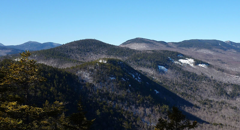
That name, "Crippies", is so bizarre! According to the WMG, "the origin of this peculiar name is one of the mysteries of White Mountains nomenclature." As I understand it, this term applies only to the group of 4 small peaks between Mt. Pickering and Mt. Langdon. For anyone unfamiliar with what a "Crippie" looks like, the 4th Crippie is shown in the center foreground of the photo below.
View of a "Crippie" (center foreground)
There are no loop options available for this trek, and so the ideal way to traverse this range is to do what others on this Forum have reported doing, i.e. spot a car at the Mt. Stanton end, and at the Mt. Langdon trailhead in Bartlett. Otherwise, if you do an "out & back" hike as I did, you climb the mountains on the outbound portion of the hike, and then must re-climb them on the return. However, these mountains are not that tall, and so I didn't find it to be a big deal.
For me, this was an enjoyable hike, but it's probably not for everyone. From the outset, you must adopt the mindset that this isn't a true wilderness hike, nor is it considered as one of the all-time classic hikes in the Whites. However, it is still a hike worth doing, and there are views along the way that I found very pleasant and very interesting.
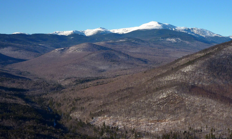
From several vantage points along the trail, there are some very nice views up the Rocky Branch Valley toward the Presidential Range. Although the photo below is slightly zoomed, these same features can easily be seen with the naked eye.
Looking Up Rocky Branch Valley Toward Presidentials
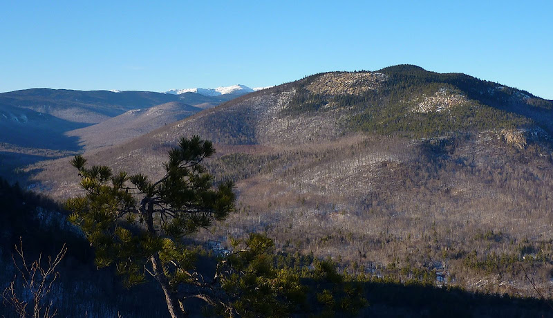
Particularly at the Mt. Stanton end of the hike, there are some good close-up views of the ledges on Iron Mountain (another great hike in this same area of the Whites!).
Ledges on Iron Mountain
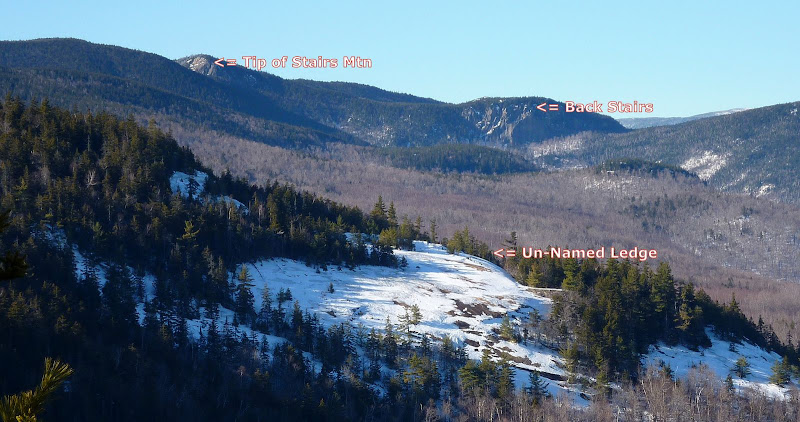
And speaking of ledges, I've labeled 3 features on the photo below. This will likely be mildly interesting ONLY to folks with an appreciation of trivia. Anyway, most everyone is familiar with Stairs Mountain with the unique "Giant Stairs" formation at its southern tip. Just to the east of Giant Stairs is a cliff which I think rock climbers have dubbed "Back Stairs". And, just to complete the tour of this photo, in the foreground there is a huge ledge. It's located on the east side of Mt. Langdon, and as far as I know, it has no name.
View of 3 Features for Those Who Admire Trivia
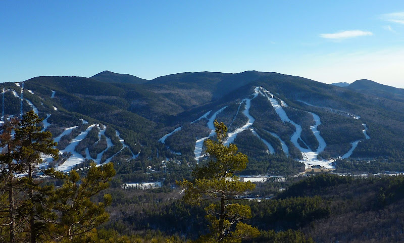
If you happen to have a particular liking for views of the Attitash Ski area, then this is definitely a hike for you! . All along the south side of the trail, there are scenes such as shown in the photo below.
View of Attitash Ski Area
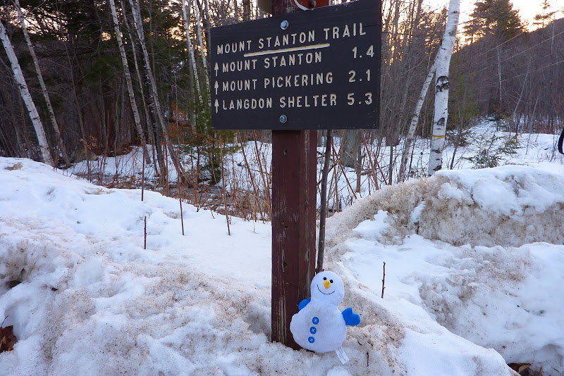
And last of all, I cannot guarantee that the cheerful little guy in the photo below will be there to greet you at the trailhead. I have no idea how this guy happened to be there, but he/she seemed happy performing the job as the official trailhead-greeter!
A Cheerful Trailhead Greeter
1HappyHiker
That name, "Crippies", is so bizarre! According to the WMG, "the origin of this peculiar name is one of the mysteries of White Mountains nomenclature." As I understand it, this term applies only to the group of 4 small peaks between Mt. Pickering and Mt. Langdon. For anyone unfamiliar with what a "Crippie" looks like, the 4th Crippie is shown in the center foreground of the photo below.
View of a "Crippie" (center foreground)

There are no loop options available for this trek, and so the ideal way to traverse this range is to do what others on this Forum have reported doing, i.e. spot a car at the Mt. Stanton end, and at the Mt. Langdon trailhead in Bartlett. Otherwise, if you do an "out & back" hike as I did, you climb the mountains on the outbound portion of the hike, and then must re-climb them on the return. However, these mountains are not that tall, and so I didn't find it to be a big deal.
For me, this was an enjoyable hike, but it's probably not for everyone. From the outset, you must adopt the mindset that this isn't a true wilderness hike, nor is it considered as one of the all-time classic hikes in the Whites. However, it is still a hike worth doing, and there are views along the way that I found very pleasant and very interesting.
From several vantage points along the trail, there are some very nice views up the Rocky Branch Valley toward the Presidential Range. Although the photo below is slightly zoomed, these same features can easily be seen with the naked eye.
Looking Up Rocky Branch Valley Toward Presidentials

Particularly at the Mt. Stanton end of the hike, there are some good close-up views of the ledges on Iron Mountain (another great hike in this same area of the Whites!).
Ledges on Iron Mountain

And speaking of ledges, I've labeled 3 features on the photo below. This will likely be mildly interesting ONLY to folks with an appreciation of trivia.
View of 3 Features for Those Who Admire Trivia

If you happen to have a particular liking for views of the Attitash Ski area, then this is definitely a hike for you!
View of Attitash Ski Area

And last of all, I cannot guarantee that the cheerful little guy in the photo below will be there to greet you at the trailhead. I have no idea how this guy happened to be there, but he/she seemed happy performing the job as the official trailhead-greeter!
A Cheerful Trailhead Greeter

1HappyHiker
Last edited:

