How We Got Safely Out of White-Out Winter Conditions Above Tree Line - Share Stories

vftt.org

Help Support vftt.org:

This site may earn a commission from merchant affiliate links, including eBay, Amazon, and others.

Driver8

New member
Joined
Aug 13, 2012
Messages
779
Reaction score
0
Location
West Hartford, CT (Photo: Sages Ravine, Salisbury,
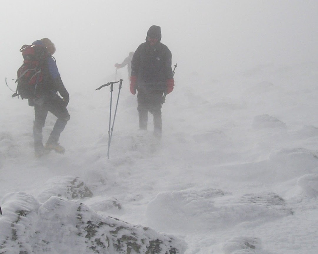
This thread is for people to share their stories of how they successfully got out of white-out winter conditions and safely onto followable trail sheltered by trees or terrain, or otherwise to safety. How well had you trained and prepared for this eventuality? What techniques did you use? Were you alone or in a group? How did that make a difference, if it did? How did your gear or lack thereof figure in? Did you contact anyone off the mountain - family and friends, 911, SAR, park rangers?

After the tough winter we've just had, it's on everyone's minds, so a bit of skill- and experience-sharing might do some good. Thanks in advance.
 
Last edited:
I've started heading the wrong way a few times on Monadnock or Cardigan when I let my guard down since I know those mountains really well. Luckily I make a habit of checking my compass frequently, so it's a matter of a couple of minutes to find a summit landmark and then follow the correct bearing.

Those weren't unexpected whiteouts or dangerous conditions, just literally getting lost in a fog. In winter I'm a lot more careful. I've turned around lots of times when conditions started going bad. You don't usually go from plenty-of-visibility to can't-see-your-hands without any warning.

I'll press on if I feel I understand the weather pattern, have lots of daylight and/or am willing to camp in place, know the route, and can see far enough not to be too easily confused. In the Presidentials, if I can see two cairns ahead, I'm usually happy. Less than that and I go into escape mode.
At the first sign of bad weather I'll spend lots of extra time paying attention to the trail, the map, and the compass. One important technique is to frequently turn around and look back at the route you came up, so you'll recognize it on the way down. This is especially important at junctions and when leaving treeline.

Another point is that finding the trail is not the goal - survival is the goal. The trail usually makes travel a lot easier, and there are a few trails where the trail is the best way to avoid dangerous terrain, but usually the trail is optional. In winter it's normal to be off-trail at least some of the time.
 
My most epic adventure in this category would be bailing from The Dungeon at Lake of the Clouds in an insane arctic whiteout. The make a long story short, luckily we had the large scale Washburn Map of the Presi Range, so we oriented the map and took compass bearings of trails we wanted to exit on and used those. We lost the cairns almost immediately on one section, but kept going by our bearings - it suddenly cleared for a few seconds and we saw that we were only about 30 yards from the trail, but had been roughly paralleling it the entire time! That Washburn guy makes a damn good map! ;)
 
Lincoln -> Lafayette -> Greenleaf Hut we could not see the next cairn due to thick fog. We had one person stay near the cairn while the other person struck out in search of the next cairn. Fortunately this worked, but only barely. Some large rocks look like cairns! What a relief when we finally met other hikers coming up from the hut!
 
My most epic adventure in this category would be bailing from The Dungeon at Lake of the Clouds in an insane arctic whiteout. The make a long story short, luckily we had the large scale Washburn Map of the Presi Range, so we oriented the map and took compass bearings of trails we wanted to exit on and used those. We lost the cairns almost immediately on one section, but kept going by our bearings - it suddenly cleared for a few seconds and we saw that we were only about 30 yards from the trail, but had been roughly paralleling it the entire time! That Washburn guy makes a damn good map! ;)

That's a cool story - which way did you descend? Ammo? Crawford/Edmands? I loved maps before I hiked, love 'em even more now.
 
I think the closest to trouble I found myself in was this trip up Boott Spur. It start snowing as we hit treeline as dusk approached. It was dark by the time we hit the Boott Spur trail, and snowing incredibly hard. The forecast was for very low winds, and it was accurate. Had it not been, navigation would have been very difficult. As it was, there were times where one of us hung back at a cairn while the other poked ahead, but never any long searches. The heavy snow/low wind/darkness combo was amazing. We could talk to each other without raising our voices. Hopefully I'll never got a really good answer to your question, as we tend to err on the side of enjoyment vs a challenge.
 
It was not an escape so much as probably just an example of making a good decision given conditions, but I was on Monroe in January this year. No wind. Oddly warm. Zero visibility. And by zero, I don't mean 25 feet or 50 feet. You literally could not see a cairn until almost on top of it. It was inside the milk jug as the saying goes.

I was heading up the Monroe Loop from the hut. I could hear people very close by but saw no signs of them at all, no movement seen in the fog. I had compass in hand and knew which way I was heading but it was difficult trying to stay on the trail between the hut and the start of the rise on the loop trail (as the Ammo Ravine Trail Adopter I'm fairly familiar with this route up Monroe).

When coming down off Monroe, the wind was picking up and the sleet was starting; I got whacked in the face by it, giving me enough sense to skip Washington. A winter storm warning was in effect for the afternoon and it was starting. To continue up to Washington would have been in the face of a coming storm with no visibility. I took a left and headed back down Ammo Ravine.
 
OK, I will be brief, and vague so as not to incriminate anyone (including me) on the trip, which was clearly type 2 fun (not fun when having it, perhaps fun later).
About 8 of us, all very experienced and most on this board :), did a winter solstice trip up Mansfield a few years back, when the solstice was at 1:47 PM. This meant hiking in the dark, in the winter, above treeline, on purpose. As we neared the summit, on time at about 6 PM, it began to snow and the clouds descended. Visibility decreased to perhaps 100 feet. Cold (mid teens), wind maybe 20 mph, pretty typical. So far, all as expected. Then we realized that cairns on Mansfield are built for summer use, and most were buried, and GPS was useless due to cold batteries, and we knew the approximate compass heading back to treeline but only within 5-10 degrees, which would give us an error too big to safely navigate by compass alone. Hmm. So we explored the summit for a while. Kind of a long while. And people started getting cold so we needed to get out of there.

Anyway, one of the smarter members of our group (not me) came up with a plan that worked. He took the brightest headlamp we had, and went on 50-100 foot jaunts in every direction within 90 degrees of our known intended course, shuffling his feet and poles as he went, till he discovered the next cairn, where we all reassembled. Rinse, repeat. After another 30-40 minutes we found a sign at treeline, which was not our intended trail but got us in the direction we needed to go. We got back to the cars none the worse for wear, though perhaps 3 hours later than we all intended. We learned a lot that evening!
 
Last edited:
Cold (mid teens), wind maybe 20 mph, pretty typical. So far, all as expected. Then we realized that cairns on Mansfield are built for summer use, and most were buried, and GPS was useless due to cold batteries [...]

Loss of GPS in these conditions must have been a real bummer. Normally, a working GPS can be of great help in extremely low visibility especially if you have good trail maps on it or if you just decided to retrace your steps by following you tracks in GPS back to where you came from. I just checked and my GPS is rated down to -4F but I have heard that not all batteries are equal in low temperatures, so I would love to learn more about it at some point.
 
Loss of GPS in these conditions must have been a real bummer. Normally, a working GPS can be of great help in extremely low visibility especially if you have good trail maps on it or if you just decided to retrace your steps by following you tracks in GPS back to where you came from. I just checked and my GPS is rated down to -4F but I have heard that not all batteries are equal in low temperatures, so I would love to learn more about it at some point.

I'll defer to many others here with extensive experience but I believe lithium ion batteries last longer than regular and/or rechargeable batteries in cold weather. I use rechargeable batteries and on a freshly charged set I can go all day with non stop use (8-12 hrs) in temps 0 deg and above without the batteries dying. Not sure how much faster the charge goes in extreme cold. While not as accurate, I'll keep the GPS in a pants pocket versus hanging loose on a pack strap when I Winter hike.
 
The answer for me, in general, is meticulous planning ahead of time (I've never gone above treeline expecting anything other than whiteout conditions) and a high level of competence navigating by compass.

Here's one example: Day two of a Presi-traverse backpack three winters ago, coming down Washington to Lakes then on to Monroe. Heavy wind, cold, poor visibility, freezing fog/blowing snow. Getting to Crawford path from the summit of Washington is actually sort of a hassle (start out going northwest, then turn west, then southwest, but don't miss a trail junction!) With the conditions being what they were, we took a bearing directly on Lakes from the summit of Washington rather than trying to find the start of the trail, figuring we'd likely run into Crawford path anyway before we got to Lakes. This worked, and we picked up Crawford path after losing several hundred feet of elevation. But perhaps 1/2 mile or so from Lakes the snow was deep enough and visibility poor enough that we could no longer follow the trail. We knew quite precisely where we were (had been following our progress very closely on our map), so we took another bearing on Lakes and headed in that direction. Visibility was bad enough that we were tripping over snow drifts because we couldn't see them and occasionally sliding down steep drifts because we couldn't see those either. It really, truly is possible to walk directly off a cliff if visibility is bad enough. But we knew we weren't in the vicinity of any cliffs or serious drop offs. We got to the spot where we thought Lakes 'should' be, and there was in fact a 'lake,' just not 'Lakes." But after backtracking and wandering around a bit, we finally found the hut, though not until we were basically right on top of it. We stood in the lee and gathered ourselves to decide what we wanted to do next. We weren't particularly gripped, these conditions come with the territory, and we'd all been in that territory before; plus, we had full overnight gear and plenty of bailout options. So after taking some food and water we headed off for Monroe on a compass bearing. But the wind got a little worse, and midway up Monroe we just could not go on, so we turned around and fought bitterly through the wind, which had been at our right shoulder but was now directly in our left eye. We re-gathered in the lee of Lakes. The temp was predicted to drop further (it was 10 below at the time) and the wind to pick up (it was already heavy), so we decided it was time to bail. Once again, we took a bearing on the first 1/2 mile or so of Ammo Ravine and headed off. It wasn't terribly difficult to find the right drainage with a good compass bearing, but there were few cairns or anything else to guide us until we were into the woods. In spite of our relative confidence, it was a great relief to get out of the wind and whiteout - visibility improved markedly just a few hundred feet below Lakes, and the wind all but died. So, naturally, we began to question our decision to bail... :) We were lucky enough to hitch a ride back to our cars from the Cog base station and headed off to the Moat. When we got out of the car, we could see a snow plume coming off the Presidentials, and the wind, even from that low altitude, was roaring! I do not on any level regret our decision to bail. We ate well. A couple of days later I realized that the underside of one of my nostrils had been exposed to the wind (through my balaclava and up the nose slot in my face mask) and I had a somewhat painful frost nip that took a couple of weeks to heal. I was reminded each time I blew my nose.

The keys to the success of this trip (a successful bailout - is that an oxymoron? Nah...), I think, were having full overnight gear so that, in the absolute worst case, we could drag an injured party member off the ridge, dig in, and camp quite comfortably for several days if necessary. We knew all of our bailouts. We had full confidence in our ability to navigate by compass. We had all experienced bad conditions in the past. These factors allowed us to keep our heads and think quite clearly and rationally, even when the conditions were pretty bad.
 
Loss of GPS in these conditions must have been a real bummer. Normally, a working GPS can be of great help in extremely low visibility especially if you have good trail maps on it or if you just decided to retrace your steps by following you tracks in GPS back to where you came from. I just checked and my GPS is rated down to -4F but I have heard that not all batteries are equal in low temperatures, so I would love to learn more about it at some point.
Lithium primary (non-rechargeable) are the best in the cold. NiMH and LIon (lithium ion, rechargeable lithium) are intermediate and alkaline are the worst. The exact temperature limits for each chemistry depend on the device and the age and charge state of the battery.

I'll defer to many others here with extensive experience but I believe lithium ion batteries last longer than regular and/or rechargeable batteries in cold weather. I use rechargeable batteries and on a freshly charged set I can go all day with non stop use (8-12 hrs) in temps 0 deg and above without the batteries dying. Not sure how much faster the charge goes in extreme cold. While not as accurate, I'll keep the GPS in a pants pocket versus hanging loose on a pack strap when I Winter hike.
I think you may be confusing lithium ion (rechargable) and lithium primary (non-rechargeable) cells. The field replaceable AA and AAA lithium cells are primary cells.

Batteries extract their energy from chemical reactions and chemical reactions slow down in the cold. The cold does not reduce the amount of energy contained in a cell, just the rate at which it can be delivered (ie less available current in the cold). Thus a battery stored in the cold or "run down" in the cold will generally be useable after rewarming so warming the batteries in your pocket may help for short periods.

I generally use NiMH AA cells in my (Garmin 60CSx) GPS and have had no problems down to temps of 5F or so. I also carry lithium (primary) spares. Some just use lithiums from the start in the cold.

Doug
 
The answer for me, in general, is meticulous planning ahead of time (I've never gone above treeline expecting anything other than whiteout conditions) and a high level of competence navigating by compass.

Here's one example: Day two of a Presi-traverse backpack three winters ago, coming down Washington to Lakes then on to Monroe. Heavy wind, cold, poor visibility, freezing fog/blowing snow. Getting to Crawford path from the summit of Washington is actually sort of a hassle (start out going northwest, then turn west, then southwest, but don't miss a trail junction!) With the conditions being what they were, we took a bearing directly on Lakes from the summit of Washington rather than trying to find the start of the trail, figuring we'd likely run into Crawford path anyway before we got to Lakes. This worked, and we picked up Crawford path after losing several hundred feet of elevation. But perhaps 1/2 mile or so from Lakes the snow was deep enough and visibility poor enough that we could no longer follow the trail. We knew quite precisely where we were (had been following our progress very closely on our map), so we took another bearing on Lakes and headed in that direction. Visibility was bad enough that we were tripping over snow drifts because we couldn't see them and occasionally sliding down steep drifts because we couldn't see those either. It really, truly is possible to walk directly off a cliff if visibility is bad enough. But we knew we weren't in the vicinity of any cliffs or serious drop offs. We got to the spot where we thought Lakes 'should' be, and there was in fact a 'lake,' just not 'Lakes." But after backtracking and wandering around a bit, we finally found the hut, though not until we were basically right on top of it. We stood in the lee and gathered ourselves to decide what we wanted to do next. We weren't particularly gripped, these conditions come with the territory, and we'd all been in that territory before; plus, we had full overnight gear and plenty of bailout options. So after taking some food and water we headed off for Monroe on a compass bearing. But the wind got a little worse, and midway up Monroe we just could not go on, so we turned around and fought bitterly through the wind, which had been at our right shoulder but was now directly in our left eye. We re-gathered in the lee of Lakes. The temp was predicted to drop further (it was 10 below at the time) and the wind to pick up (it was already heavy), so we decided it was time to bail. Once again, we took a bearing on the first 1/2 mile or so of Ammo Ravine and headed off. It wasn't terribly difficult to find the right drainage with a good compass bearing, but there were few cairns or anything else to guide us until we were into the woods. In spite of our relative confidence, it was a great relief to get out of the wind and whiteout - visibility improved markedly just a few hundred feet below Lakes, and the wind all but died. So, naturally, we began to question our decision to bail... :) We were lucky enough to hitch a ride back to our cars from the Cog base station and headed off to the Moat. When we got out of the car, we could see a snow plume coming off the Presidentials, and the wind, even from that low altitude, was roaring! I do not on any level regret our decision to bail. We ate well. A couple of days later I realized that the underside of one of my nostrils had been exposed to the wind (through my balaclava and up the nose slot in my face mask) and I had a somewhat painful frost nip that took a couple of weeks to heal. I was reminded each time I blew my nose.

The keys to the success of this trip (a successful bailout - is that an oxymoron? Nah...), I think, were having full overnight gear so that, in the absolute worst case, we could drag an injured party member off the ridge, dig in, and camp quite comfortably for several days if necessary. We knew all of our bailouts. We had full confidence in our ability to navigate by compass. We had all experienced bad conditions in the past. These factors allowed us to keep our heads and think quite clearly and rationally, even when the conditions were pretty bad.

That's textbook quality, I think. Thanks so much for sharing your experience, hb.
 
Lithium primary (non-rechargeable) are the best in the cold. NiMH and LIon (lithium ion, rechargeable lithium) are intermediate and alkaline are the worst. The exact temperature limits for each chemistry depend on the device and the age and charge state of the battery.


I think you may be confusing lithium ion (rechargable) and lithium primary (non-rechargeable) cells. The field replaceable AA and AAA lithium cells are primary cells.

Batteries extract their energy from chemical reactions and chemical reactions slow down in the cold. The cold does not reduce the amount of energy contained in a cell, just the rate at which it can be delivered (ie less available current in the cold). Thus a battery stored in the cold or "run down" in the cold will generally be useable after rewarming so warming the batteries in your pocket may help for short periods.

I generally use NiMH AA cells in my (Garmin 60CSx) GPS and have had no problems down to temps of 5F or so. I also carry lithium (primary) spares. Some just use lithiums from the start in the cold.

Doug

No apparently I meant lithium primary because I didn't realize there was a rechargeable lithium type battery. As always, my ignorance on this forum has yielded another learning opportunity! :p
 
P1010032.JPG


This was at the top of Abol Slide heading to the summit of Katahdin. We placed wands to find our way back to the trail off the plateau/summit area.
We wandered around a bit to find the summit sign. Missing the trail down would have been inconvenient.
 
I didn't realize there was a rechargeable lithium type battery.
Most (nearly all?) cellphones and portable computers have rechargeable lithium-ion batteries. Lots of other consumer devices too...

Lithium-ion batteries have high energy density (both per weight and per volume) but are electrically delicate (over charging or over discharging will destroy them*) and have a relatively short shelf life. They also tend to be expensive.
* The control electronics generally prevent such failures.

Doug
 
On my first hike up Mt Washington, the cloud line was about at the top of Tuckerman Ravine. Once in the clouds, we navigated by standing near each cairn and waiting until a gap in the fog revealed the next cairn. After a while we began to hear engine sounds and suddenly arrived at a parking lot.

Since then, I have occasionally used car engine sounds as an aid to navigation.

Doug
 
That's a cool story - which way did you descend? Ammo? Crawford/Edmands?

We kept on truckin' down the Crawford Path. We were on a 3 day Presi Traverse, training for Denali and were actually hauling sleds roped together for some sections. We had all our Alaskan-grade gear, so we were plenty comfortable. This was the 2nd training traverse we had done where we had deliberately chosen a terrible weather window to give us some arctic-like experience.

Needless to say, the Presi Range was more than happy to oblige!

Chuckle. They're good at that. Did conditions improve significantly with elevation loss, or only once you hit treeline?
 
That's a great pic, Chip. The closest I've gotten to real winter peril out hiking was on Pico Peak January 19, 2013. High winds, gusting to 45ish, temps around 10-15 F. I was highly bundled, and well equipped, but solo. Was running low on daylight and daunted by the howling of the NW wind and a slight feeling of chill. Turned back after a rest stop at the cabin at 3500', about 3 pm. Got back to the car in daylight, and both the temp and the wind became well more than acceptable at about 3200'. Remarkable the difference a bit of elevation and getting on the lee side of a landmass can make in winter.

The mountaineering lessons reinforced were the importance of paying close attention to conditions, trusting one's considered reactions to them, and turning back when in doubt and near the margin, especially when solo.
 
Top