Is There a Similarly-Worded Trail Sign Somewhere in the Whites?

vftt.org

Help Support vftt.org:

This site may earn a commission from merchant affiliate links, including eBay, Amazon, and others.

1HappyHiker

Well-known member
Joined
Jan 18, 2007
Messages
1,973
Reaction score
405
Location
Bethlehem, NH
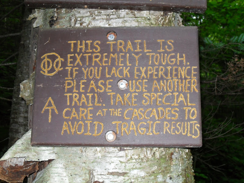
The sign shown in the photo below was taken on a recent hike in the Willoughby State Forest in Vermont. I'm just curious if anyone has seen a trail sign similar to this somewhere in the Whites???? I vaguely recall seeing something comparable somewhere in NH . . . but then again . . . maybe not!

CAUTION! HOLD CHILDREN; LEASH DOGS
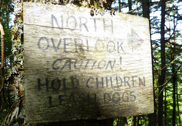
P1030686.JPG

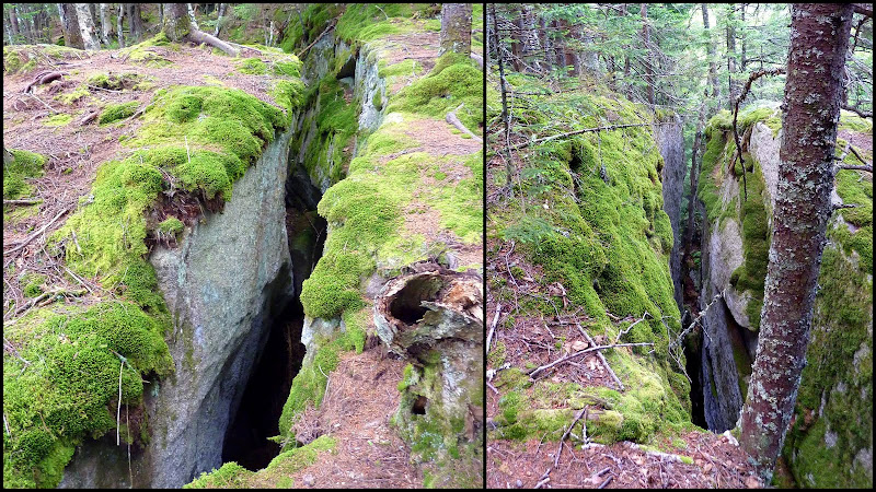
Take a look at the composite photo below. The reason for this sign is to warn you of the enormous fissures in the bedrock (which I subsequently learned are 30 to 40 feet deep)!
In order to access an outlook from a nearby ledge, you need to take a giant step (or jump) over these huge chasms.:eek:

Mt_Hor_Trek.jpg
 
Last edited:
I don't remember ever seeing such a sign -- I think, given the situation, it's helpful and may have saved some from a nasty fate.
 
On the way up Stairs Mountain, I think. Before you get to the top there’s a short side path to an overlook. There may have been some sort of barrier, too, to prevent you from falling off and getting back onto the trail below in a hurry.
 
Guess the don't call it Willoughby Gap for nothin'. Great sign. :)
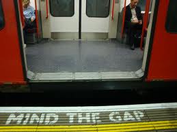
Hmmm . . . and taking it a step further to the international level, you wonder if for a similar fissure in England there would be a sign that merely read: "Mind the Gap!".:rolleyes:
Mind_the_Gap.jpg
I don't remember ever seeing such a sign -- I think, given the situation, it's helpful and may have saved some from a nasty fate.
Agreed! And, this looks like a place to definitely avoid when conditions are wet and/or icy!:eek:
Not so wordy a sign. It merely says DOWNLOOK, with an arrow below it.

And the view: Not as much of a barrier as I’d remembered, either. More like a tripping bar.
Thanks Raymond for taking time to round up some photos from the Stairs Mountain viewpoint. And yup, that sure does look more like a tripping bar than a barrier!:eek:
 
There used to be a DOC sign with a skull and crossbones on it coming down the A.T. on Mt. Cube, which was well in advance of a steep descent on an otherwise-moderate section of trail

That section has since been relocated out of existence, and after the recent N Twin thread I think many hikers would object to it as non-standard (as well as a similar DOC "No Unicycles" sign).
 
Was there a ladder at that place on Mount Cube, Roy? I remember Eric Ryback, in his ‘‘Hiking the Appalachian Trail’’ account, mentioning a ladder up that mountain.

I was a kid when I read that repeatedly, and I pictured Mount Cube looking something like Devil’s Tower, with a looooong ladder up one side, dangling in the breeze.
 
I don't remember if there is a sign on the Kinsman Ridge Trail or actually on the side trail on the NW side of the mountain that leads to a Flume like structure; but I recall that being a place you come up on rather abruptly while traveling downhill towards it's edge. Nice little dropoff there that is also a bit shrouded by the vegetation.
 
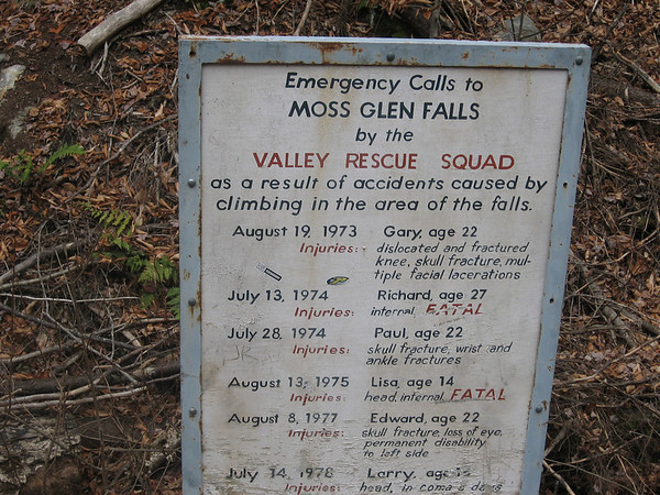
What about Glen Ellis Falls in Pinkham Notch? It seems that I remember a similar sign posted there at some point. Many years ago, family friends told me about a visit with their barking dachshund. When they suddenly no longer heard any barking, they noticed that their dog had fallen over the edge and was hanging from his collar and leash tied to the fence. They hauled him in and found that he was none the worse, and resumed barking within a couple of minutes.
 
>Was there a ladder at that place on Mount Cube, Roy?

I don't remember a ladder, but it was a near vertical cliff that required scrambling unlike the rest of that trail (a direct route to 25-A rather than the current circuitous route)

>I pictured Mount Cube looking something like Devil's Tower,
>with a looooong ladder up one side, dangling in the breeze.

Eric Ryback does have a way with words, perhaps he wanted to make the A.T. sound more exciting than it was :) I would guess it was maybe 12' high.

Do you remember if he came to it going downhill which it would have been heading NB? You might even still be able to find that section of trail from the top - it's posted at the bottom now if I recall.
 
He did the Trail southbound; I wouldn’t swear now that he ascended the ladder, but that’s the impression or memory that I have of it.

Our local library had that two-volume collection back in the day. Not sure if it’s still there or not. I saw it at The Mountain Wanderer a few years ago for a pretty penny, so I guess it’s a classic. Eric Ryback’s was the lead story, I think, and my favorite.
 
Was there a ladder at that place on Mount Cube, Roy? I remember Eric Ryback, in his ‘‘Hiking the Appalachian Trail’’ account, mentioning a ladder up that mountain.

I was a kid when I read that repeatedly, and I pictured Mount Cube looking something like Devil’s Tower, with a looooong ladder up one side, dangling in the breeze.

hmmmm. more good reasons to head over to the N. summit of Cube!:D
Much of the upper section of the mountain is within the AT corridor, but I do think the lower portion, closer to the Mt. Cube Sugarhouse is posted now. It might be possible to descend, and then use the yellow boundary blazes to guide yourself back to the trailhead on 25A.

The old AT which descends from the N. Summit of Mt Cube can still be found (well, three years ago). Hillwalker and I found it while doing some corridor monitoring. However, if there is a nasty strech it must be on private property north of the current boundary. GPS track on Wikiloc.
 
>He did the Trail southbound; I wouldn't swear now that he ascended
>the ladder, but that's the impression or memory that I have of it.

That would work, probably the same spot but I think the ladder had been removed when I was there a few years later - if it was that rickety it was probably better to climb the rock :)

>Our local library had that two-volume collection back in the day. Not
>sure if it's still there or not. I saw it at The Mountain Wanderer a
>few years ago for a pretty penny, so I guess it's a classic.

That's where I read it, now it's hidden away and you have to ask for it

> Eric Ryback was the lead story, I think, and my favorite.

I wouldn't say it had a lead story, his was the one that sounded most exciting to a kid no doubt

Another teenager who did the trail alone about that time 1969? and I think was also in the book was Jeff Hancock - ring any bells, George? His father drove him down and they buried resupply canisters at many road crossings along the way. I was on a snowshoe trip with him the next winter and after everybody else who wanted took a turn breaking I think
he broke the whole rest of the way.
 
Top