Lincoln Woods Trail Destruction - Storm Irene

vftt.org

Help Support vftt.org:

This site may earn a commission from merchant affiliate links, including eBay, Amazon, and others.

J&J

Active member
Joined
Oct 6, 2004
Messages
534
Reaction score
186
Today I took a walk down the Lincoln Woods trail (I still prefer the Wilderness trail myself) to see what kind of damage was done by the Pemi. Incredible stuff has happened.

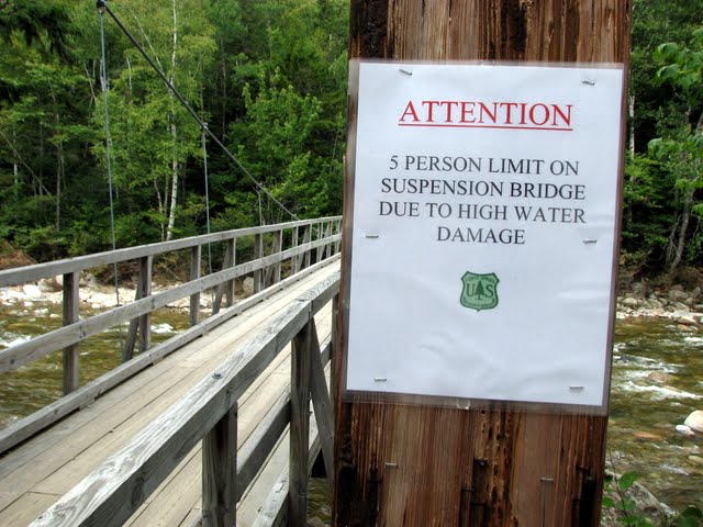
Warning signs galore today. This was one of them.
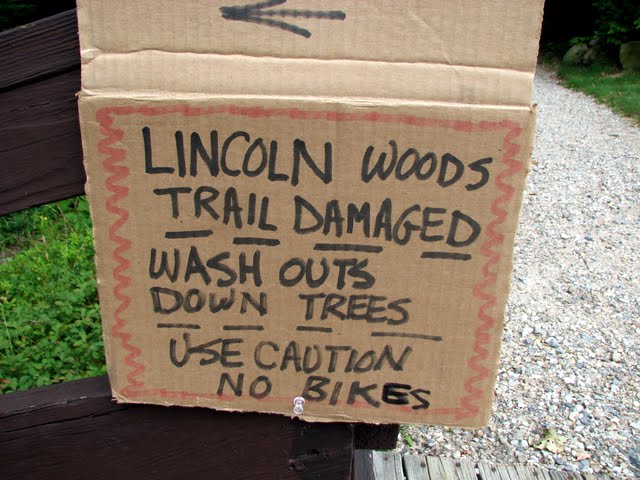
IMG_0021.JPG


That's a scary thought.
IMG_0023.JPG


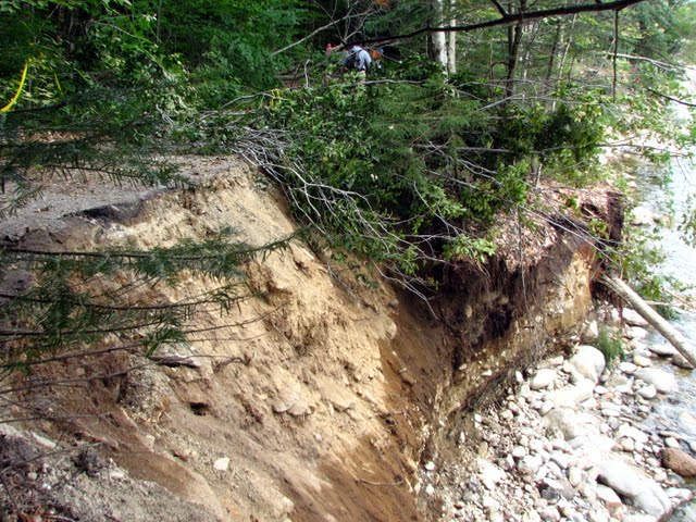
Watch out below and don't get too close to the edge.
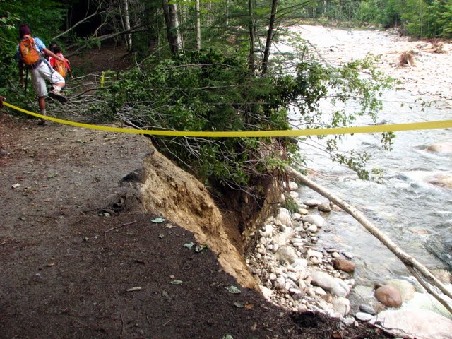
IMG_0035.JPG


Another view of the same spot.
IMG_0038.JPG


From the spur path leading to the Pemi at the Osseo trail.
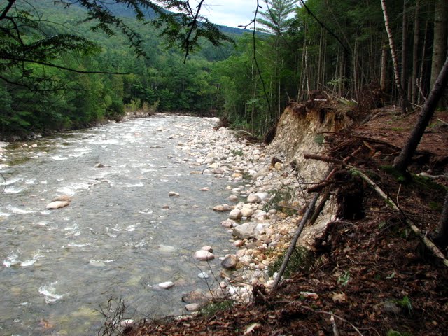
IMG_0049.JPG


Looking at the damage from river level.
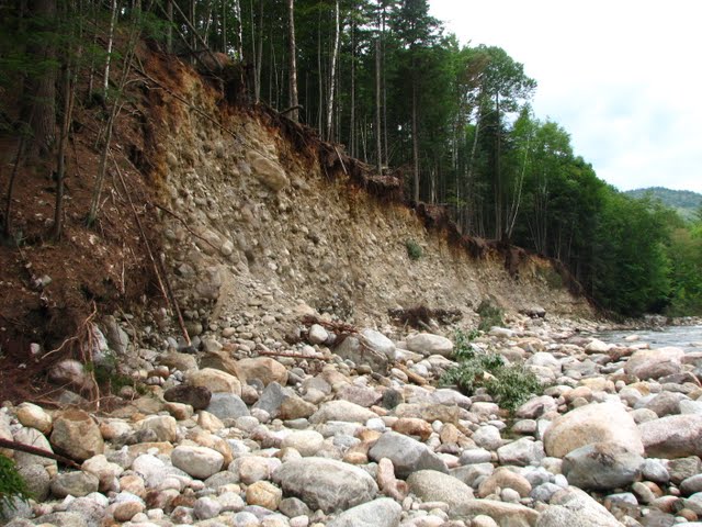
IMG_0058.JPG


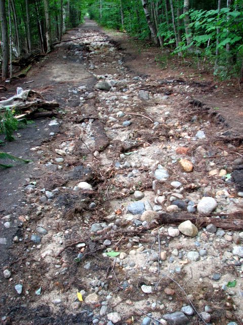
This entire area was overrun by the river as witnessed by the fresh sand deposits.
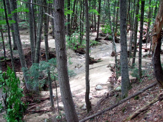
IMG_0069.JPG


I wonder if this will provide an opportunity to yank the old railroad ties out. I would hate to see them go.
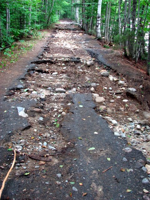
IMG_0075.JPG


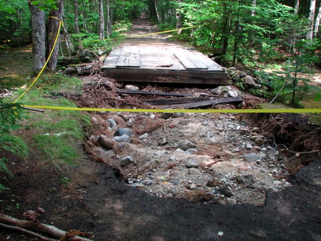
More damage.
IMG_0076.JPG


This is where I turned around.
IMG_0078.JPG


Just thinking out loud here but I wonder how the now long gone Pemi suspension bridge would have fared with this storm. Maybe the river would have taken her out. A more respectable end. Maybe all the bridge detritus has been washed downriver and nothing remains to be cleaned up.
 
Great shots!! Much better than my cell phone pics (that I can't seem to upload). It sure does look different out there now!!
 
attachment.php

The new erosion at the junction of the Osseo Trail


attachment.php

The great new views of the Hancocks from the same spot
 
Last edited:
Just thinking out loud here but I wonder how the now long gone Pemi suspension bridge would have fared with this storm. Maybe the river would have taken her out. A more respectable end. Maybe all the bridge detritus has been washed downriver and nothing remains to be cleaned up.

i was wondering the same thing! I wonder how some of the other Wilderness bridges are doing....

nice pictures!!!! WOW - the POWER of nature!!!!
 
Just thinking out loud here but I wonder how the now long gone Pemi suspension bridge would have fared with this storm. Maybe the river would have taken her out. A more respectable end. Maybe all the bridge detritus has been washed downriver and nothing remains to be cleaned up.
i was wondering the same thing! I wonder how some of the other Wilderness bridges are doing....
That bridge was pretty high up--my guess is that the structure itself would have been above the water unless an endpoint was undermined. I don't recall if it had stabilizing cables which might have been at risk.

Doug
 
That bridge was pretty high up--my guess is that the structure itself would have been above the water unless an endpoint was undermined. I don't recall if it had stabilizing cables which might have been at risk.

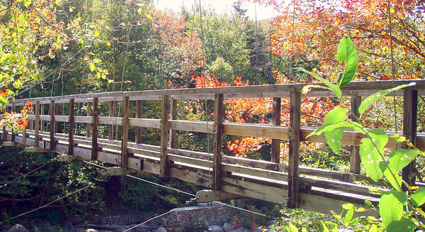
I took a photo the day before the closure, in Sept. 2009, that gives some idea how high up that bridge was:

654676013_T64Aa-M-1.jpg


I took a couple of others that confirm the considerable height. Unless you were there at highwater, however, you couldn't be certain, I guess. A visit might be instructive.
 
Also, I believe both ends were anchored on some pretty solid-looking rock outcroppings. So I doubt undermining of the end points would have been an issue either.
 
That bridge was pretty high up--my guess is that the structure itself would have been above the water unless an endpoint was undermined. I don't recall if it had stabilizing cables which might have been at risk.

I took a photo the day before the closure, in Sept. 2009, that gives some idea how high up that bridge was:

I took a couple of others that confirm the considerable height. Unless you were there at highwater, however, you couldn't be certain, I guess. A visit might be instructive.
Thanks--your pic shows the stabilizing cables but not their anchors.

The following pics (2/22/2011, post bridge removal) taken from the location of the eastern end show the height and site of the western end.
vga_IMG_0462.JPG

vga_IMG_0463.JPG

Clearly the western end was on bedrock and not likely to have been undermined.

Doug
 
Last edited:
I thought the same thing about the Pemi Bridge - definitely a more fitting end.

Those pictures are telling -- and te five person limit sign? Freaky.
The limit might be consistent with damage to the stabilizing cables--to minimize bounce and sway when people are on it. Or maybe they just haven't had time to check it out fully and want to limit the load until it is properly checked out.

Doug
 
This pic, taking on the same Sept. '09 hike at the south end of the lamented Pemi Bridge, sheds only a little more light:

654676165_f6Gfw-M-2.jpg
The bridge is in the way... :) :(

It does show the angle of a stabilizing cable--the anchor is obviously lower than the bridge.

I recall the stabilizing cables from this or a similar suspension bridge (I think it was the Dry River Bridge in 2002 before it was washed out and replaced)--they form catenaries out to both sides and down a bit.

Doug
 
Top