Loop of slides 9/19/09

vftt.org

Help Support vftt.org:

This site may earn a commission from merchant affiliate links, including eBay, Amazon, and others.

bristlecone

New member
Joined
May 27, 2009
Messages
98
Reaction score
26
Location
Singapore
Some form of this trip had been in the works for over a year. They day had come; we had made it past the gathering of kilt-clad folks, it was time. An approach on a wonderfully cool and clear morning had brought us to our first highlight.
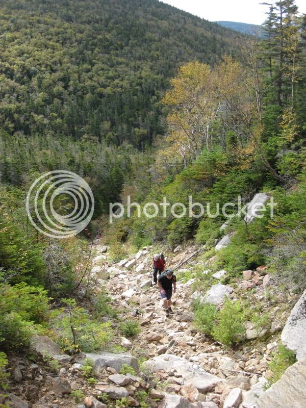
IMG_2504.jpg


We enjoyed all the charms of climbing a new slide - the climb itself, the slowly unfolding views, the unfamiliar new perspectives of familiar mountains.
IMG_2517.jpg


Teledancer surveys his progress
IMG_2518.jpg


and plots his strategy for the next move
IMG_2522.jpg


Quadripedal action was a central theme
IMG_2540.jpg


Nearing the top
IMG_2545.jpg


Teledancer enjoying the heck out of the slide and feeling that it had been too long since he had been on one
IMG_2549.jpg


Andrew B goes for the upright technique
IMG_2552.jpg


It was Holli's first slide climb - finishing the final slab like she had been here before
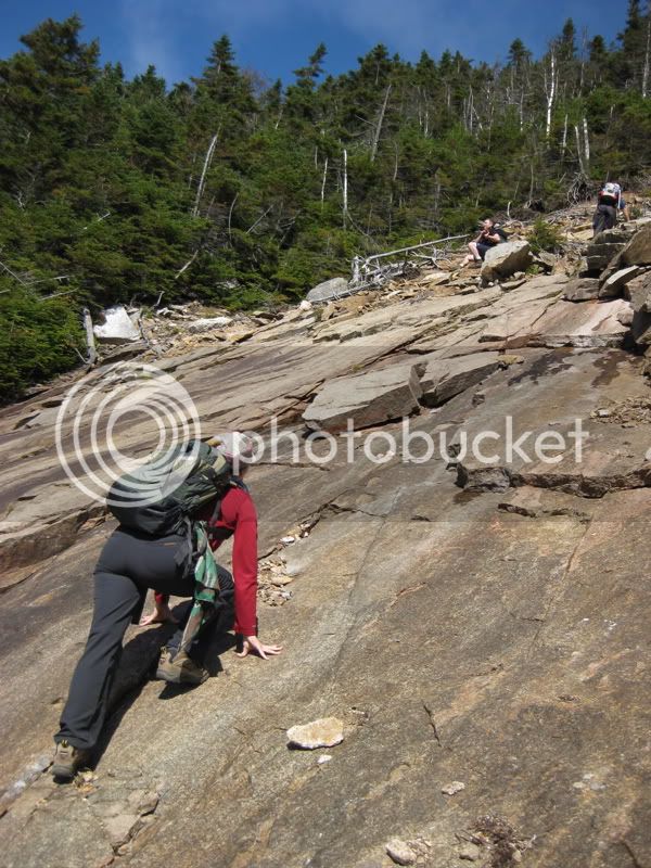
IMG_2555.jpg


That abrupt transition from wide open to rather not
IMG_2563.jpg


Where's the hiker?
IMG_2566.jpg


We had a pleasant lunch break at the summit alongside a few other hikers, chatting about this and that. Teledancer thought he heard bagpipes, Andrew thought he might, Holli and I remained skeptical.

Instead of an after-lunch nap, we opted for about a mile and a half of bushwhacking out and partially back along a trailless ridge. Would it be 'open,' and take an hour or two, or not, and take... is there really an upper time limit to bushwhacking through blowdowns and fir waves?

The first section was beautifully open. Farther along, one minor blowdown tested our good spirits, which remained undented. The rest of the way was a bit open, ocasionally thicker. On average:
IMG_2576.jpg
 
We enjoyed the approach to the summit of note along a narrow, rocky ridge. The summit itself offered few views, nor much evidence of the alleged fire tower remains, but we enjoyed this unique and interesting viewpoint along the way. A sampling...
IMG_2574.jpg


Doubling back, where's the hiker?
IMG_2575.jpg


We were confronted with our navigational crux: Find the top of another slide that was randomly located on a featureless mountainside significantly below a ridge that itself was a bit featureless. Where should we turn off, and what direction should we head? Caving in to the temptation of technology, I turned on my GPS. It stubbornly refused to get a signal as I wandered through the montane vegetables. Even walking around with it balanced on my head (for a good view of the sky and a fashionable look) didn't really help. Stop in an opening and let it sit there until it acquired enough signal, or select a dropoff point and bearing based on feeling?

Choice B. Which landed us right here.
IMG_2578.jpg

Blind luck favors the blind. I mean, we deftly read the terrain, navigated, and followed our noses in a clever and astute way, and popping out exactly on top of our target slide did not surprise us in the least.

If only we had ten feet of stable snow and skis. Resourceful as ever, lack of those things did not preclude telemark technique.
IMG_2582.jpg


Unavoidably we brought some of the mountain down with us.
IMG_2584.jpg


Up the slabby slide and down the gravelly slide? We must be one clever bunch.
IMG_2591.jpg


Teledancer training for his next hikercross event
IMG_2593.jpg


One last bit of lower-elevation bushwhacking brought us to a trail so graceful that we had visions of nordic tours over cold, wispy snow dancing through our heads. We closed up our loop in a quiet back-to-the-barn march amongst the lengthening shadows and signs of the season to come.
IMG_2595.jpg


But the day goes to Holli - her first slide climbs and first bushwhack, enjoying it the whole time.
 
There were some guys with me on that loop, but they're both unreliable characters. At least the so-called "doctor" is considered unreliable.
 
The bagpipes were probably from the Highland festival At loon this weekend.
They have gads of Bagpipers from all over. I'm sure a sound or two drifted over to where you were.
 
Did you find the spring at the bottom of the second slide? Cool hike!

-Dr. Wu

Yes, a very pleasant surprise. Then the stream promptly disappeared, only to reappear shortly before plunging into a "tangled mess," as one of us put it, that we opted not to descend into.

I still can't believe our luck (er, I mean skill...:rolleyes:) nailing the top of slide 2. Happened upon a whiff of a gully on a descending traverse, followed it... perfect.

WSC - nice avatar! (;), I think)
 
Last edited:
How beautiful is this?!!! Some of those pics could give you verdigo! Thanks for posting!

happy trails :)
 
Thanks for bravely asking that, Una_dogger - I read the report twice trying to see if I missed something. Must be a private joke on the rest of us :D
 
Thanks for bravely asking that, Una_dogger - I read the report twice trying to see if I missed something. Must be a private joke on the rest of us :D
No, not a joke on people, and certainly not a neener-neener sort of thing. :) It's just where I have ended up. For a long time I avoided boards like this because I thought the publishing of detailed route info on the internet encouraged overuse of certain sensitive and hitherto wild areas (as belabored, with a somewhat different focus, on the ossipee threads). But then I came to think that it was neat that people connected, shared their experiences, made new friends and hiked together.

So my compromise for lightly-used areas is to post the essence of the trip - the experiences, the pictures, the sense of adventure - just without the X on the map. In a sense, I don't think that the X really adds much to the story. It's the spruce, and moss, and collapsing gravel, and navigation folly, and all those other palpable things that constitute the experience.

As for impact, we did our share that day. Many of our steps ripped the beautiful carpet of moss, collapsed decaying logs that weren't quite ready to fall to the ground, and broke up whatever imperceptible things might have started growing in the soft gravel. Our sounds in the woods and my posting of photos did something to diminish the 'wildness' that Waterman articulated so well. But despite the few shreds of information on our route that we had picked up beforehand, much was left for us to figure out and discover - a kind of adventure that is lost when each step is mapped out with georeferenced photos.

It's the kind of place that just can't be what it is with more traffic and more posted route info. I'd argue that that isn't elitist - get out the map and compass, have a play about with google earth, and set off for adventure! :D And send me a PM if you are interested in slide adventures - I've got a few more to pay a visit to before the snow flies! ;) (and again once enough of it does...)
 
Last edited:
So my compromise for lightly-used areas is to post the essence of the trip - the experiences, the pictures, the sense of adventure - just without the X on the map. In a sense, I don't think that the X really adds much to the story. It's the spruce, and moss, and collapsing gravel, and navigation folly, and all those other palpable things that constitute the experience.

I completely agree, bristlecone! I was thinking I had missed something in the post, or that it was such a popular spot that everyone but I realized where it was! :D Glad that is not the case!

I've wondered often when posting too much detail of some of the more obscure bushwhacks I have been on. The wilderness experience does suffer if a lonely location becomes overrun. I know a few places still that I don't even wish to post a photo of!

Looks like some fun slides! Thanks for the great report! :)
 
Now I know whose footprint we found in the sand on your "second slide" the next day :D

We also climbed this impressive slide on Sunday, but used the regular trail to go down. This is a beautiful, quiet and fragile environment indeed, thanks for posting such a nice and discreet trip report :cool:
 
Bristlecone, you beat me to the trip report, and did a good job. About the only thing you left out is that we really did dance across that ridge and then scamper down the slide. If the blood on my arms and legs did not validate it as a bushwhack, then of course the spruce needles in my belly button did. Overall, the vegetation on that ridge was the most open I have ever encountered on a bushwhack. It really was a spectacular day!! (To be repeated again for sure) :D
 
Top