The Hikers
New member
Monday Morning (5-17-2010) found us in Bartlett village at the traihead for the Mt Langdon trail. Our plan was to hit Mt Parker and Mt Resolution, both of which offered good views on what was correctly forecast as a beautiful day.
The Mt. Langdon Trail, for most of its length is an old logging road with easy grades and occasional flat sections.After it climbs up to Oak Ridge, it goes back down a couple of hundred feet until it meets the Junction with the Mt Parker Trail. Here you take a left on the Mt. Parker Trail which goes another1.4 miles, fairly steeply but with switchbacks. At a total of 3.9 miles you reach Parker Mountain.
Here we viewed our next objective:
Resolution from Parker

And also
Crawford From Parker

After enjoying the views for awhile , we decided to set off for Resolution,knowing we had another 3.8 miles before we reached the summit of that mountain. The trail was pretty good, although not as well travelled as the previous one. It dropped down pretty fast, and passed over three "bumps".There was some blowdown, but nothing really taxing. Negotiating one of these, we noticed what turned out to be the branch trail to the southerly knob of Resolution. Having read that there were great views from here, we started up the .1 mile trail. Immediately we hit our first patch of monorail which surprised us since the trail had been clear and dry up to this point. a few more patches of snow, and some thick brush, and we came out on the wide open ledge of the southern knob.
Immediately we were glad we hadn't missed this location as the views were breathtaking
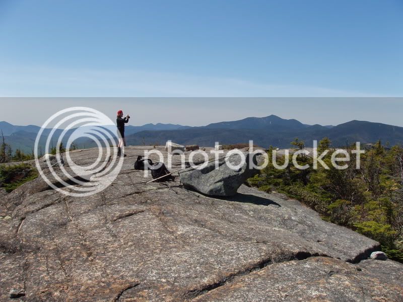

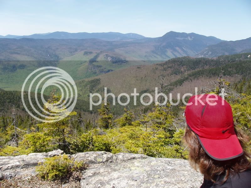
It struck us that hikers reaching Resolution from the Davis Trail side probably wouldn't take the time to seek out the southern knob, missing this wonderful view. We both agreed that this was one of the best viewpoints we had ever seen, with all the mountains and notches laid right out in front of us.
After having lunch at this spot, we continued on to find the top of Resolution. The view here was nice, but didn't compare to what we had just seen.
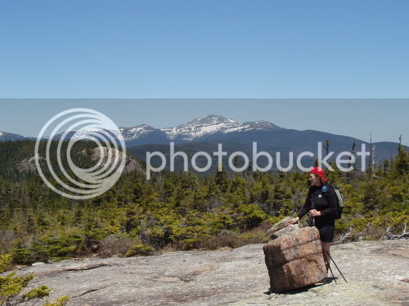
Stairs and Mt. Washington from Resolution
We tried in vain to find a herd path to the east/ northeast knob and its promised views, and as we knew we had a long trip back, we headed out.
Return trips always seem LONNNNNNGGGGGG, and this one was no exception. It had warmed up considerably by now, and as we got lower, the black flies made themselves known.Now, I am not too effected by these, although I AM annoyed. I had left my long-sleeved shirt on and long pants, and I seldom use bug dope. Joyce had changed into short sleeves and shorts, and sprayed with bug dope, but to no avail. Those little critters drove her crazy, which resulted in a VERY fast descent.
However, the Saco River goes by, right across the street from the trailhead, so its cooling waters refreshed us, and a nice Ice Latte restored our temprements for the way home.
It was a long day, we guess we probably did about 14-15 miles, but after rest and recovery we say "Well Worth IT!!" Do not miss the chance to check out the views from that southern knob of Resolution.
The Mt. Langdon Trail, for most of its length is an old logging road with easy grades and occasional flat sections.After it climbs up to Oak Ridge, it goes back down a couple of hundred feet until it meets the Junction with the Mt Parker Trail. Here you take a left on the Mt. Parker Trail which goes another1.4 miles, fairly steeply but with switchbacks. At a total of 3.9 miles you reach Parker Mountain.
Here we viewed our next objective:
Resolution from Parker

And also
Crawford From Parker

After enjoying the views for awhile , we decided to set off for Resolution,knowing we had another 3.8 miles before we reached the summit of that mountain. The trail was pretty good, although not as well travelled as the previous one. It dropped down pretty fast, and passed over three "bumps".There was some blowdown, but nothing really taxing. Negotiating one of these, we noticed what turned out to be the branch trail to the southerly knob of Resolution. Having read that there were great views from here, we started up the .1 mile trail. Immediately we hit our first patch of monorail which surprised us since the trail had been clear and dry up to this point. a few more patches of snow, and some thick brush, and we came out on the wide open ledge of the southern knob.
Immediately we were glad we hadn't missed this location as the views were breathtaking


It struck us that hikers reaching Resolution from the Davis Trail side probably wouldn't take the time to seek out the southern knob, missing this wonderful view. We both agreed that this was one of the best viewpoints we had ever seen, with all the mountains and notches laid right out in front of us.
After having lunch at this spot, we continued on to find the top of Resolution. The view here was nice, but didn't compare to what we had just seen.
Stairs and Mt. Washington from Resolution

We tried in vain to find a herd path to the east/ northeast knob and its promised views, and as we knew we had a long trip back, we headed out.
Return trips always seem LONNNNNNGGGGGG, and this one was no exception. It had warmed up considerably by now, and as we got lower, the black flies made themselves known.Now, I am not too effected by these, although I AM annoyed. I had left my long-sleeved shirt on and long pants, and I seldom use bug dope. Joyce had changed into short sleeves and shorts, and sprayed with bug dope, but to no avail. Those little critters drove her crazy, which resulted in a VERY fast descent.
However, the Saco River goes by, right across the street from the trailhead, so its cooling waters refreshed us, and a nice Ice Latte restored our temprements for the way home.
It was a long day, we guess we probably did about 14-15 miles, but after rest and recovery we say "Well Worth IT!!" Do not miss the chance to check out the views from that southern knob of Resolution.
