Most Difficult New England Winter 4kers

vftt.org

Help Support vftt.org:

This site may earn a commission from merchant affiliate links, including eBay, Amazon, and others.
See a lot of references to skiing in/out on trails. Have zero experience with cross country gear. Can you buy a set up that works with regular winter boots that you would hike in? How much would a basic set up go for? Does it really save that much time? Difficulty? I've "skated" in my downhill skis cutting over to chair lifts, etc and it seems like a lot of work, especially if I had a 30+ lb backpack full of gear. I assume the x-country gear makes it easier. If I went that route it would probably only be for closed roads and flat areas like Lincoln Woods, etc. to save time versus walking.

I've rarely done this so don't consider me an an expert on this subject. That said, I've placed my hiking boots inside my pack and used a basic x-c ski set-up since I was skiing on flat surface. When it came time for the climb, I put my x-c ski boots inside a plastic bag and buried them in the snow off-trail next to my skis. I have to say it does save time and make it easier.

I have read however that the official 4,000 footer rules indicates you can only use skis if it was a road in the summer used by cars and subsequently closed in winter. I would interpret that to mean that skiing Lincoln Woods to hike up the Bonds or Livermore Road for the Tripyramids would not be allowed. I'm not the rule maker and nor do I care how you do it, but I think you should know if you want to 'play by the rules.'
 
Yah probably out then. I thought the trail left right from 302. I guess out and back it is.
It's about 1/2 mile up to the trailhead. In the past, there's been a small area plowed near 302 to leave a vehicle. I had my truck broken into there, the only time it's ever happened. Kendron Flume is close to 302.
 
Last edited:
I broke out the maps this morning and it was the Ethan Pond Trail I was thinking of, not Kedron. Only 2.6 miles to Willey Summit and only portion of 1.1 mile section of Willey Range trail sounds steep (with the ladder section you previously mentioned) with a 0.3 mile road walk. Have to keep it on the radar once the snow buries the ladders.
 
It says here that skis and showshoes are both allowed in winter (it’s about halfway down the page). It’s snowmobiles that are verboten.

However, I remember reading in ‘‘Forest and Crag’’ that — years ago — a group of AMCers in snowshoes were faster getting up and down Mount Marcy than a group of ADKers in cross country skis were. ‘‘Your mileage may vary,’’ as they say.

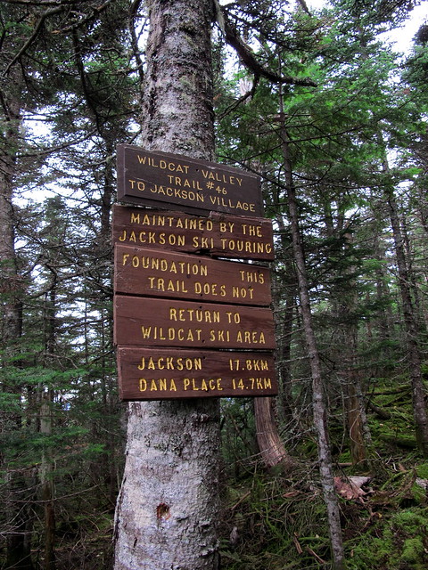
Regarding the Wildcats from the south, which I mentioned above, I did climb them via the Bog Brook and Wildcat River trails back on September 27, and descended on the Wildcat Valley Ski Trail, which is marked on the Map Adventures White Mountains map. I had inquired (here on Views from the Top) about the ski trail a few weeks before getting around to hiking it, but I’m afraid I never followed up with the announcement that I had successfully used the route. But I am still grateful for the information everyone offered, so thanks very much.

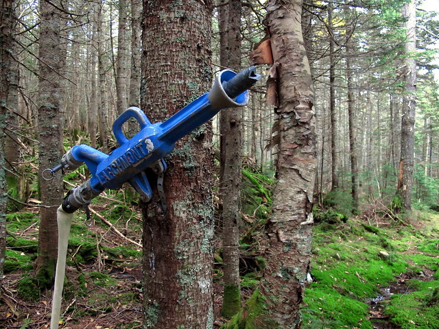
It was a great route, I thought, but I wouldn’t want to get hit up for a $14 toll (or whatever) at this time of year. (There was a snow gun way up near the top, hanging on a tree, so perhaps the cross country trail is guarded?) Probably no one else wants to pay, either, and that’s why the discussions are always about Nineteen Mile Brook and the Wildcat Mountain ski slopes.

11274179185_442b5302fc_z.jpg


11274177865_a809c6a9e8_z.jpg
 
I prefer up OBP down FWT in winter because you can either snowshoe ski down it or butt slide :) Plus the views from The Agonies on OBP are phenomenal in winter on a nice day.

I gather most people, for scenery, prefer FWT to OBP/Greenleaf. I'm the opposite. I found views from the Agonies outstanding, especially from cliff-top up to the summits, while I found the falls on FWT ok but not outstanding - Beaver Brook is the better trail for falls, imo, and I prefer Race Brook Falls in SW Mass for pretty waterfalls (6, with two over 80') to FWT (4 with 1 about 90'). What FWT leads up to, imo, is what makes it special, that and Shining Rock.
 
I gather most people, for scenery, prefer FWT to OBP/Greenleaf. I'm the opposite. I found views from the Agonies outstanding, especially from cliff-top up to the summits, while I found the falls on FWT ok but not outstanding - Beaver Brook is the better trail for falls, imo, and I prefer Race Brook Falls in SW Mass for pretty waterfalls (6, with two over 80') to FWT (4 with 1 about 90'). What FWT leads up to, imo, is what makes it special, that and Shining Rock.

I go CCW in the summer time, because my knees would rather go up the steeper FW trail and down the OBP. In the winter, I do the reverse, because 1. butt sliding potential on FW, 2. prevailing winds tend to be on my back, and 3. descended off Lafayette can be tricky in bad conditions, so best to avoid it.
 
Sometimes the trickiest part of winter travel is the route-finding, especially when descending from above treeline. Finding the 'entrance' to the trail below treeline can be surprisingly hard/impossible, and the more snow, the harder it is. I've had some dicey situations descended off Moosilauke, the Ammo from LOTC Hut, Valley Way, and the Randolph Path from Edmonds Col toward Gray Knob.
 
I have read however that the official 4,000 footer rules indicates you can only use skis if it was a road in the summer used by cars and subsequently closed in winter. I would interpret that to mean that skiing Lincoln Woods to hike up the Bonds or Livermore Road for the Tripyramids would not be allowed. I'm not the rule maker and nor do I care how you do it, but I think you should know if you want to 'play by the rules.'
As said already, skis are fine on any trail/road/bushwack for your 4000'ers.
 
It's possible that the Hancocks in March would be much tougher than Jefferson in January
I've done two 'true' winter 4K's (during the qualified time) and two more in winter conditions. I was looking for easy ones to start on, but as one of the qualified winters was Hancock in March, I'm feeling much better now - thank you TJsName! ;)

Anyway, I've done all of NE in 3-season so I'm branching out and hoping to do at least a half-dozen NH 4K's this winter. I'm also going to be 'day-tripping' to NH to accomplish this. I'd like to complete at least one northern presi (Washington/Jefferson/Adams) during this season, but start with some easier ones. In fact, I'll probably warm up on Cardigan (yes, I realize that is not a 4K), because I might be able to trick another flatlander to join me. If that does not work, I have no issues in going solo, but I'm also open to suggestions.

I'll be keeping an eye out on VFTT to consider joining a group once or twice, too. I'd say I'm pretty fit (did 24m/10k'/10 peak single-day presi traverse in 14:30). Just need to build some confidence on more challenging winter terrain. Turned back 3/4 up Ben Nevis this last spring (it wasn't spring on Ben Nevis)...
 
In days of yore before the Base Station Road was plowed, Jefferson and Monroe were considered the most difficult above-treeline peaks but now I would say Adams. Lafayette is not that difficult on a nice day as it has a good trail almost sure to be packed out, I'd call Lincoln harder. Again Washington is not that hard in good conditions but has the longest list of people who found bad conditions could kill.

I can certainly see that about Monroe and Jefferson. I recall heading toward Monroe in the winter a few years back after heading up from Pinkham Notch (Lions Head). The idea of crossing over the saddle from the top of Tux to the top of Ammo Ravine looked incredibly daunting that day. Unbroken, deep windswept drifts, no sign a trail existed for the most part, and very limited visibility, swirling snow. I have no doubt Monroe could be as hard/harder than Washington from the east. With the Ammo approach now accessible in winter, Monroe is just slightly harder than Madison (compared to the traditional VW route) IMO. The steeps on Ammo Ravine can be challenging, but the descent can be a breeze.

I turned back.
 
I've done two 'true' winter 4K's (during the qualified time) and two more in winter conditions. I was looking for easy ones to start on, but as one of the qualified winters was Hancock in March, I'm feeling much better now - thank you TJsName! ;)

Anyway, I've done all of NE in 3-season so I'm branching out and hoping to do at least a half-dozen NH 4K's this winter. I'm also going to be 'day-tripping' to NH to accomplish this. I'd like to complete at least one northern presi (Washington/Jefferson/Adams) during this season, but start with some easier ones. In fact, I'll probably warm up on Cardigan (yes, I realize that is not a 4K), because I might be able to trick another flatlander to join me. If that does not work, I have no issues in going solo, but I'm also open to suggestions.

I'll be keeping an eye out on VFTT to consider joining a group once or twice, too. I'd say I'm pretty fit (did 24m/10k'/10 peak single-day presi traverse in 14:30). Just need to build some confidence on more challenging winter terrain. Turned back 3/4 up Ben Nevis this last spring (it wasn't spring on Ben Nevis)...

Here's what I would suggest for you. Mt. Pierce, Hale, Jackson, Tecumsah, Liberty ( can add Flume if your doing well) then Madison via the Valley way. Madison is not bad, but you stick your neck out above the hut. Pick a good day and be carefull, you could screw the pooch up there if your not that experienced. The northern peaks are no playground for a novice. When your ready for Madison pm me, Ill go with you if you want, but my dog will be there too.
 
Another question I had was on Mt Willey. Does anyone ever do this from the South via Kedron Flume Trail/Ethan Pond Trail
Ethan Pond is often broken out to the Willey Range trail, or at least has but one storm's worth of snow, but WRT from there to the summit of Willey is almost never broken out and you can be dealing with a whole winter's accumulation. My user pic here for awhile was a photo of my hand reaching up out of the pit when I fell trying to break it out, with only one companion.

One VFTT member had a massive birthday party where two groups went in from the south for Willey-Field-Tom (the second, slower group skipped Tom in favour of Avalon) and a third group came from the north for Tom-Field-Willey. We keyswapped on the ridge. WRT was, of course, completely unbroken and it was a good thing we had a small army. As it was the N-S group came out a bit later than expected.
 
Of course it always depends on if the trails have been broken out...I have had good luck with the Kendron Flume Trail route, which for some reason to me, is more interesting than doing the road walk up to the Ethan Pond trail..did not even need snowshoes once (traction needed) and the ladders were easily done...plus there always appears to be room to park at the Willey House site...and it seemed shorter time wise than going in the EPT side...eye of the beholder I guess....
 
Top