sdways01
New member
Mt. Cardigan
10-27-12
Holt Trail --> Mowglis Trail --> Manning Trail
Distance: 4.7 mi.
Elevation Gain: 1,748 ft. (Overall) 2,206 ft. (Total)
Time: 2:15 (Mt. Cardigan) 3:57 (total)
I've been meaning to hike Mt. Cardigan for quite a while. And since I wanted to hike up the Holt Trail, I knew I should get to it before winter. With a cloudy afternoon predicted due to the outer edges of hurricane Sandy coming in and a family event in the evening, this shorter hike seemed like a good idea for today.
When I got to the Cardigan Lodge, the skies were blue and there were hardly any clouds. A pleasant surprise. Shortly after heading out, I was already losing my outer layers as the warming temps were kicking in. The early trails are on old woods roads and are very easy. After a crossing of Failey Brook on a nice bridge and a moderate climb after, I was already at the fork to go up the Holt Trail. I was expecting the dry week we had plus the partly sunny skies predicted for today would make the trail dry and easier to climb. From here, the first bit of the Holt Trail is pretty easy following a bank next to the brook. Eventually you start to turn left away from it and the climb gets steeper, but still not overly steep.
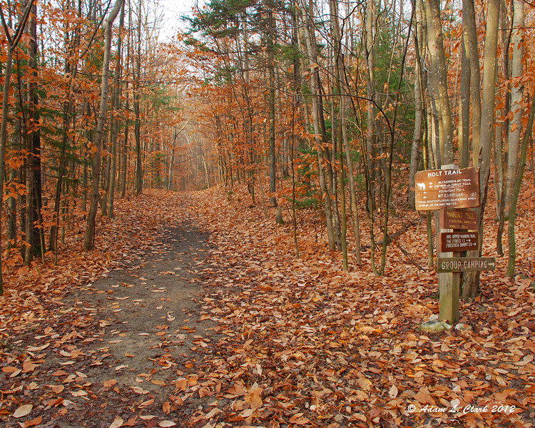
Early Trail
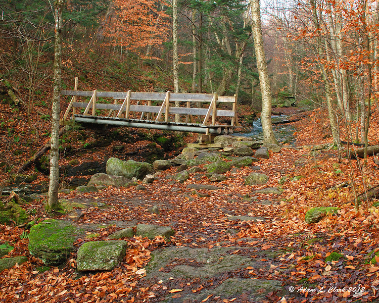
Bailey Brook crossing
Then you come to the first challenge of the trail. From here to the summit, it stays steep. Shortly before the steep part, I had noticed the temps seemed to be cooling off. When I turned around to look, I could see the clouds had come in and even the lower parts of the mountain above me were getting in the clouds. The start of the steep section is a crack in the rocks the trail goes up. Normally I would go up the rock right next to it, but things were just damp enough from the moisture in the air and the lack of sun in this spot that I couldn't do that. I ended up hiking up int he crack, which wasn't as easy as I expected, and required more lifting with my arms than expected. You can tell some people go around this, but I don't like when paths get made off trail and I was up for the challenge.
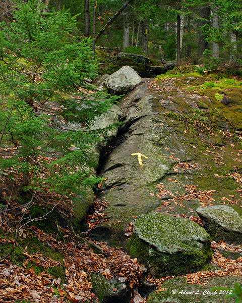
The first challenge of the trail
From here, the trail stays steep and goes up and over many large rocks. Soon it starts to pop up out of the trees though and go over more sections of steep open rock. At this point, I was already above the bottom of the clouds. The trail continues over mostly open rock while going in and out of the trees some. The paint blazes are a bit faded here, so stopping and looking ahead was needed at times to make sure where you actually wanted to go. Traction wasn't too bad on the open rock, but some places were a bit smooth or slicker than other spots. The last steep climb up open rock was definitely the hardest of the hike. Under dry sunny conditions, I would have just carefully gone up the rock looking from rough surfaces to provide traction. But with today's dampness, I decided the edge of the rock would be the safest route. The start isn't bad, but then you need to go around a large rock you can't go over. Grip around it wasn't good and it involved pulling my self along the rock a lot. There aren't many good hnad holds, so this wasn't overly easy. Once around that rock, there is another you can go around or possibly over. I found a way to get up on to it and went over it. From here to the summit wasn't bad. I knew I needed to head up and that the summit was close, but all of a sudden it seemed like the blazes went away. I just headed straight up and eventually found one just before the tower. It was so cloudy, I couldn't see the tower until I was about 100 feet from it. More blazes here would be helpful in conditions like this.
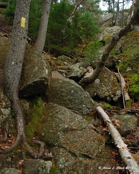
Rocky and steep
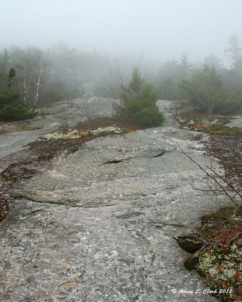
Much of the upper Holt Trail is like this
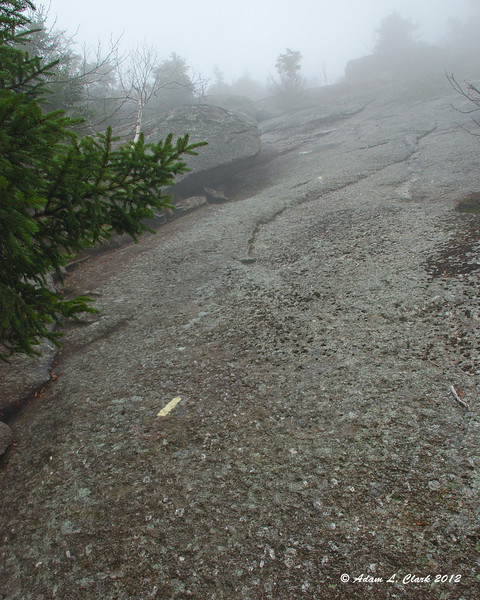
The hardest climb of the trail
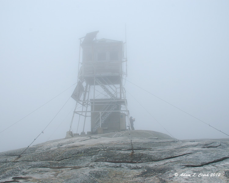
Summit tower
I took a nice break at the summit and talked to other hikers. They assured me there are actually good views from here, but I never saw any. When I headed out, I followed the blazes I expected to be my trail. I couldn't actually see anything in the distance to verify this, but there are only so many trails off the summit. Going down into the saddle between the summit and Firescrew was easy and mostly gentle. A few trees, but mostly over open rock with scattered trees around. The start of the Manning Trail was the same. Eventually it gets a bit steeper and heads into the trees more. Once you are back into the trees and below the steep bits, the trail was nice and easy again. It was a bit muddy in places, but the mud wasn't deep. Waterbars had recently been cleaned out to prepare for the storm. Near the trailhead again, I could see someone ahead of me carrying a shovel. That would explain the clean waterbars. Other small crews were heading out for more trail clean up when I got back to the car too.
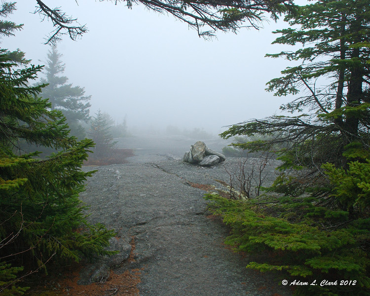
Mowglis Trail
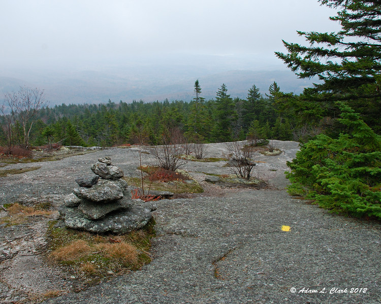
Almost getting some views on the way down
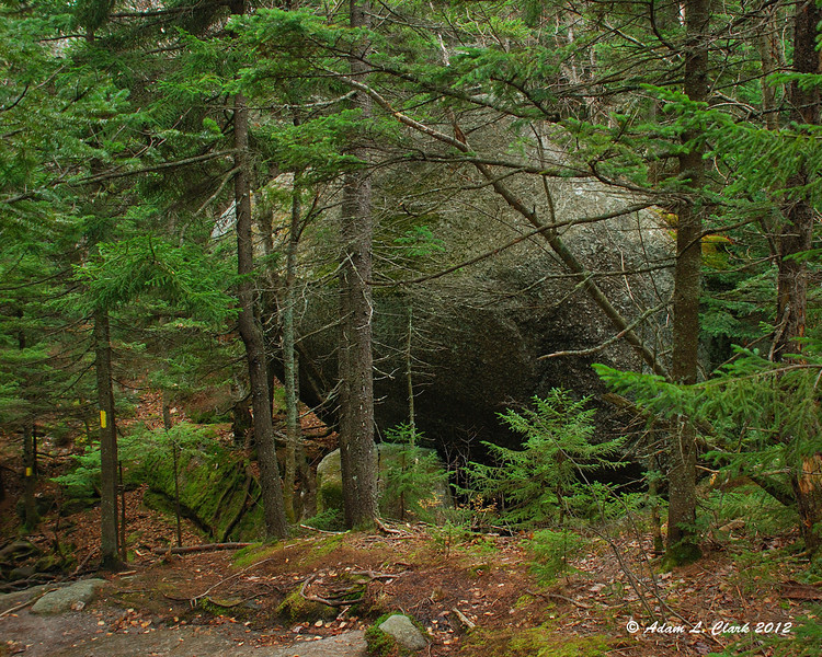
Large glacial erratic next to the trail
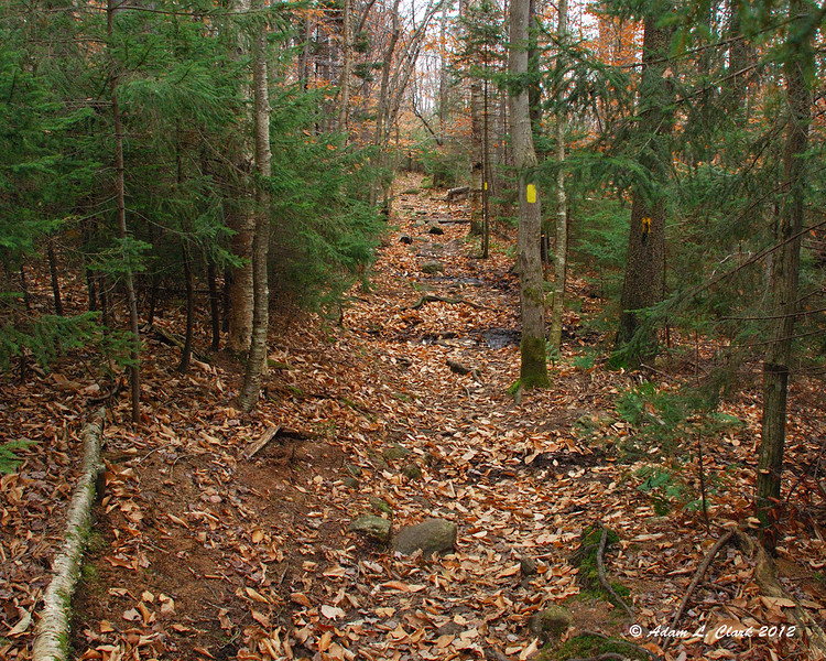
Small patches of mud
If it had been any wetter today, the Holt Trail probably wouldn't have been a good idea. As it was, it was challenging and tricky in places. Carefull footing was needed. I would go back to it on a drier day for sure though. The route I took down would be a great route in the winter I think. With so much of it on mostly open ledges, I am sure it would be a great hike after some fresh snow. I'm sure I will come back for that, plus to get the views I am told are here.
All in all it was still a good hike even with the clouds. I will certainly come back again to hit more trails and hopefully see the views.
For all the pictures from the hike, just go HERE
10-27-12
Holt Trail --> Mowglis Trail --> Manning Trail
Distance: 4.7 mi.
Elevation Gain: 1,748 ft. (Overall) 2,206 ft. (Total)
Time: 2:15 (Mt. Cardigan) 3:57 (total)
I've been meaning to hike Mt. Cardigan for quite a while. And since I wanted to hike up the Holt Trail, I knew I should get to it before winter. With a cloudy afternoon predicted due to the outer edges of hurricane Sandy coming in and a family event in the evening, this shorter hike seemed like a good idea for today.
When I got to the Cardigan Lodge, the skies were blue and there were hardly any clouds. A pleasant surprise. Shortly after heading out, I was already losing my outer layers as the warming temps were kicking in. The early trails are on old woods roads and are very easy. After a crossing of Failey Brook on a nice bridge and a moderate climb after, I was already at the fork to go up the Holt Trail. I was expecting the dry week we had plus the partly sunny skies predicted for today would make the trail dry and easier to climb. From here, the first bit of the Holt Trail is pretty easy following a bank next to the brook. Eventually you start to turn left away from it and the climb gets steeper, but still not overly steep.

Early Trail

Bailey Brook crossing
Then you come to the first challenge of the trail. From here to the summit, it stays steep. Shortly before the steep part, I had noticed the temps seemed to be cooling off. When I turned around to look, I could see the clouds had come in and even the lower parts of the mountain above me were getting in the clouds. The start of the steep section is a crack in the rocks the trail goes up. Normally I would go up the rock right next to it, but things were just damp enough from the moisture in the air and the lack of sun in this spot that I couldn't do that. I ended up hiking up int he crack, which wasn't as easy as I expected, and required more lifting with my arms than expected. You can tell some people go around this, but I don't like when paths get made off trail and I was up for the challenge.

The first challenge of the trail
From here, the trail stays steep and goes up and over many large rocks. Soon it starts to pop up out of the trees though and go over more sections of steep open rock. At this point, I was already above the bottom of the clouds. The trail continues over mostly open rock while going in and out of the trees some. The paint blazes are a bit faded here, so stopping and looking ahead was needed at times to make sure where you actually wanted to go. Traction wasn't too bad on the open rock, but some places were a bit smooth or slicker than other spots. The last steep climb up open rock was definitely the hardest of the hike. Under dry sunny conditions, I would have just carefully gone up the rock looking from rough surfaces to provide traction. But with today's dampness, I decided the edge of the rock would be the safest route. The start isn't bad, but then you need to go around a large rock you can't go over. Grip around it wasn't good and it involved pulling my self along the rock a lot. There aren't many good hnad holds, so this wasn't overly easy. Once around that rock, there is another you can go around or possibly over. I found a way to get up on to it and went over it. From here to the summit wasn't bad. I knew I needed to head up and that the summit was close, but all of a sudden it seemed like the blazes went away. I just headed straight up and eventually found one just before the tower. It was so cloudy, I couldn't see the tower until I was about 100 feet from it. More blazes here would be helpful in conditions like this.

Rocky and steep

Much of the upper Holt Trail is like this

The hardest climb of the trail

Summit tower
I took a nice break at the summit and talked to other hikers. They assured me there are actually good views from here, but I never saw any. When I headed out, I followed the blazes I expected to be my trail. I couldn't actually see anything in the distance to verify this, but there are only so many trails off the summit. Going down into the saddle between the summit and Firescrew was easy and mostly gentle. A few trees, but mostly over open rock with scattered trees around. The start of the Manning Trail was the same. Eventually it gets a bit steeper and heads into the trees more. Once you are back into the trees and below the steep bits, the trail was nice and easy again. It was a bit muddy in places, but the mud wasn't deep. Waterbars had recently been cleaned out to prepare for the storm. Near the trailhead again, I could see someone ahead of me carrying a shovel. That would explain the clean waterbars. Other small crews were heading out for more trail clean up when I got back to the car too.

Mowglis Trail

Almost getting some views on the way down

Large glacial erratic next to the trail

Small patches of mud
If it had been any wetter today, the Holt Trail probably wouldn't have been a good idea. As it was, it was challenging and tricky in places. Carefull footing was needed. I would go back to it on a drier day for sure though. The route I took down would be a great route in the winter I think. With so much of it on mostly open ledges, I am sure it would be a great hike after some fresh snow. I'm sure I will come back for that, plus to get the views I am told are here.
All in all it was still a good hike even with the clouds. I will certainly come back again to hit more trails and hopefully see the views.
For all the pictures from the hike, just go HERE
