Jabberwalk
New member
Now I know how this peak got its name!! It is quite deceiving!
Thanks to Doc Ross and others for their prior TR's which we found very helpful. I met my friend, Hufflepuff, in Twin Mountain and we proceeded to the Old Cherry Mountain Road. We parked at Camp 7 which is about 2.4 miles from Rt. 302.
Our plan was to follow the advice of several hikers to by pass the western summit by heading almost due east towards the main peak. This heading took us on a lateral traverse of the northern edge of the west peak. But, after 1.5 hours of steady progress through mostly open woods, littered with mossy rocks and blowdowns, we started to wonder. Could the massive peak above us possibly be the one we were looking for?? We could not resist the temptation to head up the hill. It was really steep and really high. Big mistake, too.
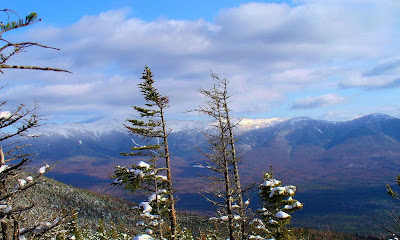
At the top we realized that it was the wrong peak, and we could see our target off to the east. I swear it looked lower than the peak we were standing on - very deceptive. The trip over to the main peak was not too bad, since we managed to stay to the north of the ridge, as recommended by other savvy hikers. We arrived at the top, which showed only 10 feet higher by my altimeter, in a little over 2 hours - not too bad for a couple of old ladies.


