mtruman
New member
We spent a wonderful 4 days in Vermont this week to celebrate our 30th anniversary. We had planned to get in more hiking but between the weather and wanting to see more of Vermont on our first time there we wound up limiting it. We had originally planned to hike the day we went up (Sunday) but changed out mind and decided on sightseeing instead. After a couple of stops in Waterbury and lunch in Stowe we found ourselves at the foot of Mt Mansfield on a perfect fall day. We drove past the entrance to the toll road but the pull of the mountain was too strong and we turned around and went back. Better to drive to the top and hike the ridge on a perfect day than to miss it all together.
I felt guilty all the way up as we drove instead of using our feet. Stopping at the first parking area and looking across the valleys in their beautiful autumn colors the guilt started to fade. Considering that this was the Sunday of a holiday weekend in peak foliage season the crowd wasn't too bad. Getting to the summit parking area we were greeted by an icy breeze and clear blue skies. We layered up, grabbed the camera and headed north on the ridge. The views were incredible - across Lake Champlain to the Adirondacks to the west and to the White Mountains in the east. There had been snow earlier that day on the summit and there were patches of snow and ice across the ridge. Beautiful! We hiked across the ridge and stopped just before the final ascent up the Chin to avoid the crowds on top. We can't cross this 4000 footer off our list yet - but we'll definitely be back to do it the right way! At least for today the cheating paid off...
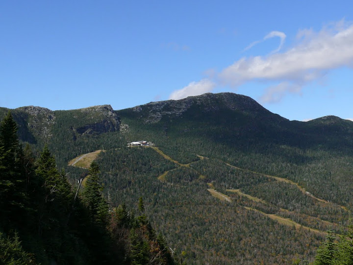
Ski Lodge and summit ridge from auto road
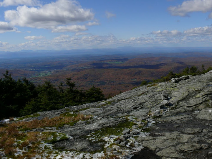
Lake Champlain and Adirondacks in the distance from summit ridge
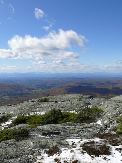
Snow on the ridge
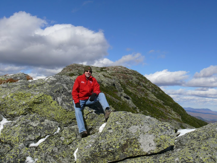
Hanging out below the Chin
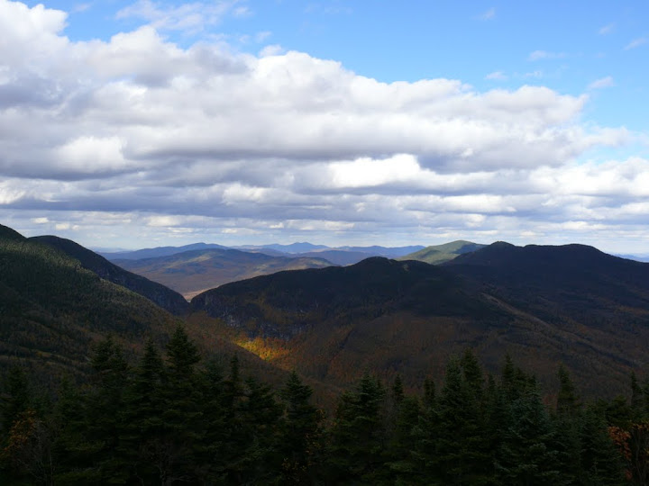
Green Mountains
Camel's Hump
Monday looked to be our last good weather day of the remaining three so after an early breakfast we set out for Camel's Hump. Following the wonderful directions provided by Google maps we wound up down a maze of dirt roads at a dead end. We flagged down a truck going by to ask directions. "Camel's Hump? Not out here...". Great!! After retracing our route and following the simple directions in the trail guide we got to the trail head by 9:00.
We decided to take the Forest City - Long Trail - Burrows Trail loop since we don't care for out-and-backs if there is an option. The Forest City trail up was in good shape with easy going most of the way. The trail gets steeper coming to Wind Gap and there is an open ledge with beautiful views just before the junction. At Wind Gap the Long Trail begins up the ridge to the summit. We kept looking for the view over the small pond with Camel's Hump in the distance from Wind Gap that we've seen so many times but didn't find it. We realized later that you have to go a few tenths down the Dean Trail. Next time...
The Long Trail up the ridge is beautiful and gets very steep approaching the summit. The final couple of tenths skirt the summit cliffs and require a bit of interesting scrambling. As we got out above treeline we were greeted by ice and snow and the need for watching our step on the slippery ledges. The summit was spectacular! Clear blue skies with clouds drifting over. With crowds starting to gather on top we headed down below the summit to a protected spot out of the wind on the ledges for lunch and more time to soak in the amazing views. As we headed out after lunch the skies were clouding over - perfect timing.
Heading down the ledges from the summit was interesting. There was a lot of ice on the rocks and even spots that appeared dry were often slippery but we got down without incident. I wasn't looking forward to what had to be a very steep 2 mile descent. Surprisingly the Burrows Trail down never was steep and it was a very quick hike down. We still can't figure out how a longer and steeper ascent on Forest City and LT could have such an easy way down ending at the same point. Going to have to study the topos to figure this out. At any rate, this was definitely the right way to do the loop and made for a perfect day of fall hiking! The first taste of Vermont, the Green Mountains and Long Trail have left us wanting more. We'll be back. So many mountains, so little time...
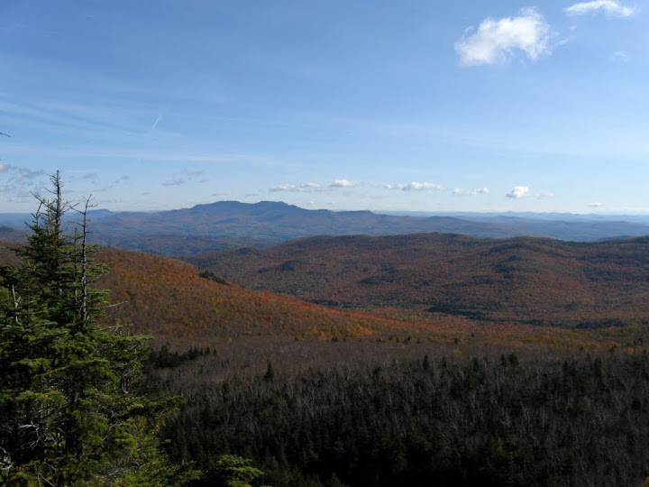
Worcester Range from ledges below Wind Gap
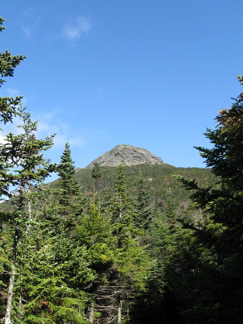
Camel's Hump summit above Wind Gap
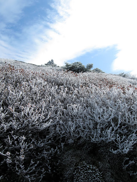
Frosty summit approach
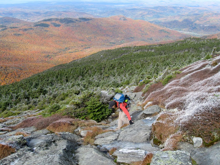
Nat approaching the top
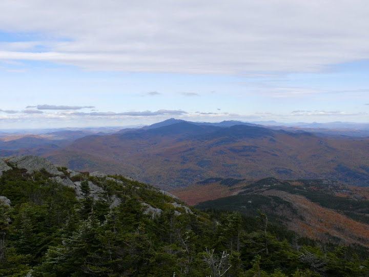
Mansfield in the distance from the summit
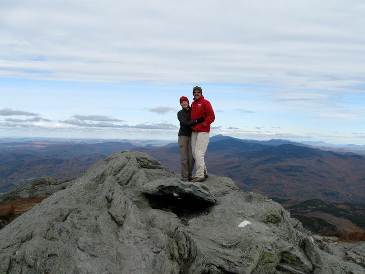
Top 'O the Hump
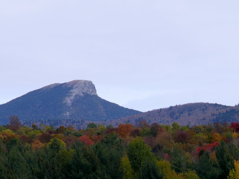
View back to the summit on the drive home
Complete photo album here: http://picasaweb.google.com/mtruman42/MtMansfieldAndCamelSHumpOct09#
I felt guilty all the way up as we drove instead of using our feet. Stopping at the first parking area and looking across the valleys in their beautiful autumn colors the guilt started to fade. Considering that this was the Sunday of a holiday weekend in peak foliage season the crowd wasn't too bad. Getting to the summit parking area we were greeted by an icy breeze and clear blue skies. We layered up, grabbed the camera and headed north on the ridge. The views were incredible - across Lake Champlain to the Adirondacks to the west and to the White Mountains in the east. There had been snow earlier that day on the summit and there were patches of snow and ice across the ridge. Beautiful! We hiked across the ridge and stopped just before the final ascent up the Chin to avoid the crowds on top. We can't cross this 4000 footer off our list yet - but we'll definitely be back to do it the right way! At least for today the cheating paid off...

Ski Lodge and summit ridge from auto road

Lake Champlain and Adirondacks in the distance from summit ridge

Snow on the ridge

Hanging out below the Chin

Green Mountains
Camel's Hump
Monday looked to be our last good weather day of the remaining three so after an early breakfast we set out for Camel's Hump. Following the wonderful directions provided by Google maps we wound up down a maze of dirt roads at a dead end. We flagged down a truck going by to ask directions. "Camel's Hump? Not out here...". Great!! After retracing our route and following the simple directions in the trail guide we got to the trail head by 9:00.
We decided to take the Forest City - Long Trail - Burrows Trail loop since we don't care for out-and-backs if there is an option. The Forest City trail up was in good shape with easy going most of the way. The trail gets steeper coming to Wind Gap and there is an open ledge with beautiful views just before the junction. At Wind Gap the Long Trail begins up the ridge to the summit. We kept looking for the view over the small pond with Camel's Hump in the distance from Wind Gap that we've seen so many times but didn't find it. We realized later that you have to go a few tenths down the Dean Trail. Next time...
The Long Trail up the ridge is beautiful and gets very steep approaching the summit. The final couple of tenths skirt the summit cliffs and require a bit of interesting scrambling. As we got out above treeline we were greeted by ice and snow and the need for watching our step on the slippery ledges. The summit was spectacular! Clear blue skies with clouds drifting over. With crowds starting to gather on top we headed down below the summit to a protected spot out of the wind on the ledges for lunch and more time to soak in the amazing views. As we headed out after lunch the skies were clouding over - perfect timing.
Heading down the ledges from the summit was interesting. There was a lot of ice on the rocks and even spots that appeared dry were often slippery but we got down without incident. I wasn't looking forward to what had to be a very steep 2 mile descent. Surprisingly the Burrows Trail down never was steep and it was a very quick hike down. We still can't figure out how a longer and steeper ascent on Forest City and LT could have such an easy way down ending at the same point. Going to have to study the topos to figure this out. At any rate, this was definitely the right way to do the loop and made for a perfect day of fall hiking! The first taste of Vermont, the Green Mountains and Long Trail have left us wanting more. We'll be back. So many mountains, so little time...

Worcester Range from ledges below Wind Gap

Camel's Hump summit above Wind Gap

Frosty summit approach

Nat approaching the top

Mansfield in the distance from the summit

Top 'O the Hump

View back to the summit on the drive home
Complete photo album here: http://picasaweb.google.com/mtruman42/MtMansfieldAndCamelSHumpOct09#
