You are using an out of date browser. It may not display this or other websites correctly.
You should upgrade or use an alternative browser.
You should upgrade or use an alternative browser.
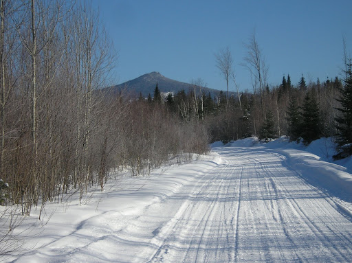
Mt. Sugarloaf 3710' Feb. 24
- Thread starter HikerDoc
- Start date

Help Support vftt.org:
This site may earn a commission from merchant affiliate
links, including eBay, Amazon, and others.
docross
In Memoriam to a Deceased Member
Thanks for planning a great hike, Ed! I sure appreciated not having to bushwhack after the slog Al and I had the day before on the Pilots!
Pics look great, except the photo labeled Georg is actually me; Georg is a lot trimmer than I!
My photos: http://picasaweb.google.com/spinner2243/Sugarloaf20080224
Pics look great, except the photo labeled Georg is actually me; Georg is a lot trimmer than I!
My photos: http://picasaweb.google.com/spinner2243/Sugarloaf20080224
Last edited:
forestgnome
New member
forestgnome
New member
RoySwkr
New member
- Joined
- Sep 4, 2003
- Messages
- 4,467
- Reaction score
- 285
Blue/Bunnell is higherHikerDoc said:parked at a spot which gave a good shot of Sugarloaf, the highest peak in the north country,
The N peaks are getting tougher when the state won't let you drive in
forestgnome
New member
Hikerdoc, I believe the issue is Picassa. I was able to insert a thumbnail, but when I tried to insert the full image I got a message saying that Picassa does not share URLs.
I use Photobucket. It's free and easy to use. Many here use Webshots.
happy trails
I use Photobucket. It's free and easy to use. Many here use Webshots.
happy trails
HikerDoc
New member
Thanks. I'll look into them.
Similar threads
- Replies
- 7
- Views
- 1K

