1HappyHiker
Well-known member
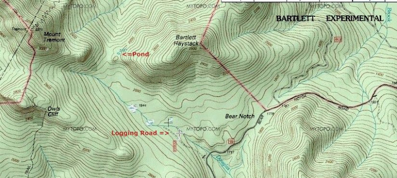
Does anyone have any insight about the little body of water situated in the col between Bartlett Haystack and Mt. Tremont (see map below)?
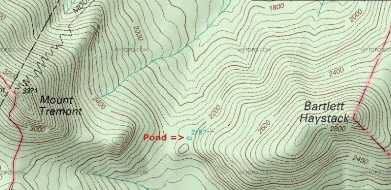
This little speck of water recently caught my attention, and so I did a bushwhack off the Mt. Tremont Trail to check it out. By taking measurements from a topo map, I had roughly calculated that this little watery spot in the woods to be about 150 ft by 80 ft. Those dimensions seemed to be pretty much consistent with what I saw when I arrived at this body of water. Admittedly, I didn't do any actual measurements, but just merely "eye-balled it".
The best I can tell, there are no size-standards regarding what constitutes a pond or a lake. However, I think using the word "lake" for this little body of water would be a "stretch". But, on the other hand, there is a body of water in the saddle between Mts. Madison & Adams that is nearly the same size as this little guy. And guess what . . . it's called Star LAKE!
But, for this particular body of water, perhaps the word "pool" might be the most appropriate term. I've shared the photos posted below with David Govatski (USFS, retired). Based purely upon what he could see in the photos, he feels that this might be what is technically known as an ephemeral pool. These depressions typically only contain water during periods of snow melt, or during rainy periods, etc.
This is pure speculation on my part, but I'd think that most ephemeral pools are too small to be shown as a body of water on a topo map. Perhaps at best, they might be depicted merely as a swampy area. But given the size of this pool, maybe it retains some water throughout most of the year. If so, then it might show up on satellite imagery as a permanent body of water, and thus be depicted as a small pond on the current-day topographic maps.
I've looked at some of the historic topo maps that are available online and I didn't find this body of water. I suppose this could mean either that it didn't exist when the maps were made, or simply that no one knew it was there!
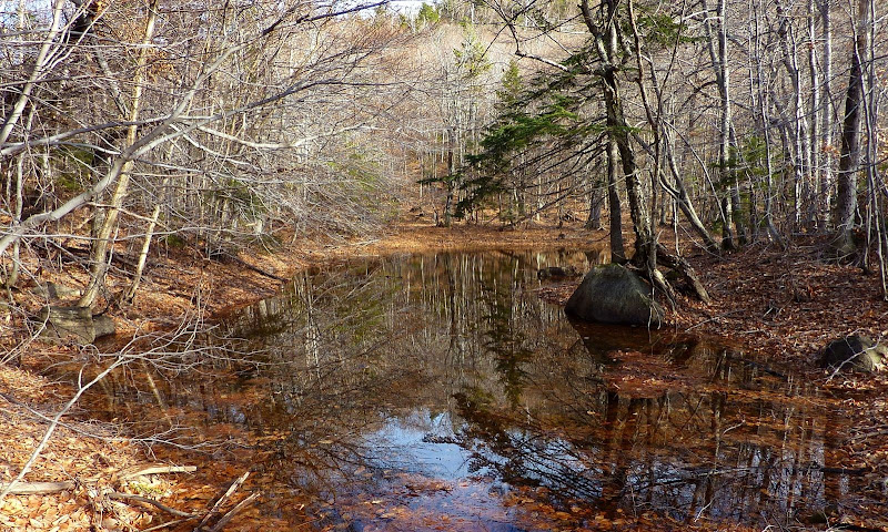
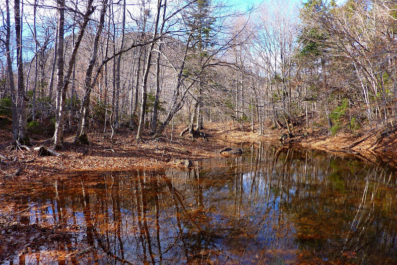
Anyway, below are two snapshots. The first photo was taken from the western end of the pond/pool. The second photo was taken from the eastern end looking toward Mt. Tremont which can be seen sort of silhouetted through the trees.
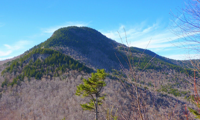
Speaking of Mt. Tremont, I extended my bushwhack to include a small ledge that's just about a tenth of a mile west of what I've nicknamed as "Tremont Pond". From this ledge, I got a somewhat unique close-up view of Mt. Tremont (see photo below).
1HappyHiker

This little speck of water recently caught my attention, and so I did a bushwhack off the Mt. Tremont Trail to check it out. By taking measurements from a topo map, I had roughly calculated that this little watery spot in the woods to be about 150 ft by 80 ft. Those dimensions seemed to be pretty much consistent with what I saw when I arrived at this body of water. Admittedly, I didn't do any actual measurements, but just merely "eye-balled it".
The best I can tell, there are no size-standards regarding what constitutes a pond or a lake. However, I think using the word "lake" for this little body of water would be a "stretch". But, on the other hand, there is a body of water in the saddle between Mts. Madison & Adams that is nearly the same size as this little guy. And guess what . . . it's called Star LAKE!
But, for this particular body of water, perhaps the word "pool" might be the most appropriate term. I've shared the photos posted below with David Govatski (USFS, retired). Based purely upon what he could see in the photos, he feels that this might be what is technically known as an ephemeral pool. These depressions typically only contain water during periods of snow melt, or during rainy periods, etc.
This is pure speculation on my part, but I'd think that most ephemeral pools are too small to be shown as a body of water on a topo map. Perhaps at best, they might be depicted merely as a swampy area. But given the size of this pool, maybe it retains some water throughout most of the year. If so, then it might show up on satellite imagery as a permanent body of water, and thus be depicted as a small pond on the current-day topographic maps.
I've looked at some of the historic topo maps that are available online and I didn't find this body of water. I suppose this could mean either that it didn't exist when the maps were made, or simply that no one knew it was there!
Anyway, below are two snapshots. The first photo was taken from the western end of the pond/pool. The second photo was taken from the eastern end looking toward Mt. Tremont which can be seen sort of silhouetted through the trees.


Speaking of Mt. Tremont, I extended my bushwhack to include a small ledge that's just about a tenth of a mile west of what I've nicknamed as "Tremont Pond". From this ledge, I got a somewhat unique close-up view of Mt. Tremont (see photo below).

1HappyHiker
Last edited:

