Mount Nancy (3926') via Nancy Pond Trail and Mount Nancy Herd Path ("Unofficial") for ~12 miles, ~3150 feet, 6 hours
The weather forecast improved enough for Sunday that hiking Nancy made sense. On my way to meet Bob & Geri, I saw a shooting star, meaning that it was clear enough to see one. North of the Lakes Region, however, the weather was not as good as forecast, but at least Nancy was not in the clouds. Usually a moose sighting means an excellent hike is awaiting me, but today I saw no moose so I'll extend the good hike omens to include meteors. We got underway at 8:40 and saw a lot of footprints. A short while later, a group was coming down the trail, probably from the Notchland Inn, since they weren't equipped for a long stroll in winter conditions. Sure enough, above the Inn's connecting trail (which had no signs of traffic, and looked to have plenty of blowdowns), the footprints were reduced to one (inbound) so we expected to meet somebody later today.
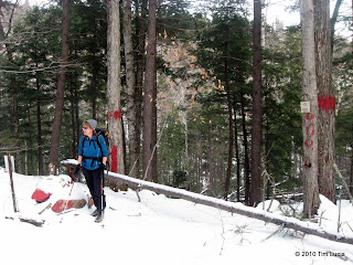
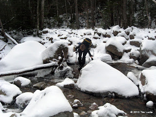
Geri at the Notchland Inn's trail jct., Geri crossing Nancy Brook
The only water crossing of significance was the big one over Nancy Brook and there were two paths you could go by (apologies to Led Zeppelin) without getting more than your boot bottoms wet. The first 2.4 miles are fairly gentle, but as we approached the cascades, the trail got steeper. Here and there are views to the northeast of Stairs and Resolution. When we arrived at Nancy Cascade, it was mostly frozen over, with water running behind the ice. There were a few locations where water was splashing over rocks and freezing to the outside. From the base of the falls, it switchbacks steeply until passing the col with Duck Pond Mountain where it levels out and approaches Nancy Pond.
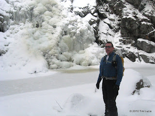
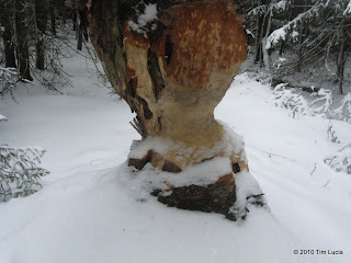
Bob at Nancy Cascade, Beaver Woodworking near Nancy Pond
The ponds in this area are famous for being flooded by beavers and while we didn't see any, there were clear signs they are around. Besides the dam, there was a birch tree that had been gnawed pretty well, but was still standing. I used to work right next to the Merrimack River and I learned that beavers love poplar trees, which they fell, and then submerge and anchor to the bottom some of the smaller branches to eat during periods of ice.
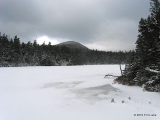
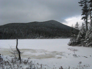
Anderson across Nancy Pond, Anderson across Norcross Pond
The recent trail work and relocation along the ponds was semi-visible under the few inches of snow. From the beginning of Nancy Pond until the dam at Norcross Pond, the trail spends a lot of time on bog bridges - made from 4x8 milled lumber. Both ponds were frozen and snow covered but nobody felt brave enough to test the ice thickness today. Mount Anderson dominates the far side of both.
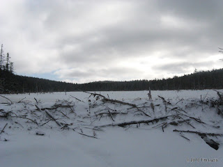
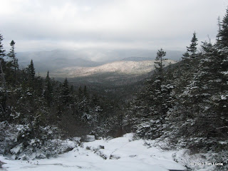
View of Norcross at Dam Level, Looking into the Pemi (Twins would be visible)
At the "no camping" sign near the end of Norcross, we detoured left and visited the beaver dam and beginnings of Norcross Brook. I can see hanging out here in the summer, enjoying the views, and maybe doing a little swimming. Today was not warm enough to stay put for very long, and the views were a bit clouded in, at least down in the Pemi. After a few pictures, we returned to the trail and crossed it to find the herd path up Mount Nancy. Taking the left branch (as the right branch dead-ends), we shortly came to the junction with the slide. While not icy, it was snowy and we saw no reason to go up the slide proper, so a few pictures and back to the herd path we went. Despite the "do not maintain" warning, the herd path is clearly maintained since there were only a few blowdowns and the brush was not terribly thick. Although quite steep, there are plenty of handholds and we didn't need traction to make it up. Beyond the steep section, it flattens out a bit before coming to the summit outlook facing northeast. In this section, the maker of the inbound footprints was coming the other way. At the start of the hike, Bob had commented how at this time of year when you run into other people, chances are you know them. Turns out the owner of the footprints was Stu, who recognized me from trip reports and Bob & Geri from the Seema gourmet hut trips.
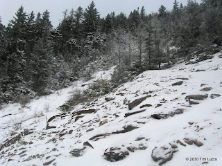
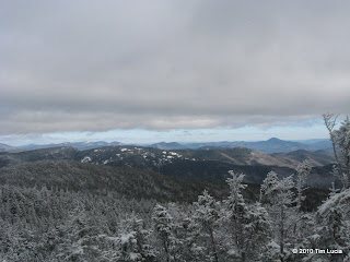
The slide nearest the herd path, Views From The Top
Upon returning to the steep section, I opted to put on microspikes, but Bob made it down without traction. With limited snow depth and a lot of roots, it was questionable if they made me less likely to fall. Geri took it easy on the way up, having no goal of summitting, and we picked her up on the way down. Back at Norcross Pond, Stu had waited for us, and we ate lunch and re-hydrated before walking out together.
All photos from this trip
Tim
The weather forecast improved enough for Sunday that hiking Nancy made sense. On my way to meet Bob & Geri, I saw a shooting star, meaning that it was clear enough to see one. North of the Lakes Region, however, the weather was not as good as forecast, but at least Nancy was not in the clouds. Usually a moose sighting means an excellent hike is awaiting me, but today I saw no moose so I'll extend the good hike omens to include meteors. We got underway at 8:40 and saw a lot of footprints. A short while later, a group was coming down the trail, probably from the Notchland Inn, since they weren't equipped for a long stroll in winter conditions. Sure enough, above the Inn's connecting trail (which had no signs of traffic, and looked to have plenty of blowdowns), the footprints were reduced to one (inbound) so we expected to meet somebody later today.


Geri at the Notchland Inn's trail jct., Geri crossing Nancy Brook
The only water crossing of significance was the big one over Nancy Brook and there were two paths you could go by (apologies to Led Zeppelin) without getting more than your boot bottoms wet. The first 2.4 miles are fairly gentle, but as we approached the cascades, the trail got steeper. Here and there are views to the northeast of Stairs and Resolution. When we arrived at Nancy Cascade, it was mostly frozen over, with water running behind the ice. There were a few locations where water was splashing over rocks and freezing to the outside. From the base of the falls, it switchbacks steeply until passing the col with Duck Pond Mountain where it levels out and approaches Nancy Pond.


Bob at Nancy Cascade, Beaver Woodworking near Nancy Pond
The ponds in this area are famous for being flooded by beavers and while we didn't see any, there were clear signs they are around. Besides the dam, there was a birch tree that had been gnawed pretty well, but was still standing. I used to work right next to the Merrimack River and I learned that beavers love poplar trees, which they fell, and then submerge and anchor to the bottom some of the smaller branches to eat during periods of ice.


Anderson across Nancy Pond, Anderson across Norcross Pond
The recent trail work and relocation along the ponds was semi-visible under the few inches of snow. From the beginning of Nancy Pond until the dam at Norcross Pond, the trail spends a lot of time on bog bridges - made from 4x8 milled lumber. Both ponds were frozen and snow covered but nobody felt brave enough to test the ice thickness today. Mount Anderson dominates the far side of both.


View of Norcross at Dam Level, Looking into the Pemi (Twins would be visible)
At the "no camping" sign near the end of Norcross, we detoured left and visited the beaver dam and beginnings of Norcross Brook. I can see hanging out here in the summer, enjoying the views, and maybe doing a little swimming. Today was not warm enough to stay put for very long, and the views were a bit clouded in, at least down in the Pemi. After a few pictures, we returned to the trail and crossed it to find the herd path up Mount Nancy. Taking the left branch (as the right branch dead-ends), we shortly came to the junction with the slide. While not icy, it was snowy and we saw no reason to go up the slide proper, so a few pictures and back to the herd path we went. Despite the "do not maintain" warning, the herd path is clearly maintained since there were only a few blowdowns and the brush was not terribly thick. Although quite steep, there are plenty of handholds and we didn't need traction to make it up. Beyond the steep section, it flattens out a bit before coming to the summit outlook facing northeast. In this section, the maker of the inbound footprints was coming the other way. At the start of the hike, Bob had commented how at this time of year when you run into other people, chances are you know them. Turns out the owner of the footprints was Stu, who recognized me from trip reports and Bob & Geri from the Seema gourmet hut trips.


The slide nearest the herd path, Views From The Top
Upon returning to the steep section, I opted to put on microspikes, but Bob made it down without traction. With limited snow depth and a lot of roots, it was questionable if they made me less likely to fall. Geri took it easy on the way up, having no goal of summitting, and we picked her up on the way down. Back at Norcross Pond, Stu had waited for us, and we ate lunch and re-hydrated before walking out together.
All photos from this trip
Tim
