pudgy_groundhog
Active member
Note, the pictures in the post look a little blurry. All our pictures and notes can be found here:
http://www.pbase.com/pudgy_groundhog/patagonia
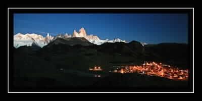
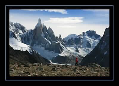
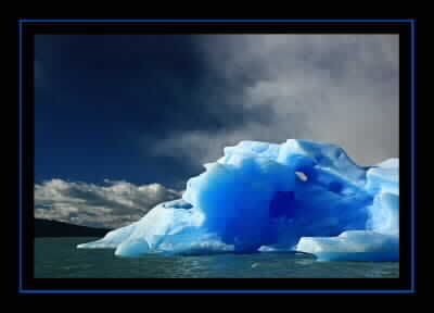
During March, Steve and I spent three weeks in Chile and Argentina. Our trip was divided into two sections: visiting Torres del Paine in Chile and Los Glaciares National Park in Argentina (mainly the northern section referred to as "Fitzroy").
Getting to the end of the earth is not an inconsequential matter. Especially when you are flying Aerolineas Argentinas. We left Friday evening from JFK and after a long flight, even longer immigration lines, a missed flight, feeling like we were on the Amazing Race, and eight hours on unpaved roads on a bus, we finally arrived Sunday evening in Torres del Paine. *phew* Finally, we could get down to business.
Most people visiting the park hike what is called the "W". The "W" hits many of the highlights of the park and is set up with refugios that allow people to trek in the park without having to carry a tent or food. We intended to do the "W" as part of the full circuit of the Paine Massif. We carried a tent to allow us to be more flexible and although we had dinners in the refugios a few times, we only stayed in one once (after a particularly soggy day). The prices for the refugios had at least doubled from the prices in the guide book. Overall the park was pretty expensive (due to remoteness and being a major tourist attraction).
The circuit + the W is about 75 miles with 10,800 feet elevation gain -- not too bad. We didn't have a set schedule because there were some key places we wanted views, so were going to play it by ear depending on weather and how we felt. I had expected to have a fair amount of clouds and rain and although we did have some, overall the weather was much better than we expected and we were able to see everything we wanted to see. We ended up taking eight days to do the trek, although we hiked over half the mileage in the first three days (around 47 miles) because the weather was super. Our trekking itinerary:
- Las Torres to Refugio Dickson
- Refugio Dickson to Campamento Paso (over Paso John Gardner, the highest point on the circuit)
- Camp. Paso to Lago Paine Grande (formerly known as Lago Pehoe)
- Paine Grande to Camp. Britianica in the Valle del Frances
- Camp. Britanica to Los Cuernos
- Los Cuernos to Las Torres (intended to go to Reg. Chileano or Camp. Torres, but rain changed our mind)
- Las Torres to Camp. Torres (by the base of the Torres)
- Camp. Torres back to Las Torres and out of the park
Some of our favorites: the solitude on the back of the circuit (the W is pretty crowded, even this time of year which is more off peak. I can't even imagine what it would be like in peak season!), Paso John Gardner, Glacier Gray, the Cuernos from Lago Pehoe, Valle del Frances, and the Torres.
And some pictures:
Sunrise over Lago Dickson
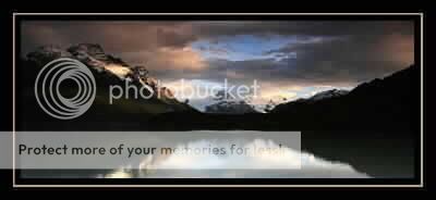
Sunrise over Glacier Grey:

Cuernos and Paine Grande at Sunrise from Lago Pehoe:

The Torres at Sunrise:

Gauchos Driving Horses (near Las Torres):

http://www.pbase.com/pudgy_groundhog/patagonia
During March, Steve and I spent three weeks in Chile and Argentina. Our trip was divided into two sections: visiting Torres del Paine in Chile and Los Glaciares National Park in Argentina (mainly the northern section referred to as "Fitzroy").
Getting to the end of the earth is not an inconsequential matter. Especially when you are flying Aerolineas Argentinas.
Most people visiting the park hike what is called the "W". The "W" hits many of the highlights of the park and is set up with refugios that allow people to trek in the park without having to carry a tent or food. We intended to do the "W" as part of the full circuit of the Paine Massif. We carried a tent to allow us to be more flexible and although we had dinners in the refugios a few times, we only stayed in one once (after a particularly soggy day). The prices for the refugios had at least doubled from the prices in the guide book. Overall the park was pretty expensive (due to remoteness and being a major tourist attraction).
The circuit + the W is about 75 miles with 10,800 feet elevation gain -- not too bad. We didn't have a set schedule because there were some key places we wanted views, so were going to play it by ear depending on weather and how we felt. I had expected to have a fair amount of clouds and rain and although we did have some, overall the weather was much better than we expected and we were able to see everything we wanted to see. We ended up taking eight days to do the trek, although we hiked over half the mileage in the first three days (around 47 miles) because the weather was super. Our trekking itinerary:
- Las Torres to Refugio Dickson
- Refugio Dickson to Campamento Paso (over Paso John Gardner, the highest point on the circuit)
- Camp. Paso to Lago Paine Grande (formerly known as Lago Pehoe)
- Paine Grande to Camp. Britianica in the Valle del Frances
- Camp. Britanica to Los Cuernos
- Los Cuernos to Las Torres (intended to go to Reg. Chileano or Camp. Torres, but rain changed our mind)
- Las Torres to Camp. Torres (by the base of the Torres)
- Camp. Torres back to Las Torres and out of the park
Some of our favorites: the solitude on the back of the circuit (the W is pretty crowded, even this time of year which is more off peak. I can't even imagine what it would be like in peak season!), Paso John Gardner, Glacier Gray, the Cuernos from Lago Pehoe, Valle del Frances, and the Torres.
And some pictures:
Sunrise over Lago Dickson

Sunrise over Glacier Grey:

Cuernos and Paine Grande at Sunrise from Lago Pehoe:

The Torres at Sunrise:

Gauchos Driving Horses (near Las Torres):

Last edited:

