
Becca M
Active member
12/17/11 (pictures at end!): Paugus, why Paugus? Been there, done that, but, not from the Kanc! One other car in the Champney Falls Parking lot besides me. All the cars on the Kanc seemed to be at the 4K-footer trailheads. Which left this one pretty much abandoned. I took a quick right onto Bolles Trail and headed up. Before the height of land, I was surprised to see a washed out snowmachine bridge. SO many water crossings and washouts– it would be tough in a snowmobile!!!!
The height-of-land came quicker than anticipated…. OH, I kind of miss-read the topo elevations not realizing there would be SO much downhill to the Beeline Trail – basically losing everything I’d gained. Glad I accidentally carbo-loaded at a recent Christmas Party!
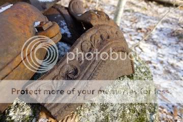
The Bolles Trail is kind of neat: it’s mostly old logging roads through open woods and all along it there are many snowmachine bridges in various states of decay. Despite their presence, I still found the trail difficult to follow, particularly near the wet flats. There were occasional yellow blazes but there was so little foot traffic that I almost never saw moss worn off the treadway! Coming upon the old logging camp was a special treat! By the end of the day I would actually see 2 stoves (incomplete)! Wow!
From Bolles southbound, I took a right onto the Beeline and Old Paugus Trails to the shoulder of Paugus—a little icy and steep – glad I had my microspikes for the ledges. Awesome views there, as usual. From the top of those ledges, I set off on a north bearing for my second round of “Paugus for no particular reason.”
The woods looked familiar since I had just been there during the summer. It’s moderately open to the sag and then to the summit but there’s a nasty bit of spruce to avoid – just enough to throw me off on the way back, but, I hit some pretty (not-on-bearing) ledges as a result! ANYWAY, I had a little trouble finding the actual summit. It looked kind of how I remember it, but, I could not be sure (the battery in my altimeter died). I checked all the highpoints as well—hope I got it this time but who the heck knows and, I guess I really don’t care…. OK, strike that—I wanted to hit SOME kind of highpoint today, so, I guess I DO care!!!!
Then, a quick, slippery descent ALMOST to the Bolles Trail. I decided to take a right onto the cutoff going south to Bolles – very pleasant logging road! Once back on Bolles northbound, I noticed some rather impressive/new snowmobile bridges. Looks like the main snowmachine trail eventually cuts east before Beeline Trail. Near Beeline OF COURSE, I dropped my map. Luckily, I was only 10 minutes up the trail before I realized it. I hurried back to find it, determined not to lose ANOTHER map in the woods!!!
Of course, I underestimated the effort required to go back up the Bolles Trail at the end of the day – it was tedious, but, a definite calorie burner – YAY!!!!
Here are some pictures so you can imagine what it was like:
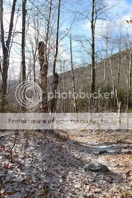
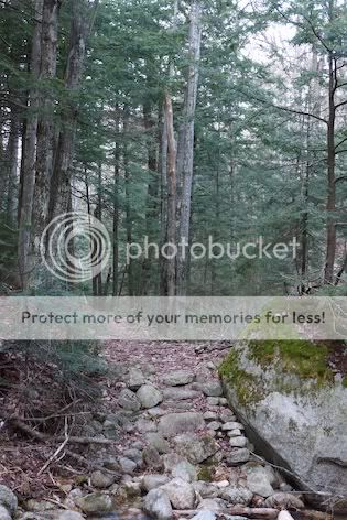
A portion of the Bolles Trail:
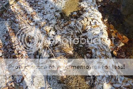
Hard-to-see, but, in the flats on the Bolles Trail, very cool stacking of leaves from excess runoff:
One of the stoves I saw. Look at the detail on the leg of the stove!!!
Heading west onto Beeline, one of the first stream crossings is marked with cairns. This one reminded me of a cat. Note similarity to cat (cat is an example only – sadly, there were no wild cats seen today in the woods. This cat has no use for woods—she is in her natural habitat—a wood-stove-heated living room.)

Her Majesty Chocorua from the height-of-land on Bolles Trail. A little difficult to see, but, a unique perspective.

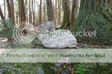
Interesting rock steps
And finally, the setting sun after a fine day outside

10 degrees cooler at the end of the day and not a car in the lot…. Unfortunately I lost my keys inside my car and it just kept getting colder and colder until I finally found them.. D’oh!!!!
Enjoy!!!!
The height-of-land came quicker than anticipated…. OH, I kind of miss-read the topo elevations not realizing there would be SO much downhill to the Beeline Trail – basically losing everything I’d gained. Glad I accidentally carbo-loaded at a recent Christmas Party!
The Bolles Trail is kind of neat: it’s mostly old logging roads through open woods and all along it there are many snowmachine bridges in various states of decay. Despite their presence, I still found the trail difficult to follow, particularly near the wet flats. There were occasional yellow blazes but there was so little foot traffic that I almost never saw moss worn off the treadway! Coming upon the old logging camp was a special treat! By the end of the day I would actually see 2 stoves (incomplete)! Wow!
From Bolles southbound, I took a right onto the Beeline and Old Paugus Trails to the shoulder of Paugus—a little icy and steep – glad I had my microspikes for the ledges. Awesome views there, as usual. From the top of those ledges, I set off on a north bearing for my second round of “Paugus for no particular reason.”
The woods looked familiar since I had just been there during the summer. It’s moderately open to the sag and then to the summit but there’s a nasty bit of spruce to avoid – just enough to throw me off on the way back, but, I hit some pretty (not-on-bearing) ledges as a result! ANYWAY, I had a little trouble finding the actual summit. It looked kind of how I remember it, but, I could not be sure (the battery in my altimeter died). I checked all the highpoints as well—hope I got it this time but who the heck knows and, I guess I really don’t care…. OK, strike that—I wanted to hit SOME kind of highpoint today, so, I guess I DO care!!!!
Then, a quick, slippery descent ALMOST to the Bolles Trail. I decided to take a right onto the cutoff going south to Bolles – very pleasant logging road! Once back on Bolles northbound, I noticed some rather impressive/new snowmobile bridges. Looks like the main snowmachine trail eventually cuts east before Beeline Trail. Near Beeline OF COURSE, I dropped my map. Luckily, I was only 10 minutes up the trail before I realized it. I hurried back to find it, determined not to lose ANOTHER map in the woods!!!
Of course, I underestimated the effort required to go back up the Bolles Trail at the end of the day – it was tedious, but, a definite calorie burner – YAY!!!!
Here are some pictures so you can imagine what it was like:
A portion of the Bolles Trail:
Hard-to-see, but, in the flats on the Bolles Trail, very cool stacking of leaves from excess runoff:
One of the stoves I saw. Look at the detail on the leg of the stove!!!
Heading west onto Beeline, one of the first stream crossings is marked with cairns. This one reminded me of a cat. Note similarity to cat (cat is an example only – sadly, there were no wild cats seen today in the woods. This cat has no use for woods—she is in her natural habitat—a wood-stove-heated living room.)
Her Majesty Chocorua from the height-of-land on Bolles Trail. A little difficult to see, but, a unique perspective.
Interesting rock steps
And finally, the setting sun after a fine day outside
10 degrees cooler at the end of the day and not a car in the lot…. Unfortunately I lost my keys inside my car and it just kept getting colder and colder until I finally found them.. D’oh!!!!
Enjoy!!!!
Last edited:
")