Becca M
Active member
June 20, 2012: mountain biked Eastside Trail, walked Wilderness Trail, Thoreau Falls Trail, turned around, returned to Wilderness Trail, crossed the Pemi River north to the old Wilderness Trail, followed the old portion (now discontinued) of the Wilderness Trial, and crossed back near Franconia Brook Bridge.
Further background: Something bad happened to my knee the previous week. Still trying to figure out what's wrong (with Ortho Dr's help) and hoping it will heal on its own sooner rather than later!!!! I am attempting to practice patience, which, for me, is more challenging than anything I’ve ever hiked.
At any rate, I was given the green light to walk and ride a bike. Sooooo, at Lincoln Woods, I wished Mark T & Valerie C a good hike to Owl’s Head and then I got my stuff together. Biking the East Side Road/Trail is pretty fun since Hurricane Irene. I got to bike along the edge of the washouts and challenge myself on the uphills. Once inside the Wilderness boundary, I dismounted and locked the bike up.
First thing at the campground/Wilderness boundary was to check out the Pemi River Crossing. This time I spotted the sign across the water. The water looked a little deep although I knew it was about as low as it gets. At first I pondered exploring the East Side Trail further on foot, returning, and then carrying the bike across the river. I just felt as though I’d fall in if I were carrying the bike—it is impossible to use a staff (for me) AND carry a heavy bike…. Tuck those thoughts into the back of my mind. Not sure what I want to do….
So I started walking up the East Side Trail towards the Cedar Brook Trail. I kept moving right along. Then I came to the wide slow-moving stream crossing around a mile into the Wilderness that always seems to throw a little more at me every time. I thought, “HAH! The water is low. It won’t get me this time!”
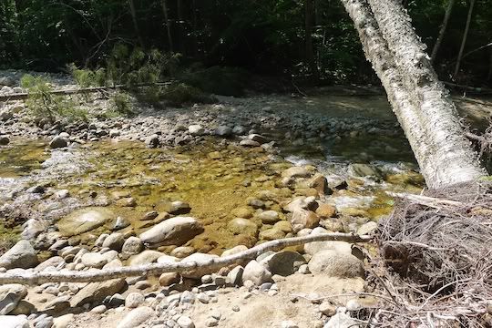
A couple steps on rounded rocks and I found the unstable one. BAM. Sitting in the stream. Gaitors, trailrunners, shorts: all soaked to the skin. Actually felt pretty good because of the heat!!! At least the water wasn’t sloshing in my shoes!!! At this point I figured whatever I wanted to do for river crossings, I was IN!!!!
Here’s that dastardly first stream crossing that soaked me (looks so innocent, doesn’t it????):
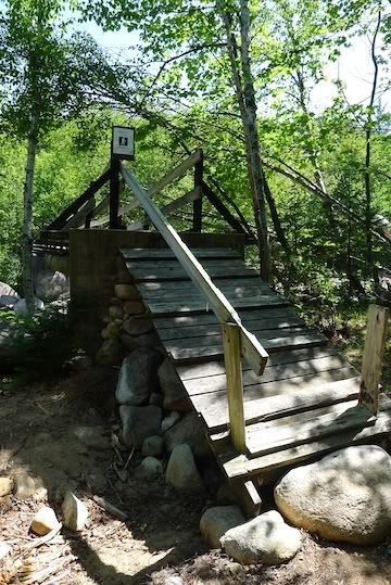
And on I went, sailing past the Cedar Brook Trail on towards Thoreau Falls which always draws me. I kept doing calculations of time to see if maybe I could get there and get back before dark, or, at least, before Mark & Valerie would find my car still in the same spot in the lot and wonder if I were in trouble….. and I took the left onto the Thoreau Falls Trail. I was a little curious about the bridge there since Irene. The bridge has been mended – I was happy about that.
Almost like it was (ramp is back in place):
But, only one at a time!!!!
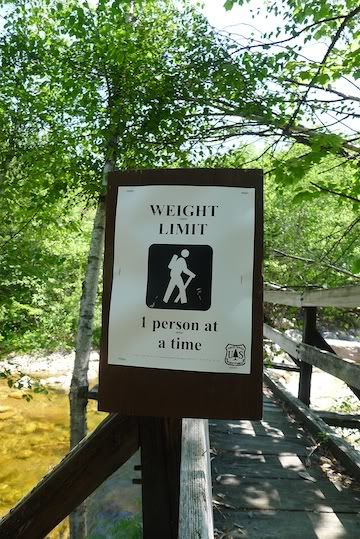
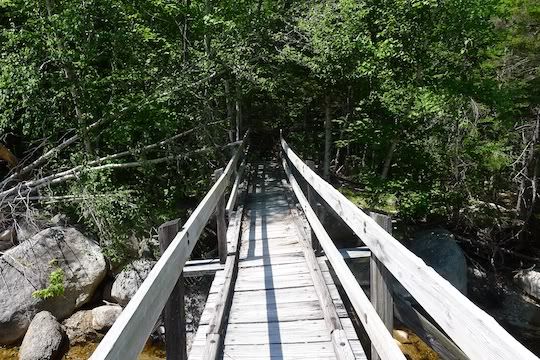
But, it looks pretty strong:
Further up Thoreau Falls Trail – these logs look like gateposts:
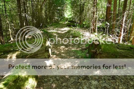
But, not even as far as the first logging camp, my knee just didn’t feel right. I decided to turn around. I hated to do that. BUT, I started to think about other options for my return. I did have to make a walking stick since I didn’t bring any. It helped, maybe, psychologically. So, I retraced my steps thinking briefly about taking a right just before the TFT Bridge and bushwhacking down to the west side of the Pemi. I realized I didn’t want to get stuck bushwhacking with a bad knee in case anything went wrong!!!
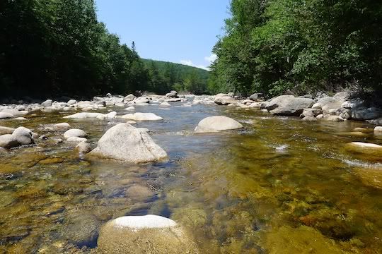
So, back at the site of the old suspension bridge (RIP) over the Pemi River, I cut down to the river. There are a bunch of herd paths leading down to the water. And, submerging my feet, I found a decent crossing a little north of the bridge site. Here’s a pic from mid-river (the old way was so much higher). But, up to my knees in river, here it is:
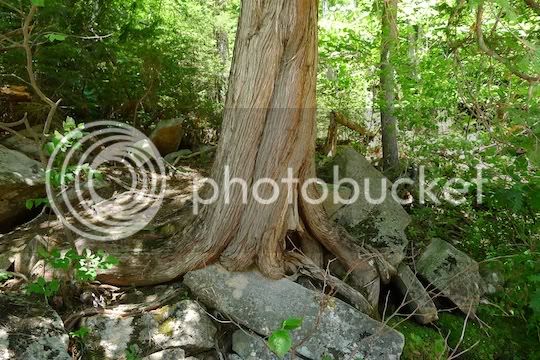
Unfortunately, on the opposite (north) side, I had a lot of trouble getting up the bank. This tree trunk caught my eye as I was clawing my way up:
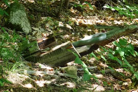
Old anchor bolts holding nothing:
The old Wilderness Trail on the north side of the Pemi River had random trash and LOTS of blowdowns which were difficult to step over. I was pretty happy when I got close to the Bondcliff Trail.
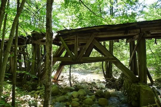
Those of you watching the old RR trestle decay will enjoy this recent pic. The trestle is still looking pretty good:
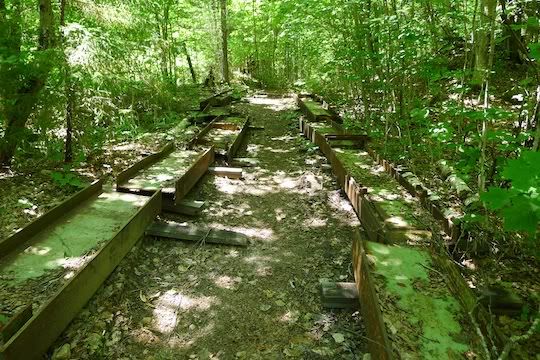
The former Black Brook Bridge cut up, laid out, and aligned with the RR Bridge.
Then I hunted for the herd paths down to the crossing. I took the herd path just past the Franconia Brook Trail sign. That herd path led to a VERY high embankment. I found a few rocks and dropped down to the little stream below, crossed THAT to a herd path, and wound across that mini-island. The path led back to the river. It was too deep there so I headed up-stream and started walking in the open sections. Then, I had to fight back up the opposite bank – it was tricky to get back up due to the Irene damage PLUS my knee was really aching.
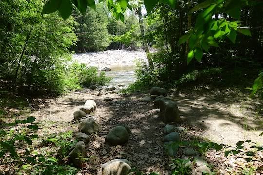
Looking towards the final crossing:
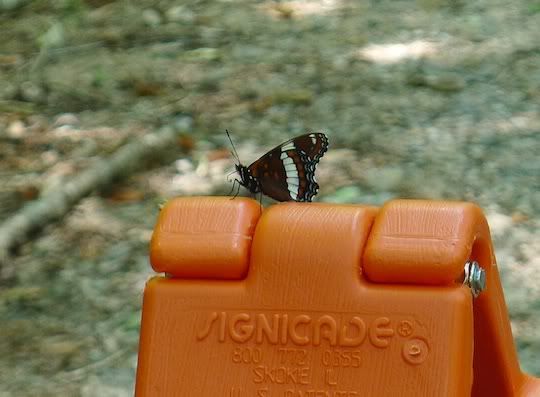
Back to my bike and back on an easy ride (except for the culvert blow-out). Just past the culvert, this butterfly sat on the signboard:
A fine day!!!! Enjoyed finally doing those river crossings; didn’t enjoy the knee ☹
Further background: Something bad happened to my knee the previous week. Still trying to figure out what's wrong (with Ortho Dr's help) and hoping it will heal on its own sooner rather than later!!!! I am attempting to practice patience, which, for me, is more challenging than anything I’ve ever hiked.
At any rate, I was given the green light to walk and ride a bike. Sooooo, at Lincoln Woods, I wished Mark T & Valerie C a good hike to Owl’s Head and then I got my stuff together. Biking the East Side Road/Trail is pretty fun since Hurricane Irene. I got to bike along the edge of the washouts and challenge myself on the uphills. Once inside the Wilderness boundary, I dismounted and locked the bike up.
First thing at the campground/Wilderness boundary was to check out the Pemi River Crossing. This time I spotted the sign across the water. The water looked a little deep although I knew it was about as low as it gets. At first I pondered exploring the East Side Trail further on foot, returning, and then carrying the bike across the river. I just felt as though I’d fall in if I were carrying the bike—it is impossible to use a staff (for me) AND carry a heavy bike…. Tuck those thoughts into the back of my mind. Not sure what I want to do….
So I started walking up the East Side Trail towards the Cedar Brook Trail. I kept moving right along. Then I came to the wide slow-moving stream crossing around a mile into the Wilderness that always seems to throw a little more at me every time. I thought, “HAH! The water is low. It won’t get me this time!”
A couple steps on rounded rocks and I found the unstable one. BAM. Sitting in the stream. Gaitors, trailrunners, shorts: all soaked to the skin. Actually felt pretty good because of the heat!!! At least the water wasn’t sloshing in my shoes!!! At this point I figured whatever I wanted to do for river crossings, I was IN!!!!
Here’s that dastardly first stream crossing that soaked me (looks so innocent, doesn’t it????):

And on I went, sailing past the Cedar Brook Trail on towards Thoreau Falls which always draws me. I kept doing calculations of time to see if maybe I could get there and get back before dark, or, at least, before Mark & Valerie would find my car still in the same spot in the lot and wonder if I were in trouble….. and I took the left onto the Thoreau Falls Trail. I was a little curious about the bridge there since Irene. The bridge has been mended – I was happy about that.
Almost like it was (ramp is back in place):

But, only one at a time!!!!

But, it looks pretty strong:

Further up Thoreau Falls Trail – these logs look like gateposts:

But, not even as far as the first logging camp, my knee just didn’t feel right. I decided to turn around. I hated to do that. BUT, I started to think about other options for my return. I did have to make a walking stick since I didn’t bring any. It helped, maybe, psychologically. So, I retraced my steps thinking briefly about taking a right just before the TFT Bridge and bushwhacking down to the west side of the Pemi. I realized I didn’t want to get stuck bushwhacking with a bad knee in case anything went wrong!!!
So, back at the site of the old suspension bridge (RIP) over the Pemi River, I cut down to the river. There are a bunch of herd paths leading down to the water. And, submerging my feet, I found a decent crossing a little north of the bridge site. Here’s a pic from mid-river (the old way was so much higher). But, up to my knees in river, here it is:

Unfortunately, on the opposite (north) side, I had a lot of trouble getting up the bank. This tree trunk caught my eye as I was clawing my way up:

Old anchor bolts holding nothing:

The old Wilderness Trail on the north side of the Pemi River had random trash and LOTS of blowdowns which were difficult to step over. I was pretty happy when I got close to the Bondcliff Trail.
Those of you watching the old RR trestle decay will enjoy this recent pic. The trestle is still looking pretty good:

The former Black Brook Bridge cut up, laid out, and aligned with the RR Bridge.

Then I hunted for the herd paths down to the crossing. I took the herd path just past the Franconia Brook Trail sign. That herd path led to a VERY high embankment. I found a few rocks and dropped down to the little stream below, crossed THAT to a herd path, and wound across that mini-island. The path led back to the river. It was too deep there so I headed up-stream and started walking in the open sections. Then, I had to fight back up the opposite bank – it was tricky to get back up due to the Irene damage PLUS my knee was really aching.
Looking towards the final crossing:

Back to my bike and back on an easy ride (except for the culvert blow-out). Just past the culvert, this butterfly sat on the signboard:

A fine day!!!! Enjoyed finally doing those river crossings; didn’t enjoy the knee ☹
