Jazzbo
Well-known member
- Joined
- Jan 1, 2005
- Messages
- 1,199
- Reaction score
- 171
Pemi East Branch Excursion
Date: 9/19/2020
An excursion out to East Branch and North Fork of the East Branch Pemigewassett River has been on my to-do list for some time. Saturday ended up being the day. I road my mountain bike up the East Side Road for 2.9 miles to the Wilderness Boundary and hid the bike in the woods, and started hiking whereupon I met up with a back-country ranger who said she was hiking out to Thoreau Falls Bridge area for routine patrol so we walked together for 3 miles or so. I enjoyed our conversation very much. We talked about legacy of the logging rail roads and many other interesting things.
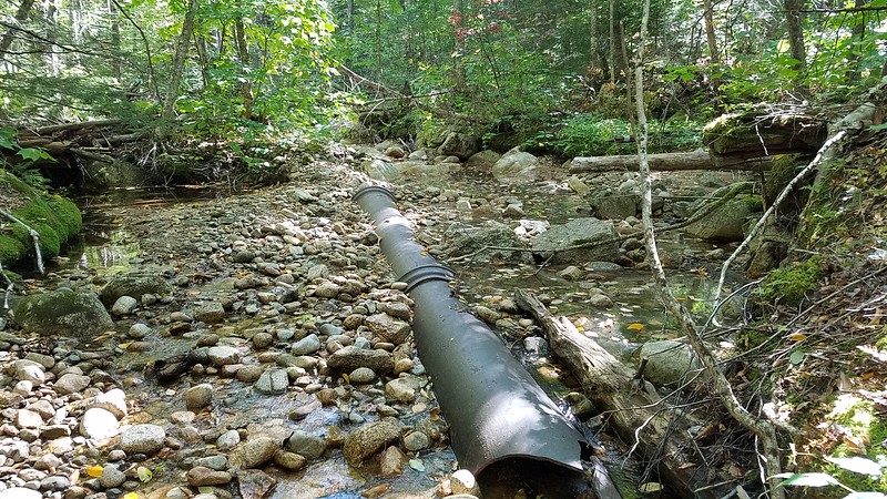
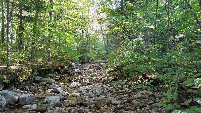
There were two primary items I was interested in. First was to examine an interesting terrain feature I saw on Stonewall Mapper. I thought this feature would be another logging road, but it turned out to be a channel that supplied water to the large diameter cast iron pipes one passes by just before the bridge crossing. I followed the channel to its source at the river. I found many peculiar artifacts all along the channel including signs of blasting, embedded timber, corduroying timbers. I think it was a pre-existing channel that was enhanced to improve flow to an impoundment from which the steam engines took on water for the boilers. There must have been a dam here that has since been breached. One can still see remains of the cribwork adjacent to the cast iron pipe. The logging RR went along the top of the dam on its way to the old rail road bridge. I’ve always wondered what the purpose of the wrought iron pipe was. I now think it was installed as part of the dam to drain off water prevent overtopping dam and the rail bed.
The wrought iron pipe located just before reaching former site of Thoreau Falls Bridge. By the way it is against the law to remove artifacts from WMNF.
The channel which I followed all the way to East Branch.
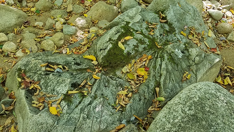
I came across several boulders which show signs of having been blasted to reduce obstructions to slow within the channel.
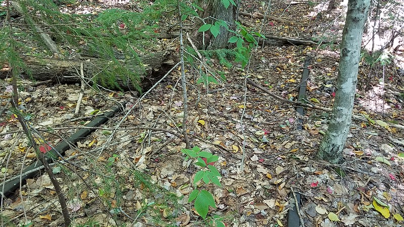
Second item of interest was to cross the East Branch and North Fork to find and follow the railroad bed of a spur of the logging railroad that extended up the west side of the North Fork. The flood waters of 1927 storm took out the bridge and it was decided it was too costly to rebuild the bridge and to abandon the tracks and equipment on that side of the North Fork. Due to recent drought water crossing was trivial. I located the track bed fairly quickly, but was disappointed not to see any rails. I kept going and eventually started seeing rails. A fairly sizable tree has grown up.
I eventually reached the famous harp switch and observed that the spur split into two sets of rails.
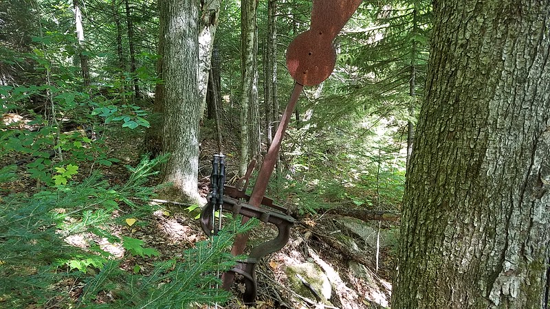
It is extremely rare to find the entire harp switch mechanism in the White Mountain National Forest.
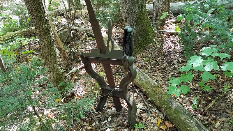
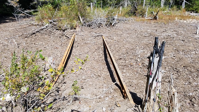
The two sets of rails diverge from each other. One of these was a siding or perhaps this was simply the end of the line and they were both sidings.
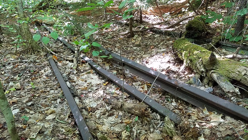
The two sets of rails extended into a marshy area making it trickier to follow the rails. Unfortunately, there wasn’t time to perform more than a cursory exploration, due to dense forest and marshy terrain encountered along the route.
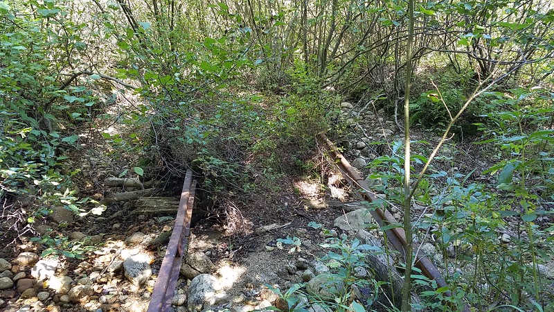
I eventually lost the rails altogether and it was time to formulate an exit strategy. I could simply back track or since water was low making for easy crossing I decided to work my way over to the North Fork and cross it. The river bed was dominated by an enormous boulder field which was quite interesting. I rock hopped across river, scrambled up the bank, and shortly met up with the Thoreau Falls Trail right at the harp switch for Camp 22. What good luck! Two harp switches in one day, although this one was far less complete.
A third Item was optional pending extra time. With remaining daylight, I figured I had enough time to make a quick run over to Crystal Brook to make preliminary examination of east bank to see if there were any sled roads associated with another interesting terrain feature I discovered in Stonewall Mapper. I then turned back and hiked rapid pace to get back to bike in time for the ride back to Lincoln Woods. I did have time to stop at site of former suspension bridge for a brief rest and re-fuel.
I rode the 2.9 miles of East Side Trail back to trailhead parking lot in twilight and had to resort to headlamp for the last mile. I encountered a male moose with medium size rack who stopped to study me briefly and then sauntered into the forest.
Date: 9/19/2020
An excursion out to East Branch and North Fork of the East Branch Pemigewassett River has been on my to-do list for some time. Saturday ended up being the day. I road my mountain bike up the East Side Road for 2.9 miles to the Wilderness Boundary and hid the bike in the woods, and started hiking whereupon I met up with a back-country ranger who said she was hiking out to Thoreau Falls Bridge area for routine patrol so we walked together for 3 miles or so. I enjoyed our conversation very much. We talked about legacy of the logging rail roads and many other interesting things.
There were two primary items I was interested in. First was to examine an interesting terrain feature I saw on Stonewall Mapper. I thought this feature would be another logging road, but it turned out to be a channel that supplied water to the large diameter cast iron pipes one passes by just before the bridge crossing. I followed the channel to its source at the river. I found many peculiar artifacts all along the channel including signs of blasting, embedded timber, corduroying timbers. I think it was a pre-existing channel that was enhanced to improve flow to an impoundment from which the steam engines took on water for the boilers. There must have been a dam here that has since been breached. One can still see remains of the cribwork adjacent to the cast iron pipe. The logging RR went along the top of the dam on its way to the old rail road bridge. I’ve always wondered what the purpose of the wrought iron pipe was. I now think it was installed as part of the dam to drain off water prevent overtopping dam and the rail bed.
The wrought iron pipe located just before reaching former site of Thoreau Falls Bridge. By the way it is against the law to remove artifacts from WMNF.

The channel which I followed all the way to East Branch.

I came across several boulders which show signs of having been blasted to reduce obstructions to slow within the channel.

Second item of interest was to cross the East Branch and North Fork to find and follow the railroad bed of a spur of the logging railroad that extended up the west side of the North Fork. The flood waters of 1927 storm took out the bridge and it was decided it was too costly to rebuild the bridge and to abandon the tracks and equipment on that side of the North Fork. Due to recent drought water crossing was trivial. I located the track bed fairly quickly, but was disappointed not to see any rails. I kept going and eventually started seeing rails. A fairly sizable tree has grown up.

I eventually reached the famous harp switch and observed that the spur split into two sets of rails.

It is extremely rare to find the entire harp switch mechanism in the White Mountain National Forest.

The two sets of rails diverge from each other. One of these was a siding or perhaps this was simply the end of the line and they were both sidings.

The two sets of rails extended into a marshy area making it trickier to follow the rails. Unfortunately, there wasn’t time to perform more than a cursory exploration, due to dense forest and marshy terrain encountered along the route.


I eventually lost the rails altogether and it was time to formulate an exit strategy. I could simply back track or since water was low making for easy crossing I decided to work my way over to the North Fork and cross it. The river bed was dominated by an enormous boulder field which was quite interesting. I rock hopped across river, scrambled up the bank, and shortly met up with the Thoreau Falls Trail right at the harp switch for Camp 22. What good luck! Two harp switches in one day, although this one was far less complete.
A third Item was optional pending extra time. With remaining daylight, I figured I had enough time to make a quick run over to Crystal Brook to make preliminary examination of east bank to see if there were any sled roads associated with another interesting terrain feature I discovered in Stonewall Mapper. I then turned back and hiked rapid pace to get back to bike in time for the ride back to Lincoln Woods. I did have time to stop at site of former suspension bridge for a brief rest and re-fuel.
I rode the 2.9 miles of East Side Trail back to trailhead parking lot in twilight and had to resort to headlamp for the last mile. I encountered a male moose with medium size rack who stopped to study me briefly and then sauntered into the forest.
Last edited:

