Perfect Weather and New Camera Katahdin, Hamlin Peak 09/20/10

vftt.org

Help Support vftt.org:

This site may earn a commission from merchant affiliate links, including eBay, Amazon, and others.

Jazzbo

Well-known member
Joined
Jan 1, 2005
Messages
1,199
Reaction score
171
Location
Waltham, MA Jazzbo & Marty meet Bigfoot on Kenne
I had perfect weather and a new camera and I was in Baxter State Park to finish my NE67. I elected to hike into Chimney Pond for 2 nights enabling a shorter distance just shy of 6.0 miles RT for the hike (or should I say climb?) up the Cathedral Trail and hike over to Hamlin and descend via Hamlin Ridge Trail. I was able to spend an hour on summit of Baxter sharing the joy with all the other happy people.

It took me almost 3 hours to go up Cathedral. The climb up Cathedral was a thriller for me. I don't usually do stuff like this one, but someone whose opinion I trust suggested going this route so I did and it really made it an awesome outing. I just took my time and stopping to rest frequently and enjoy the views. This was made easier by starting from Chimney Pond with fresh legs - not that it was a picnic carrying a huge pack up the Chimney Pond Trail the day before. The upper part of that CP trail is really rocky and rough.

My new Canon SX130 really rocks as a hiker camera. It is really powerful performer and takes great pics. I may write a review in another thread after I've spent more time learning about it's functions. All these pics were taken in the EASY mode or Landscape mode.

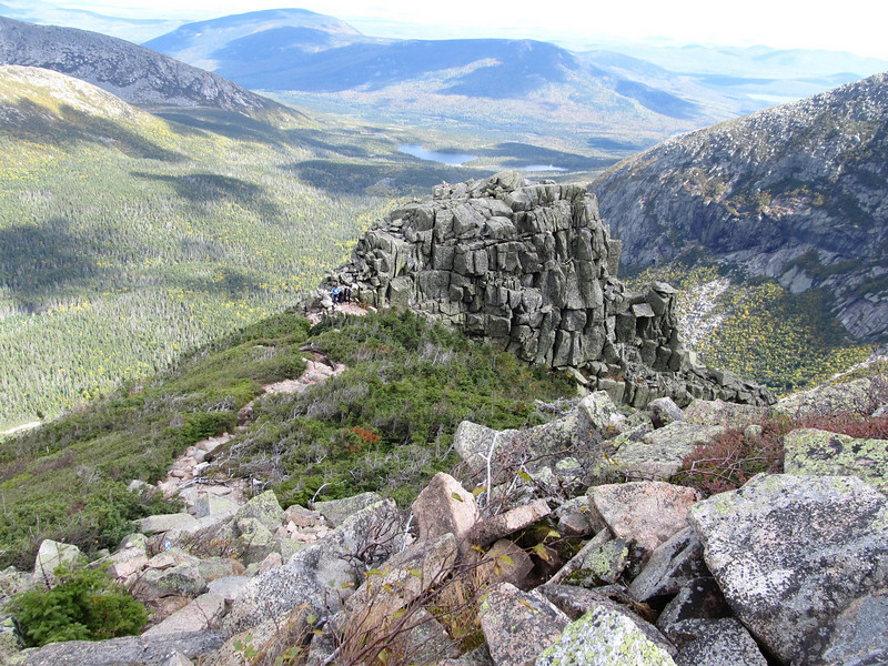
Looking up at first Cathedral.
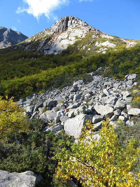
1020959150_DcBr2-L.jpg


Looking down on first Cathedral.

1020939447_CLTDn-L.jpg


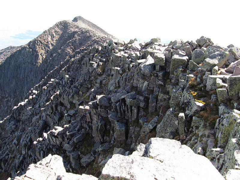
Looking down from next Cathedral. Yikes!!! :eek:
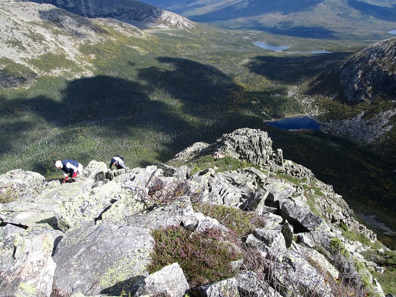
1021006349_LX4he-L.jpg


I'm relieved that's over! The views were awesome. I thruhiker had just proposed to his girlfriend after completing the AT. A large group had just assembled for this celebration. Some pictures from the top. Pamola and the Knife Edge.
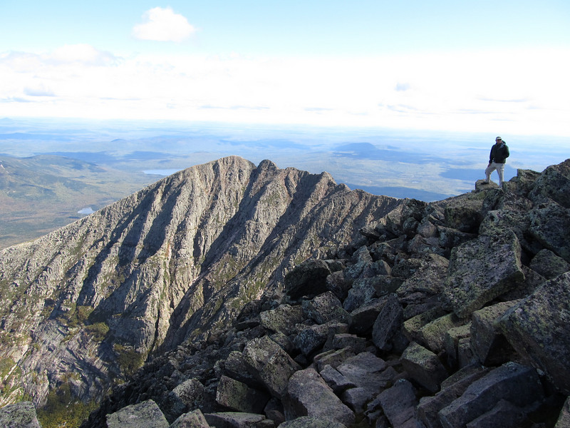
1020959298_qFkUm-L.jpg


South Peak

1020970111_zcHap-L.jpg


Views towards Doubletop, OJI, N&S Brothers.
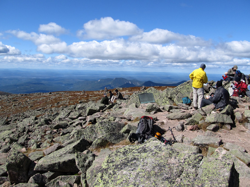
1020957931_kAVSk-L.jpg


Veiw of my route across the Tableland towards Hamlin
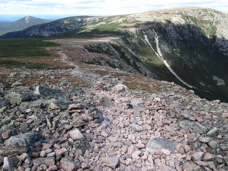
1020970530_fWMrs-L.jpg


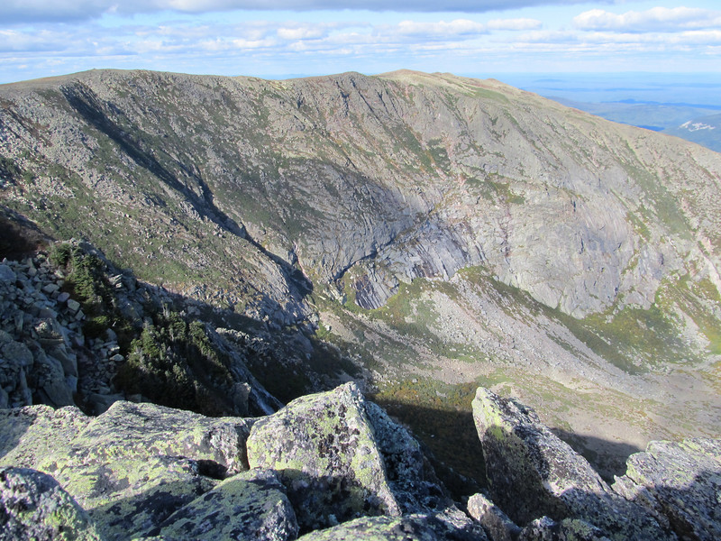
Series of views into North Basin from the Hamlin Ridge Trail. First the headwall of the cirque.
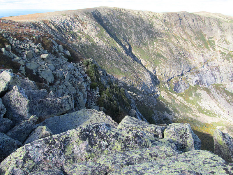
1020982616_oygnC-L.jpg


The middle of the cirque.

1020982264_HEjaG-L.jpg


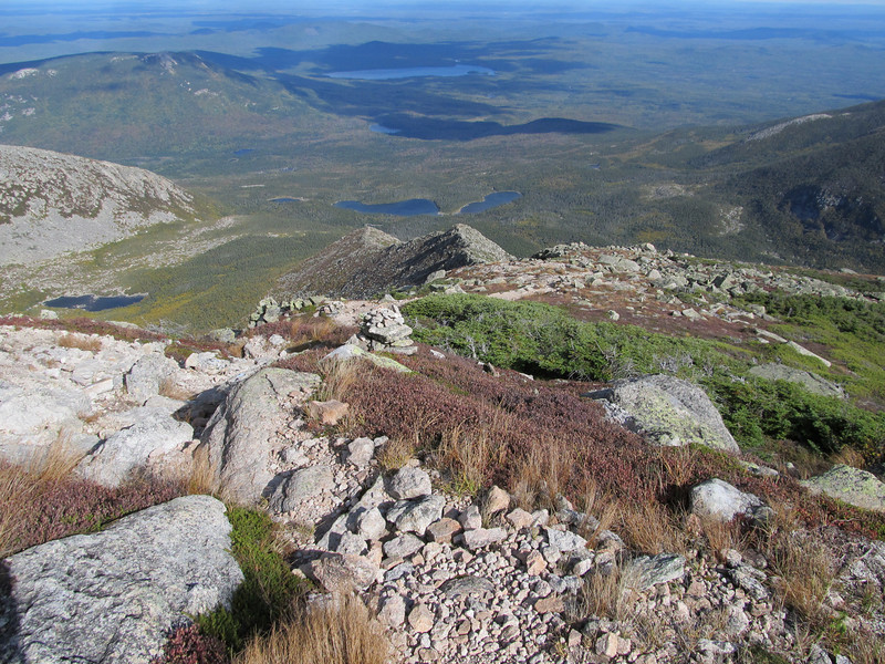
Finally the outlet with the end morraine and one of the Basin Ponds.
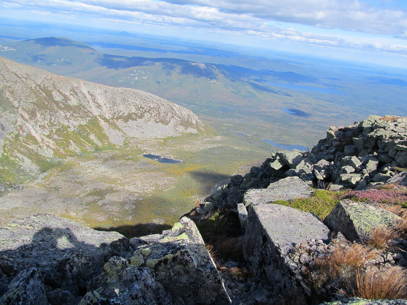
1020985212_n6gbr-L.jpg


That's all folks! BTW I summited N & S Brother on 9/22 in 40 MPH winds and socked in summit, but at least it didn't rain. So completing my NE67. I'll be back to N Brother next year to go get Fort and Coe. Yeah I know I should have gotten Fort, but weather was not so hot and I was solo so I went for the easier summit. Like Arnold says "I'll be Back!" I celebrated by renting a cottage at Kidney Pond after 4 nights in bunkhouses.
 
Last edited:
Great photos from the Cathedral - one of my favorite trails. Nice idea to snare one of those cabins for your last night - I've envied the people staying there, when it has been cold and wet.
 
Jazzbo, I love that last photo. So much motion in the shape of the terrain. Those Cathedral pics are great too. I wonder if I have the gonads to tackle those yet...
Glad you safely did NoBro... Fort will still be there next time.
 
wow, wow, wow, wow wow!!!

Yeah, wow. :)

Katahdin looks freaking amazing, as does that whole mountain range, holy cow. I'm at a loss for words.


I think it is time to look up that camera. I;m looking for a couple different types of cameras...one that is a nice easy compact hiking camera that takes top quality photos, and another that is more pro-like, that I can bring on a hike, that takes good photos.

Keep the pics a comin!!

grouseking
 
Yeah, wow. :)

I think it is time to look up that camera. I;m looking for a couple different types of cameras...one that is a nice easy compact hiking camera that takes top quality photos, and another that is more pro-like, that I can bring on a hike, that takes good photos.

Keep the pics a comin!!

grouseking

Thanks GK! The Canon SX130 is a just released updated version of SX100, SX110, and SX120. The basic design well-tested and just keeps getting updated. It is great camera for $250. Since it is newly released it will slowly drop down in price if you can wait a bit. I think Staples carries the SX120 if you want to see one some time.

One important selection criteria for me is it runs on AA batteries same as my headlamp and water treatment. I've always been leary of cameras with odd batteries. Believe me it is pretty hard to find compact full-featured cameras without the li-ion batteries.
 
Last edited:
Great pics, impressive shots!

Looks like you had some nice weather for part of it...never a bad thing to have to go back to BSP!!!

Thanks for sharing!:D
 
Awesome

We've been working on the NH 48...so haven't been to Baxter this year.

Those pictures make me REALLY question this decision...I miss Baxter and that Cathedral trail (my favorite of all times...um...so far)

Thanks for sharing...
 
Great pics, impressive shots!

Looks like you had some nice weather for part of it...never a bad thing to have to go back to BSP!!!

Thanks for sharing!:D
I agree! :D

"Katahdin is a strange, lone, savage hill, unlike all others...It does not need superlatives to set it off." - Fannie Hardy Eckstorm
 
beautiful pics, and I'm envious of your weather! we were there last thursday through sunday; didn't make out quite so well... but hey, the glass is half full... =) will post some pics soon.
 
Congrats on your NE67, Ray!

Also, nice slide Ktaadn show! I need to look at my old shots of the Great Basin headwall between the Saddle Trail and Hamlin Peak, as I do not remember that long Y-shaped slide so visible in your photos.

This Friday, I am leading a glacial geology field trip from Roaring Brook to the mouth of North Basin and across to Chimney Pond, paying much attention to the Basin Ponds moraine, which I think was formed by continental ice in the lowlands to the east as opposed to alpine ice from the cirques. A fairly esoteric debate, but does have implications for paleoclimate at the end of the last ice age, when I think that temperatures rose too dramatically to support alpine glaciers in the cirques, which must have been carved before the last continental icesheet overrode the mountain. The Maine Geological Survey just published a wonderful new book titled "A Guide to the Geology of Baxter State Park and Katahdin" (Bulletin 43; comes with two large color geological maps).

Being a fan of glacial geology myself I was mighty impressed with how rugged trails become when they pass over glacial moraines. The BSP trail maintainers build these long bridges over long stretches of moraine ... I think mostly because the water drains through broad stretches of moraine deposit rather than in a concentrated ravine. During storm events river crossings must be pretty nasty.

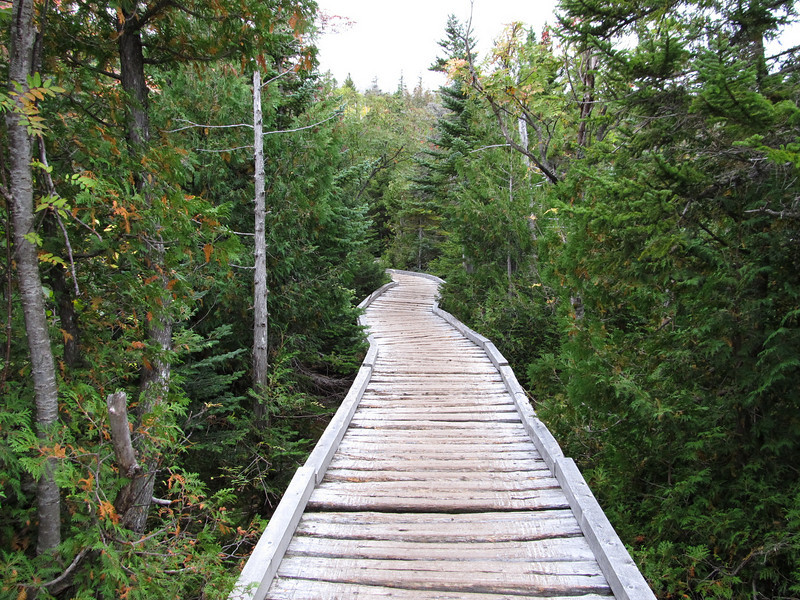
I took some pictures of the these long bridges of the Chimney Pond Trail over the moraines just uphill of the Basin Ponds.

1025184124_Ws6MN-L.jpg


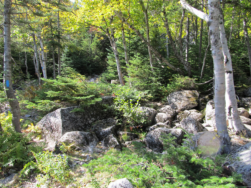
Typical mix of boulders in dry creek bed at least it's dry at the moment.

1025191571_HpGkG-L.jpg


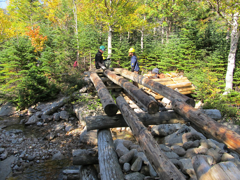
I also took pictures of bridge replacement project in progress on CP TRail just above Basin Ponds when I passed through on 9/21.

1025185206_FygEv-L.jpg
 
The log bridges on the CP Trail are impressive, and remind me of the summer when I was trapped at Chimney Pond for days at a time by torrents of water before the bridges were built (not a bad place to be trapped :) ). But, I do not think that those areas are lateral or end moraines similar to the Basin Ponds moraine and recessional moraines downslope of the BP moraine, but rather just bumpy till hummocks. Nevertheless, the overbank flow from those small streams draining the Ktaadn cirques is sometimes amazing after rainstorms.

Also, about a half mile below Chimney Pond there is a feature named Dry Pond (can be seen in some or you photos), which as its name suggests does not hold water, EXCEPT for 2-3 days following rainstorms. I think that Dry Pond provides a modern analog for the other ponds on Ktaadn, whose basal organic sediments provide radiocarbon ages that are thousands of years too young. My explanation is that these other ponds took thousands of years to seal themselves after deglaciation, with Dry Pond being the last hold out, as it still drains today, clearing out all the organic debris in the process.
 
Last edited:
I am trying to figure out your route. Up Cathedral to the summit, then a trip of over to South peak (to look down the knifes edge)? and then back to Hamlin and then down Hamlin Ridge trail. The south peak photo is what confuses me, most folks keep going down the knife edge.

Looks like you had a great day.

I opted to go to Hamlin to get credit for NE67. If I'd taken moment to study my map it might have ocurred to me to go over to South Peak to at least take a look down the Knife Edge. It looks short enough. As it was I was having a good time eating my lunch and hamging out with everybody. I'll attack the Knife Edge some other time.
 
Jazzbo, glad you're enjoying the camera. There's nothing like having a new toy to play with. Question: you were able to insert your photos into your post, and you store your pictures on smugmug. This is the first time I've ever seen a smugmug user insert photos into a post. I've tried several times (and heard other smugmug users talk about it) without success. Any special procedures? I know HOW to insert a pic into a thread, that's not the issue. The issue is that, until now, I didn't think smugmug users COULD do it. I quoted one of your posts to check out the insert image syntax. Looked normal. Anything extra that you had to do? Thanks.
 
Top