Small plane crashes into Santanoni Peak

vftt.org

Help Support vftt.org:

This site may earn a commission from merchant affiliate links, including eBay, Amazon, and others.

Puma concolor

Well-known member
VFTT Supporter
Joined
Nov 28, 2003
Messages
1,080
Reaction score
129
Location
New York
Don't know if there is any discussion of this on the NY boards, but two people were apparently killed when a small aircraft crashed high on Santanoni Peak. Here is today's Adirondack Daily Enterprise story:

Plane crash
 
FAA speak "Controlled flight into terrain"

Basically it sounds and looks like the pilot drove his plane into the mountain, not intentionally, but likely no defect in the aircraft caused it to happen. My brother is an instructor pilot (land and seaplane). This, is not uncommon unfortunately. At 4200' with mountains that are 4600'. That is information that is pretty clearly marked on the charts also. The highest elevation in the grid.

Sounds like it was likely a tragic mistake.

Keith
 
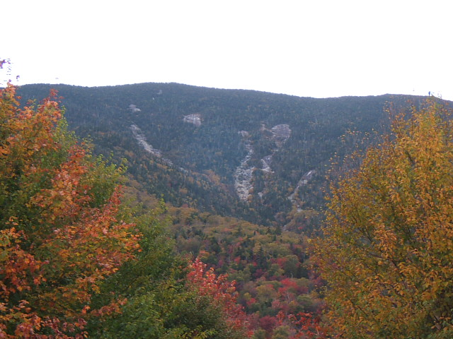
It looks from the video that the crash site is almost directly on the bare rock of the left wing of the Twin slides. What could be the chances?
 
The several very tops of the various taller fingers of that slide sit at about 4200'.
 
Last edited:
Image of Twin Slides from BlackSpruces library.

STW%20028.jpg
 
"just after sunset in clear, calm skies"

Sunday, it may have been sun and clear skies around the High Peaks but it certainly wasn't the case in the mountains as dense fog and low clouds were playing hide and seek all day with layers moving about switfly and temperatures constantly changing from warm to cold to warm. It was a strange day for sure. Which makes me think that flying over the High Peaks may have been much more challenging than it appears. Many climbers have experienced as sudden as strong winds particularly on days when the wind blows hot and cold. According to members of the Santanoni Club who stumbled upon it not long ago there is another crash site very near that same slide.

In any case for the families there are no explanations that will ease their pain.
 
"just after sunset in clear, calm skies"

Sunday, it may have been sun and clear skies around the High Peaks but it certainly wasn't the case in the mountains as dense fog and low clouds were playing hide and seek all day with layers moving about switfly and temperatures constantly changing from warm to cold to warm. It was a strange day for sure.

Perhaps reporters/authorities should be made aware of that.

In any case for the families there are no explanations that will ease their pain.

Maybe the above would help a bit.
 
Yes I have been quite surprise reading those accounts of a sunny Sunday... I did a loop over Pitchoff Ridge where skies were far from clear and my husband who stayed at our house in New Russia all day said Giant and RPR were in dense fog all day as well.
 
I am not an aviator but a direct flight path NNW from Saratoga Springs to Malone would go almost right over Couchrashraga and just west of Mount Santanoni. See map below with crude line. (blue points are my High Peaks waypoint collection). If the plane drifted east he would hit Santanoni rather than follow the lower terrain over Couchie and up to the Chubb/Ausable or Saranac valleys to Malone (Whiteface is a clear view from Couchie).

http://www.vftt.org/forums/attachment.php?attachmentid=2870&stc=1&d=1258769968
 

but one clue that could help determine what happened is a handheld GPS unit that was found at the crash site. Small planes such as this Piper Cherokee are not required to have flight recorders, and this one didn't have one, but the GPS could help fill in some information gaps.

"If it was recording, if it was actually operating at the time, then it can actually capture the route of flight and speeds and things, altitudes," Hicks said. "But we don't know if it was operating or not."
This bit of information is interesting. You would think they would have turned it on by now, unless it was damaged.
 
This bit of information is interesting. You would think they would have turned it on by now, unless it was damaged.

It likely is damaged, just my opinion. That certainly doesn't mean that the data isn't recoverable though. Depending on many variables it very likely is recoverable, if it was recording, its just up to the level of determination of the GPS makers' engineers. Also most investigators are smart enough to not screw with evidence too much if they know people with more capabilities might be able to retrieve something....if they don't do something on scene to make it irretrievable.

Keith
 
Top