Snowshoeing at the Foot of the Hancocks, Just for the Fun of It (05-Jan-2010)

vftt.org

Help Support vftt.org:

This site may earn a commission from merchant affiliate links, including eBay, Amazon, and others.

1HappyHiker

Well-known member
Joined
Jan 18, 2007
Messages
1,973
Reaction score
405
Location
Bethlehem, NH
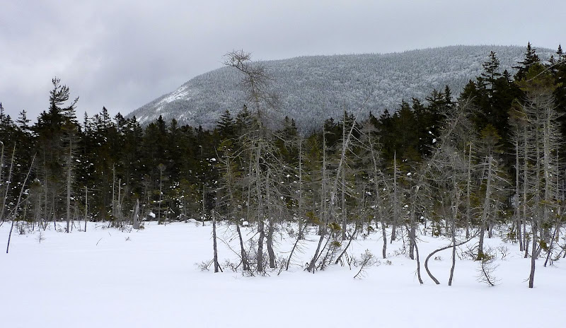
On the morning of our hike, my friend Steve put together a spur of the moment plan for a snowshoe adventure. With an overcast sky and an "iffy" forecast for the remainder of the day, it seemed pointless to have any "lofty" goals (such as conquering a 4k peak), especially since neither of us is working on a peak bagging list! So, we embarked on a snowshoe hike mainly for the pure joy of being out in the woods on a winter day. It sure beats working out at a gym!:)

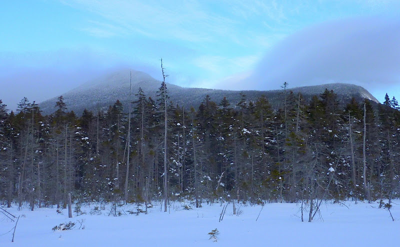
From the standpoint of photographs, the highlight of the day were the views from an open bog which we accessed via a short 10 minute bushwhack off the west side of the Cedar Brook Trail (from a point about midway between the Hancock Notch Trail and the Hancock Loop Trail). The photo below shows the top of South Hancock peaking through a misty cloud.

South Hancock
P1030622.JPG

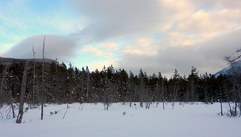
The next photo shows the Hancock Notch (south end of Hancock ridge on left, and north ridge of Mt. Huntingdon on right). Admittedly, from this particular vantage point, this "notch view" is not nearly as dramatic as say looking down the Crawford Notch from Mt. Willard. But nonetheless, it is a pleasant and a unique view.

Hancock Notch
P1030623.JPG

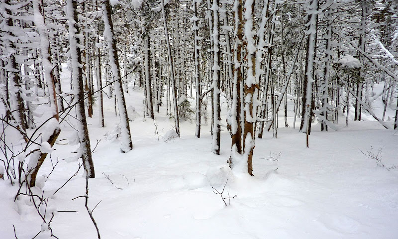
In addition to the short bushwhack to the bog, we also continued along the Cedar Brook Trail to the 3,100 ft. height-of-land saddle between Mt. Hitchcock and North Hancock. Here the trail enters the Pemigewasset Wilderness. This required us to "break trail" for about 0.7 miles beyond the point where the Hancock Loop Trail branches off the Cedar Brook Trail. On a better viewing day, this additional side-trip would have earned us a view through the scrub toward Mt. Lafayette off to the northwest. But with the overcast conditions, this was simply not happening on this particular day. However, it was not without its rewards. We tramped through some gorgeous snow-coated woods.

Snow-Coated Woods
P1030615.JPG

Overall, we had a leisurely hike, stopping whenever & wherever, and for as long as we wanted. We covered about 6.8 miles round trip.

1HappyHiker
 
Last edited:
nice report. i really like the picture of south hancock with the notch to the right. may have to try and find that view some day. i have to admit that for as many times as i've climbed the hancocks i've never continued further up into cedar notch (or hancock notch either). i may have to remedy that at some point.
looks like it was a nice snowshoe.

bryan
 
I hiked the whole Cedar Brook Trail as part of a three day backpack over the Willey Range and Bonds last Spring. I really enjoyed the whole Cedar Brook trail. It gets significantly rougher and muddier once you pass the Wilderness boundary. Hiking this route is a great way to almost guarantee you will run into no other hikers- even on a busy holiday weekend. In fact, you can generally go from Hancock Notch all the way to Stillwater Junction without seeing much traffic.

The one downside of this hike is that coming off the Bonds and hiking to Hancock Notch instead of Lincoln Woods is a very long slog with 1000 feet of vertical gain! I wasn't enjoying Cedar Brook as much on the way back as I was on the way out.

Note that this was done before the Pemi Bridge removal so there's no official connection between the Bonds and the Cedar Brook trail these days.
 
East Hitchcock is a New England 3K and just a stone's throw from the height of land on Cedar Brook Trail. Twenty years ago the woods were open all the way, just like in your beautiful pictures. We did it as a snowshoe and enjoyed the family of gray jays that escorted us.
 
i have to admit that for as many times as i've climbed the hancocks i've never continued further up into cedar notch (or hancock notch either). i may have to remedy that at some point.
Hey, I have to admit that this was my first time hiking on the Cedar Brook Trial beyond the junction with the Hancock Loop Trail.
And, to date, I also have never ventured eastward on the Hancock Notch Trail beyond the junction with the Cedar Brook Trail.
There's always something new to do in the Whites!!;):)
I hiked the whole Cedar Brook Trail as part of a three day backpack over the Willey Range and Bonds last Spring.
Now that sounds like quite an adventure!!
Cedar Brook Tr makes a nice BC ski route from the Hairpin Turn to Lincoln Woods.
Doug, that does indeed appear to be a nice ski route. Just curious, when you've done this, was it done as an "out & back" from Lincoln Woods, or was it done as some sort of loop . . . or "none of the above"?!
East Hitchcock is a New England 3K and just a stone's throw from the height of land on Cedar Brook Trail. Twenty years ago the woods were open all the way, just like in your beautiful pictures. We did it as a snowshoe and enjoyed the family of gray jays that escorted us.
Sounds like some fond memories there, Audry.
By any chance, do you have any photos from that trip that you've digitized which could be posted?
 
Last edited:
Doug, that does indeed appear to be a nice ski route. Just curious, when you've done this, was it done as an "out & back" from Lincoln Woods, or was it done as some sort of loop . . . or "none of the above"?!
It is a nice ski route--I've done it a number of times. It's covered in David Goodman's "Backcountry Skiing Adventures, Classic Ski and Snowboard Tours in Maine and New Hampshire".

Start at the Hairpin turn on the Kanc, take the Hancock Notch Tr, Cedar Brook Tr, and the East Branch Tr to Lincoln Woods. The start is ~1000 ft higher than the finish. 11mi, ~1000 ft climb, ~2000 ft descent. Intermediate difficulty. (Skins can be helpful on the ascent.)

Spot a car, hitch a driver from Lincoln Woods, or walk the ~5mi along the Kanc.

Doug
 
I did a four day backpack from Thornton to Mt. Washington using the Cedar Brook Trail as one leg of the trip. Two things come to mind. First there seem to be a blowdown every 50 yards that require you to crawl on your stomach. Second, it is home to a colony of killer grousers that lie in wait for unsuspecting hikers.
 
Doug: Thanks for the additional info!

MadRiver: Wow! On a multi-day expedition such as that, I'd bet that the "colony of killer grousers" is but just one of many memorable incidents along the way. Just took a look at a trail map to get some sense of a possible routing for your entire trek. I'm merely guessing, but it looks like you might have started your journey on the East Pond Trail from the Tripoli Rd trailhead.
 
Here was my route. I walked 2.2 miles from my house to the Welsh/Dickey trailhead. I headed towards Dickey, but instead of taking the right off the logging road I continued straight following a bike/xc trail that dumped me out on the Tripoli road. I then took the East Pond Trail to the Kanc. I bushwhacked to the Hancock Trail and then followed the Cedar Brook Trail to the Wilderness Trail. At Stillwater Junction I picked up the Nancy pound trail and followed that to route 302. I road walked a miles to the Davis Path and took that all the way to Washington. I had spotted a car before the trip at the NF parking area for Ammonoosuc Trail. It was a fun trip. I would like to do it again this summer or next.
 
I did a four day backpack from Thornton to Mt. Washington using the Cedar Brook Trail as one leg of the trip. Two things come to mind. First there seem to be a blowdown every 50 yards that require you to crawl on your stomach.
Maybe I was just lucky in choosing better times--I don't remember any real problems with blowdowns on CBT.

Second, it is home to a colony of killer grousers that lie in wait for unsuspecting hikers.
They don't seem to be as vicious when there is a good snow cover... :)

Doug
 
Maybe I was just lucky in choosing better times--I don't remember any real problems with blowdowns on CBT.


They don't seem to be as vicious when there is a good snow cover... :)

Doug

I also didn't have any blowdown issues on Cedar Brook. I hiked it last Memorial Day weekend and it was very, very muddy but pretty much free of blowdowns.
 
Maybe I was just lucky in choosing better times--I don't remember any real problems with blowdowns on CBT.


They don't seem to be as vicious when there is a good snow cover... :)

Doug

This trip was 5 or 6 years ago so someone must have cleared the blowdowns. Other than the blowdowns, I did enjoy the trail.
 
North Ridge of Mt Huntington

North Ridge of Mt Huntington in your photo appears to show a slide area. I've been told that slide is one of the preferred routes for bagging Mt Huntington. Person I was discussing Mt Huntington with was wondering if the slide had grown in or not. Did you get a good look at the slide or better yet get any better pictures of it. Your friend Steve may even have mentioned in passing.
 
North Ridge of Mt Huntington in your photo appears to show a slide area. I've been told that slide is one of the preferred routes for bagging Mt Huntington. Person I was discussing Mt Huntington with was wondering if the slide had grown in or not. Did you get a good look at the slide or better yet get any better pictures of it.
Ray . . . this will likely be of little help. Below is the only other snapshot that I have of the talus on Mt Huntington.
Also, I've never been there, and haven't talked with anyone who has taken that particular route all the way to the summit of Huntington.
P1030607.JPG
 
This trip was 5 or 6 years ago so someone must have cleared the blowdowns. Other than the blowdowns, I did enjoy the trail.

I think those blowdowns all migrated a few miles north to the Shoal Pond Trail. That was the really tough part of my hike in this area.
 
Top