Southern Ossipees (NH) Traverse, 11/16/08

vftt.org

Help Support vftt.org:

This site may earn a commission from merchant affiliate links, including eBay, Amazon, and others.
If you check Article 1, Section 2 of the VFTT Rules and Regulations, it specifically says that hazing rookie members in the event of the veteran member having to work a double is not permitted and can be punishable by multiple red squares and dirty looks :)

Oh you really are a clever one...:)

So much PEER pressure!

Jeez! And I am still at work...:cool:
 
Any idea what you did for mileage and gain?

Miles were about 10 - rocket21 probably has a more exact number. I could have given you exact vertical gain if I'd remembered to click the button on my altimeter at the start. For the similar Shaw-Flagg (Banana-Gorilla) loop he and I hiked in May, it was 2,750 feet. Adding Sentinel may have made yesterday a little more than that.

The Sentinel Trail was not as nice yesterday as when I hiked it in May, as there has been rather heavy logging near and over a few parts of it since then. For that reason, you might want to consider the Banana-Gorilla loop instead, which includes most of the good stuff we hiked yesterday. That would also give you a far shorter car-spot - about half a mile from Camp MerrowVista to McDuffie Road.
 
Well, I am working a double and won't be home till late so I vote for the rookie, LRiz to write it!

I give in, I give in... I'll write it, as long as you all promise not to tease me for my terrible memory. :)

If all goes to plan, I'll have something ready by tomorrow. Stay tuned for an update!
 
I give in, I give in... I'll write it, as long as you all promise not to tease me for my terrible memory.

Don't let una_dogger bully you! :)

Here's a cheat sheet (probably riddled with typos and grammatical mistakes): Trip Report

I came up with a bit over 3,000 vertical feet. While 8.5 miles sounds about right, 4,100 feet sounds a bit high - though, MichaelJ was doing a lot of bobbing dance moves when he was singing Sussudio, so perhaps anything's possible.
 
Hey LRiz

That's a pretty good cheat sheet from rocket...

I'd just be copying that:)

kidding of course..

the beauty of any hike whether solo or with a large and friendly group..is that everyone's experience is different...

we certainly had quite a range of weather and trail conditions..some amazing rock in the Ossipees....

looking forward to your report
 
Mount Shaw/The Ossipees 11/16/08

What can I say, I got tired of waiting.;)

01mountshaw111608.jpg

Trip Leader

Mount Shaw 2990' via Sentinel Mountain, Canaan Mountain 2072', Mount Flagg 2800', and descending by Black Snoot 2803' and Big Ball Mountain 2015'
8.5 Miles 3000 +/- Elevation gain
Kevin, Judy and Emma and a host of others!

We seldom plan to do a hike more than a week in advance, and we seldom respond to open calls, but when we saw the plans for this hike posted and saw the line up of folks who were interested in making this hike we knew we wanted to join in. Anticipation grew as the date approached and we kept a close eye on the weather which was threatening to be a wash out for the day in question. For once the weathermen got it right and the hike had to be postponed to the following day. Sunday morning folks began arriving at the designated spot where a bull moose decided to put on a show for the early arrivals. We arrived just in time for him to spook and head off across a meadow and disappear into the forest. Soon a large group had gathered and we began the trip to the carspot and the trailhead. On the way over it rained pretty hard but a quick check of some electronic gadgets showed the squall line passing and little rain coming our way for the rest of the day. We started out on a wet trail on our way to our first outlook on Sentinel Mountain. On the way up it was disappointing to see that there had been recent logging done there, but thats how it goes sometimes. It will add a more diverse habitat for the local wildlife and five years from now will hardly be noticeable. Climbing up to Sentinel was a sort of homecoming for me as it was the first thing outside of Massachusetts I had ever climbed going back over thirty years ago. At the ripe age of eighteen I made the climb with my future first wife. We were well equipped with a pack of cigarettes and a bottle of wine. At least I'm somewhat older and wiser now. Well, at least older. After a few quick group summit shots we were off along the trail towards Cannan mountain which the trail skirts around the south shoulder of, then on to Mount Flagg which has some good views to the north from its ledges before reaching the rampart like summit where a scramble up onto the rock heap affords a 360 degree view. As we had climbed the temperature had dropped about 20 degrees and the wind picked up significantly, although at the same time the sun made its appearance. From Flagg we made a beautiful climb through a lovely birch forest on our way to the high point of our trip, Mount Shaw. Along the way there was a lot of scrambling to do over broken boulders which made the going a bit slow and somewhat difficult, but the rocky sections were broken up by smooth paths through birch forests and some sections of smooth slabs, so the going wasn't always tough. On the summit of Mount Shaw we gathered again for lunch. Many folks had brought along treats to share and my one regret of the day was that I didn't snag a cupcake when I had a chance. I thought I'd get one later, then missed out. Sigh! The usual incredible view to the north was obscured today by a number of snow squalls that moved quickly across the landscape. We had a perfect vantage point to watch these so it was a good consolation prize for missing out on the view. The clouds made for interesting skies all day long and I can't speak for everyone, but days like this are much more fun for me than clear blue skies. From Shaw we made our way along a carriage road over to Black Snoot. (We decided to call this summit Black Snoot so as not to be confused with the other Black Snout further to the north. No one can come up with a good explanation as to why there are two.) The carriage roads had been made all over this section of the mountains to entertain the owners of the famous Castle in the Clouds. It was nice to have some easy terrain to hike for a while. From Black Snoot there is a great view west across Lake Winnepesaukee to the Belknap Range. We watched more squalls drift across the massive lake and the sun found holes in the clouds where it reached down to the surface of the lake and lit it up with brilliant, shimmering patches of iridescence. Descending from Black Snoot we were soon scrambling up to the summit of Big Ball Mountain where we stopped to watch the play of sunlight and dark clouds as snow squalls passed over the great lake. To the east there was a brief, faint rainbow over Dan Hole Pond. Eventually we made our way down the slippery, leaf-strewn trail back to our waiting cars where we piled in and drove back to our starting point. It was great to spend the day talking to all the different folks who were along on this trip. I wish I could have spent more time getting to know everyone, but it was great just to get to meet them all. Trips like these reinforce the belief that the hiking community as a whole is full of great people who are willing to share their time and knowledge to introduce others to all the little slices of heaven that the northeast has to offer. Sometimes we get caught up in hiking lists and forget to go out and explore. The Ossipees are a perfect excuse to put aside the lists and go out and discover another section of the world that we may have overlooked.

21amountshaw111608.jpg

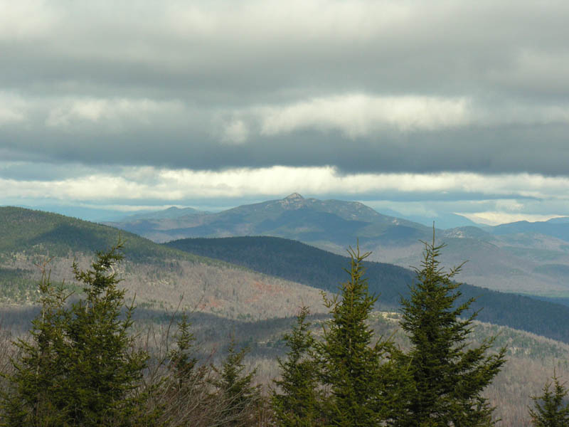
Mount Chocorua from Mount Shaw

Pics here:

http://ghostflowers.smugmug.com/gallery/6583865_5wFGK/1/419347980_trmEr#419357288_mkTNE

KDT
 
Wow, thanks to Kevin, I think you're off the hook, una_dogger (though that doesn't mean you'll be made fun of for enternity...I'm still waiting to see a trip report from the Osceolas, too :) ).

Great trip report, Kevin - nice to finally meet y'all!
 
Well, the GPS track is 8.69 miles long. When I threw it on a topo map it calculated 2560' of vertical gain, but of course that's only as accurate as the topo itself, not accounting for any ups and downs less than a contour. The GPS' profile, at the end of the hike, said 4163' of vertical, and it's usually very accurate. If I run the .gpx myself with absolutely no filtering for inaccuracy or any smoothing, it's over 6000', but that's not a valid way to calc it, anyway.

Regardless, this was an awesome hike and I'm very glad to have had the opportunity to be on it! New friends, old friends, dog friends, it was a lot of fun and a beautiful area to hike in. When do we go back for the other 6?
 
When do we go back for the other 6?

Two of the six (Larcom and Bayle) are rather short day trips, which may become much less accessible once the snow arrives (snowbanks, unbroken trail).

As for the other four, they could be done in a long, western traverse on snowshoes. I'm thinking about putting something together this winter for Roberts (perhaps the most scenic hike in the entire Lakes Region) and Faraway. Turtleback and Bald Knob could be added on, but that would be a very very long day on snowshoes, even considering that side of the Ossipees has easy grades and good footing (almost all carriage roads). So, perhaps Turtleback and Bald Knob might be done as an additional hike, or added on as a Route 171-southwestern traverse in the spring of Bald Knob/Turtleback/Shaw/Black Snoot/Big Ball.
 
The GPS' profile, at the end of the hike, said 4163' of vertical, and it's usually very accurate.

I suspect the bottom of the barrel jokes McRat was telling by the end of the hike (poor Rosie O'Donnell) may have caused your GPS to malfunction in an ill fated attempt to put itself out of its misery :)
 
I suspect the bottom of the barrel jokes McRat was telling by the end of the hike (poor Rosie O'Donnell) may have caused your GPS to malfunction in an ill fated attempt to put itself out of its misery :)


Hey! I resemble that! I still maintain that the really bad joke is just as fascinating in construction as a good one. I'm almost ashamed to admit, and some here could testify - we were FAR from the bottom of the barrel. :eek:

I had a blast hiking the Ossipees with all of you. There really is no such thing as small mountains, only a small sense of adventure.

Great seeing old friends and new. I'm looking forward to taking some more trips in the area down the line.
 
I'm enjoying all the reports and pictures trickling in and I'm glad the hike was enjoyable for all. Like the Belknap Range, I don't think I will ever tire of the Ossipees. After playing around there for several years now there is still so much more to see and enjoy.
 
rocket21 said:
As for the other four, they could be done in a long, western traverse on snowshoes.

Perhaps, but the Bald Knob Trail strikes me as possibly too steep in places for enjoyable snowshoeing (unless you were thinking of the Bald Knob Cutoff and Shannon Brook Trail, which would add much length).

rocket21 said:
I'm thinking about putting something together this winter for Roberts (perhaps the most scenic hike in the entire Lakes Region) and Faraway.

buckyball1 and I enjoyed this route a month or so ago.

rocket21 said:
So, perhaps Turtleback and Bald Knob might be done as an additional hike, or added on as a Route 171-southwestern traverse in the spring of Bald Knob/Turtleback/Shaw/Black Snoot/Big Ball.

Bald Knob/Turtleback is an enjoyable pairing, as I discovered in a solo hike this summer. I've been thinking about that longer traverse myself, mainly for purposes of red-lining some of the carriage-road trails between Turtleback and Shaw.
 
Perhaps, but the Bald Knob Trail strikes me as possibly too steep in places for enjoyable snowshoeing (unless you were thinking of the Bald Knob Cutoff and Shannon Brook Trail, which would add much length).
The top part of that trail is indeed rather steep, as well as the portion along the ledge next to the brook, but my concern would be more along the lines of parking at that trailhead - I don't recall if the snowbanks were pushed back there last year. Using Shannon Brook would likely be imperative, adding another mile or so to the hike.

Bald Knob/Turtleback is an enjoyable pairing, as I discovered in a solo hike this summer. I've been thinking about that longer traverse myself, mainly for purposes of red-lining some of the carriage-road trails between Turtleback and Shaw.
It could be a nice snowshoe, as much of the grades and falllines are good (other than the connector from Shannon Brook). It could also possibly be done as a cross country ski trip (avoiding the connector).
 
I wish I could have made it Sunday. I'll be hiking the area tomorrow instead. If anyone else missed out and cares to join me, drop me a line.
 
Bald Knob and Turtlehead make a fine ski trip from the bottling plant as long as one goes before the snow machines are out.
And one can carry skis up Mt. Roberts and ski out past Faraway and down Faraway/Cold Spring Trails with the right snow.
 
The Ossipees, from a Rookie’s Perspective

4:20am – I’m rather forcefully awakened by the angry beep of my alarm clock. Resisting the ever-appealing lure of the snooze button, I slowly amble out of bed and take note of the steady sound of raindrops falling outside my window. Usually repelled by bad weather, the thought of an intentional rainy day hike brings a smile to my face. Rocket and I had explored the Belknaps the day before (a nice little loop over Mt. Mack and Mt. Klem), and I thoroughly drenched my boots in the process. As I head downstairs to take a shower, I stop briefly by our woodstove to check on their condition. Still drenched. Excellent.

5:00am – The rain seems to intensify as I barrel down route 93 on my way to the trailhead. Being utterly hopeless with directions (the fact that my mind was addled by lack of sleep certainly didn’t help), I had decided to give myself a full additional hour of driving time. About 30 minutes into my journey I realize that I am very low on gas and make a brief stop to fill up/grab an extra large Red Bull in an attempt to wake up. 10 minutes later I’m on my way… music on full blast, amped up on caffeine, and silently cursing the rain for beating down so relentlessly.

7:30am – Amazingly, I was able to find McDuffee Road with relative ease (only two text messages to Rocket asking for directions… quite an accomplishment! :)). Parking my car on the side of the road, I’m greeted by the fantastic sight of – a bull moose! – grazing nonchalantly about 20 feet ahead of me. He doesn’t seemed fazed at all by our presence… that is, until Virga and Emma arrive, at which point he becomes quite nervous at the sight of the dogs, jogs off along the road, and (with surprising grace, I must say), jumps over a stone wall and takes off across an adjacent field. I find myself very excited, seeing as I’ve never gotten so close to a moose before in my entire life.

As time passes, more and more people begin to arrive. Being a rookie, many of the faces are unfamiliar to me, and my shyness starts to kick in a little. By the time 8:00 rolls around, our numbers have swelled to… 18? 19? 20? – a huge turnout for the hike. Four separate cars are needed to transport the group to the trailhead on Mountain Road! I place my backpack in the back of Rocket’s truck, and then hitch a ride with MichaelJ and his friend (please remind me of your name – I feel terrible!). As soon as we set off, it begins to downpour. Cold, hard, sheets of rain... I worry that my gear will be soaked!

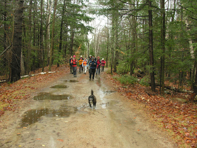
Sometime after 8:00am – We arrive at Mountain Road. By this time, the rain had subsided to little more than a drizzle, though I opt to put on my rain jacket anyway. After gathering for a quick group shot, we’re off! A thick coating of leaves blanket the trail, which is wide and starts to climb almost instantly. Soon, we pass a section of trail that had very recently been logged, making the footing very muddy. At this point, Trail Bandit directs us to the left, where the trail narrows and is marked by a very pretty blue and metallic badge/blaze. Within five minutes or so, it steepens up considerably, as we slowly make our way up Sentinal Mountain. The slippery wet rocks make the ascent a little tough, and I find myself grabbing onto all sorts of little trees and roots to stop myself from falling. After a minor scramble up a particularly slippery rock ledge, the views suddenly open up. Big bold clouds in every shade of grey imaginable stretch beautifully across the sky. Although the wind is strong and chills my rain-drenched clothes almost instantaneously, the cold seems negligible to me. Caught up in the splendor of the surrounding scenery, I can do little but stand in place with a huge grin plastered across my face. Soon, the “purist” in me snaps back to life… and I decide to take a quick side trip to the official high point, which is in a small treed-in area a little to my left. Our group then gathers once again for a summit photo, and in no time at all we’re off down the Mountain trail on our way to Mt. Flagg.

Sentinel Mountain to Mt. Flagg – Man, is the going tough! I’m not exactly the most coordinated of beings, and find myself slipping and sliding all over the wet leaves and rocks. W7xman, noticing my clumsiness, kindly offers to lend me one of his poles… but I am determined to preserve on my own. The trail conditions don’t seem to affect Rocket at all, however – He bounds ahead of all of us at an enviable speed, cutting back branches and moving blow downs as he makes his way along the trail. Soon, we encounter a particularly large one that requires the combined strength of Kevin and MichaelJ (hyped up on his espresso shot) to disassemble and remove. We stop briefly to gather at the Merrowvista ledges, another lovely ledgy outlook with fantastic views, but are soon on our way again once more. The blazing on the trail is very extensive, and would definitely make for a very pleasant headlamp hike (especially if one was to get lost in dark conditions). We pass a small cabin (a new future AMC hut, perhaps? ;-)), and soon start to spread out again as a group. Looking back, I smile as I see the long stretch of orange snaking its way along the trail. At least we know that we’ll more than stand out to any potential hunters in the woods. Upon reaching a second cabin/shelter, we stop again to take a break and regroup. Feeling cold and more than a little hungry, I put on my gloves and munch on a particularly yummy apple. The ledges of Mt. Flagg are visible through the trees. As we start to ascend our second peak, the terrain changes considerably. Leaf-coated ground gives way to (dry!) rocky trail. We soon hit a section that’s bizarrely flat, and resembles a sidewalk more than anything else. After a little more climbing (including a very cool rock scramble), we are soon on the ledges just below Mt. Flagg. Rocket and I have a little time to spare, so we drop our backpacks and make a quick trip to the summit. The views, once again, are just gorgeous. I hop up on one of the summit rocks to ensure that I’ve reached the very highest point. Looming ominously ahead of us stands Mt. Shaw, our highpoint of the day… just itching to be climbed.

Mt. Flagg to Mt. Shaw – After retrieving my backpack, I continue down the trail with Kevin, Judy, Silverfox, w7xman, Trail Bandit, and two of our adorable canine companions (Emma and Virga). The footing is a little tough as we descend briefly between the peaks, but becomes a lot smoother as we begin to climb through magnificent birch glades. The wind picks up considerably at this point, and I soon find it necessary to put on another layer. The ascent is moderate yet steady, and within no time at all we’re on the summit of Mt. Shaw. Once again, we were greeted by incredible views – Unfortunately, I’m not yet very knowledgeable when it comes to determining the location of nearby mountains, but knew for certain that Chocorua was visible in the distance. Chilled again by the wind, I crouch down on a little log bench and pull on my lovely warm fleece hat. We linger on the summit for quite a while, eating our lunch and taking in the scenery around us. I feel like such an idiot for having forgotten to bring my camera on such a perfect day.

Continued in Next Thread...
 
The Ossipees - From a Rookie's Perspective (Part II)

Mt. Shaw to Black Snoot –The trail from Mt. Shaw to Black Snoot (Snout, Stout…) is wide and grassy, which makes for a quick and pleasant trip between the peaks. The wind, however, continues to blow down on us relentlessly, and I have a tough time getting warm again. On the summit of Black Snoot, Rocket and McRat exchange “That’s what she said” jokes as I bounce around trying to shake off the cold. I know we’re close to home because I can see our cars in the distance. Trail Bandit soon urges us to head back down. As Una Dogger, Jazzbo, MichaelJ, and the lovely Terra pass us as we reach the trail junction. We decide to wait for the entire group to gather before making our way down the trail. It’s extremely windy at this point. I lend Amicus my extra pair of gloves so that he can warm his hands.

Black Snoot to the Trailhead – The footing once again is tough. I find it necessary to crouch down and partially butt-slide to fend off a potentially embarrassing fall! Soon we pass an old, decaying hunting stand. Rocket and Trail Bandit dare one another to climb it… but luckily they both see reason and choose not to do so :). After a brief climb, we’re soon on the summit of Big Ball Mountain. The ledges are criss-crossed with interesting lines, and oddly resemble the shell of a turtle. With extreme care, I gradually make my way across the rocks, trying to step on mossy patches when I can (once again the ledges are very slippery). Feeling a little brave, I attempt to jump down from one particularly high rock onto the ground… and promptly fall on my butt. The view back towards Black Snoot is very impressive – The mountain appears far higher than a 2,000 footer. Upon stopping to take a short break and regroup, the wind is so powerfully strong that I’m literally blown back and forth at its mercy (okay… perhaps I’m exaggerating just a little, but it was very forceful ;))… and then, to the sheer Joy of MichaelJ, it suddenly begins to snow (little tiny dots that almost resemble hail). Rocket snaps a picture, but in a few minutes the precipitation ceases.

As we re-enter the woods, the trail takes on its most treacherous form of the day (though luckily not of the butt-sliding persuasion). I veer to the left of the trail and grasp branches to help ease my descent. Many people slip and slide – McRat had a few particularly memorable falls, as did MichaelJ (but he did not technically “fall” because his butt did not hit the ground ;)). Fortunately, we all make it down unscathed, and soon hit a nice stretch of smooth road. The end of the hike is near. Tired, yet wholeheartedly content, I make my way down the road and back to my car… no longer quite as shy, and happy to have participated in such a fantastic VFTT adventure.
 
Last edited:
Top