Tecumseh view clearing

vftt.org

Help Support vftt.org:

This site may earn a commission from merchant affiliate links, including eBay, Amazon, and others.
More cutting on Tecumseh than just view area, new bootleg trail to new view

I don't know if someone touched on this in this thread, but I just wanted to observe that about a month ago I noticed an obvious bootleg path off of the western section of the Tecumseh summit loop. The path was recently cut and led about .2 miles south to a new viewpoint, also recently cut, that provides a view south over the ridge to the ski area and obviously all the peaks that way. How new is this? Anyone else notice it?
 
I don't know if someone touched on this in this thread, but I just wanted to observe that about a month ago I noticed an obvious bootleg path off of the western section of the Tecumseh summit loop. The path was recently cut and led about .2 miles south to a new viewpoint, also recently cut, that provides a view south over the ridge to the ski area and obviously all the peaks that way. How new is this? Anyone else notice it?

Haven't been there since Nov '13, so I can't add observations, only a question. If the loop's split, downhill of the summit, is at 12 o'clock and the southwestward section of the Mount Tecumseh Trail leading off the summit toward Tripoli Road is at about 4 o'clock, where is this new side trail?
 
Last edited:
Haven't been there since Nov '13, so I can't add observations, only a question. If the loop's split, downhill of the summit, is at 12 o'clock and the southwestward section of the Mount Tecumseh Trail leading off the summit toward Tripoli Road is at about 4 o'clock, where is this new side trail?

It is at 6 O'Clock on the southern tip of the summit shown in the GPS track image below:

attachment.php


I don't know if someone touched on this in this thread, but I just wanted to observe that about a month ago I noticed an obvious bootleg path off of the western section of the Tecumseh summit loop. The path was recently cut and led about .2 miles south to a new viewpoint, also recently cut, that provides a view south over the ridge to the ski area and obviously all the peaks that way. How new is this? Anyone else notice it?

Yes!

11248072_985301404826442_147879140349226669_o.jpg

August 29, 2015

Tim
 

Attachments

  • 2015-09-23_16-58-26.jpg
    2015-09-23_16-58-26.jpg
    62.1 KB
Last edited:
Not sure if this is the trail you're talking about. Saw this on the Gale River Trail in mid Sept. of last year. And I'm pretty sure it was'n there in early August. A good 30' swath of spruce laid out in a pile for not much of view even on a clear day I'd imagine. Pretty ugly and unnecessary. I've no idea if this was, or was not authorized. But in my eyes, it's damned ugly.

Was this on Gale River Trail or on the GRT a short distance heading toward Galehead Hut? I went to Galehead Hut about 6 weeks ago and specifically noted a clearing on the GRT I did not recall and the first thing I thought of was if this was an unauthorized view clearing. It appeared to have no other purpose at all. That's what got me thinking if they don't enforce clearing issues these little spots are going to start popping up everywhere.

I wish I could think of what trail meant. I remember reading a thread about how someone (I want to say a mountain club or similar group) had made some controversial -but I believe approved- view clearings and then when I did the trail noting how large and ugly they were (stumps, downed trees left, etc). I only did the trail once. The area of the clearings was in a big switchback and the trail was pretty gravel packed. It was maybe two summers ago. The "controversy" was new to me because I had just started following this forum but it could well have been older than that. I can't for the life of me recall the trail.

I thought it was below the junction but can't be positive. At any rate, it's an ugly mess.
 
I don't know if someone touched on this in this thread, but I just wanted to observe that about a month ago I noticed an obvious bootleg path off of the western section of the Tecumseh summit loop. The path was recently cut and led about .2 miles south to a new viewpoint, also recently cut, that provides a view south over the ridge to the ski area and obviously all the peaks that way. How new is this? Anyone else notice it?
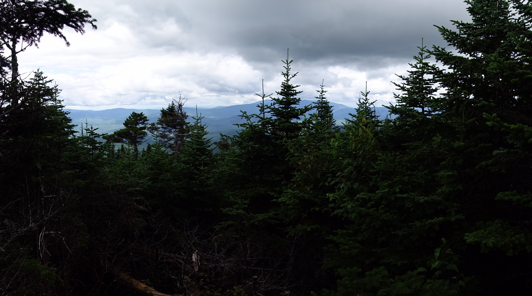
The herd path is probably closer to 100 yards long (a full branch of the summit loop is 0.2 miles). The actual view I believe has been visited for years (have heard stories from multiple folks about accidentally finding it while doing their winter 48 in the old days). The first part of the herd path has been there for a very long time, as it leads to a bootleg camp site. The second part of the herd path was hacked (stumps sticking up; sound familiar?) circa September 2013 if I recall correctly...around the same time, I was the Tecumseh organizer for Flags on the 48 and was caught off guard when the old tree we were planning to anchor the pole to disappeared just before the event. Fortunately we brought enough straps to improvise a new solution.
 
It is at 6 O'Clock on the southern tip of the summit shown in the GPS track image below

...

Tim

Thanks, Tim.

I want to understand clearly, if possible. Does your track depict you walking this herd path? So as you ascend to the summit from the south, by the left/west branch of the loop, the hp goes right, southward, from right near the summit? So it departs from the official trail on the summit knob at something like 3990', a bit south of the summit proper?

You understand it clearly. I found it by accident because while coming down, my dog chose to go straight instead of right (right being the steep part of the trail.) I then went across the Sossman to the tower and part way down the ski trails (Tangent / Periphery) before rejoining the Mt. Tecumseh Trail where it is closest to the ski trail.

View attachment Tecumseh .zip

Tim
 
Last edited:
Yes, the length of this spur might be more accurately described as about .1 or a little less, my memory was faulty. But it would be accurate to say you have to keep going down it a little ways, the view isn't immediate.

Tim... Your post shows it perfectly. I won't say anything about the Yankees or Red Sox though.
 
I also noticed that path just behind Tecumseh’s summit, but I didn’t investigate it far enough to discover that it led to a view. Next time.

There is also a well-beaten or possibly cleared path way out on the western end of Mt. Tecumseh Trail, beyond West Tecumseh, on another minor summit. There wasn’t much of a view from it, though.

21670956482_29e03fd9cd_k.jpg
 
You understand it clearly. I found it by accident because while coming down, my dog chose to go straight instead of right (right being the steep part of the trail.) I then went across the Sossman to the tower and part way down the ski trails (Tangent / Periphery) before rejoining the Mt. Tecumseh Trail where it is closest to the ski trail.

...

Tim

Thanks again. Seems like the industrious view-improver has kept at it. Wonder if it's the same person, going around the Whites, doing this in selected places - Waumbek and Starr King, Gale River Trail, Tecumseh, etc.

Come to think of it, I think I saw that side trail on my climb. Being very goal-directed, I just reckoned it not to be the path to the top and discarded it mentally. Had I known, I'd've checked it out. I do that more nowadays when arriving at summits, looking for side views, esp on viewless or limited view summits.

The thing about this spur path is that similar views can be had from the ski slopes, so this effort is arguably superfluous.
 
Last edited:
Waumbek is a natural clearing caused by an ever increasing blowdown patch. The view is actually just past the summit on the KRT.

I speculate that Starr Kings view was reestablished by the maintaining club.

The FS is going to be clearing a helispot on Cabot near the cabin. It potentially will open up some views as the former firetower clearing is rapidly growing in. It was limited to east/west views

The Mt Speck view was cleared by the one of the state of maine agencies when they renovated the tower. For several years the tower was closed and the summit was surrounded by a ring of tall firs and spruces making it a disappointing trip.

East Osceola, North Tripyramid and one of the Carters just will take more folks tromping down on the topsoil at the highpoint compacting it and slowly choking off the roots of the trees for a few more years. Add in a godo wind event and they will open up.
 
Waumbek is a natural clearing caused by an ever increasing blowdown patch. The view is actually just past the summit on the KRT.

Hiked it couple months ago. Loved that viewspot. Spoke with Steve Smith about it after and he noted its expansion and expressed the sense that the natural forces at work may have been aided by lobber and saw. I thought the Waumbek view much superior to those presently afforded by Starr King. I did happily get an ok through-the-trees view of Cabot and Terrace from the large rock just across the trail from SK's summit.

Off topic: I could raise this in a different thread, if preferred. On visiting Starr King and Waumbek, I noted, from Google Earth and on-the-ground observations, that maybe 0.1 to 0.2 east of Starr King's chimney, it looked like a side trip of 100 feet or so south from the SKT would get one to a sharp drop-off which looked to yield a nice view. Anyone ever check this possible view out? I didn't, being solo and doing my best at the time to do the regulation trip. Turned out to be a late night as it was.
 
Last edited:
Saw this on the Gale River Trail in mid Sept. of last year. And I'm pretty sure it was'n there in early August. A good 30' swath of spruce laid out in a pile for not much of view even on a clear day I'd imagine. Pretty ugly and unnecessary. I've no idea if this was, or was not authorized. But in my eyes, it's damned ugly.


I thought it was below the junction but can't be positive. At any rate, it's an ugly mess.

I was up there this weekend (Galehead/Garfield), and immediately noticed this new "viewpoint", not remembering it having been there before either (my last visit to that area was in February 2014). It is on the Garfield Ridge Trail about halfway between the Gale River Trail junction and the Hut, and is indeed rather abrupt and while it offered an interesting directional view, was not necessary. Quite a lot of felled trees for seemingly no real purpose?
 
Not sure if this is the trail you're talking about. Saw this on the Gale River Trail in mid Sept. of last year. And I'm pretty sure it was'n there in early August. A good 30' swath of spruce laid out in a pile for not much of view even on a clear day I'd imagine. Pretty ugly and unnecessary. I've no idea if this was, or was not authorized. But in my eyes, it's damned ugly.

Apparently the trail I was thinking of was the Gorge Brook Trail on Moosilauke. I had a Facebook memory pop up today for a Moosilauke hiking album so I scrolled through it and there it was! There were two large clearings on the "elbow" of the trail that juts out to the East at about 3500-3600'. I thought I had read that some people were not happy about the clearings. They are fairly large and unnatural looking. Only time I ever did this trail so I have no idea if there were smaller, natural clearings before that were expanded or if this was 100% new work.
 
Those views on Gorge Brook were creating during the trail building process. There were slight natural views there, and they were expanded when the trail was cut. There are several artificial views cut on Moosilauke, but all on private land and by the landowners.
 
Those views on Gorge Brook were creating during the trail building process. There were slight natural views there, and they were expanded when the trail was cut. There are several artificial views cut on Moosilauke, but all on private land and by the landowners.

Thanks. When I was there it had been "freshly" cut with a lot of the trees and stumps still visible. Prior to my hike I had read something about how people were not pleased with the work and as I went up the trail I was wondering about these clearings and then was like "Ahh. These must be the clearings." Maybe I misunderstood what I read about clearings as being on trail when it was directed at some off trail activity. They were ugly outlooks, especially considering not too much farther up you emerge from the scrub with plenty of views.

It is not the best picture but here is the clearing:
Clearing On Moose.jpg
 
Top