The Feathered Hat
Active member
Trails: Tuckerbrook, Hardwood Heaven, Coppermine
Miles: ~6

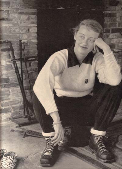
The story is well known. In 1939 the great film star Bette Davis, who enjoyed spending time in Sugar Hill, N.H., when she wasn't making movies, was out hiking by herself and managed to get lost on the way to Bridal Veil Falls. An employee of Peckett's, one of the local Sugar Hill inns, named Arthur Farnsworth found her and took her back to the trailhead. Thus began a romance -- not the first love story that's begun this way, I'm sure. On New Year's Eve 1940 Farnsworth and Davis were married, but in the summer of 1943 he died unexpectedly two weeks following a fall that had cracked his skull. Rumors speculated that Davis had pushed her husband down a flight of stairs in a drunken rage, but nothing was ever proven and the death was ruled accidental.
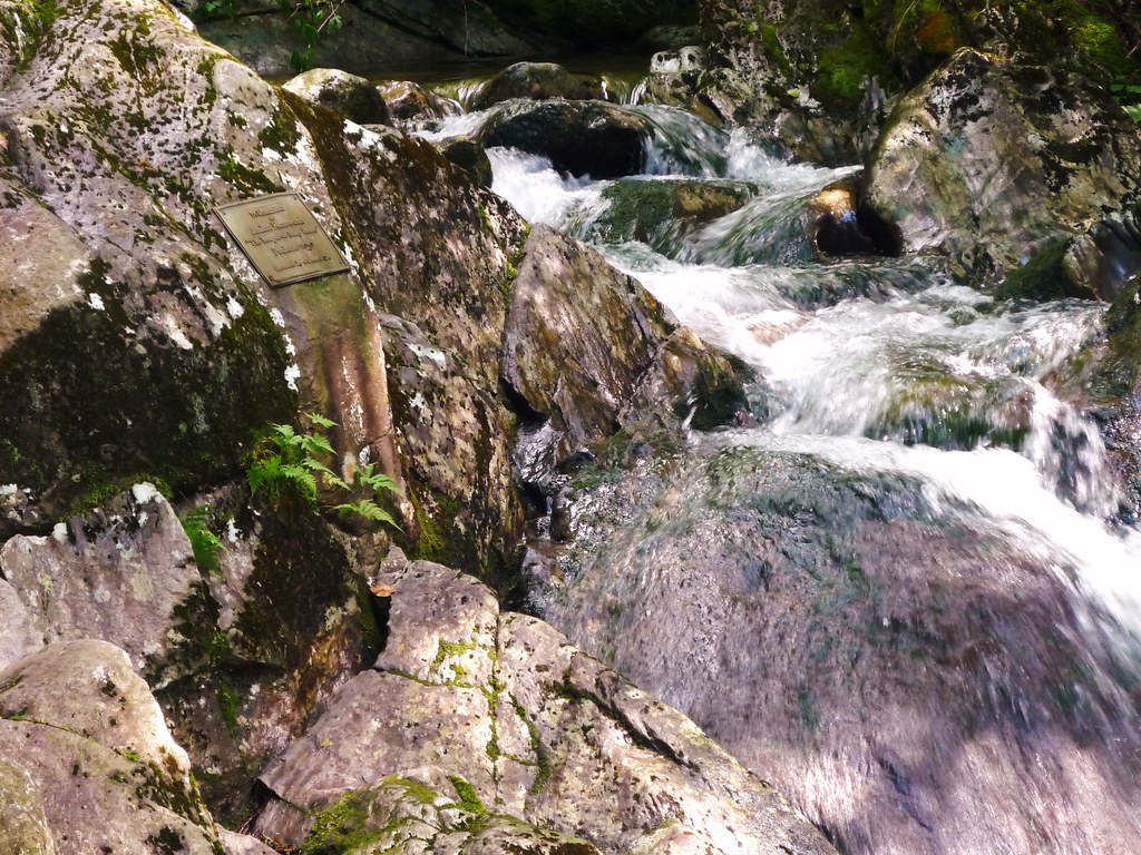
After Farnsworth's burial, Davis had a plaque mounted on a boulder beside Coppermine Brook, near the spot where Farnsworth had found her, and the plaque remains there to this day. Its location isn't really a secret, but many people who hike the popular Coppermine Trail to Bridal Veil Falls miss it because the plaque isn't beside the trail (and it isn't visible at all in winter due to snow cover). Finding the plaque is a treat, though, and worth the short, easy off-trail wander.
Tuckerman and I decided to hike up to Bridal Veil Falls after work on Friday, taking a bit different route than usual. We began not at Coppermine Road but up on Tuckerbrook Road, which spurs off of Wells Road, which itself branches off of State Route 116 a quarter mile south of the Franconia Inn. We followed the lower portion of the Tuckerbrook Trail -- in winter this is one of the old Mittersill ski trails, perhaps a trail that Bette Davis had once skied (at the bottom is one of my favorite trail signs in all of the Whites: "Caution! Alpine Downhill Skiers!" -- even though the nearest ski area is miles away). There's a small parking area at the top of Tuckerbrook Road, just past an old log home. Directly ahead is the Old Mittersill Road Trail, marked by a sign; the Tuckerbrook Trail is 90 degrees to the right, with no sign.
In short order the route passes the "Swiss Border" shortcut, branching right, that's part of the Franconia XC Ski Association network of trails; in four-tenths of a mile from the trailhead the "Von Ryan's Express" XC ski trail also branches right. From here, just up a short, steep pitch, the Hardwood Heaven Trail goes right. (The Tuckerbrook Trail continues to the top of Mittersill, and from there it's an easy walk to the top of Cannon Mountain. This is a fantastic alternative route to Cannon's peak, though somewhat longer than taking Kinsman Ridge Trail from the bottom of the tram.)
Hardwood Heaven indeed: this mile-long trail passes through a beautiful broadleaf woods before dropping down to meet the Coppermine Trail. There's some mud in the flat spots, and since this trail is under-used you'll be picking your own way around the bogs. But overall, this stretch offers gorgeous hiking.
To find the Davis plaque, once you reach the junction with the Coppermine Trail continue straight toward Coppermine Brook. With just a little exploring you'll find it:
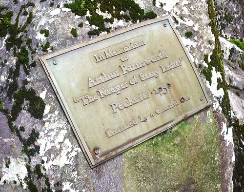
It's intriguing that Miss Davis, one of Hollywood's great divas, did not have her name inscribed on the plaque, referring to herself only obliquely as "a Grateful One" among the "Stray Ladies" that Farnsworth seemed to have a knack for finding. The plaque's wording presents a touching bit of romantic humility from a woman who, in her career, bucked even the most powerful studio executives and who could be, by all accounts, a terror on a film set. Yet in this wedding photograph, she and her Arthur glow with love:

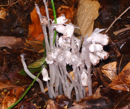
Taking the Tuckerbrook/Hardwood Heaven alternative cuts off a mile of the crowded Coppermine Trail (though adds about a half-mile). Five minutes' hiking up the Coppermine Trail brings you to where the trail first nudges Coppermine Brook, the traditional half-way spot on the hike up to Bridal Veil Falls. Tuck and I found a nice stand of Indian Pipe near the brook:
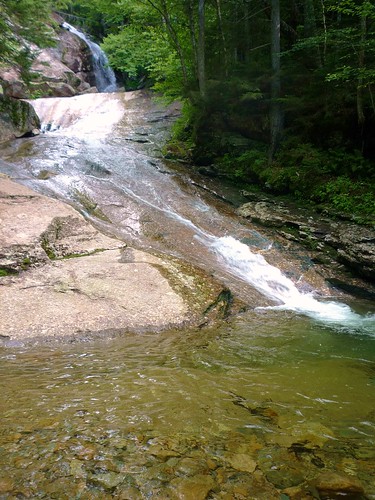
The trail was wet but surprisingly not very muddy. Fairly quickly, we reached the falls, which look like this from just above the Coppermine shelter:
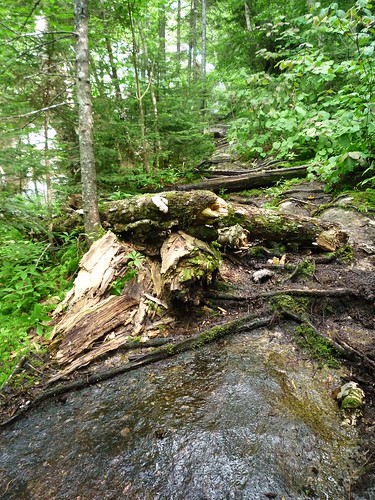
There are two ways to climb up to the upper falls, a tricky climb up and over several big, mossy boulders to the left and a muddy, very slippery herd path to the right. We opted for the latter, which I thought would be easier for the dog. It was -- but the open rock faces are quite slick and require focus and attention to negotiate successfully:
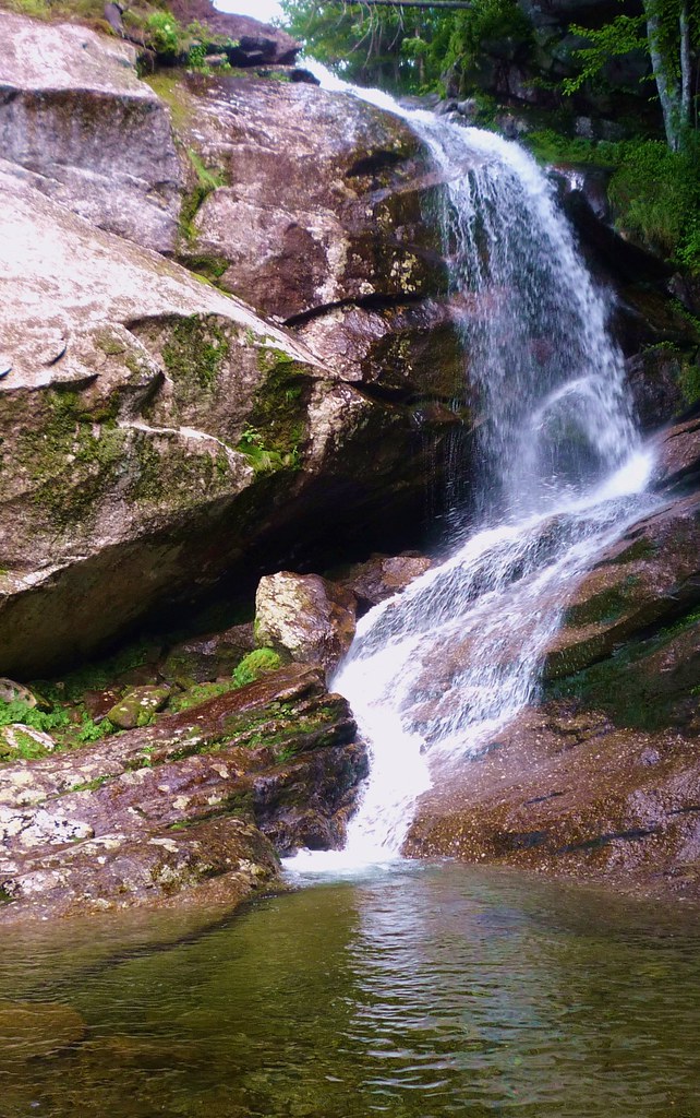
But once you reach the top, the falls are beautiful and really flowing right now from all the summer rain:
After snacking a bit and taking a few more photos, Tuck and I headed back the way we came. On our way to the falls we had met no one, but on the way down we ran into the expected crowds, though as soon as we got back on the Hardwood Heaven stretch we were hiking by ourselves again. The trip, which is about 6 miles going this way (it's about 5.5 miles following only the Coppermine Trail from the parking area at the bottom of Coppermine Road), took us three hours; we were doing some leash training on the trail that slowed us down a bit.
This is a pretty great, pretty easy hike for stretching your legs and touching a bit of cool local history.
A few more photos:
http://www.flickr.com/photos/99682097@N00/sets/72157621978935316/
Steve B
The Feathered Hat
[email protected]
________________________________
Tuckerman's report for dogs:
Lots of water. Good mud. A couple of frogs. People. Dogs.
Slippery rocks!
Who's Bette Davis? A breeder?
*** Three sniffs (out of four). T-Dog says check it out.
Miles: ~6

The story is well known. In 1939 the great film star Bette Davis, who enjoyed spending time in Sugar Hill, N.H., when she wasn't making movies, was out hiking by herself and managed to get lost on the way to Bridal Veil Falls. An employee of Peckett's, one of the local Sugar Hill inns, named Arthur Farnsworth found her and took her back to the trailhead. Thus began a romance -- not the first love story that's begun this way, I'm sure. On New Year's Eve 1940 Farnsworth and Davis were married, but in the summer of 1943 he died unexpectedly two weeks following a fall that had cracked his skull. Rumors speculated that Davis had pushed her husband down a flight of stairs in a drunken rage, but nothing was ever proven and the death was ruled accidental.
After Farnsworth's burial, Davis had a plaque mounted on a boulder beside Coppermine Brook, near the spot where Farnsworth had found her, and the plaque remains there to this day. Its location isn't really a secret, but many people who hike the popular Coppermine Trail to Bridal Veil Falls miss it because the plaque isn't beside the trail (and it isn't visible at all in winter due to snow cover). Finding the plaque is a treat, though, and worth the short, easy off-trail wander.
Tuckerman and I decided to hike up to Bridal Veil Falls after work on Friday, taking a bit different route than usual. We began not at Coppermine Road but up on Tuckerbrook Road, which spurs off of Wells Road, which itself branches off of State Route 116 a quarter mile south of the Franconia Inn. We followed the lower portion of the Tuckerbrook Trail -- in winter this is one of the old Mittersill ski trails, perhaps a trail that Bette Davis had once skied (at the bottom is one of my favorite trail signs in all of the Whites: "Caution! Alpine Downhill Skiers!" -- even though the nearest ski area is miles away). There's a small parking area at the top of Tuckerbrook Road, just past an old log home. Directly ahead is the Old Mittersill Road Trail, marked by a sign; the Tuckerbrook Trail is 90 degrees to the right, with no sign.
In short order the route passes the "Swiss Border" shortcut, branching right, that's part of the Franconia XC Ski Association network of trails; in four-tenths of a mile from the trailhead the "Von Ryan's Express" XC ski trail also branches right. From here, just up a short, steep pitch, the Hardwood Heaven Trail goes right. (The Tuckerbrook Trail continues to the top of Mittersill, and from there it's an easy walk to the top of Cannon Mountain. This is a fantastic alternative route to Cannon's peak, though somewhat longer than taking Kinsman Ridge Trail from the bottom of the tram.)
Hardwood Heaven indeed: this mile-long trail passes through a beautiful broadleaf woods before dropping down to meet the Coppermine Trail. There's some mud in the flat spots, and since this trail is under-used you'll be picking your own way around the bogs. But overall, this stretch offers gorgeous hiking.
To find the Davis plaque, once you reach the junction with the Coppermine Trail continue straight toward Coppermine Brook. With just a little exploring you'll find it:


It's intriguing that Miss Davis, one of Hollywood's great divas, did not have her name inscribed on the plaque, referring to herself only obliquely as "a Grateful One" among the "Stray Ladies" that Farnsworth seemed to have a knack for finding. The plaque's wording presents a touching bit of romantic humility from a woman who, in her career, bucked even the most powerful studio executives and who could be, by all accounts, a terror on a film set. Yet in this wedding photograph, she and her Arthur glow with love:

Taking the Tuckerbrook/Hardwood Heaven alternative cuts off a mile of the crowded Coppermine Trail (though adds about a half-mile). Five minutes' hiking up the Coppermine Trail brings you to where the trail first nudges Coppermine Brook, the traditional half-way spot on the hike up to Bridal Veil Falls. Tuck and I found a nice stand of Indian Pipe near the brook:

The trail was wet but surprisingly not very muddy. Fairly quickly, we reached the falls, which look like this from just above the Coppermine shelter:

There are two ways to climb up to the upper falls, a tricky climb up and over several big, mossy boulders to the left and a muddy, very slippery herd path to the right. We opted for the latter, which I thought would be easier for the dog. It was -- but the open rock faces are quite slick and require focus and attention to negotiate successfully:

But once you reach the top, the falls are beautiful and really flowing right now from all the summer rain:

After snacking a bit and taking a few more photos, Tuck and I headed back the way we came. On our way to the falls we had met no one, but on the way down we ran into the expected crowds, though as soon as we got back on the Hardwood Heaven stretch we were hiking by ourselves again. The trip, which is about 6 miles going this way (it's about 5.5 miles following only the Coppermine Trail from the parking area at the bottom of Coppermine Road), took us three hours; we were doing some leash training on the trail that slowed us down a bit.
This is a pretty great, pretty easy hike for stretching your legs and touching a bit of cool local history.
A few more photos:
http://www.flickr.com/photos/99682097@N00/sets/72157621978935316/
Steve B
The Feathered Hat
[email protected]
________________________________
Tuckerman's report for dogs:
Lots of water. Good mud. A couple of frogs. People. Dogs.
Slippery rocks!
Who's Bette Davis? A breeder?
*** Three sniffs (out of four). T-Dog says check it out.
Last edited:

