The Captain (NH)

vftt.org

Help Support vftt.org:

This site may earn a commission from merchant affiliate links, including eBay, Amazon, and others.

SpencerVT

Member
Joined
May 26, 2015
Messages
412
Reaction score
20
Location
Brattleboro, Vermont
The Captain looks like an awesome peak and if weather permits, I would like to tackle it on Sunday.
From the very end of the Forest Access road, (The Sawyer river approach) at least on the map I have, it appears to be only a little over a mile of bushwhacking to the summit of The Captain. However, previous reports I have read on here state that it is a very thick bushwhack and just the bushwhack part is like 2.5 hours one way to reach the summit. Is that really the case?? - 2.5 hours of bushwhacking to cover about 1.2 miles to reach the summit??? Any other info would be much appreciated! I have to make sure and leave early enough because the days are so short now. I've heard its about 10 hours round trip.
 
It has been years but when I did it, the woods were very tight. We tried to slab up the elevation to the east to end up at the low point on the ridge to the east and regretted it, dense spruce/fir and a lot of steep rocky cliffs to deal with. Heading down we skirted the cliffs immediately to the east and then ended up walking down the stream bed as the woods were too thick. Definitely not recommended to walk in the stream in November. Its been 15 years so optimistically the woods are more mature and easier to travel. Sawyer River road was washed out that year so we had to add in the walk from the kanc via the Sawyer River trail so it took around 11 hours round trip. You can drive to the end of the road thes days so you cut out a lot of miles.
 
Thanks!
Sounds brutal. From the Sawyer approach it sounds like the only option though is to approach it from the low point to the east (between Captain and Carrigain) because the west side cliff. That's a lot of extra miles you had to do going all the way from Kancamagus, maybe its doable in 9 hours with that cut out - especially since that's about all the daylight hours we have right now.
 
My research shows it's about a 10 mile round trip. Most of the hiking will be on Livermore Rd (FR 86 and FR86A) to between 2300 and 2500 ft elevation then approximately a 1 mile BW. Looks like the best route would be to set a bearing for Carrigan Pond until you hit the ridge. Recent beta shows thick but not heavy stuff. Due to the steepness and density I would assume 2 hours for the whack.

Edit: there is a gate at the entrance to Sawyer River rd. A of 11/21 it was currently open.
 
Last edited:
My USGS map which has a FS overlay that appears to be within five year or so shows a gate just after the Sawyer Pond Trail.
 
Follow Sawyer River past Carrigain parking area until you hit a gate and park there (gate is closed and there's a kiosk) You have some small logging roads to walk first on the right, straight and then past a campsite in a gravel area then start the whack. A couple of areas have minor brush to get through so we started using the stream area. Stay right on the incline (don't go left and around to the summit, head right). A lot of rock climbers have helped with the path so it's fairly defined at the start before peeling off. There may still be a treat at the summit. Careful on descent, don't go right as you'll hit some ledges (same thing on ascent, don't go left)
 
Follow Sawyer River past Carrigain parking area until you hit a gate and park there (gate is closed and there's a kiosk) You have some small logging roads to walk first on the right, straight and then past a campsite in a gravel area then start the whack. A couple of areas have minor brush to get through so we started using the stream area. Stay right on the incline (don't go left and around to the summit, head right). A lot of rock climbers have helped with the path so it's fairly defined at the start before peeling off. There may still be a treat at the summit. Careful on descent, don't go right as you'll hit some ledges (same thing on ascent, don't go left)

Thanks! How long did it take you? Approx. how far past Carrigain parking area is it til you hit the gate?
 
I think it was only a mile to two up the SRR. We took our time but think it was 7 hours or so. The woods aren't to bad, hit some steeps that slowed us so we needed to go more right. Supposedly there is an old tent site that's a marker but we never found it. You'll find the road walk and through the gravel pit area easy and even the first part in the woods is smooth going.
 
I've done it several times, but my data is old. I would recommend going up from the east (the Carrigan side) not from the west (the Hancock side.) Meaning climb towards the col between Carrigan and the Captain, then head west towards the peak.

The time I climbed it from the Hancock side, it was easy to get to the col via the rock slab river bed. But the climb up to the peak from the col was really tough steep krumholtz. I remember slipping and arresting by the string of my compass around my neck. I was not sure if I was glad it did not break. It was not a good way.

From the east, I found it easier. Follow along closer to the top of the cliff vs. the top of the ridge. (Meaning stay to the left on the ascent). Eventually you need to head to the summit and this was when it got thick with blowdown. There were multiple canisters when I was up there so you need to ask yourself if you are bagging peaks or canisters. Some people just assume the canister is on the top (and stop there), others actually go to the top.
 
Made it to the summit of the Captain yesterday (Sunday) via the Sawyer River approach. I was able to make very good time - it only took me 5 hrs, 10 mins round trip. I was able to follow at least some form of herd trail or dry stream bed up to an elevation of over 2500'. The bushwhack from there wasn't too bad - steep at times, but only a couple super thick sections. It was bitterly cold, but a beautiful day. I went to the giant rock on the top which seemed like it could have been higher than the canister, but it was tough to tell given how thick it was. Even saw a moose! Thanks to everyone for the tips - it was a very fun and successful hike, a great mountain!

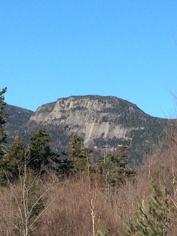
Zoomed in view of the Captain on the approach:
22795673754_aff72fc10d_c.jpg


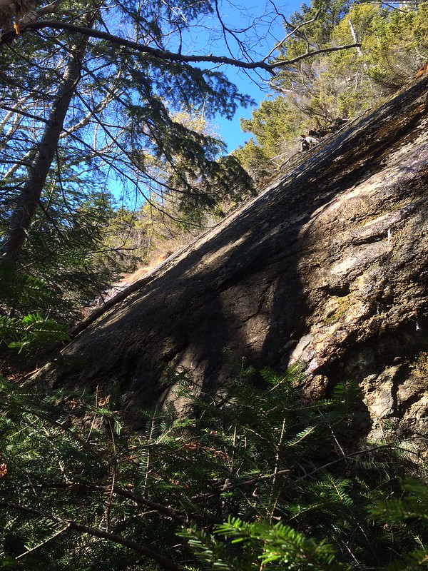
Some cliffs/ledges that I had to skirt around on the way to the col. between Carrigain and Captain:
23397848596_8bb5f013d0_c.jpg


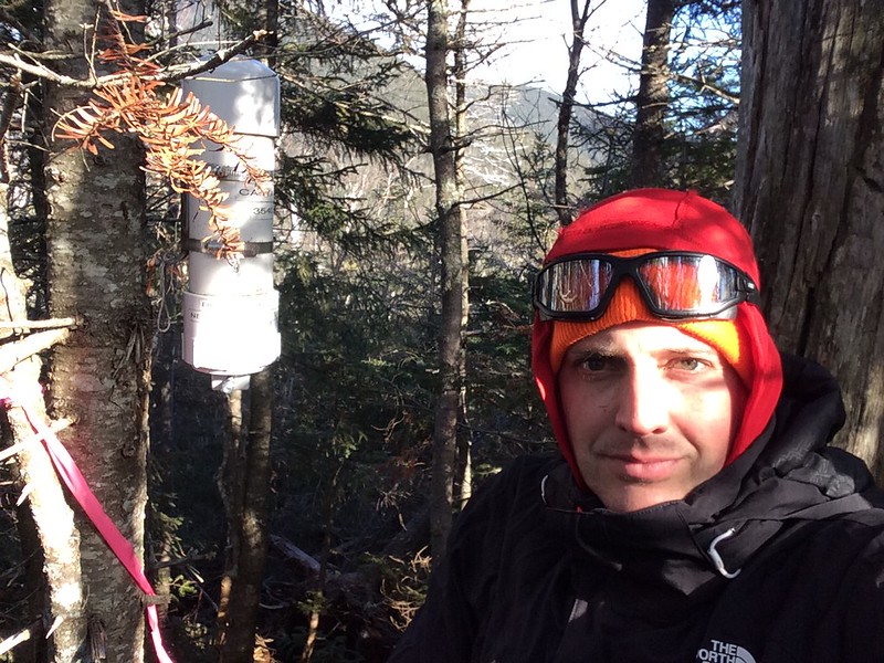
At summit canister with Carrigain in the background. Cold!
23315560782_4ac8b19f3d_c.jpg


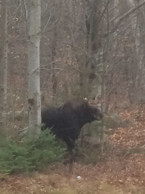
Saw a moose on way out, kept a good distance away but nonetheless still got a good photo:
23424022955_9fa42711c6_c.jpg
 
Congratulations! That's a very long and brushy day. That moose would have spooked me. It was a bull moose!! I see SO MANY moose signs in that neck of the woods. I love that area, but it terrifies me :)

Great job!!
 
Top