1HappyHiker
Well-known member
There were intermittent snow showers and a very overcast sky that showed no signs of significant improvement any time soon. I waited around the house for awhile, hoping for some rapid improvement. By mid morning, the weather conditions were much the same. I concluded that it simply wouldn't be worth it to me to drive far from home, nor to hike to some peak where I probably would see little or nothing!
So, I eventually decided to head for the Pondicherry Wildlife Refuge for a simple low-altitude hike. However, en route I remembered a little hike that my friends Joanne & Kevin had recently reminded me about. They recently took a stroll on the Flat Iron XC Ski Trail which begins just a short distance up Zealand Road from Route 302. I had done this mini trek about 2 years ago, but had completely forgotten about it until they reminded me. Since it would not be that far out of my way, I decided to make a quick side trip to the Zealand Road winter parking lot, and then hoof it up the road to do that short hike.
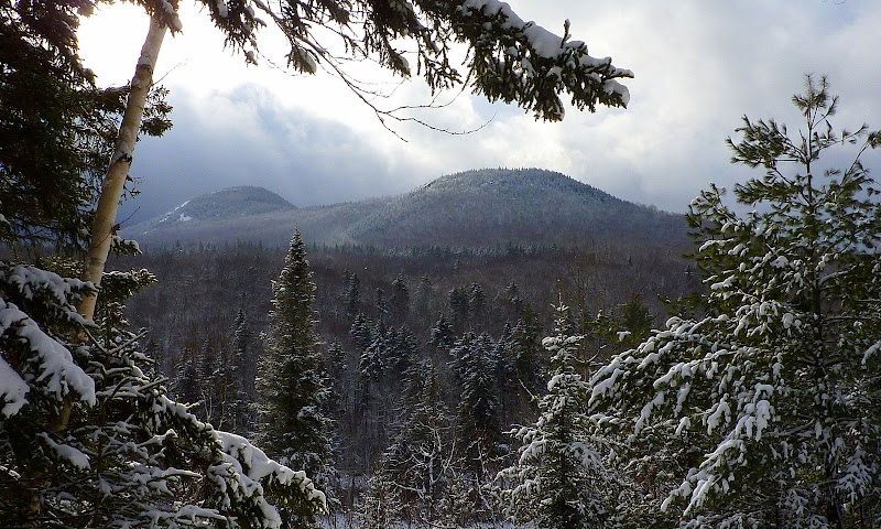
Even though there were no grooved ski tracks, I still wore snowshoes so as not to posthole this XC Trail. There are some nice riverside views along this trail, but I think the best feature is the outlook which provides a slightly different viewing angle on North & South Sugarloaf.
North & South Sugarloaf (from Flat Iron XC Ski Trail)
After this short foray on the XC Trail, I headed back to the parking lot. I had started the car, and was ready to pull out and head for Pondicherry, but then I happened to think that the Lower Ammonoosuc Falls was just a short trek from the other end of the parking lot. So, I stopped the engine and headed for the Falls. Within minutes I could see the Falls in the distance and could tell that the water was really churning after its long journey from high up at Lakes of the Clouds.
Lower Ammonoosuc Falls (from a distance)
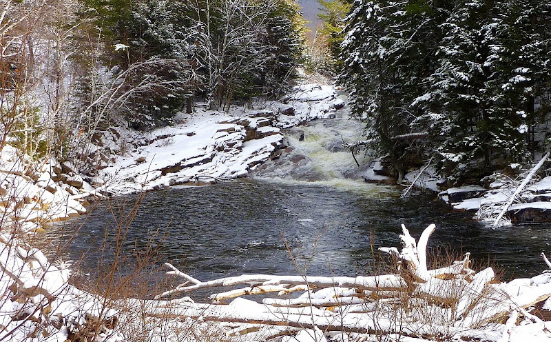
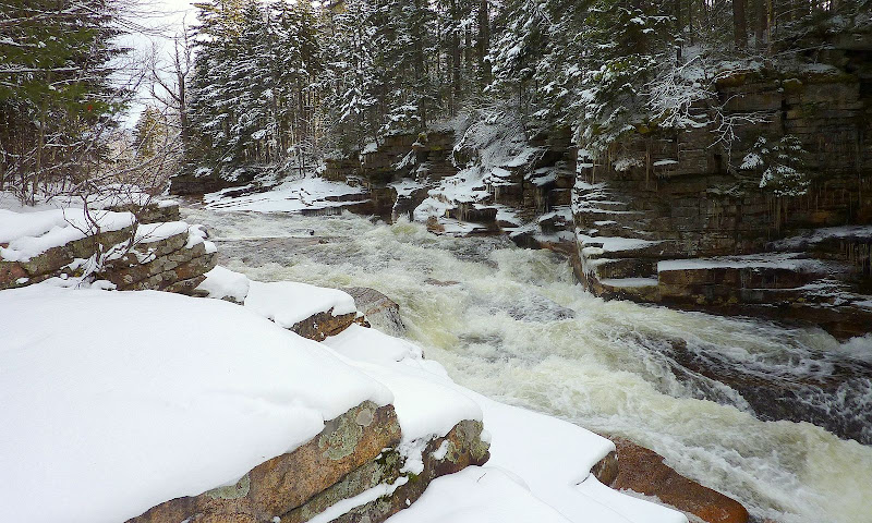
After snapping a photo of the Falls from a distance, I headed on up the trail to get a photo from a closer vantage point.
Lower Ammonoosuc Falls (a closer view)
OK, with two mini-hikes now under my belt, I finally headed off for the short drive to the Pondicherry Wildlife Refuge. I opted to access the Refuge via the Presidential Rail Trail. I picked up this trail by parking along the road on Rt. 115A about 0.4 miles from the junction with Route 115. On other occasions, I've accessed the Refuge via the Colonel Whipple Trail, and also via the Pondicherry Rail Trail which begins off the north side of the road that leads to the Mt. Washington Regional Airport. However, the Presidential Rail Trail is my favorite since it takes you through the Moorhen Marsh.
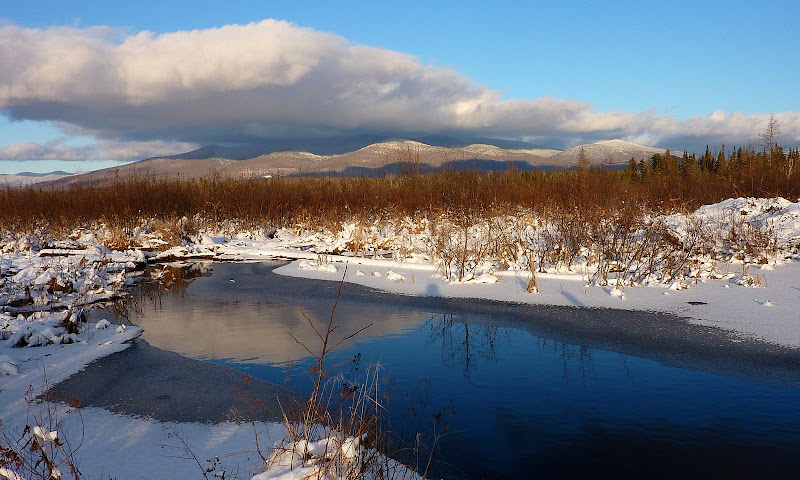
From the Moorhen Marsh, there are some very nice views toward the Pliny Range which is the home of peaks such as Mt. Waumbek and Mt. Starr-King.
Pliny Range from Moorhen Marsh
When the weather cooperates, there are also some unique views toward the Presidential Range. However, on this particular day, the Presidentials were mostly in the clouds.
Presidential Range (in the clouds) from Moorhen Marsh
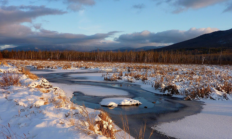
Also, at several points along the way, there are excellent views of Cherry Mountain with its Owl's Head Peak and Mt. Martha clearly visible.
Cherry Mountain
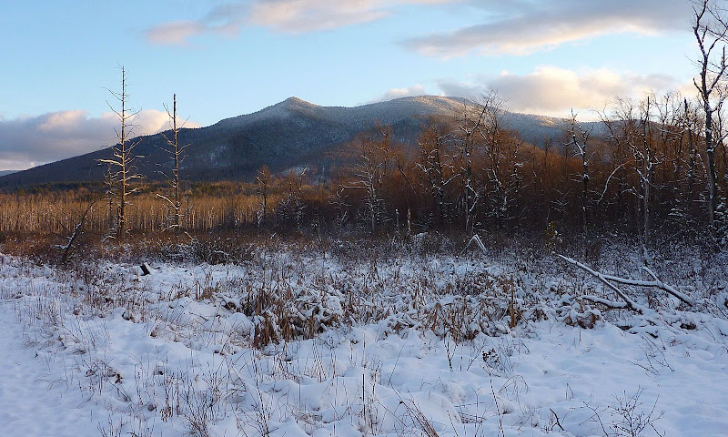
So, that was my day . . . three mini-hikes . . . each unique in their own special way.
1HappyHiker
So, I eventually decided to head for the Pondicherry Wildlife Refuge for a simple low-altitude hike. However, en route I remembered a little hike that my friends Joanne & Kevin had recently reminded me about. They recently took a stroll on the Flat Iron XC Ski Trail which begins just a short distance up Zealand Road from Route 302. I had done this mini trek about 2 years ago, but had completely forgotten about it until they reminded me. Since it would not be that far out of my way, I decided to make a quick side trip to the Zealand Road winter parking lot, and then hoof it up the road to do that short hike.
Even though there were no grooved ski tracks, I still wore snowshoes so as not to posthole this XC Trail. There are some nice riverside views along this trail, but I think the best feature is the outlook which provides a slightly different viewing angle on North & South Sugarloaf.
North & South Sugarloaf (from Flat Iron XC Ski Trail)

After this short foray on the XC Trail, I headed back to the parking lot. I had started the car, and was ready to pull out and head for Pondicherry, but then I happened to think that the Lower Ammonoosuc Falls was just a short trek from the other end of the parking lot. So, I stopped the engine and headed for the Falls. Within minutes I could see the Falls in the distance and could tell that the water was really churning after its long journey from high up at Lakes of the Clouds.
Lower Ammonoosuc Falls (from a distance)

After snapping a photo of the Falls from a distance, I headed on up the trail to get a photo from a closer vantage point.
Lower Ammonoosuc Falls (a closer view)

OK, with two mini-hikes now under my belt, I finally headed off for the short drive to the Pondicherry Wildlife Refuge. I opted to access the Refuge via the Presidential Rail Trail. I picked up this trail by parking along the road on Rt. 115A about 0.4 miles from the junction with Route 115. On other occasions, I've accessed the Refuge via the Colonel Whipple Trail, and also via the Pondicherry Rail Trail which begins off the north side of the road that leads to the Mt. Washington Regional Airport. However, the Presidential Rail Trail is my favorite since it takes you through the Moorhen Marsh.
From the Moorhen Marsh, there are some very nice views toward the Pliny Range which is the home of peaks such as Mt. Waumbek and Mt. Starr-King.
Pliny Range from Moorhen Marsh

When the weather cooperates, there are also some unique views toward the Presidential Range. However, on this particular day, the Presidentials were mostly in the clouds.
Presidential Range (in the clouds) from Moorhen Marsh

Also, at several points along the way, there are excellent views of Cherry Mountain with its Owl's Head Peak and Mt. Martha clearly visible.
Cherry Mountain

So, that was my day . . . three mini-hikes . . . each unique in their own special way.
1HappyHiker
Last edited:
