Three Ponds Mountain

vftt.org

Help Support vftt.org:

This site may earn a commission from merchant affiliate links, including eBay, Amazon, and others.
My only advice is to go there via Hell Devil Dam (site) just so you can report back and tell us about this interesting sounding place!

:D :D
 
I would guess the most obvious route would be to follow the trail from the road up to "The Notch", and head northwest up the ridge. Of course, I haven't been there before, so I don't know if there are private property issues or whatnot. This is a rather vague question, so if you could explain your motivations and/or concerns it might elicit more specific advice...

There's a chance that Peak_Bagr (Spencer) has been there, so I would say you should PM him.
 
Looks like hitting the NPT until it crosses the creek and then follow the N by NE drainage, (shows a old trail but don't know) until just below the notch and take the NW drainage str to the summit. Given the lines I'd stay to the right, a lot more gradual and given that there is a ridge to the S and SW on the way up you might buy more open woods. That ridge leading up from the "notch" looks thin if you go all the way up like I think most would and I'll wager its thicker with possible blow down given its shape. I "vegetation" whack so maybe my approach is a little different.

What is it like 3000 ft 6 inches? Are you planning a mid week attack? I'd join ya if your looking for company and aren't set on Sat the 20th since I have 4 offers of plans for that day already. If I take the plans to go the NH and finish the NHHH with Albee I'd be away Sunday too. Any week day is fine I work nights.
 
That's funny I started writing and got caught up watching "The Natural" on TV and left the message up and didn't see your post, Albee!
albee said:
There's a chance that Peak_Bagr (Spencer) has been there, so I would say you should PM him.
I highly doubt that one, he lives up close to the high peaks region and coming done here to get the most southern 3ker in the ADK is real out of the way. I mentioned Indian Lake one day and he said he hates that drive.
 
here is a copy of the NPT start out of Northville

Miles Trail Description
00.00 Northville (795' elev.) The trail begins at the western end of the bridge over the Sacandaga River and follows Rt. 30 north.
03.30 The trail leaves Rt. 30 and follows County Rt. 6, entering from the west, marked Benson Center
06.20 North road on the right leads to the trail to Cathead Mt. fire tower 2.7 miles, 1,300 ft. ascent (2,423' elev.)
08.50 The trail bears left on the main road.
09.20 Benson Center (1,289' elev.) This hamlet is but a handful of homes in the valley of the North Branch West Stony Creek. Make a right turn on to a dirt road (Washburn Rd.) at this location.
09.75 At the fork in the road bear to the left on Godfrey Rd.
10.25 Parking lot, the route is passable by automobile to this point. A trail register is located a short distance beyond the parking area.
11.55 Parking lot, passable by four wheel drive vehicle to this point.
11.85 The trail crosses the North Branch of the West Stony Creek.
12.70 The trail crosses Goldmine Creek.

I just checked the weather for that area and it shows ran for 9 of the next 10 days so you might need a Kayak! :rolleyes:

Roy Hobbs just broke the clock tower, now thats a homerun! :)
 
Last edited:
"I highly doubt that one, he lives up close to the high peaks region and coming done here to get the most southern 3ker in the ADK is real out of the way. I mentioned Indian Lake one day and he said he hates that drive."

While Spencer and Brian may not have been done this specific one, they are 600-700 peaks along the way to climbing every named peak and mt on all the ADK quads.
I've done a bunch of whacks with them and know that while they may not like the drive, we all love the open woods of the Indian Lake area. ;)
 
correction

"11.55 Parking lot, passable by four wheel drive vehicle to this point."

This is incorrect. You will reach the parking lot on the right side of the road (Godfrey Rd) at 10.3 miles (from Northville) ... park there and the register is a short walk up the road. You could drive a short ways past the register but you'd have to turn around. You have to walk past the rod and gun club and along the road to West Stony Creek.

and you still cannot climb Cathead (but then you probably already knew that).
 
kwc said:
"11.55 Parking lot, passable by four wheel drive vehicle to this point."

This is incorrect. You will reach the parking lot on the right side of the road (Godfrey Rd) at 10.3 miles (from Northville) ... park there and the register is a short walk up the road. You could drive a short ways past the register but you'd have to turn around.

You mean "10.25 Parking lot, the route is passable by automobile to this point. A trail register is located a short distance beyond the parking area." that parking lot?
 
While Spencer and Brian may not have been done this specific one, they are 600-700 peaks along the way to climbing every named peak and mt on all the ADK quads.
I've done a bunch of whacks with them and know that while they may not like the drive, we all love the open woods of the Indian Lake area. ;)

Wow, since I read this I can't stop thinking about it. I decided that I just don't think that can be possible. Stinkyfeet (Sue) just wrote in another thread that it took her 15 years to complete the 48x12. She is a top of the board speed hiker and she can knock off a bunch at a time doing loops and ridges on trails. Spencer and Brian just finished the 46 in 2004 like a month after I did. They finished the ADK100 last year on ST#5, you'll know that better than me. This year they have been focusing on bushwhacking the 46. So where and when could they have squeezed in 500-600 mountains? Not to mention they would be at least half bushwhacks. :confused: I think you had one of those conversations like we all have were they said they had a desire to do it and mentioned they figured it would be 600-700 peaks and you somehow thought they implied they had done them. If I'm wrong I'll carry alot of crap up Noonmark when Sunny finishes her ADK100, I was already going for the mini keg but you can add whatever you want!
:D ;)

Edit: I just read Spencer's thread on some of this, I wasn't thinking of like 1500 ft hills off the road as mountains so I could see them hitting a real high number. They may or may not be at 700 but I don't see that as mattering where ever they are is close enough for me since I wasn't thinking of it that way- You win, bring on the party gear, I thought I remember that Spencer was carrying the grill though! :D I should have been smart enough to delete this post! :eek: ;)

I'm figuring Roy won't mind a mini High-jack since he is a 600 or so mountain kind of a guy. ;) :)
 
Last edited:
albee said:
I would guess the most obvious route would be to follow the trail from the road up to "The Notch", and head northwest up the ridge. Of course, I haven't been there before, so I don't know if there are private property issues or whatnot. This is a rather vague question, so if you could explain your motivations and/or concerns it might elicit more specific advice...

There's a chance that Peak_Bagr (Spencer) has been there, so I would say you should PM him.


This is close to what I did when I climbed it. I turned off the trail before the notch to avoid the steep terrian. I don't recall private property issues. I think that this areas is accesssed frequently in winter by the public xc skiers as it is close to Lapland. IIFC. I remember it as a nice hike....let me check my records.
 
"I wasn't thinking of like 1500 ft hills off the road as mountains"

Didn't see Three Ponds Mt as any large crag and was simply replying to their accomplishing 600-700 of the named mts and peaks on the ADK quads as part of their quest to get them all. Some of them are devils regardless of the height.
If you want to see the topos, I'm sure the boys will be happy to
show you. ;)
 
Didn't see Three Ponds Mt as any large crag
Lol, you didn't know Three Ponds was the Matahorn of the southern Indian lake area! :D

Some of them are devils regardless of the height.
Your right on with that Alan and the enjoying the open woods of that area.
If you want to see the topos, I'm sure the boys will be happy to
show you. ;)
Actually that was my immediate thought, its stuff like that inspires. And the idea of going over maps I know we all hate. :D

I actually had to go back and look at the route I suggested when Albee wrote me basically "What the hell", and then John S agreed with his although his route adjustment to that course was almost my exact route. I was referring to following the valleys of the water drainage and its direction leading to the "notch" and then towards the summit. And when I said follow the drainage he thought I meant get in it when we talked on the phone, lol! When I said follow that drainage up towards the summit I mean the general valley area, prob about 100-200 ft to the right in this case. I didn't like the idea of going directly up from the notch because of those tight lines just above it that looked almost cliff like then going out to a thin ridge for the reasons I stated.

Funny how we talked about regional or your group of bushwhacker buddy talk changes region to region. In NE he said how you can always just hit a ridge and follow the moose activity. Well, there isn't much moose activity over here and ridges in NY are just thicker without a herd path most of the time. And the drainage thing is how a bunch of whackers I know refer to the valley area of a water flow not the actual water flow. I would imagine this mountain is so low (even though its the Matahorn) ;) that there might even be maples on top, hehe. :)
 
From my records

Climbed it on May 4, 96 so you know this is ancient data.

Started from the small parking lot 1/4 inch :D (assuming your on a 1:24000), East of the 404 marked elevation just of west of Upper Bensen.

9:30am car
10:20 cross stony creek 50' up the west branch from the fork (if I note where to cross then it must not be obvious or easy)
11:10 turn off 0.3 miles before the notch
climbed directly for that little cliff at 780ft then skirt it on the left (so a direct route up it was not possible)
"some spots growth and blowdown but not bad"
12:55-1:05 Summit
decended the dominant drainage from the little col between the two summit bumps
2:00 back at the notch trail
3:00 back at stony creek junction
3:30 car

40F, rain.
~10mi, 1750 ft
with Sue Eliers and Trudi Fullerton
wore Sorels (I guess they were needed :confused: )
 
Thanks, John. If it took you 6 hrs it will take me 12 so maybe I'll wait for more daylight next summer.

Just shows the lack of interest in 3k in NY and on this board, if I asked about a NH 3k I'll bet I would have got 20 people who'd climbed it
 
Roy,

IMHO there is a much longer history associated with the NE and NH 3k peaks. In the same way that the NH 4k peaks have had a longer climbing history. Much has to do with where some of the early outings clubs had their bases and activities. i.e. Harvard OC, Dartmouth OC, Boston AMC, etc. Also, most of the ADK100 and NY3ks are much farther from some of the large population centers and their history, existence and locations are little known about.
There are, for example, about 22 known completers of the ADK100, and the best estimates are that there are no more than 10 to at most 20 more who have done them but not publicized the fact.
There is a growing interest in the ADK100 Cat100 and NY3k peaks and but they are a lot less institutionalized. Online sharing of GPS routes is largely frowned upon and most 'whack peaks have little in the way of herd paths except along the ridges or near summits.
As you noted, the interest is no where near what you find in New England but its growing.
 
Last edited:
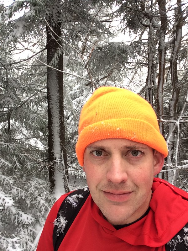
My wife and I hiked Three Ponds Mountain on Saturday. COLD. 2 inches of snow at the summit. We took the same route that John Swanson describes earlier in this thread and it took us 6 hours and 17 minutes round trip. It should be noted that the "Notch" trail leading up out of the Stony Creek Junction doesn't really exist anymore. It has become overgrown since '96 when John did it. I mean, you can still follow it for a ways, but there is tons of blowdown, and in another fews years it will basically be non-existent. It also completely disappears well before the Notch - no signs of a trail anymore at all as you get closer to the notch. However, buswhacking along the creek that goes up toward the notch was flat and very easy.
What wasn't so easy is bushwhacking up to the summit of Three Ponds from the Notch, because the snow relentlessly kept falling on us as we hit the trees going through. It was constant bombardment by falling snow the entire way to the summit. We got to the summit mid-day and it was super cold and windy - probably 24-25 degrees but with a wind child that felt much colder. Made good time going back, because once you get back down to the Notch area it's pretty flat open woods all the way back (and there is still some trail to follow) and then it is basically a road walk from Stony Creek junction back to Godfrey Road in Upper Benson where our truck was parked.

At summit of Three Ponds Mountain, ADKs:
23038293736_6ebe87e858_c.jpg


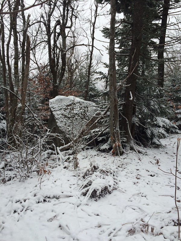
Boulder a few feet off the summit of Three Ponds Mountain, ADKs:
22645995017_d01dc52e15_c.jpg
 
Top