Trail to Mendon?

vftt.org

Help Support vftt.org:

This site may earn a commission from merchant affiliate links, including eBay, Amazon, and others.

Paradox

New member
Joined
May 29, 2006
Messages
2,268
Reaction score
314
Location
Holderness, NH, Avatar: Pine Marten on Mt Field
The USGS maps depict a trail that runs from the Long Trail across the summit of Little Killington then heads in a westerly direction to the col between LK and Mendon and then South. I cannot find reference to it anywhere, nor is it depicted on other maps. Does anyone have any information on this trail?

 
I think it's long gone. NY Spencer did the bushwhack to Mendon from Little Killington at one of the VT gatherings some time ago and from what I remember of his storytelling didn't come across any old trail like this. I certainly don't remember seeing sign nor sign of anything when I was up on LK.

Was that the old route of the AT? I know there was some rerouting done in that area (for example, the trail you see on the map coming from Shrewsbury Peak hits some other n-s trail on the map, but in reality only intersects the LT/AT *south* of Little Killington).
 
Last edited:
I recommend you hiking it from the other side. It is easy going up an old road and then the bushwhack to the summit from the suggested location has a herd path. I recall lots of flies on the summit but decent views providing a unique perspective of the area.
 
I hiked Mendon from the North side unnamed logging road on Memorial day weekend and was all over the col area. Herd paths are everywhere however I didn't find a substantial trail. I'm not willing to admit it wasn't there only that I didn't find it.

I also see the trail on copies of MyTOPO maps and suspect MichaelJ is right in regards to a former routing of the AT.

It would be interesting to learn if it's still marked and easy to navigagte.
 
I Herd paths are everywhere however I didn't find a substantial trail. I'm not willing to admit it wasn't there only that I didn't find it.
I would agree that there is not one main herd path. I ended up hooking up one after another but it did reduce the whacking component.
 
Was that the old route of the AT? I know there was some rerouting done in that area (for example, the trail you see on the map coming from Shrewsbury Peak hits some other n-s trail on the map, but in reality only intersects the LT/AT *south* of Little Killington).

I think you're right MJ. When I did it a few years back--the first time I met Sabrina by the way, only later on Pico--I went over little Killington. It was a very stiff approach with a lot of downed spruce.

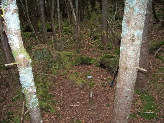
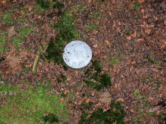
However, I did come across an AT marker in the ground.
100_1497.jpg


100_1496.jpg


There is a section of that ridge that has a pretty good heard trail, but I agree, unless you're trying to prove something, it's not the route of choice. On the way back, on a hunch, I dropped off to my left through fairly open woods, found the old forest road, and followed it and a path all the way back to the AT.
 
I think you're right MJ. When I did it a few years back--the first time I met Sabrina by the way, only later on Pico--I went over little Killington. It was a very stiff approach with a lot of downed spruce.

However, I did come across an AT marker in the ground.

<cut>

...
Note that these are bound markers for the AT corridor, not trail markers. In other words, they mark the extent of the right of way on either side of the trail and may be several hundred yards from the trail.

A good example of the corridor marking is the little cleared swath you cross when you whack from South Crocker to Redington. This is the boundary for the AT land, not the trail.

Most times there is no swath, but the markers are out there. I know a surveyor who set these markers a few years back near Killington when the AT had just gotten title to the land. Maybe he set that one.

I also tried to whack from the AT up to Little K and thence to Mendon a few years back. It was a hot day and it was so thick I soon gave it up. I had done the traditional route to Mendon previously which was much easier going. I was checking out this route just "for the fun of it". NOT!
 
Note that these are bound markers for the AT corridor, not trail markers. In other words, they mark the extent of the right of way on either side of the trail and may be several hundred yards from the trail.

A good example of the corridor marking is the little cleared swath you cross when you whack from South Crocker to Redington. This is the boundary for the AT land, not the trail.

Most times there is no swath, but the markers are out there. I know a surveyor who set these markers a few years back near Killington when the AT had just gotten title to the land. Maybe he set that one.

I also tried to whack from the AT up to Little K and thence to Mendon a few years back. It was a hot day and it was so thick I soon gave it up. I had done the traditional route to Mendon previously which was much easier going. I was check:confused:ing out this route just "for the fun of it". NOT!

OK, very interesting. I guess that answers my question. I've often wondered about that marker.
 
Yup
, AT Corridor Boundary marker.

Paradox, I was on Mendon last week. There were a few entries in the cannistre describing a hellacious bushwack from little killington. Its easier to do the very short and open whack from the Long Trail to the old carriage road, then turn left just before the second cairn. I took a 233 magnetic there, walked about 100 feet into the woods and found a very easy to follow herdpath that went over the false summit and over to the cannistre on the true summit.


Feel free to pm me if you need more info.
 
Last edited:
If you want to see the route between the Carriage Road and the LT/AT I have it shown here. It's very easy to follow, though if you're going up towards the LT/AT you need to bear sharp right up what looks like a drainage when the old road starts bearing down off the contour.
 
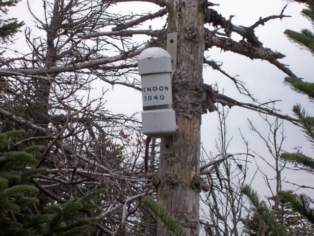
Unless it's changed since I was last there, this is what you are looking for:
100_1498.jpg


I also saw, standing just a few feet from that canister, the largest bear I've ever seen with my own two eyes.:eek: If you see him give him my greetings.:D
 
If you want to see the route between the Carriage Road and the LT/AT I have it shown here. It's very easy to follow, though if you're going up towards the LT/AT you need to bear sharp right up what looks like a drainage when the old road starts bearing down off the contour.

Glory Be! That trail is marked on the map!


Thanks folks!
 
I also see the trail on copies of MyTOPO maps and suspect MichaelJ is right in regards to a former routing of the AT.
I don't think it is a former LT/AT route, just a woods road. I hiked it in the '60s and '70s and it wasn't there either time, but when I did a bushwhack W of the ridge I found a lot of piles of cordwood that had been cut and never hauled out.
 
We have a similar maxim in dentistry: Remember the five "P's"; Prior Planning Prevents Poor Performance. :)
In the service it's six P's ;)

The "trail" (and the upper portion of the road that curves around the headwall) is only on the new (1997) quad, not on the 1983 quad (photoinspected--surveyed 61, modified 74). I really can't imagine what it's supposed to be, or what could have sprung up between 1961 (or 1983?) and 1997, but disappear by 2009.

The Catamount XC ski trail and a snowmobile trail (maybe coinciding for part?) also pass through the area, although (as best I can tell) well south of Mendon. (I believe the road over the shoulder of Robinson Hill is the snowmobile trail.) There's a lot going on in that area...and very little of it is useful for getting to Mendon.
 
Top