1HappyHiker
Well-known member
Over the holidays I’ve had the pleasure of being visited by family members. But as enjoyable as the visit was, these folks are not really into hiking. So now that the family visit is over, I’m back out on the trails again. I decided to ease my way back into it by checking on a couple of my adopted trails (i.e., the Osgood Cutoff, plus the Osgood Trail from the Osgood Cutoff to the Great Gulf Trail junction).
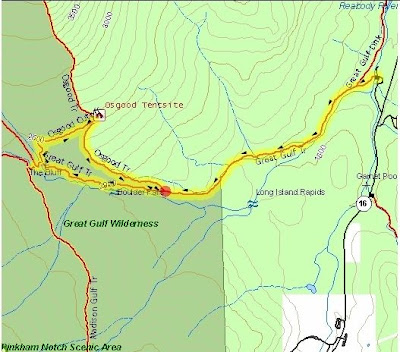
When checking on the adopted trails named above, I do a clockwise loop hike as shown on the map below.
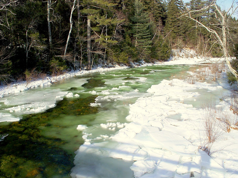
As I began the hike and approached the suspension bridge that spans the Peabody River, one of the first things that struck me was that the river was green! A little early for St. Patrick’s Day!? I’ve hiked this route several times in the winter, and I don’t recall ever seeing the river being green. But, I’m sure some VFTT person will have an explanation for this phenomenon.
Below is a photo of the green Peabody River:
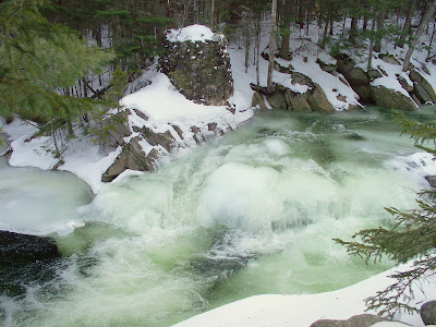
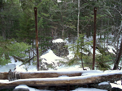
Even before adopting the trails named above, I would often do this 6-mile loop hike just because it was fun to do. Call me silly (or whatever), but one of the fun things I enjoy when doing this loop is to make a side-trip along a short remnant of “ye olde” Osgood Trail. This remnant is easy to follow, and it runs from a point on the current day Great Gulf Trail to the point where the former route of the Osgood Trail once crossed the West Branch Peabody River on a large bridge. This is a very picturesque spot on the river. And although the bridge is long gone, the old bridge abutments are still intact.
Below are two photos showing the old bridge abutments.
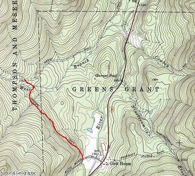
Below is a map showing the former route of the lower portion of the Osgood Trail between the Auto Road and the junction with the Great Gulf Trail. (As I understand it, this lower segment is now sort of woven into the fabric of the Great Glen Trails complex.)
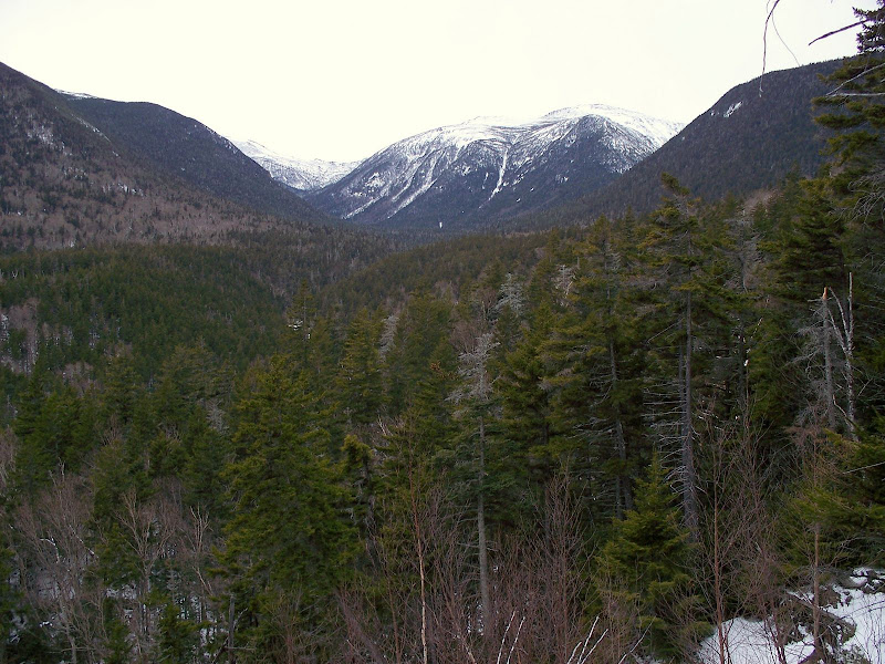
Besides offering the opportunity to hike along a short remnant of “ye olde” Osgood Trail, the loop hike itself provides some unique views into the Great Gulf. One such view is from the area named “The Bluff” which is located on the Great Gulf Trail near the junction with the Osgood Cut-Off. And, there’s also an unnamed spot (slightly off-trail) along the Osgood Cut-Off that provides another view into the Great Gulf.
Below is a photo showing one of the views into the Great Gulf from this loop hike:
Other Items of Possible Interest:
Here are just a couple of other things of possible interest. As of about noon on the day of this hike (02-Jan-2009), the Great Gulf Trail was broken out only to the junction with the Osgood Cutoff. There were no signs of traffic continuing west on the Great Gulf Trail beyond this point. I broke trail on the Osgood Cutoff and removed a few nuisance blow-downs. (Also, several small blowdowns were removed from the Osgood Trail between the tentsite area and the Great Gulf Trail junction).
Earlier in the day when I passed by the Osgood Trail at the Great Gulf Trail junction, the Osgood was unbroken. However, the segment of the Osgood between the tentsites and the Great Gulf Trail junction is now broken out. Not only did I travel this segment, but I also met several hikers on snowshoes on this segment who were on their way to overnight camp at the tentsites. These folks planned to go to Mt. Madison on Saturday and break out the rest of the Osgood.
I wore snowshoes for this entire trek. This not only made for easier going on unbroken sections of trail, but also helped maintain the integrity of those sections of trail shared with cross-country skiers.
So overall, this 6-mile loop hike was as enjoyable as ever, and it was great to be out & about in the Whites once again!
1HappyHiker
When checking on the adopted trails named above, I do a clockwise loop hike as shown on the map below.

As I began the hike and approached the suspension bridge that spans the Peabody River, one of the first things that struck me was that the river was green! A little early for St. Patrick’s Day!? I’ve hiked this route several times in the winter, and I don’t recall ever seeing the river being green. But, I’m sure some VFTT person will have an explanation for this phenomenon.
Below is a photo of the green Peabody River:

Even before adopting the trails named above, I would often do this 6-mile loop hike just because it was fun to do. Call me silly (or whatever), but one of the fun things I enjoy when doing this loop is to make a side-trip along a short remnant of “ye olde” Osgood Trail. This remnant is easy to follow, and it runs from a point on the current day Great Gulf Trail to the point where the former route of the Osgood Trail once crossed the West Branch Peabody River on a large bridge. This is a very picturesque spot on the river. And although the bridge is long gone, the old bridge abutments are still intact.
Below are two photos showing the old bridge abutments.


Below is a map showing the former route of the lower portion of the Osgood Trail between the Auto Road and the junction with the Great Gulf Trail. (As I understand it, this lower segment is now sort of woven into the fabric of the Great Glen Trails complex.)

Besides offering the opportunity to hike along a short remnant of “ye olde” Osgood Trail, the loop hike itself provides some unique views into the Great Gulf. One such view is from the area named “The Bluff” which is located on the Great Gulf Trail near the junction with the Osgood Cut-Off. And, there’s also an unnamed spot (slightly off-trail) along the Osgood Cut-Off that provides another view into the Great Gulf.
Below is a photo showing one of the views into the Great Gulf from this loop hike:

Other Items of Possible Interest:
Here are just a couple of other things of possible interest. As of about noon on the day of this hike (02-Jan-2009), the Great Gulf Trail was broken out only to the junction with the Osgood Cutoff. There were no signs of traffic continuing west on the Great Gulf Trail beyond this point. I broke trail on the Osgood Cutoff and removed a few nuisance blow-downs. (Also, several small blowdowns were removed from the Osgood Trail between the tentsite area and the Great Gulf Trail junction).
Earlier in the day when I passed by the Osgood Trail at the Great Gulf Trail junction, the Osgood was unbroken. However, the segment of the Osgood between the tentsites and the Great Gulf Trail junction is now broken out. Not only did I travel this segment, but I also met several hikers on snowshoes on this segment who were on their way to overnight camp at the tentsites. These folks planned to go to Mt. Madison on Saturday and break out the rest of the Osgood.
I wore snowshoes for this entire trek. This not only made for easier going on unbroken sections of trail, but also helped maintain the integrity of those sections of trail shared with cross-country skiers.
So overall, this 6-mile loop hike was as enjoyable as ever, and it was great to be out & about in the Whites once again!
1HappyHiker
Last edited:
