Walking Through History on South Uncanoonuc Mountain

vftt.org

Help Support vftt.org:

This site may earn a commission from merchant affiliate links, including eBay, Amazon, and others.

ksearl

Active member
Joined
Jan 19, 2011
Messages
261
Reaction score
31
Location
New Hampshire
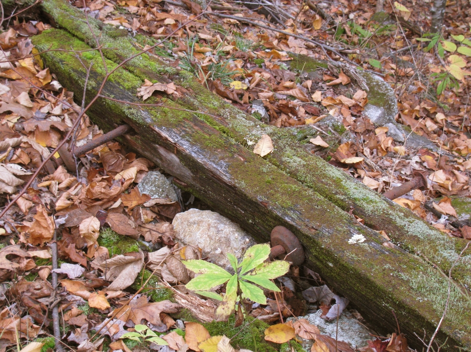
I had a few free hours this past Saturday, so I decided to checkout South Uncanoonuc Mountain. I've never heard a good thing about this peak due to the radio towers on the summit and the limited views. However, I've read a lot about the history of the mountain, so I was excited to get up there and see if I could find some remnants from the past. I was able to find some old foundations, railway ties, benchmark and more. There were also a couple good views...not the Whites, but it was fine for a small hike in the Manchester area.

Here's my full, detailed report: http://livefreeandhikenh.blogspot.com/2011/10/some-history-on-south-uncanoonuc.html Please visit if you have a minute!

Here are some of my favorite pics:
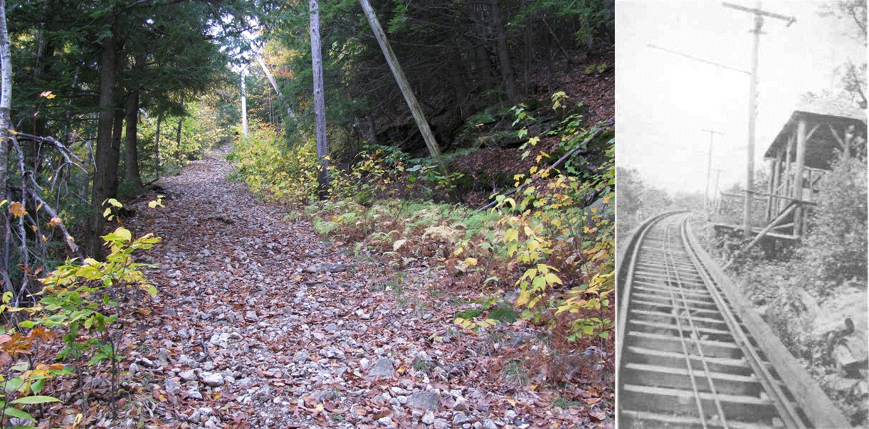
Incline+Blog+2.jpg

I got this comparison idea (current/past) from 1HappyHiker on his blog...credit for a good idea is all his!
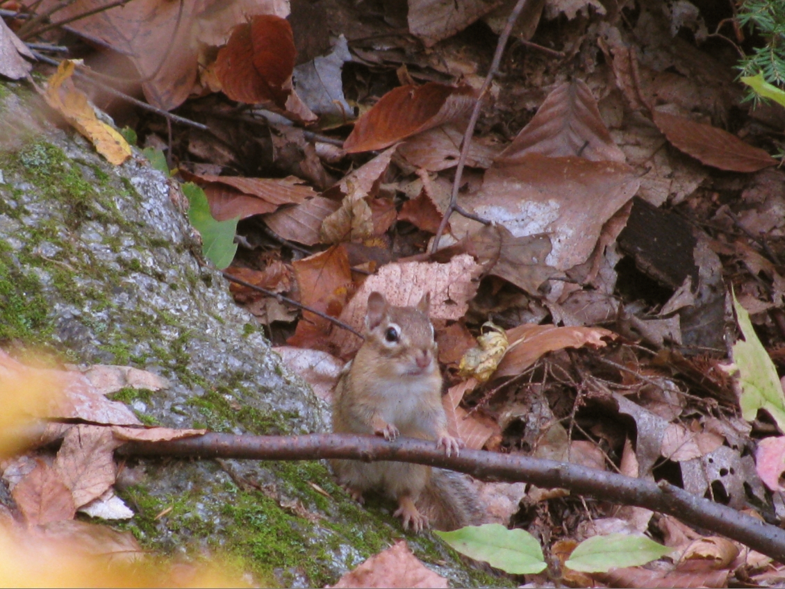
Chipmunk.jpg


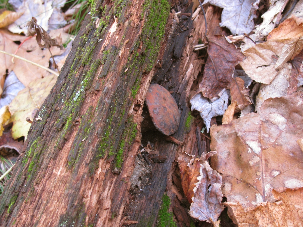
Rail+Tie.jpg


Rail+Tie3.jpg


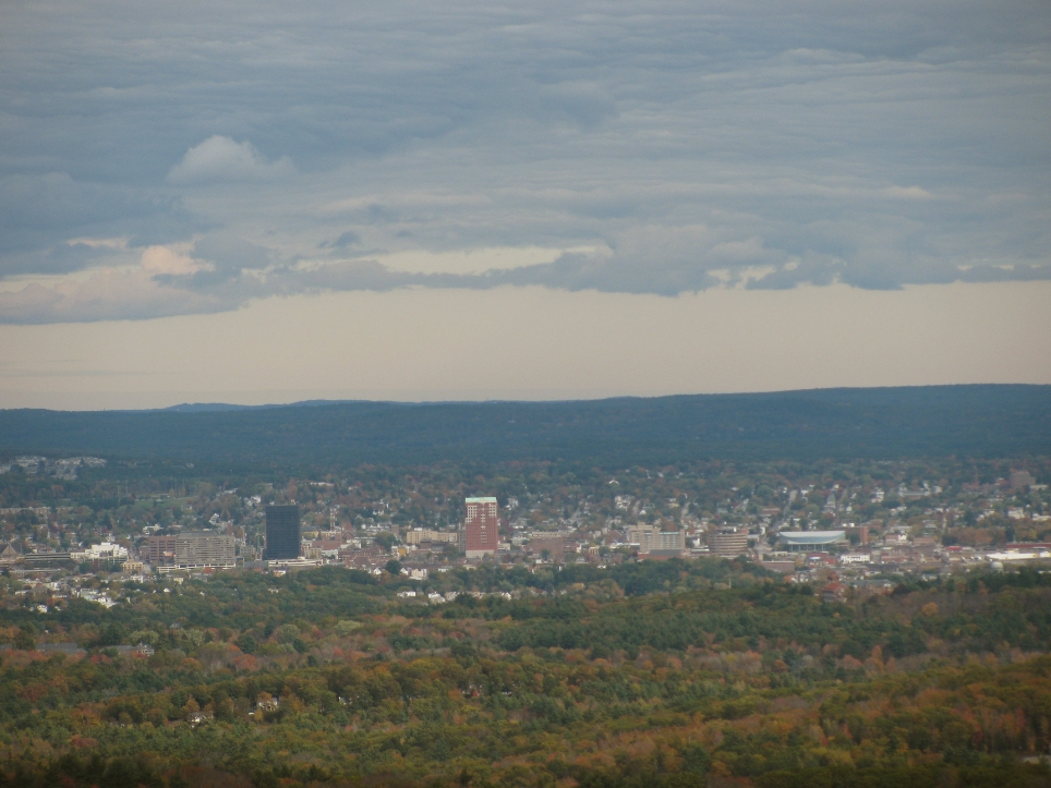
Views+manch.jpg


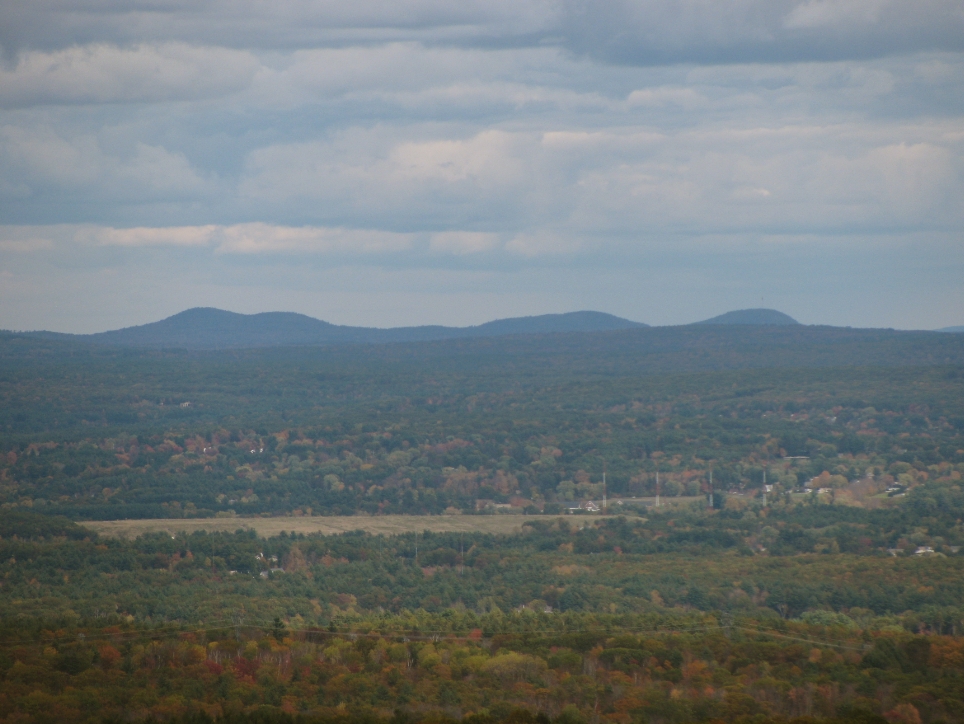
Views+Mountains.jpg

Not sure what mountains these are...any help out there?
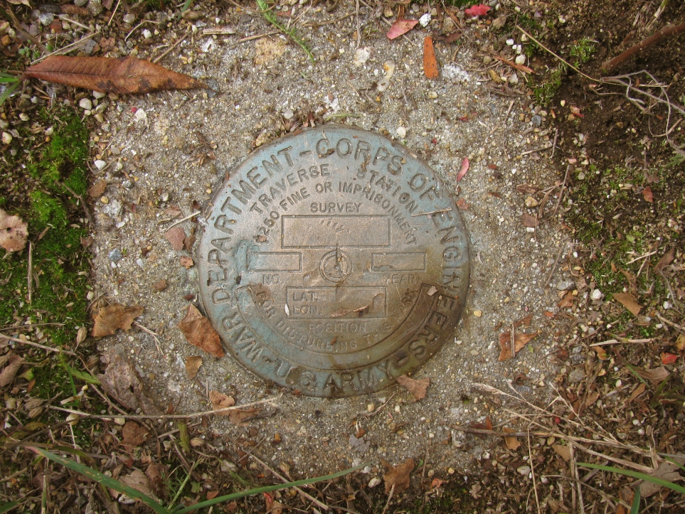
Benchmark.jpg


Thanks,
Karl
 
Last edited:
Nice report Karl. Looks like you caught the bustling metropolis of Manchvegas in all her glory! :D

The mountains... I'm not 100% sure to be honest? I assume you're looking southwest/west, since Manchchester or Nashua should be visible looking east or southeast. Maybe the Pack Monadnocks?

I've been eyeing these peaks, literally every day on my drive to work. You may have inspired me to bring my hiking gear and make it a late afternoon trip one of these days. :)
 
I too enjoyed the history all around me when I hiked up to So. Uncanoonuc two summers ago, by the trail that follows the bed of the old Incline RR. The only really good views I found were the from the east-facing ledge on the Walker Trail, with a nice panorama of Manchester, and I gather that goes for you also?

That is what really intrigues me about your "name these peaks?" photo. If it was taken from the Walker Trail ledge, it couldn't include Pack Monadnock or any peaks to the west. I gather that it is not a blown-up section of your preceding photo of downtown Manchester, cropping out the City and enlarging some of the peaks on the horizon (which appear to include the Pawtuckaways)? In that case, since it must be looking either to the north or the south of downtown, I would guess it is some of the peaks to the NE, which could include Fort and Nottingham Mtns., which straddle the Epsom-Deerfield line, nearly 20 miles away? Maybe Saddleback to the right? Someone who knows that area better could make a better guess.

The trail to No. Uncanoonuc from the north is nicer, as you described in your TR to it last Fall, but has less history and lacks any view equaling that from Walker Trail ledge. I hiked both summits on the same day because, collectively, they are one of the Thoreau 16 - the 1Ks that Henry David T. is known to have climbed.
 
JacobH and Amicus - Thanks for the feedback.

Amicus, I agree, I think the Pawtuckaways are just barely visible over Manchester. And yes, both pictures were taken on the Walker Trail Ledge. The mountain pictures were focused way in, all the way to the left most view on the ledge. I actually have a picture showing both Manchester and the mountains in one shot, but it isn't loaded on the web, so I have no URL to load it up on VFTT. It would have given good perspective to the direction of them. I would say NE for sure.

Based on it's northern proximity to Manchester, I was thinking they may be the Blue Hills Range or the Belknaps. I think they are too prominant to be be the Blue Hills Range though, so I think they may be the Belknaps way off in the distance. What do you think?

JacobH - These peaks are worth the effort I think. Not the greatest views, but they get you in the woods, which is what I love about any hike! I hope you give them a try!

Karl
 
Last edited:
The mountains... I'm not 100% sure to be honest? I assume you're looking southwest/west, since Manchchester or Nashua should be visible looking east or southeast. Maybe the Pack Monadnocks? :)

I think those hills are more to the north, in the direction of Bow. See the signal towers on the right? I think those are along what's known as the Goffstown Back Road. Then again, I could be wrong.
 
I think those hills are more to the north, in the direction of Bow. See the signal towers on the right? I think those are along what's known as the Goffstown Back Road. Then again, I could be wrong.
Every photo should be auto-stamped with GPS coord and compass bearing along with the date :)

I thought they were transmission towers hence the view was ENE looking toward Saddleback and Pawtuckaway, I don't think it looks like Belknaps

One of the original ~1870 survey stations was on this peak, but near the old fire tower footings which are now fenced in - PapaBear thinks he found it but I'm not so sure

You don't have a photo of the old insulator, perhaps somebody finally stole it
 

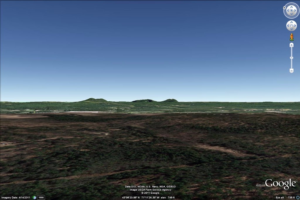
I think Pawtuckaway is the winner.

Pawtuckaway.jpg


Put myself on top of South Uncanoonuc and zoomed in until I was hovering over Candia or so. I have my Google Earth set to exaggerate elevation a bit so mountains look a little taller than they are in reality.
 
JacobH - That's awesome! Pawtuckaway is the winner for sure! I didn't think the Pawtuckaway peaks would be that prominent in the skyline. Thanks for taking a look this! It's really cool how well it matches up.

Thanks again!
Karl
 
Karl . . . you've done a magnificent job with those comparison photos (i.e. old vs. current). Plus, your report overall is simply terrific and informative!

Thank you for sharing your historical research with us!
 
JacobH's Google Earth creation certainly equates the Pawtuckaways with the mystery photo mountains. At 22 miles, I guess they are about the right distance. I originally ruled them out because, at first glance, they seemed to be behind downtown Manchester. I see now. however, that they are behind just the north part of the City, which seems to be residential or at least without tall buildings. Moreover, I see radio towers in about the right position, a little east of the Piscataquog River, in Goffstown near its border with Manchester.

I thought those mountains looked familiar - the scenic remains of a volcanic ring dike (a traverse of which is a great day hike, with excellent views of So. Uncanoonuc, obviously).

The Belknaps are too far away, at nearly 40 miles, and much too far to the north.
 
Hi John - Thanks for the kind words! Your post about walking around the Zealand Area in search of some views that matched older pictures inspired me to try this out. I was very pleased with how they came out. I give you the credit!

Amicus - Thanks, I thought the same thing about the Pawtucks being behind the city at first glance. I'm really impressed by JacobH's Google Earth usage on this!
 
Thanks for some very interesting history on Uncanoonuc. I remember this as being the first peak I ever hiked ... way back ... how about the mid 1950s?? I was on a family day picnic trip in the state park. I was very young then and recall taking the trail up to the fire tower.
 
Top