Where the Hale is the WF Trail?

vftt.org

Help Support vftt.org:

This site may earn a commission from merchant affiliate links, including eBay, Amazon, and others.
Mot,

You need to look backward if you are looking for the WF trail not the FW trail :)

Why didn't you follow the wires? The first time in winter, we headed uphill from the first crossing and eventually found the wires which of course led to the trail. The second time, we didn't look at the 15' map closely enough and started on the wrong side of the side brook but eventually found the trail. At the 2nd and 3rd crossings of Little River you were way too far up.

Note that the trail originally started at the Twin trail on the W side of the Little River and immediately crossed, so by using the herd path to avoid the double crossing you are not going by the "natural" junction.

Yor,

Does this mean it originally had its own crossing before the 2nd crossing and the steep bank the current herd path ascends on the bend? Never noticed any wires. Are there still a few poles like Garfield's tractor road? Interesting what you see sometimes when you look harder!;)
 
It sounds like we've all been through the same woods there - lots of nice little streams and ferns!!! :)

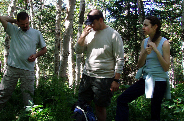
Indeed. I don't know if this will look familiar to you - an attractive birch glade where we took a break about halfway between the Little River and the Lend-a-Hand Trail:

246697596_Q5nvk-M.jpg
 
And if you want a bit of variety, you can try to follow the Tuttle Brook Trail up Hale. The TH is off the road just east of the Twin Mtn airport and the first part of the trail is still shown on the modern (1995) 24K topo.

It was long abandoned when a group of which I was a member did it in winter in the mid-to-late 1970s. The leader had had to scout it in the summer. IIRC there was still an arrow on a tree when we did it.

A Google search finds a brief description from the 1936 guidebook in http://www.vftt.org/forums/showthread.php?t=21562:
P. 306-Tuttle Brook Trail-“follows to its end the road which passes the freight house of the now abandoned B&M RR station at Twin Mountain. Here the Baby Twins Trail diverges L (N) of the farmhouse. The Tuttle Brook Trail passes to the R (W) of the house. It crosses the Bethlehem pipeline 1m. from the station and climbs by easy grades to the Hale Brook Trail 1/2m. below the summit of Mt Hale.DISTANCE Station to Baby Twins Trail .6m; to Mt Hale 4 1/2m., 3h.”

Doug
 
Baby Twins == Sugarloaves ???
I think so. It would appear that it is another name for the North and Middle Sugarloaves.

There was/is a trail that connects from the Tuttle Brook Tr not far from the TH and goes to the mid-point of the trail between the North and Middle Sugarloaves. It appears to the continuation of the current Sugarloaf trail down to Zealand Road. It is shown on the modern 24K topo (1995).

The 7.5' (24K) Twin Mountain, NH quad (trailhead area) shows both the Tuttle Brk Tr and the Baby Twins Tr. However, the 7.5' (24K) South Twin Mountain, NH quad does not show the Tuttle Brk Tr. (The dividing line between the two quads is just S of the summit of Middle Sugarloaf.)

Neither the Tuttle Brook Tr nor the Baby Twins Tr is shown on the AMC maps. See the SE corner of http://docs.unh.edu/NH/whit35se.jpg (This may be a modern map, not the 1935 map as indicated.) and the NE corner of http://docs.unh.edu/NH/frcn29ne.jpg (1929). Map indices at http://docs.unh.edu/nhtopos/Whitefield.htm and http://docs.unh.edu/nhtopos/Franconia.htm.

Doug
 
Last edited:
The Tuttle Brook area in Acme Mapper:
http://mapper.acme.com/?ll=44.26180,-71.51276&z=14&t=T

Back when I was trail-bagging, I followed the USFS trail from Twin Mtn village to the col on the Sugarloaves, not sure which edition of the WMG it was in but it's vanished again
That is likely to be the Baby Twins Trail. Shown on the Twin Mtn quad http://docs.unh.edu/NH/whit35se.jpg or http://www.archive.org/download/usgs_drg_nh_44071_c5/k44071c5.tif (SE corner), but not on Acme Mapper.

EDIT:
My 1969 WMG describes it as a continuation of the Sugarloaf Trail (from Zealand Rd to the "southerly end of the clearing at the Twin Mountain Municipal Recreational Area"), but my 1976 WMG says that the trail beyond the branch to N Sugarloaf has been discontinued.

Doug
 
Last edited:
Yup, is that the name it had?
It would seem so--the name Baby Twins Tr is from the map and the 1936 guidebook. The 1969 WMG simply describes it as a continuation of the Sugarloaf Tr. (The trails to the peaks are described as side branches.)

From 1936 Guidebook via http://www.vftt.org/forums/showthread.php?t=21562:
P. 305-Baby Twins Trail-“diverges L from the Tuttle Brook Trail just inside the National Forest Boundary, at the farm house .6m from the Twin Mountain Station, and runs 1.3m to the col between the North and Middle Sugar Loaves where it meets the Sugar Loaf Trail.”

I have no recollection of the BTT from my Tuttle Brk Tr bushwack/hike, but it was a long time ago.

Doug
 
the name Baby Twins Tr is from the map and the 1936 guidebook. The 1969 WMG simply describes it as a continuation of the Sugarloaf Tr. (The trails to the peaks are described as side branches.)

I checked my records at home and I hiked it in 1977 based on the 1972 WMG, which still describes the Sugarloaf Trail as a through trail from Zealand Rd to Twin Mtn with spurs to the summits. I'm surprised that it's not in the 1976 book.

Someday I will figure out if the mileage of now-gone trails I've hiked exceeds that of current trails.
 
Indeed. I don't know if this will look familiar to you - an attractive birch glade where we took a break about halfway between the Little River and the Lend-a-Hand Trail:

246697596_Q5nvk-M.jpg


Wow, great memories. I'm trying to remember who that young lady is, though. ;)
 
Or, you can turn left at the cardboard cutout of Geri ;)

I see my cardboard cutout services are still needed Tim!
Back to FW Trail, we were first ones up one day this winter with some new snow on the ground. Looking for the little tree was key although we still had a few 'is this it?' moments thinking the winter trail may make it not so noticeable. Lovely morning, we were breaking trail and didn't see anyone else on the way up. I descended Hale same route and was surprised to see something like a total 10-12 skiers, 1 snowboarder, 2 hikers and 1 dog. Guess the skiers wait for the hikers to break out the trail! geri
 
Joe C and I did the Fire Warden's trail for the first time two February's ago with Mohamed. There was 6 inches of fresh snow, and we were the first ones on the trail. The glades are so open that we would have lost the trail in a dozen places had Mo not had his GPS with a track of one of his earlier hikes up it.
 
Top