Whitewall Mtn. and a scary little knife edge

vftt.org

Help Support vftt.org:

This site may earn a commission from merchant affiliate links, including eBay, Amazon, and others.

forestgnome

New member
Joined
Dec 3, 2004
Messages
2,625
Reaction score
600
Location
..Madison, NH
a nice hike along Zealand Trail in the morning...
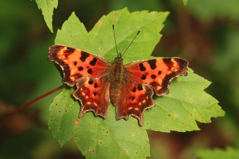
IMG_3679aaa.jpg


this little being was in a bad place, right in the middle of the busy trail on a rock, so I scooted him onto a leaf and got him off the trail...
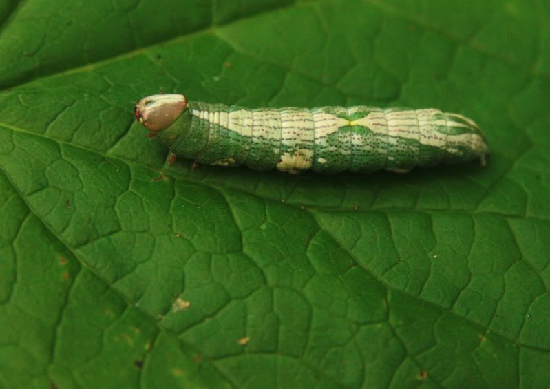
IMG_3690aaa.jpg


a look up the slides where I started up from the Ethan Pond Trail...
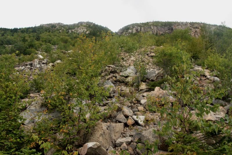
IMG_3694aaa.jpg


most of the way up, looking at the headwalls at the top...
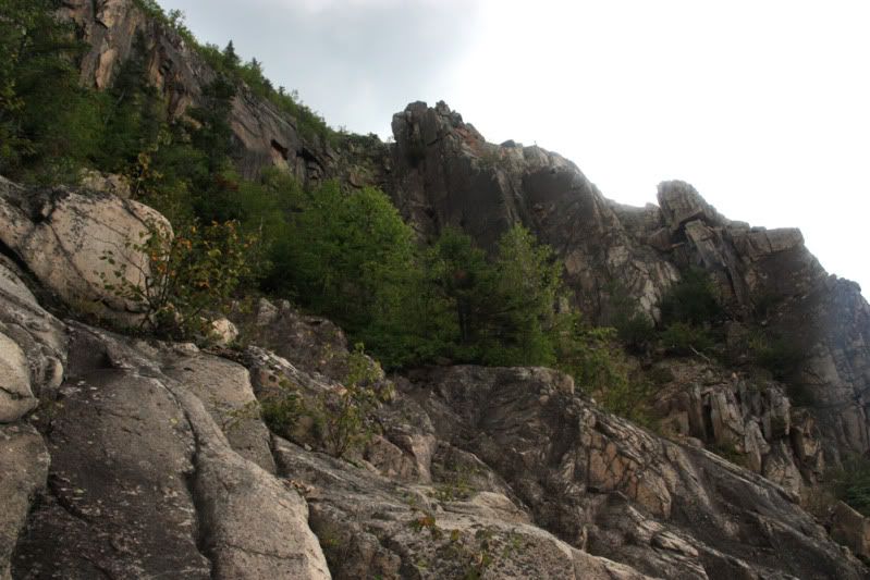
IMG_3700aaa.jpg


IMG_3705aaa.jpg


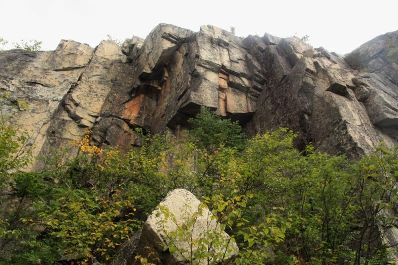
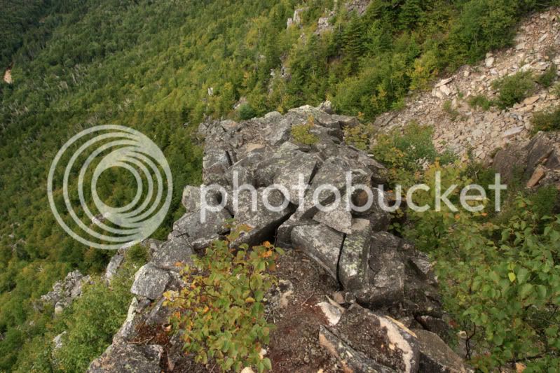
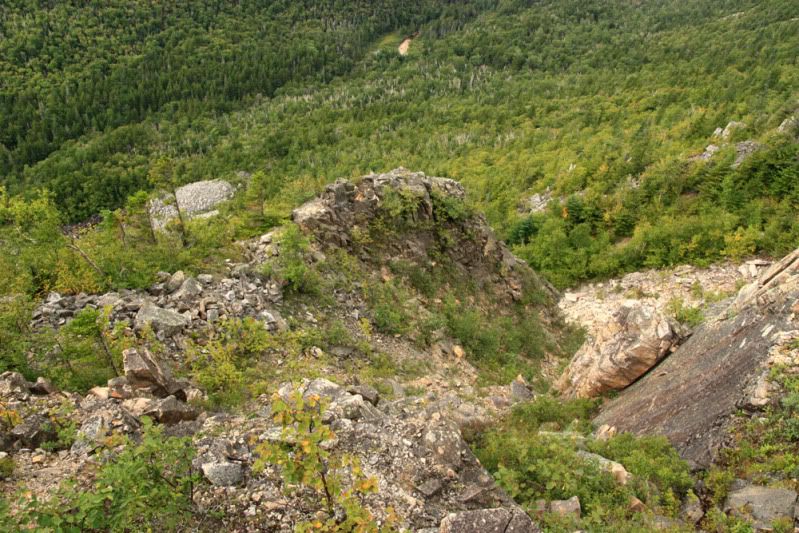
Near the top I decided to take a different route than I did last time I hiked here. I went up a little gully that lead south, toward the summit. Then I decided to climb the western wall of this little gully and follow that up. I kept climbing it as it became a bit scary, too lazy to turn back and try another way. As I climbed it became more narrow and there are cracks everywhere. It was a long drop to each side and there are way too many cracks in the rock...not my kind of thrill but it was exhilerating after I made it alive...

Here's a look down from the top of it...
IMG_3710aaa.jpg


and here's a look from a bit higher above it...
IMG_3712aaa.jpg


near the top...

IMG_3707aaa.jpg


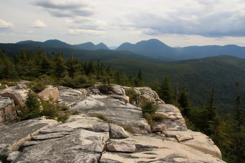
nice views fom the broad summit...

IMG_3724aaa.jpg


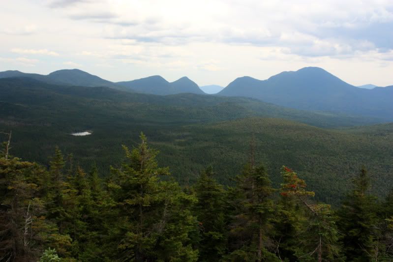
Shoal Pond and Carrigain Notch...

IMG_3732aaa.jpg


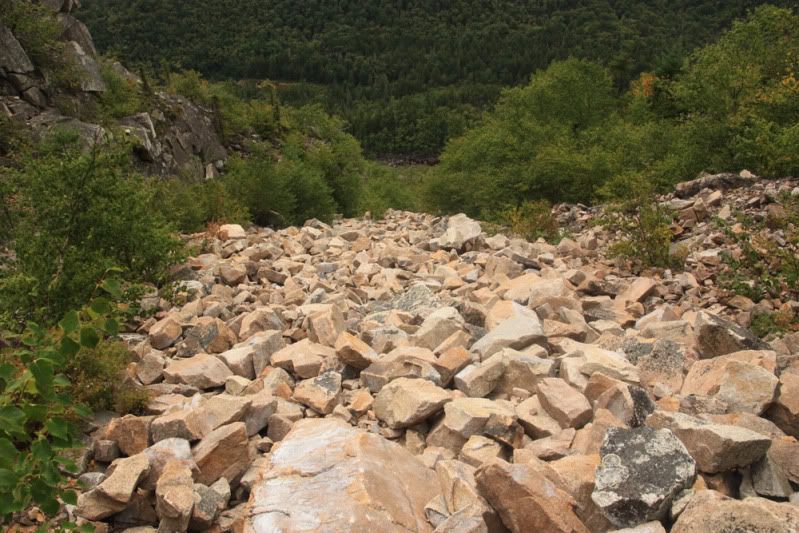
after a very long summit nap, coming down the slides...
IMG_3739aaa.jpg


Zealand Trail...

IMG_3744aaa.jpg


happy trails
 
Last edited:
Nice one Patrick!
Whitewall is a terrific place that would be a very popular destination if there was a trail leading to it . . . but I'm glad it doesn't!;):)

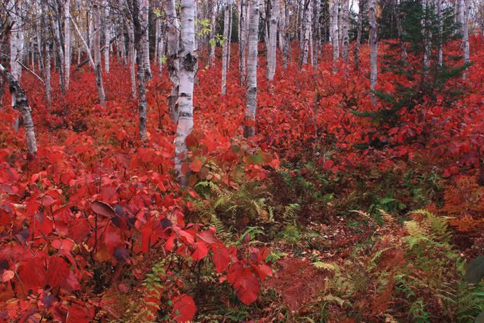
The next time you go to Whitewall (and we all return there eventually!), you might want to consider launching a bushwhack from an area just a bit west of the junction of the Ethan Pond Trail/Thoreau Falls Trail, and then ascending the east side of the mountain. There are some beautiful birch glades using that plan of attack!
 
YOu are moving to Utah?? Aww man, hopefully there are moose out there!! There might be some in the mtns east of Salt Lake City, right?

Anyways, excellent report, looks like quite an adventure too, climbing up that nasty rock area. You are very much a thrill seeker, thats for sure.


Best of luck with your move west. Keep posting!

grouseking
 
LarryD and I hiked along there a couple of weeks ago and looked up the slide and said no freakin' way! Very cool shots...I have thought of trying to get in their by taking a heading off the A-Z...anyone done that.
Great pics as always...will miss your WMNF stuff, but look forward to Utah pics - please continue to share them!!
Best wishes on your move -
 
The next time you go to Whitewall (and we all return there eventually!), you might want to consider launching a bushwhack from an area just a bit west of the junction of the Ethan Pond Trail/Thoreau Falls Trail, and then ascending the east side of the mountain. There are some beautiful birch glades using that plan of attack!
I used a similar route back in 1978, and again on Saturday during the free parking - came up onto the view ledges from the SE. The true summit is 1/4 mi NE and in evergreens however you arrive.
 
I have thought of trying to get in their by taking a heading off the A-Z...anyone done that.

Many people. I've descended that way. That whole slope is birch glades - mostly easy walking, with some spots where the hobblebush is man-high and thick enough to remind you why they call it "bushwhacking" but not too bad. From near the western end of the A-Z you don't need to take a precise heading, just stay to the west and use the cliffs (or the spruce near the cliffs) as a handrail. Next time I may look for the disused southern end of FR192 and use that as a shortcut toward the little pond northeast of the summit.
 
Last edited:
The beauty of Utah is when you land in SLC, within 30 minutes in your rental car, you are in the mountains....Like Seattle in Nw... Good country but different from whites...The ski resorts dominate the area...Funny drinking rules in cty too...
 
Next time I may look for the disused southern end of FR192 and use that as a shortcut toward the little pond northeast of the summit.

That has been reported to be very muddy which is why I didn't go that way.

On my hike Saturday, I started down the NNW ridge but descended W to the Ethan Pond Trail about .3 mi S of the Twinway. Steep and scrubby with some rocks but not scary.
 
Thanks so much for nice comments! I'll be sure to post TRs of hikes in Utah.

Yes, last autumn I hiked down the northern slope and I'll definately be back for one of my last hikes. This is a very beautiful area...

zealand099.jpg


happy trails :)
 
Last edited:
just stay to the west and use the cliffs (or the spruce near the cliffs) as a handrail.

VERY good advice. My first time coming off from the summit area (the real summit, not the ledges) we pretty much headed North and eventually got into the drainage which was wet and muddy in many spots. The second time we came off the summit in a more West direction to pick up the edge of the ridge to get down (but after a short distance I was overuled and the two people I was with decided they wanted to descend straight down to Ethan Pond trail....needless to say it was steep and frickin scary!) My whacking partner in crime wants to attack Whitewall from the East next time while hitting West Field in the process. I hear there are equally nice woods over near that side as long as you avoid getting to far South of the ledges and into more rocky walls that are (I hear) unclimable.

Brian
 
Great pictures!

Anyone know when the slide on Whitewall occurred?

We were on the Ethan Pond trail last week. Having seen Whitewall from Zeacliff the summer before, we finally got back to enjoy the view from the Ethan Pond Trail.
 
Rock Slide on Whitewall

Anyone know when the slide on Whitewall occurred?

We were on the Ethan Pond trail last week. Having seen Whitewall from Zeacliff the summer before, we finally got back to enjoy the view from the Ethan Pond Trail.

IMHO That slide is in continual process of sliding. We went up that slide few years ago and I made it my policy to stay off the main stream of rocks in that chute. We all steered to right or left of the main chute since the rocks in the chute felt like they might let go at any time. At times we had to cross the chute to get to one side or the other and it always felt like one of us might be thed cause of the next rock slide. One of FG's photos of the knife edge shows very well how ledges are in constant process of fracturing and droping down to the chute. I'm sure the chute lets fo every year or so. One of my rules of thumb (not that I'm in any way a big slide climber) was to travel only on the rocks that had lichens on them. That indicated to me they had been in place long enough to build up lichens.
 
Anyone know when the slide on Whitewall occurred?
It is more of a wide face of loose rock and rubble rather than a single slide. The notch is U-shaped indicating that it is glacial in origin. Thus the current face is probably the product of many small slides since the end of the last glacial period (nominally ~12500 years ago).

Doug
 
Top