Why the clear-cutting on I-93?

vftt.org

Help Support vftt.org:

This site may earn a commission from merchant affiliate links, including eBay, Amazon, and others.

B the Hiker

Well-known member
VFTT Supporter
Joined
Jan 31, 2008
Messages
1,225
Reaction score
173
Location
Middletown, CT
Hi all,

There are spots on I-93 in NH in between the northbound and southbound lanes where crews have clearcut absolutely everything. Numerous spots. But then again, there are more spots where they have not.

Does anyone know why they have been clearcutting those particular spots?


Brian
 
Safety issues often trump ecological concerns when it comes to roadside management. They did some similar cutting in New York a while back when it was determined that trees were growing too close to the road for a driver to have enough time to correct themselves and slow/stop before slamming into one of them.

On another note, scientifically, it's only a clearcut if the area of removed trees is at least twice as wide as the trees are tall. "Clearcut" is one of those words that tends to get thrown around a lot without any knowledge about what a clearcut actually is.
 
Okay, that was all good as far as it went. If the reason is because some trees were quite big and too close to the road, I don't understand why absolutely everything in the area was cut down, even the small trees.

I must have missed something.
 
Traffic engineers have equations that they use to determine how much clearance there needs to be on the side of the road, based on the type of road and the speed limit. Even though reaction time is a constant, the higher the speed limit, the farther someone will travel if they leave the road before being able to correct and stop themselves, because they will have traveled farther during that time it takes to react.

Because interstates have the highest speed limits, they need the greatest amount of cleared space on either side of the road.

Note that I live in New York and haven't seen the affected area to which you are referring to- could you give an approximation as to how wide the spot is?

The other thought that comes to mind, although probably not likely, is that maybe they were attempting to control an invasive species that was found in the area.
 
...Note that I live in New York and haven't seen the affected area to which you are referring to- could you give an approximation as to how wide the spot is?

In some cases, they have cleared the entire median (an area, in places, at least 50 yards wide). In others, they have cut back a good twenty yards beyond the previous clearance. In other places still, they haven't cut much or at all.

I think your 'highway engineering clearances' theory has a lot of merit, but doesn't necessarily explain the extent of cutting in some places, the inconsistency in others, and frankly, the location of still others -- they've cleared sharp hillsides over deep gullies (with heavy Armco guardrails all along) that aren't going to help anyone who busts through the guardrail.

I drive 93 at least a few times a week, and I have been wondering at this activity all spring. You're probably right, though, and I am probably overthinking it.
 
Here's some more information about clear zones:

http://www.fhwa.dot.gov/programadmin/clearzone.cfm

It looks like there are other factors other than just speed that are also used to determine the necessary clear zone:

Federal Highway Administration said:
The desired minimum width is dependent upon traffic volumes and speeds and on the roadside geometry.

Remember too that they have to clear for both directions of travel- so you'd have to take the minimum necessary width of a clear zone and double it to find out how much vegetation you need to remove from the median.

It's also likely that they decided to just remove it all rather than try to figure out the minimum width... unfortunate if true.

The same was true of the median clearing when it was done in New York. It seemed liked they cleared some areas but not others, and were inconsistent. Although, now that I think about it, most of the areas that were cleared were close to Albany, where the traffic volume is higher. As volume is one of the factors used in determining minimum width for clear zones, perhaps they weren't so inconsistent at all.

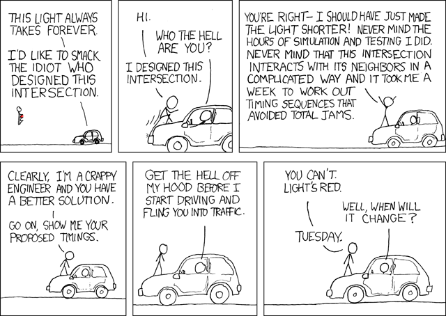
I close with this informative cartoon which, while dealing with traffic lights and not clear zones, I think sums up the situation concerning road design quite nicely:

long_light.png
 
Last edited:
I'm not sure AASHTO sightlines account for wildlife. This could be an effort to clear certain areas known for moose crossing the road, to make them more visible before they reach the pavement. Maybe?
 
In some cases, they have cleared the entire median (an area, in places, at least 50 yards wide). In others, they have cut back a good twenty yards beyond the previous clearance. In other places still, they haven't cut much or at all.

If it were up to me, that's how everything, everywhere would be cut. It creates better mixed habitat for many species that have lost there's to grazing deer and mature forest.
 
Just to make sure, you're not talking about south of Manchester where they're rebuilding from scratch, right?
 
If it weren't for the fact they just did all the bridge work and repaving, I'd suspect these are areas where they're planning to establish crossovers to put all traffic on one side while replacing the other side.
 
Top