Wow - Black Pond "Bushwhack"

vftt.org

Help Support vftt.org:

This site may earn a commission from merchant affiliate links, including eBay, Amazon, and others.
Yeah, it's the slide that's the bushwhack if you follow maintained trails to the start. It's easier to follow than some actual maintained trails. For those who haven't done it, it's not really one to brag about your "route finding skills" after finishing. Pretty straight forward.

It’s not the slide but rather the entire route - while it looks like a trail there is no official trai even beyond the slide. I remember the first time we did it was right when the “new” summit was identified and it was a true whack from old to new. Now it’s a trail.

It has to do with the Wilderness Protection Plan and the zone in which Owls Head is located. I don’t have the link handy but there are certain rules for straying off a defined path where there is a WPP and getting to Owls Head violates those rules regarding distance from the trail and how you need to travel within a particular zone.
 
I remember three groups wanting to get to Owlie in Winter. All three leaders had agreed to staggered start times, and the plan was that when each later group caught up, they'd would take over trail breaking. Well, it ended up that all three groups (24-ish people) all came together at the bowl on the skidder road. We tried, at least, but nobody volunteered to sit around and get cold ...

Tim
 
Map shows the location of Mega(anti search text)lithia. Interesting. Not sure how I feel about that. The resource will be useful for me, that is for sure.

That's the most interesting thing to me in this thread...these Strava maps show all sorts of bootleg trails and several so-called secrets on Monadnock. But they're not labelled as far as I can see...you have to already know what these bootleg heat spots are, although if you know the general area of some of these spots, these maps could provide the final clues.

P.S. The biggest so-called secret on Monadnock (mentioned earlier here) is visible on Google Earth anyways; if you know the general area you can see it.
 
If you're an AMC leader, check in with your chapter if you're planning on leading Owl's Head...if you're not, and carry a guide card, presumably you've heard from the WMNF regarding your obligations. If you don't carry a guide card, either you don't need one and shouldn't worry, or you do need one, and have other worries.

The 4000-footer committee publishes a list of their criteria and "AMC allowed to lead organized trips to the summit" isn't one that I've seen on the list. Redington, surprisingly enough, is not affected by WMNF policies regarding organized off-trail trips in Wilderness, being neither in the WMNF, nor in designated Wilderness, nor on Forest Service property.

This is a non-issue for most people.
 
The Strava map links worked for a few days but all I get now is blank page
 
Strange, now it works.

Nice to see a few tracks up to Red Rock Pond. Also nice to see the Mahoosuc Notch bushwhack to Bull Branch road as well as the Sunday River Whitecap represented.
 
Strange, now it works.

Nice to see a few tracks up to Red Rock Pond. Also nice to see the Mahoosuc Notch bushwhack to Bull Branch road as well as the Sunday River Whitecap represented.

I try to make it up to Bear Pond several times a year.
 
So is the population of Strava users distributed similarly nto that of the general hiking population? I.E., are these maps representative, or are Strava users more exploratory/adventurous? I only know a few people who use Strava, but they are all above average for sure.
 
You can edit OSM using the Strava Slide editor and leverage the tons of tracks you see in the Strava Heatmap. I'm the KMR31 editor on OSM and I used the 2015 heatmap and Strava Slide to put in Brutus and BPB
See: https://labs.strava.com/slide/

Common bushwhack routes or hurd paths are fine in OSM. Having some data is better than nothing at all IMO. However bushwhacks and hurd paths should have the "visibility" tag set to bad, if not worse. See: http://wiki.openstreetmap.org/wiki/Key:trail_visibility

The hurd paths can then be rendered to look different from how trails look using visibility. My hope is to leverage OSM and mapbox to add a new crowd sourced and updateable trail map layer to TrailsNH. Something that looks like this:
bpb.png


Some route planning tools do not follow the visibility tag so it seems like a good practice for now to not connect hard to follow paths to the trail network.
 
You can edit OSM using the Strava Slide editor and leverage the tons of tracks you see in the Strava Heatmap. I'm the KMR31 editor on OSM and I used the 2015 heatmap and Strava Slide to put in Brutus and BPB
See: https://labs.strava.com/slide/
I took this slide tool for a spin (using the demo link) and I must say that I am really impressed! It makes marking trail locations really trivial. I guess you still have to verify that the trail is there (e.g. I see Strava has traces for both old & new location for AT approaching Bear Mountain) but the job is much easier with the extra help from auto-aligner.
 
You can edit OSM using the Strava Slide editor and leverage the tons of tracks you see in the Strava Heatmap.
It creates a crapton of unnecessary points. For a trail that I manually defined with 7 points, identifying all major inflections, Slide used 30 points, nearly 4 times the data.

I've seen ways in OSM that were obviously traced from a single GPS track and defined using a bajillion points because the map-editor identified every single inflection (including obvious GPS cruft). Slide isn't nearly in this category of madness but it needs a "sensitivity adjustment" to avoid creating bloated ways.

Common bushwhack routes or hurd paths are fine in OSM. Having some data is better than nothing at all IMO.
That's fodder for a long and passionate discussion about mapping's role in wilderness ethics. Basically who decides what should be revealed on a map and is it always a good thing?

By explicitly identifying off-trail/bushwhack route on a map, you're effectively marketing it. What was once a navigational challenge is now exposed to a broad audience ... and will funnel more traffic to it. Effectively, you're taking some responsibility for the environmental impact.

It's a double-edged sword. If the goal is to reduce the impact of braided paths, then publishing a primary route may be a good thing. It may help to consolidate traffic to a narrower corridor. However, who makes this call? The land managers or the OSM map-editor?

In contrast, if a destination is to remain a challenge to one's navigational skills, then leaving it unmapped is preferable. Otherwise, the map becomes the digital equivalent of a flagged route ("dumbed down" with orange tape).

Acquiring someone else's GPS track, for the purpose of navigating to a remote location, involves a measure of intent and effort. In contrast, a map is a bulletin board that announces obscure routes to everyone. OpenStreetMap is the default "free map" on most backcountry navigation apps so a wide audience is almost guaranteed.


Some route planning tools do not follow the visibility tag so it seems like a good practice for now to not connect hard to follow paths to the trail network.
In an earlier post I had postulated this was the reason. I think you're fooling yourself into believing this dissuades people from exploring mapped bushwhack routes. Whether a routing engine can route (like BRouter) or can not route (like Graphhopper) along a "bad visibility" trail is moot. The entire bushwhack route is displayed for all to see on the map, plain as day, and that'll draw hikers to it.
 
Last edited:
I wonder how the folks who were so up in arms about the Trail Bandit Ossipee Mountain Range map feel about the Strava Heatmap? Many of the contentious trails are quite obvious on Strava, which is much more publicly accessible.

It's also a little dismaying to see bike tracks in the Sandwich Range Wilderness Area. But perhaps that's Strava users incorrectly tagging their activities. I've never actually encountered a bike (or see tire tread marks) while hiking there. I just hope the Strava map doesn't give people the idea it's a bikeable area.

That being said, I love exploring the Heatmap! I've used it to plan (road) bike routes, and new areas to hike.

People definitely ride in the Sandwich Range. I've come across tracks all around Flat Mtn Pond.

FB_IMG_1510340286868.jpg
 
Last edited:
People definitely ride in the Sandwich Range. I've come across tracks all around Flat Mtn Pond.

View attachment 5900

The Wilderness Boundry follows the Flat Mtn Pond Trail for a while, so bike use is allowed (at least to the Shelter). It's a snowmobile route in winter (all the way down to the Guinea Pond Trail and continuing through Sandwich Notch).
 
The Wilderness Boundry follows the Flat Mtn Pond Trail for a while, so bike use is allowed (at least to the Shelter). It's a snowmobile route in winter (all the way down to the Guinea Pond Trail and continuing through Sandwich Notch).

The boundary ends at the shelter. The trail around the pond is Wilderness. This was (as stated) around the pond.
 
The boundary ends at the shelter. The trail around the pond is Wilderness. This was (as stated) around the pond.

Ahh, I misinterpreted 'around' to be less litteral (which is surprising if you knew me!). :)
 
Well that's lots of fun! Thanks.

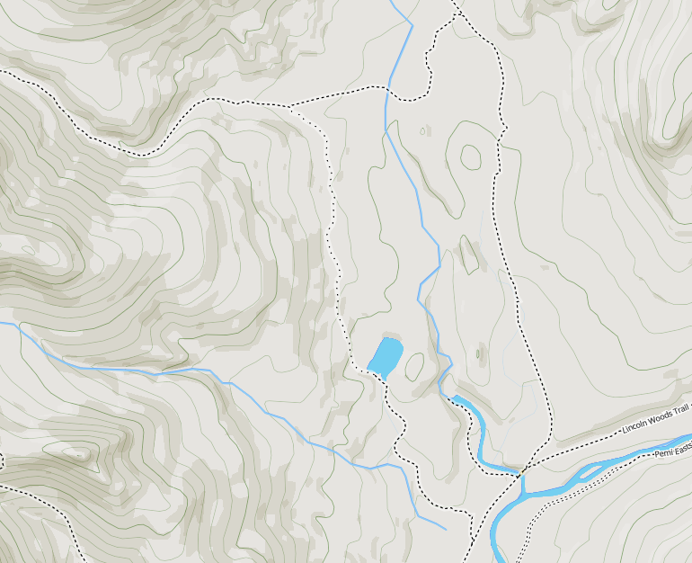
Any idea how, other than becoming a participant or developer, error info can be fed back on a non-technical level? Like writing somebody an email? For example, the Lincoln Brook Trail north of the Owl's Head slide trailhead is labelled "Owl's Head Path".

Apparently there's no easy way for a casual user to work backward from the raster to a lat/longitude point? I suppose, brute force, you could grab a section of the map and paste into an application (like say MacGPSPro) then identify a few known points and calibrate the section based on those; then you could find the lat/long for any other points on that section. I guess a bit of research would be required to determine the projection details, or trial and error against another sample set of points.

I can see this turning into a time consuming toy; just what I need!
 
Any idea how, other than becoming a participant or developer, error info can be fed back on a non-technical level? Like writing somebody an email? For example, the Lincoln Brook Trail north of the Owl's Head slide trailhead is labelled "Owl's Head Path".
I fixed the name for Lincoln Brook Trail and set up a trail "relation" for it, so that it properly shows up on Web sites / in apps that know how to display trails, e.g. https://hiking.waymarkedtrails.org/#route?id=7725349&map=14!44.1413!-71.5984

If you don't want to become an OpenStreetMap editor you can simply drop a note from OSM main page - check out the icons in the top right corner http://www.openstreetmap.org/#map=16/44.1614/-71.5903&layers=N - one of them is "Add a note to the map."

Now that I am starring at Strava heat map for over a week I see a lot of misaligned trails, especially in Northern Persis, so I can see a lot work ahead for mapping enthusiasts that will result in really accurate and beautiful map! I guess I am not the only one who decided to improve the map - I see that someone just added missing part of Pine Link for which I did not have any traces before and the map is just looking better and better!
 

Latest posts

Top