West, East, and North of the North Fork!

vftt.org

Help Support vftt.org:

This site may earn a commission from merchant affiliate links, including eBay, Amazon, and others.

Becca M

Active member
Joined
Jan 31, 2008
Messages
854
Reaction score
103
Location
Pelham & Bristol, NH
11/19/11 - a beautiful day to explore and revisit gems of the past!!! Itinerary was exploring the North Fork of the Pemi River, Thoreau Falls Trail, and Thoreau Falls. I alternated between trailrunning and bushwhacking.

First of all, as USUAL, I biked to *near* the Wilderness boundary on the Pemi East Side Trail. I wonder if the culvert will ever be repaired? There are some nasty washouts that made mtn biking difficult!!!

After the Wilderness Boundary, I hit what I call the, "Canal Zone"... see for yourself. The pic is out of focus, but, you get the idea. BTW, I was using a small point-and-shoot, so, the picture quality was EH.

Canal Zone on the East Pemi Trail:
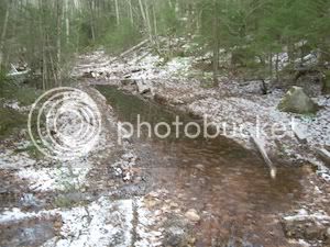
DSCN2145-shrunk-canal.jpg


Next, I headed up past the Cedar Brook Junction and came to this washout:
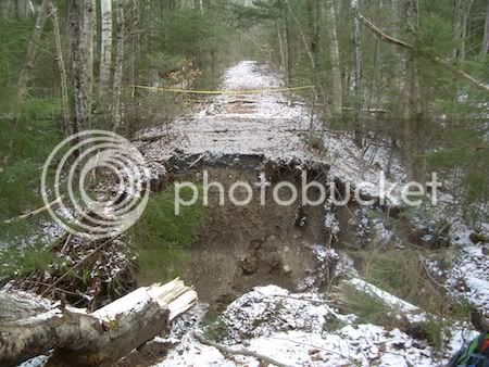
DSCN2093-shrunk-washoutcedarbrk.jpg


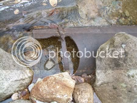
At the river crossing near the location formerly known as the "suspension bridge," I always wondered about this pipe. It's maybe a foot in diameter and originates in a rockpile about 100' upstream... some kind of water filling station for the steam engines?
DSCN2094-shrunk-pipeoncedarbrk.jpg


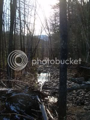
After the rickety bridge at the base of the Thoreau Falls Trail, I cut into the woods west and eventually found a crossing (albeit dicey) across the North Fork at the junction with the Pemi. Heading north, I found some fun stuff, but, at times the area was pretty soggy:
DSCN2113-shrunk-bushwhackonnorthfork.jpg


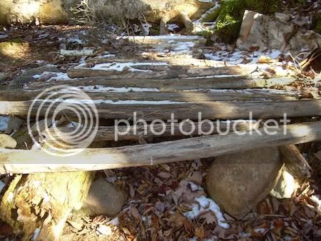
Continuing northward I found interesting rock formations in the North Fork and this odd structure. It isn't a corduroy road since it doesn't go anywhere. But, what is it?
DSCN2120-shrunk-corduroyonbushwhack.jpg


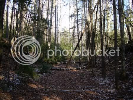
I eventually joined the old Thoreau Falls Trail on the west side of the North Fork. It was VERY peaceful:
DSCN2122-shrunk-oldtfttrail.jpg


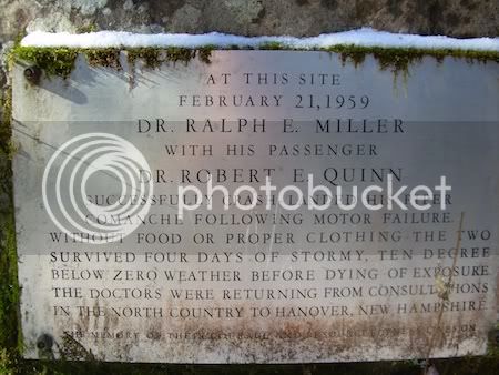
Towards Jumping Brook I found the low-to-ground plaque to the downed plane crew - very sad! I felt a little somber!!!
DSCN2123-shrunk-millersignmarker.jpg


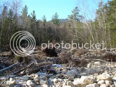
Near Jumping Brook (LOVE THAT NAME) was a huge debris field that looked like an avalanche area... I am guessing Irene did it!!!! WOW!!!
DSCN2127-irenedamagenearjumpingbrook.jpg


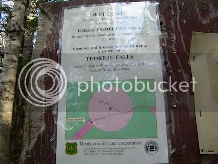
Finding my way BACK across the North Fork, I continued on up to Thoreau Falls... OH THE MEMORIES of last February when Doug Paul and I skied to Thoreau Falls from Lincoln Woods. It was horribly cold and dark; we were under headlamp much of the time.... I felt such joy when my headlamp FINALLY lit up the 1/4 mi to Thoreau Falls sign - it seemed to glow in the dark, but, I was semi-delirious!!!! It was a welcome sight again!!!! Things look much saner in daylight! It was awesome to be on the Thoreau Falls Trail again!!!!
DSCN2128-shrunk-tfallssign.jpg


On the jog out I explored the south side of the RR crossing near the Thoreau Falls Trail bridge and found this campsite at the crossings. The sandy beach looked AWESOME filled with all kind of hoof impressions, both large and small. I added my footprints to the mix. :)
DSCN2144-shrunk-riverxing.jpg


The last mile I had the pleasure of walking out with J&J - the only souls I saw all day - an EXCELLENT day!!! :)
 
East Side Trail. I wonder if the culvert will ever be repaired? There are some nasty washouts that made mtn biking difficult!!!
FWIW I've been told by Rangers at the LW station that it will be a very long time, if ever.
At the river crossing near the location formerly known as the "suspension bridge," I always wondered about this pipe. It's maybe a foot in diameter and originates in a rockpile about 100' upstream... some kind of water filling station for the steam engines?
There are also, if I'm remembering correctly, some scattered old red bricks in the same area.
On the jog out I explored the south side of the RR crossing near the Thoreau Falls Trail bridge and found this campsite at the crossings. The sandy beach looked AWESOME filled with all kind of hoof impressions, both large and small. I added my footprints to the mix.
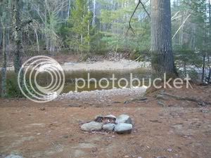
That is very near the place where one of our party described the crossing as requiring some "swimming"! There is another interesting spot on the shore about a hundred yards to the right of your picture.

Nice area. Thanks for the pictures. I hadn't been there for a long time until a couple of trips recently and you used exactly the right word: "peaceful."
 
Will, thanks for the infol!!!!

Quote: "There are also, if I'm remembering correctly, some scattered old red bricks in the same area."

YES - I saw those, too!!! So odd!!!
 
Becca, great trip report. That is my favorite kind of trip report...a tale of a trek to a seldom visited place with just the right mix of trail conditions, where you explored, what you found, questions about what you saw, plus some photos to bring it even more to life. Excellent.

Now go hiking and write another one.

You said "...the picture quality was EH..."
What does that mean?
 
Hi Becca,

I agree with Billy...these are definitely my favorite kinds of reports to read. I think it's great that you notice these little traces of a previous generation in the woods, like the pipe and the bricks.

Do you think it's possible that the odd structure is possibly a very old tent platform?

Also, that plaque is very cool but certainly humbling. Was this on a trail or off the beaten path? I've visited the B18 crash site on Waternomee a while back, which was definitely humbling too. I think I may resurrect those pictures and write an "old" trip report on it to share.

Thanks for posting. Great trek!
Karl
 
Becca,
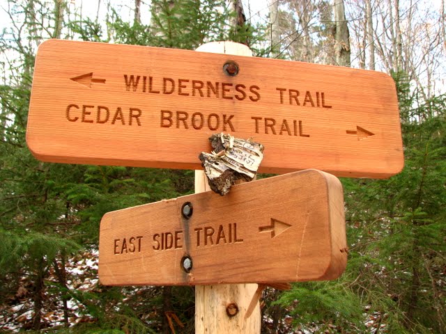
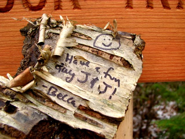
We loved your totally illegal sign posted in a Wilderness area. :eek::D
J&J

IMG_0179.JPG


IMG_0180.JPG
 
Hi Becca,

Do you think it's possible that the odd structure is possibly a very old tent platform?

Also, that plaque is very cool but certainly humbling. Was this on a trail or off the beaten path? I've visited the B18 crash site on Waternomee a while back, which was definitely humbling too. I think I may resurrect those pictures and write an "old" trip report on it to share.

Thanks for posting. Great trek!
Karl
Thanks guys!!! Yeah, that odd structure was about the size of a tent platform, and it was just south of the south end of the old Thoreau Falls trail (on the west side of the North Fork). BUT, it looked pretty uncomfortable!!! Even if they covered it in pine boughs and dirt, I would rather sleep on the ground, personally! :eek:

That plaque was VERY humbling for me, too.... just to stand there and read it in the wilderness - kind of horrifying when I think that they *survived* a plane crash only to die of exposure days later when there was a ranger cabin around a half mile away, I believe..... sometimes I think *I* have a bad day or two, but, imagine THAT situation!!!!
:eek:

OH, the plaque was off the beaten track, but, still very visible. The current (reroute) of the Thoreau Falls Trail never crosses the North Fork. This is on the old railbed which *was* on the west side of the North Fork. I can give more specific directions if anyone wants them: email me at [email protected].
 
Last edited:
Becca,
We loved your totally illegal sign posted in a Wilderness area. :eek::D
J&J

That picture is TOO funny!!!! Oh, the evidence-- may *they* never catch me,,,,
ummmmm, I *love* my Sharpie ;)

I thought the handwriting was rough enough to meet "W"ilderness standards :eek:
 
Last edited:
It's maybe a foot in diameter and originates in a rockpile about 100' upstream... some kind of water filling station for the steam engines?
DSCN2094-shrunk-pipeoncedarbrk.jpg


It isn't a corduroy road since it doesn't go anywhere. But, what is it?
DSCN2120-shrunk-corduroyonbushwhack.jpg
From the bricks, the pipe may have been at an old logging camp and supplied wash and drinking water.

Who says the road might not have gone somewhere once? I found an unconnected trestle on Mill Mtn in Stark.
 
Finding my way BACK across the North Fork, I continued on up to Thoreau Falls... OH THE MEMORIES of last February when Doug Paul and I skied to Thoreau Falls from Lincoln Woods. It was horribly cold and dark; we were under headlamp much of the time.... I felt such joy when my headlamp FINALLY lit up the 1/4 mi to Thoreau Falls sign - it seemed to glow in the dark, but, I was semi-delirious!!!! It was a welcome sight again!!!! Things look much saner in daylight! It was awesome to be on the Thoreau Falls Trail again!!!! [/IMG]
I hope it took you a little less time to find the river crossing (above the falls) in all that decadent sunlight than it took us in the dark... :)


(For those who didn't "happen" to be there back in February, we searched around for ~1 hr in the dark using dead reckoning, track following, and M&C before we finally "cheated" with the GPS to find it. We had been within ~50 ft of the ramp down to the crossing--just had to go through that unlikely looking thicket... The woods were mostly too open to show a good trail corridor with ~4ft of snow on the ground.)

Doug
 
Last edited:
Nice TR!!! The pics of the washout on the trail and the debris near the Jumping Brook are awesome...nice captures of nature :)
 
wow! what a great adventure! you really saw alot of Irene damage out there -- that washout is impressive!
The Pine Island Loop off the East Side trail in that area is pretty much gone.
 
From the bricks, the pipe may have been at an old logging camp and supplied wash and drinking water.

Who says the road might not have gone somewhere once? I found an unconnected trestle on Mill Mtn in Stark.

RE: the pipe and bricks-- YES, there was a camp in that general area (inside the turn, but, I don't have my map with me), but, it didn't look promising going downstream - very rough and no further pipe. I will be going back to look around again :)

RE: the parallel log structure--
I just had the *feeling* that the log placement wasn't for a road. It was kind of higher on a knoll. I did find and follow a skidder path to the river at one point, tho. Corduroy roads that I've seen have had fairly obvious stringer logs in the direction of travel and crossed streams or bogs. This structure was perched on some rounded rocks over a very dry area.... seemed more like a platform (albeit bumpy!!!) of some type. At first I thought some campers may have made it recently, but then I looked closely at the decay and moss and decided it was fairly old. I didn't take note of how the edges were cut... D'OH!
 
RE: the pipe and bricks-- YES, there was a camp in that general area (inside the turn, but, I don't have my map with me), but, it didn't look promising going downstream - very rough and no further pipe. I will be going back to look around again :)
Just a wild guess:

Might it have been a drainage pipe to route a spring (etc) around a building, road, etc?

Doug
 
Like you said Becca, corduroy would be used in a muddy area. Also the pieces of wood used would be strong enough to support a draft horse pulling a load if they were laying in the mud. Where the large log on the left supports it and leaves a void underneath does not look like corduroy and a horse would break through or spread it out. Sometimes a few pieces of wood may have been thrown down to help the load swing around a corner but it would not look like this. If it was a platform to bed down on it would take a few hides to make it comfortable! ;)
 
If the frame was a building foundation, there could have been a board floor and walls long since rotted away but there should be nails sticking up

If it was a road, remember that most logging was done in winter so they could have piled brush over the frame, packed it with snow, and sprayed water to freeze - I have seen movies of a steam log tractor pulling a line of log sledges like a railroad train, on a twisty haul road with the runners in frozen ruts acting like railroad rails

all right, all right, so many questions!!!! I will have to go back!!!! YAY!!!! :D
 
Top