I am getting old and my memory is going south, but ...
I am almost certain that some time ago (maybe a couple of years ago) while looking at Google Earth with the Wikiloc layer turned on I saw a trace of a trail from the end of Cook Hill Road to Bald Mountain (elev. 2,200+ feet). No trace of it on Wikiloc today
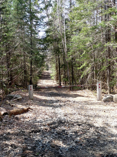
Yesterday I walked from Rt 49 to the end of that road. There is a wide track that continues, and is gated (no "No Trespassing" signs).

So I wonder whether that road leads ultimately to Bald Mountain.
Anyone know anything more?
I am almost certain that some time ago (maybe a couple of years ago) while looking at Google Earth with the Wikiloc layer turned on I saw a trace of a trail from the end of Cook Hill Road to Bald Mountain (elev. 2,200+ feet). No trace of it on Wikiloc today
Yesterday I walked from Rt 49 to the end of that road. There is a wide track that continues, and is gated (no "No Trespassing" signs).

So I wonder whether that road leads ultimately to Bald Mountain.
Anyone know anything more?
Last edited:
