grouseking
Well-known member
I've been wanting to start a thread like this for awhile....
Wax the cross country skis, and get out the snowshoes.
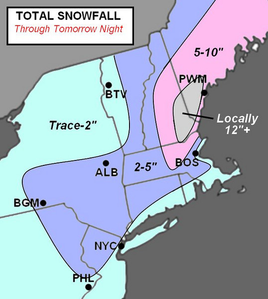
It is looking more and more like a significant snowfall is coming to central and northern New England beginning Tuesday morning. Most of the computer models are tracking a low pressure along the south coast of New England and then sending it up into the Gulf of Maine. That bodes well for central and Northern New England if you want snow, and it will put a dent into the snow drought many have been seeing. It is a little early to predict actual amounts, but the maximum precip will probably be winter storm warning criteria, meaning 6 inches or more.
Southern New England will probably be dealing with milder temps and a dry slot, so accumulations will most likely be less there, under 6 inches. I'll have more updates whenit gets closer to snow time. Who knows, I might even try to slap together an accumulation map, since I have nothing else better to do.

