1HappyHiker
Well-known member
My original plan for this day was to take advantage of the new snow and do some XC-skiing before this season for this sport comes to a close. I did a few test runs on un-groomed surfaces at various locations around the Bethlehem area and wasn't overly impressed with the quality of skiing provided by the heavy moisture-laden snow. So, it was time to press forward with my Plan B!
One of my adopted trails is the Martha's Mile Trail up on Cherry Mountain. Although it's named "Martha's Mile", the WMG lists it as 0.8 mile. Regardless, there have been reports over the past several weeks indicating that Martha's Mile is un-broken. And as a result, folks who hike up the Cherry Mountain Trail have opted not to travel on over to Owl's Head.
The "Plan B" that I mentioned earlier was to hike up to Mt. Martha and break out Martha's Mile. Although there was a report that the Cherry Mountain Trail had been hiked as recently as Sunday (28-Feb), we've received a few inches of snow since then. So, there was some trail breaking involved just to get to Mt. Martha alone, but nothing overly taxing.
Upon arriving at the Mt. Martha summit, I snapped a few photos. The views were not overly spectacular on this partially overcast day. But that was OK since photography wasn't the primary goal for this mission.
After a brief break, I began the task of breaking out Martha's Mile. Almost from the "get-go" I encountered a moderate size blow-down which I removed. Then, a few steps further and I encountered a wall of "bend-overs". Most of you know exactly what I mean! These are trees (primarily conifers) that have been bent over by the weight of heavy, highly compacted snow & ice. Sometimes they are so encased that even repeated whacking with a trekking pole (or whatever) fails to do much good.
Now please remember, I'm the Trail Adopter and have a fairly good idea of where the trail is supposed to be. But even with this knowledge, it took a few false starts before I finally found the trail. Once I determined the location of the trail, then I had to whack & hack my way through the armor-clad trees for about 25 feet or so. After that, the trail became more obvious.
After having encountered the blow-down at the beginning of the trail, and then very quickly encountering the wall of "bend-overs", I can certainly understand why no one has recently ventured onto Martha's Mile! I'll need to do some work up there this summer to try to make that end of the trail more "winter-friendly".
The snow was deep along the entire corridor for Martha's Mile. By probing with my trekking pole, my best guesstimate is that it's nearly 3 ft deep. Breaking trail was a bit of a chore, and took more time than I had anticipated. And then, if you've ever been to Owl's Head, you know how steep it is on the final approach for that last 100 ft or so. With the deep snow and steep angle of ascent, it was extremely difficult to make any forward progress. I was sliding backward two steps for every step forward.
I was beginning to run low on energy, patience, and time. Eventually, I gave up trying to reach the summit via the trail, and opted to try a bushwhack approach that I've used in summer months. This approach is still steep, and the snow was still deep! However, I was able to at least work my way to a lower ledge near the summit. From there I could see that the cloud cover had thickened since leaving Mt. Martha and the views had further deteriorated. That was the final straw. I quit!
So, in conclusion, I can tell you that as of 02-March, Martha's Mile is broken out from Mt. Martha to within about a hundred feet of the Owl's Head summit. However, I must also tell you that there were sections of the trail where all my efforts were being spoiled by large chunks of snow falling from tree branches onto the trail and covering my tracks! But hopefully, there will be enough of my track left for anyone wishing to give Owl's Head a try within the next few days. Maybe there will be at least some dots to connect, whereas before, there was nothing!
1HappyHiker
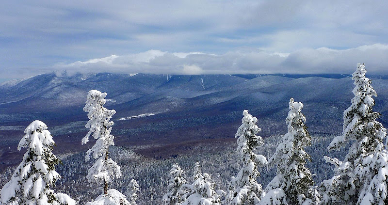
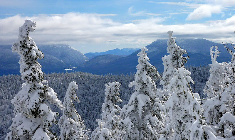
P.S. In the "for what it's worth" department, below are the only semi-worthwhile photos that I got on this particular trip.
Cloud-Covered Presidential Range

Zoomed Shot of Crawford Notch

One of my adopted trails is the Martha's Mile Trail up on Cherry Mountain. Although it's named "Martha's Mile", the WMG lists it as 0.8 mile. Regardless, there have been reports over the past several weeks indicating that Martha's Mile is un-broken. And as a result, folks who hike up the Cherry Mountain Trail have opted not to travel on over to Owl's Head.
The "Plan B" that I mentioned earlier was to hike up to Mt. Martha and break out Martha's Mile. Although there was a report that the Cherry Mountain Trail had been hiked as recently as Sunday (28-Feb), we've received a few inches of snow since then. So, there was some trail breaking involved just to get to Mt. Martha alone, but nothing overly taxing.
Upon arriving at the Mt. Martha summit, I snapped a few photos. The views were not overly spectacular on this partially overcast day. But that was OK since photography wasn't the primary goal for this mission.
After a brief break, I began the task of breaking out Martha's Mile. Almost from the "get-go" I encountered a moderate size blow-down which I removed. Then, a few steps further and I encountered a wall of "bend-overs". Most of you know exactly what I mean! These are trees (primarily conifers) that have been bent over by the weight of heavy, highly compacted snow & ice. Sometimes they are so encased that even repeated whacking with a trekking pole (or whatever) fails to do much good.
Now please remember, I'm the Trail Adopter and have a fairly good idea of where the trail is supposed to be. But even with this knowledge, it took a few false starts before I finally found the trail. Once I determined the location of the trail, then I had to whack & hack my way through the armor-clad trees for about 25 feet or so. After that, the trail became more obvious.
After having encountered the blow-down at the beginning of the trail, and then very quickly encountering the wall of "bend-overs", I can certainly understand why no one has recently ventured onto Martha's Mile! I'll need to do some work up there this summer to try to make that end of the trail more "winter-friendly".
The snow was deep along the entire corridor for Martha's Mile. By probing with my trekking pole, my best guesstimate is that it's nearly 3 ft deep. Breaking trail was a bit of a chore, and took more time than I had anticipated. And then, if you've ever been to Owl's Head, you know how steep it is on the final approach for that last 100 ft or so. With the deep snow and steep angle of ascent, it was extremely difficult to make any forward progress. I was sliding backward two steps for every step forward.
I was beginning to run low on energy, patience, and time. Eventually, I gave up trying to reach the summit via the trail, and opted to try a bushwhack approach that I've used in summer months. This approach is still steep, and the snow was still deep! However, I was able to at least work my way to a lower ledge near the summit. From there I could see that the cloud cover had thickened since leaving Mt. Martha and the views had further deteriorated. That was the final straw. I quit!
So, in conclusion, I can tell you that as of 02-March, Martha's Mile is broken out from Mt. Martha to within about a hundred feet of the Owl's Head summit. However, I must also tell you that there were sections of the trail where all my efforts were being spoiled by large chunks of snow falling from tree branches onto the trail and covering my tracks! But hopefully, there will be enough of my track left for anyone wishing to give Owl's Head a try within the next few days. Maybe there will be at least some dots to connect, whereas before, there was nothing!
1HappyHiker
P.S. In the "for what it's worth" department, below are the only semi-worthwhile photos that I got on this particular trip.
Cloud-Covered Presidential Range

Zoomed Shot of Crawford Notch

Last edited:
