Papa Bear
New member
Most of us have climbed Monadnock at least once, and some have climbed it many times over the years. It has beautiful views in all 4 seasons, but unfortunately the secret is out and gazillions of others also like to enjoy the summit, sometimes just when you want some solitude.
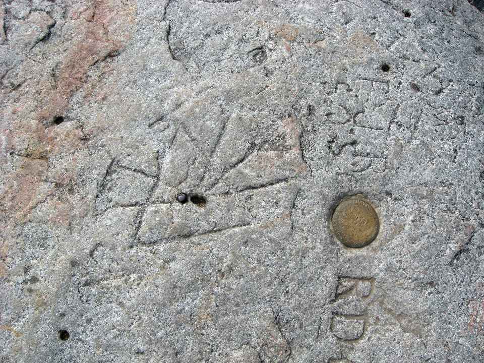
But this is not about the crowds: if you ever happened to look down at the summit, you probably noticed a disk, aka "The Monadnock Benchmark". This is a USGS disk set in 1931, But just about 1 foot to the northeast of this disk is a curious thing: three drill holes inside a triangle in the rock, with 5 lines radiating from the central drill hole. Sort of like some Mayan symbol or maybe like some of those lines in corn fields caused by space aliens.
This is actually a triangulation station established in 1860 by the US Coast Survey (predecessor to the Coast and Geodetic Survey) as part of the major survey of the east coast done in the mid 19th century. Incidentally, it's the center hole (with holes on each side, one with an iron bolt) that is the station.
Here's a photo showing the drill hole marker and the disk:

(click for larger image)
This shows the disk on the right and the drill-holes-in-triangle-with-5 lines on the left.
I have always been curious as to what was the story on the 5 lines. It's not explained on the data sheet for this mark that is published by the government (Here).
BTW, traditionalists might be interested in knowing that the government has switched almost entirely to GPS based surveys (I know, that's cheating, I think if you don't use a theodolite and heliotrope, you're missing the true experience ). This station was surveyed with GPS recently and now this 1860 marker's location is known to a little over 1 cm accuracy.
But I digress, this is about the 5 radiating lines. I've seen a number of historic survey markers which were drill holes (or sometimes small copper bolts) inside of chiseled triangles, but never one with lines radiating out from the hole like this.
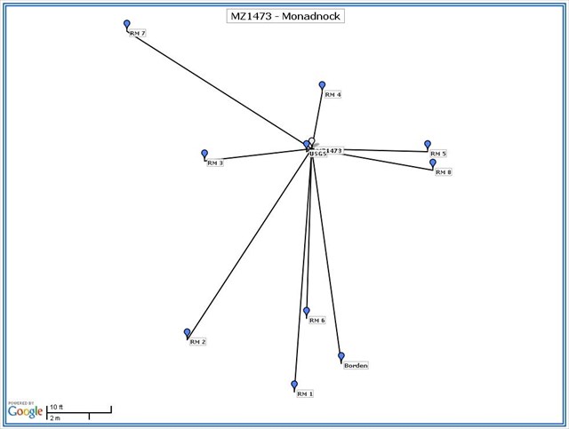
Well, with a little research and a eureka moment, I figured it out. I put a report on the subject on the Benchmark Hunting Forum I belong to here: my thread on Monadnock on the Benchmark Hunting Forum
Read it, and next time you're on Monadnock, look down and you'll see the curious marker and now you'll know why it's the way it is.
So what's with those 2 extra drill holes - you got me!
But this is not about the crowds: if you ever happened to look down at the summit, you probably noticed a disk, aka "The Monadnock Benchmark". This is a USGS disk set in 1931, But just about 1 foot to the northeast of this disk is a curious thing: three drill holes inside a triangle in the rock, with 5 lines radiating from the central drill hole. Sort of like some Mayan symbol or maybe like some of those lines in corn fields caused by space aliens.
This is actually a triangulation station established in 1860 by the US Coast Survey (predecessor to the Coast and Geodetic Survey) as part of the major survey of the east coast done in the mid 19th century. Incidentally, it's the center hole (with holes on each side, one with an iron bolt) that is the station.
Here's a photo showing the drill hole marker and the disk:

(click for larger image)
This shows the disk on the right and the drill-holes-in-triangle-with-5 lines on the left.
I have always been curious as to what was the story on the 5 lines. It's not explained on the data sheet for this mark that is published by the government (Here).
BTW, traditionalists might be interested in knowing that the government has switched almost entirely to GPS based surveys (I know, that's cheating, I think if you don't use a theodolite and heliotrope, you're missing the true experience
But I digress, this is about the 5 radiating lines. I've seen a number of historic survey markers which were drill holes (or sometimes small copper bolts) inside of chiseled triangles, but never one with lines radiating out from the hole like this.
Well, with a little research and a eureka moment, I figured it out. I put a report on the subject on the Benchmark Hunting Forum I belong to here: my thread on Monadnock on the Benchmark Hunting Forum
Read it, and next time you're on Monadnock, look down and you'll see the curious marker and now you'll know why it's the way it is.
So what's with those 2 extra drill holes - you got me!
Last edited:

